|
Ocampo Flora And Fauna Protection Area
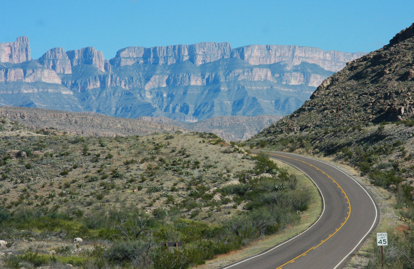
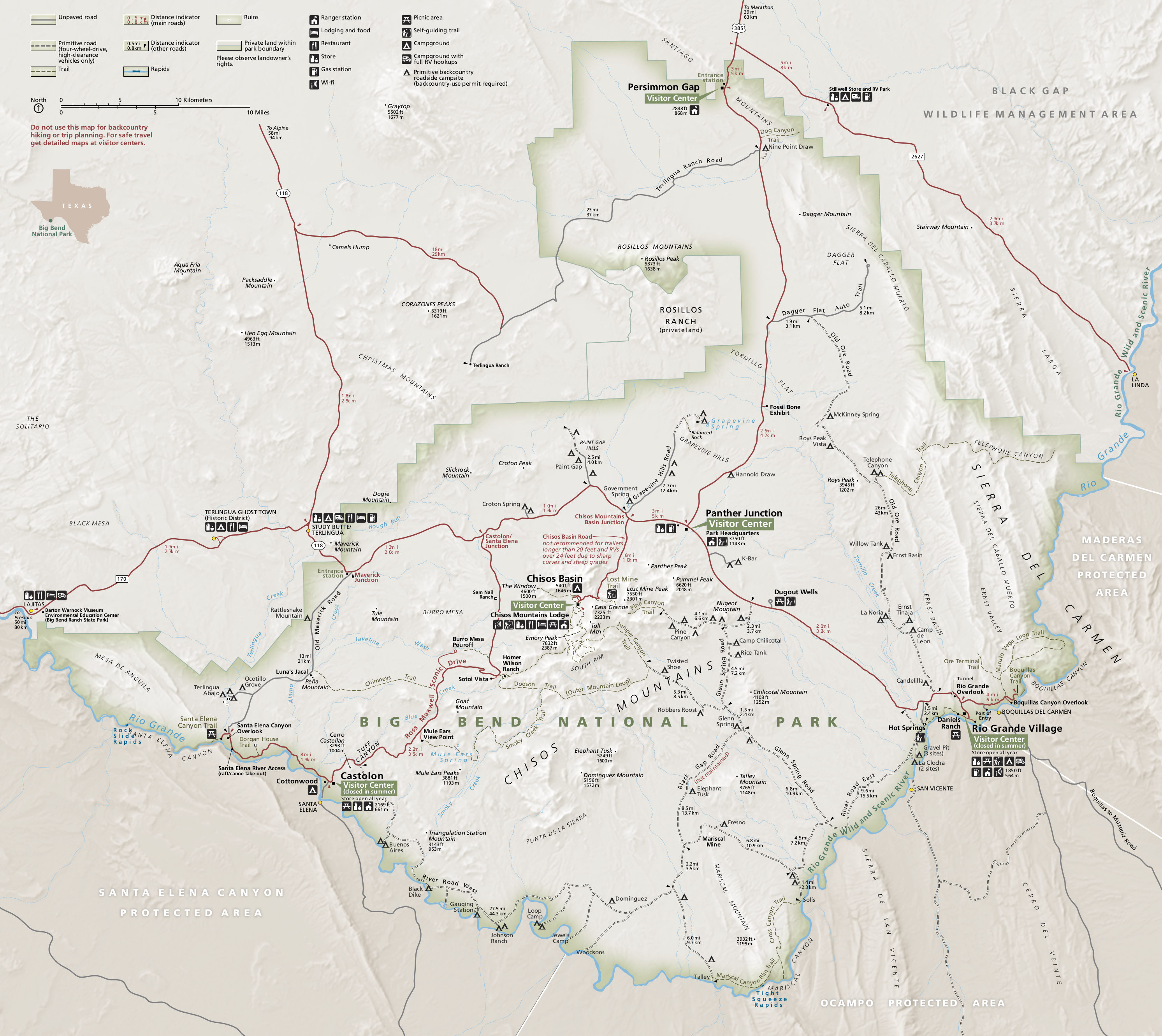
Ocampo Flora and Fauna Protection Area is a protected area in northern Mexico. It covers an area of 3442.38 km2 in the state of Coahuila. It is bounded on the north by the Rio Grande, which forms the border with the United States. It adjoins Maderas del Carmen Biosphere Reserve on the west, Cañón de Santa Elena Flora and Fauna Protection Area to the east, and Big Bend National Park to the north across the Rio Grande. Together these protected areas form the Mexico-United States international park, also known as El Carmen Big Bend Complex, a proposed transboundary protected area which protects a significant portion of the eastern Chihuahuan Desert and the Rio Grande valley. Flora and Fauna According to the National Biodiversity Information System of Comisión Nacional para el Conocimiento y Uso de la Biodiversidad The Comisión Nacional para el Conocimiento y Uso de la Biodiversidad (CONABIO; en, National Commission for the Knowledge and Use of Biodiversity) is a permanent i ... [...More Info...] [...Related Items...] OR: [Wikipedia] [Google] [Baidu] |
Ocampo Municipality, Coahuila
Ocampo is one of the 38 municipalities of Coahuila, in north-eastern Mexico, and the largest by area. The municipal seat lies at Ocampo. The municipality covers an area of 26,433 km² and is located on the international border between Mexico and the USA, here formed by the Río Bravo del Norte (Rio Grande), adjacent to the U.S. state of Texas. In 2010, the municipality had a total population of 10,991. accessdate=April 29, 2011 Towns and villages The largest localities (cities, towns, and villages) are:Adjacent municipalities and counties * - northeast * |
Coahuila
Coahuila (), formally Coahuila de Zaragoza (), officially the Free and Sovereign State of Coahuila de Zaragoza ( es, Estado Libre y Soberano de Coahuila de Zaragoza), is one of the 32 states of Mexico. Coahuila borders the Mexican states of Nuevo León to the east, Zacatecas to the south, and Durango and Chihuahua to the west. To the north, Coahuila accounts for a stretch of the Mexico–United States border, adjacent to the U.S. state of Texas along the course of the Rio Grande (Río Bravo del Norte). With an area of , it is the nation's third-largest state. It comprises 38 municipalities ''(municipios)''. In 2020, Coahuila's population is 3,146,771 inhabitants. The largest city and State Capital is the city of Saltillo; the second largest is Torreón (largest metropolitan area in Coahuila and 9th largest in Mexico); the third largest is Monclova (a former state capital); the fourth largest is Ciudad Acuña; and the fifth largest is Piedras Negras. History The name Coahui ... [...More Info...] [...Related Items...] OR: [Wikipedia] [Google] [Baidu] |
Mexico
Mexico (Spanish: México), officially the United Mexican States, is a country in the southern portion of North America. It is bordered to the north by the United States; to the south and west by the Pacific Ocean; to the southeast by Guatemala, Belize, and the Caribbean Sea; and to the east by the Gulf of Mexico. Mexico covers ,Mexico ''''. . making it the world's 13th-largest country by are ... [...More Info...] [...Related Items...] OR: [Wikipedia] [Google] [Baidu] |
Mexican Flora And Fauna Protection Areas
Mexican Flora and Fauna Protection Areas (''Áreas de Protección de Flora y Fauna'' in Spanish) comprise 29 protected natural areas of Mexico administrated by the National Commission of Protected Natural Areas (''Comisión Nacional de Áreas Naturales Protegidas'', or CONANP), an agency of the federal government. They are areas established to conform to the regulations provided by the LGEEPA and other applicable laws on places that contain habitats for which their existence depends on their preservation, transformation, and support of the species of flora and faun List of Mexican Flora and Fauna Protection Areas Baja California * Valle de los Cirios * Islas del Golfo de California (Islands of the Gulf of California) (also in Baja California Sur, Sonora, and Sinaloa) Baja California Sur * Balandra * Cabo San Lucas Campeche * Laguna de Términos Chiapas * Cascada de Agua Azul * Chan-Kin * Metzabok * Nahá Chihuahua * Campo Verde * Cañón de Santa Elena * Cerro Mo ... [...More Info...] [...Related Items...] OR: [Wikipedia] [Google] [Baidu] |
National Commission Of Natural Protected Areas
There are currently 182 Protected Natural Areas in Mexico, covering 25.4 million hectares in total. They are protected and administrated by the National Commission of Protected Natural Areas (''Comisión Nacional de Áreas Naturales Protegidas'', or 'CONANP'), a federal agency. CONANP administers: * 67 Mexican National Parks * 44 biosphere reserves * 40 flora and fauna protection areas * 18 Mexican Nature Sanctuaries * 9 natural resources protection areas * 11 natural monuments See also * LGEEPA The General Law of Ecological Equilibrium and Environmental Protection (''Ley General del Equilibrio Ecológico y la Protección al Ambiente'', or ''LGEEPA'' in Spanish) is an important piece of Mexican environmental protection Environmental pro ... - Mexico's groundbreaking 1988 environmental legislation References External linksCONANP web site (Spanish) [...More Info...] [...Related Items...] OR: [Wikipedia] [Google] [Baidu] |
Rio Grande
The Rio Grande ( and ), known in Mexico as the Río Bravo del Norte or simply the Río Bravo, is one of the principal rivers (along with the Colorado River) in the southwestern United States and in northern Mexico. The length of the Rio Grande is . It originates in south-central Colorado, in the United States, and flows to the Gulf of Mexico. The Rio Grande drainage basin (watershed) has an area of ; however, the endorheic basins that are adjacent to and within the greater drainage basin of the Rio Grande increase the total drainage-basin area to . The Rio Grande with Rio Grande Valley (landform), its fertile valley, along with its tributaries, is a vital watersource for seven US and Mexican states, and flows primarily through arid and semi-arid lands. After traversing the length of New Mexico, the Rio Grande becomes the Mexico–United States border, between the U.S. state of Texas and the northern Mexican states of Chihuahua (state), Chihuahua and Coahuila, Nuevo León a ... [...More Info...] [...Related Items...] OR: [Wikipedia] [Google] [Baidu] |
Maderas Del Carmen
Maderas del Carmen is a biosphere reserve in the northern Mexican state of Coahuila. Maderas del Carmen encompasses part of the Sierra del Carmen, a northern finger of the Sierra Madre Oriental range. The reserve includes both dry Chihuahuan Desert shrublands and forested sky island, high-elevation enclaves of Sierra Madre Oriental pine-oak forest. The reserve is home to 400 bird species and 70 mammal species, including the American black bear (''Ursus americanus''), collared peccary (''Pecari tajacu''), and cougar (''Puma concolor''). The region was designated a biosphere reserve in 2006. It is located in the municipalities of Ocampo, Ciudad Acuña, and Múzquiz. Conservation efforts The isolation of the Sierra del Carmen and its relatively undisturbed environment has led to conservation efforts in Mexico and jointly with the United States. Much of the Sierra del Carmen has been declared by the government of Mexico the Maderas del Carmen Flora and Fauna Protected Area, a ... [...More Info...] [...Related Items...] OR: [Wikipedia] [Google] [Baidu] |
Cañón De Santa Elena Flora And Fauna Protection Area
The Cañón de Santa Elena Flora and Fauna Protection Area (Spanish: ''Área de Protección de Flora y Fauna Cañón de Santa Elena'') is a protected area for plants and wildlife in the Mexican municipalities of Manuel Benavides and Ojinaga, in the state of Chihuahua. It was founded on November 7, 1994 and has an area of 277,209 hectares. The purpose of the reserve is to protect the Chihuahuan Desert, home to many species of plants and wildlife. Among the first scrub stands microphyll desert, the desert scrub rosetophilous, the pasture, the oak forest and riparian vegetation, including various species abound. In the second highlights the birds and mammals that have adapted to aridity, such as wildcat and some deer, as well as birds of prey. History The arrowheads, mortars and paintings found at the site indicate the following human occupation periods: Paleo-Indian (15,000–6,500 BC), Archaic (6500 BC – 900 AD), early Postclassic (900–1500 AD), and late Postclassic (1 ... [...More Info...] [...Related Items...] OR: [Wikipedia] [Google] [Baidu] |
Big Bend National Park
Big Bend National Park is an American national park located in West Texas, bordering Mexico. The park has national significance as the largest protected area of Chihuahuan Desert topography and ecology in the United States, and was named after a large bend in the Rio Grande/Río Bravo. The park protects more than 1,200 species of plants, more than 450 species of birds, 56 species of reptiles, and 75 species of mammals. Additional park activities include scenic drives, programs led by Big Bend park rangers, and stargazing. The area has a rich cultural history, from archeological sites dating back nearly 10,000 years to more recent pioneers, ranchers, and miners. The Chisos Mountains are located in the park, and are the only mountain range in the United States to be fully contained within the boundary of a national park. Geological features in the park include sea fossils and dinosaur bones, as well as volcanic dikes. The park encompasses an area of , entirely within Brewst ... [...More Info...] [...Related Items...] OR: [Wikipedia] [Google] [Baidu] |
Transboundary Protected Area
A transboundary protected area (TBPA) is an ecological protected area that spans boundaries of more than one country or sub-national entity. Such areas are also known as transfrontier conservation areas (TFCAs) or peace parks. TBPAs exist in many forms around the world, and are established for various reasons. The preservation of traditional animal migration patterns, ensuring sufficient food and water sources for population growth, is a critical reason for the creation of TBPAs. However, TBPAs also encourage tourism, economic development and goodwill between neighbouring countries, as well as making it easier for indigenous inhabitants of the area to travel. Types of Transboundary Protected Areas TBPAs exist in various types of geographic configuration, with various levels of ecological protection, and with various levels of international cooperation. Additionally, different organizations employ different definitions for TBPAs. Julia Marton-Lefevre broadly defines TBPAs as "are ... [...More Info...] [...Related Items...] OR: [Wikipedia] [Google] [Baidu] |
Chihuahuan Desert
The Chihuahuan Desert ( es, Desierto de Chihuahua, ) is a desert ecoregion designation covering parts of northern Mexico and the southwestern United States. It occupies much of far West Texas, the middle to lower Rio Grande Valley and the lower Pecos Valley in New Mexico, and a portion of southeastern Arizona, as well as the central and northern portions of the Mexican Plateau. It is bordered on the west by the Sonoran Desert, the Colorado Plateau, and the extensive Sierra Madre Occidental range, along with northwestern lowlands of the Sierra Madre Oriental range. Its largest, continual expanse is located in Mexico, covering a large portion of the state of Chihuahua, along with portions of Coahuila, north-eastern Durango, the extreme northern part of Zacatecas, and small western portions of Nuevo León. With an area of about , it is the largest desert in North America. The desert is fairly young, existing for only 8000 years. Geography There are several larger mountain ranges ... [...More Info...] [...Related Items...] OR: [Wikipedia] [Google] [Baidu] |


