|
Norwood Ridge
The Norwood Ridge is a rectangular upland which occupies the geographical centre of south London, centred south of London Bridge. Beneath its topsoil it is a ridge of London Clay that is capped on all sides (including as isolated knolls in the north) with remaining natural gravel deposits mixed with some sandy soil, which in the South Thames basin is a material known as the Claygate Beds. Extent and components The area is rectangular, measuring broad. Its longest side is if measured from central Brockley around which are three related knolls including Rye Hill, Nunhead or less if the start-point of the ridge is taken as One Tree Hill, Honor Oak. The upland is visible on terrain maps as three main parts of different elevation. The high, eastern ridge (Sydenham Hill Ridge) runs from One Tree Hill SSE forming: the high western halves of Honor Oak and Forest Hill, then Upper Sydenham, the east of Gipsy Hill and Crystal Palace (which has, since the station of that name w ... [...More Info...] [...Related Items...] OR: [Wikipedia] [Google] [Baidu] |
London Borough Of Southwark
The London Borough of Southwark ( ) in South London forms part of Inner London and is connected by bridges across the River Thames to the City of London and London Borough of Tower Hamlets. It was created in 1965 when three smaller council areas amalgamated under the London Government Act 1963. All districts of the area are within the London postal district. It is governed by Southwark London Borough Council. The part of the South Bank within the borough is home to London Bridge terminus station and the attractions of The Shard, Tate Modern, Shakespeare's Globe and Borough Market that are the largest of the venues in Southwark to draw domestic and international tourism. Dulwich is home to the Dulwich Picture Gallery and the Imperial War Museum is in Elephant and Castle. History Southwark is the oldest part of south London. An urban area to the south of the bridge was first developed in the Roman period, but subsequently abandoned. The name Southwark dates from the establishm ... [...More Info...] [...Related Items...] OR: [Wikipedia] [Google] [Baidu] |
Crystal Palace, London
Crystal Palace is an area in south London, England, named after the Crystal Palace Exhibition building, which stood in the area from 1854 until it was destroyed by fire in 1936. Approximately south-east of Charing Cross, it includes one of the highest points in London, at , offering views over the capital. The area has no defined boundaries and straddles five London boroughs and three postal districts, although there is a Crystal Palace electoral ward and Crystal Palace Park in the London Borough of Bromley. It forms a part of the greater area known as Upper Norwood, and is contiguous with the areas of Anerley, Dulwich Wood, Gipsy Hill, Penge, South Norwood and Sydenham. Until development began in the 19th century, and before the arrival of the Crystal Palace, the area was known as Sydenham Hill. The Norwood Ridge and an historic oak tree were used to mark parish boundaries. The area is represented by three parliamentary constituencies, four London Assembly constituenci ... [...More Info...] [...Related Items...] OR: [Wikipedia] [Google] [Baidu] |
Biggin Hill
Biggin Hill is a settlement on the south-eastern outskirts of Greater London, England, within the London Borough of Bromley. Within the boundaries of the historic county of Kent, prior to 1965 it was also in the administrative county of Kent. It is situated beyond London's urban sprawl, south-southeast of Charing Cross, with Keston to the north, New Addington to the north-west and Tatsfield, in the neighbouring county of Surrey, to the south. At the 2011 Census, Biggin Hill had a population of 9,951. Biggin Hill is one of the highest points of Greater London, rising to over above sea level. Biggin Hill Airport occupies land formerly used by RAF Biggin Hill, one of the principal fighter bases protecting London from German bombers during the Battle of Britain. History Historically, the settlement was known as Aperfield and formed part of the parish of Cudham. Biggin Hill was an ancient parish in the county of Kent, in the Diocese of Rochester, and under the Local Government ... [...More Info...] [...Related Items...] OR: [Wikipedia] [Google] [Baidu] |
Beulah Hill
The A215 is an A road in south London, starting at Elephant and Castle and finishing around Shirley. It runs through the London Boroughs of Lambeth, Southwark and Croydon. Beginning as Walworth Road, the A215 becomes Camberwell Road—much of which is a conservation area—after entering the former Metropolitan Borough of Camberwell. Crossing the A202, the A215 becomes Denmark Hill, originally known as Dulwich Hill, but renamed in 1683 to commemorate the marriage of Princess Anne (later Queen Anne) to Prince George of Denmark. After passing Herne Hill railway station the road becomes Norwood Road, Knights Hill, and then Beulah Hill at its crossroads with the A214. Beulah Hill was the site of the Croydon transmitting station, Britain's first independent television transmitter, built by the Independent Television Authority in 1955. Descending towards South Norwood the A215 becomes South Norwood Hill and then Portland Road, just after crossing the A213. A short section starting ... [...More Info...] [...Related Items...] OR: [Wikipedia] [Google] [Baidu] |
Kent
Kent is a county in South East England and one of the home counties. It borders Greater London to the north-west, Surrey to the west and East Sussex to the south-west, and Essex to the north across the estuary of the River Thames; it faces the French department of Pas-de-Calais across the Strait of Dover. The county town is Maidstone. It is the fifth most populous county in England, the most populous non-Metropolitan county and the most populous of the home counties. Kent was one of the first British territories to be settled by Germanic tribes, most notably the Jutes, following the withdrawal of the Romans. Canterbury Cathedral in Kent, the oldest cathedral in England, has been the seat of the Archbishops of Canterbury since the conversion of England to Christianity that began in the 6th century with Saint Augustine. Rochester Cathedral in Medway is England's second-oldest cathedral. Located between London and the Strait of Dover, which separates England from mainla ... [...More Info...] [...Related Items...] OR: [Wikipedia] [Google] [Baidu] |
Chislehurst
Chislehurst () is a suburban district of south-east London, England, in the London Borough of Bromley. It lies east of Bromley, south-west of Sidcup and north-west of Orpington, south-east of Charing Cross. Before the creation of Greater London in 1965, it was in Kent. History The name "Chislehurst" is derived from the Old English language, Saxon words ''cisel'', "gravel", and ''hyrst'', "wooded hill". The Walsingham family, including Christopher Marlowe's patron, Thomas Walsingham (literary patron), Sir Thomas Walsingham and Elizabeth I of England, Queen Elizabeth I's spymaster, Francis Walsingham, had a home in Scadbury Park, now a nature reserve in which the ruins of the house can still be seen. A water tower used to straddle the road from Chislehurst to Bromley until it was demolished in 1963 as one of the last acts of the Chislehurst and Sidcup UDC. It marked the entrance to the Wythes Estate in Bickley, but its narrow archway meant that double-decker buses were not ... [...More Info...] [...Related Items...] OR: [Wikipedia] [Google] [Baidu] |
Addiscombe
Addiscombe is an area of south London, England, within the London Borough of Croydon. It is located south of Charing Cross, and is situated north of Coombe and Selsdon, east of Croydon town centre, south of Woodside, and west of Shirley. Etymology Addiscombe as a place name is thought to be Anglo-Saxon in origin, meaning "Eadda or Æddi's estate", from an Anglo-Saxon personal name, and the word ''camp'', meaning an enclosed area in Old English. The same Anglo-Saxon land-owner may have given his name to Addington, around two miles to the south.Willey, Russ. ''Chambers London Gazetteer'', p 4 History First mentioned in the 13th century, Addiscombe formed part of Croydon Manor, and was known as enclosed land belonging to Eadda. The area was a rural and heavily wooded area for much of its history. Its main industries were farming and brick-making, clay deposits at Woodside providing the raw materials for the latter. During the Tudor period, Addiscombe was a large country es ... [...More Info...] [...Related Items...] OR: [Wikipedia] [Google] [Baidu] |
Bromley
Bromley is a large town in Greater London, England, within the London Borough of Bromley. It is south-east of Charing Cross, and had an estimated population of 87,889 as of 2011. Originally part of Kent, Bromley became a market town, chartered in 1158. Its location on a coaching route and the opening of a railway station in 1858 were key to its development and the shift from an agrarian village to an urban town. As part of the suburban growth of London in the 20th century, Bromley significantly increased in population and was Municipal Borough of Bromley, incorporated as a municipal borough in 1903 and became part of the London Borough of Bromley in 1965. Bromley today forms a major retail and commercial centre. It is identified in the London Plan as one of the 13 metropolitan centres of Greater London. History Bromley is first recorded in an Anglo-Saxon charter of 862 as ''Bromleag'' and means 'woodland clearing where Cytisus scoparius, broom grows'. It shares this Old ... [...More Info...] [...Related Items...] OR: [Wikipedia] [Google] [Baidu] |
Wimbledon Common
Wimbledon Common is a large open space in Wimbledon, southwest London. There are three named areas: Wimbledon Common, Putney Heath, and Putney Lower Common, which together are managed under the name Wimbledon and Putney Commons totalling 460 hectares (1,140 acres). Putney Lower Common is set apart from the rest of the Common by a minimum of of the built-up western end of Putney. Wimbledon and Putney Commons Wimbledon Common, together with Putney Heath and Putney Lower Common, is protected by the Wimbledon and Putney Commons Act of 1871 from being enclosed or built upon. The common is for the benefit of the general public for informal recreation, and for the preservation of natural flora and fauna. It is the largest expanse of heathland in London, with an area of bog with a flora that is rare in the region. The western slopes, which lie on London Clay, support mature mixed woodland. The Commons are also an important site for the stag beetle. Most of the Common is a Site o ... [...More Info...] [...Related Items...] OR: [Wikipedia] [Google] [Baidu] |
Croydon Transmitting Station
The Croydon transmitting station is a broadcasting and telecommunications facility on Beaulieu Heights in Upper Norwood, London, England (), in the London Borough of Croydon, owned by Arqiva. It was established in 1955 and initially used a small lattice tower. The present tower is high and was built in 1962. It was originally used to broadcast the London ITV signal on VHF Band III. When UHF broadcasting began, the nearby Crystal Palace transmitting station was used. VHF television was discontinued in 1985, and the Croydon transmitter was not used for regular TV broadcasting until 1997, when a new directional UHF antenna, designed to avoid interference with continental transmitters, was installed to carry the newly launched Channel 5 in the London area. It carried Channel 5's analogue signal, and the digital terrestrial signal is transmitted from Crystal Palace. Croydon also had reserve transmitters for BBC1, BBC2, ITV and Channel 4, but these were used only in the event o ... [...More Info...] [...Related Items...] OR: [Wikipedia] [Google] [Baidu] |
Crystal Palace Transmitting Station
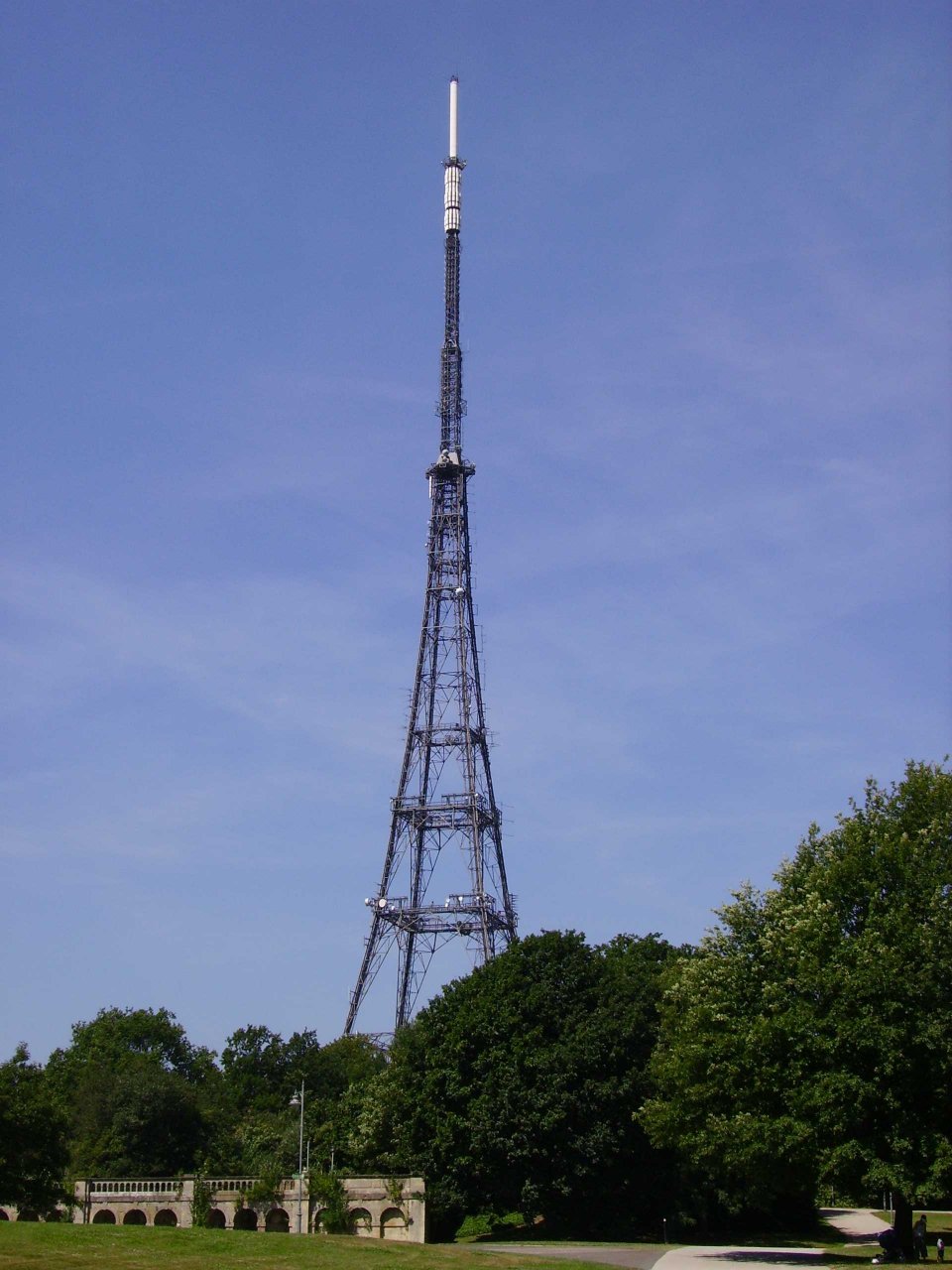
The Crystal Palace transmitting station, officially known as Arqiva Crystal Palace, is a broadcasting and telecommunications site in the Crystal Palace area of the London Borough of Bromley, England (). It is located on the site of the former television station and transmitter operated by John Logie Baird from 1933. The station is the eighth-tallest structure in London, and is best known as the main television transmitter for the London area. As such, it is the most important transmitter in the UK in terms of population covered. The transmitter is owned and operated by Arqiva. History and development The station was constructed in the mid-1950s among the ruins of the Crystal Palace. The Aquarium on whose site it stands was destroyed in 1941 during the demolition of the Palace's north water tower. (John Logie Baird's earlier transmitter and TV studios were a separate development at the other end of the Palace and perished with it in 1936.) Its new tower was the tallest struct ... [...More Info...] [...Related Items...] OR: [Wikipedia] [Google] [Baidu] |
Grangewood Park
Grangewood Park is an extensive woodland area situated in South Norwood, London. It is managed by the London Borough of Croydon. It is bounded by Grange Road, Wharncliffe Road, and Ross Road. It covers an area of . The park is located on the main A212 road (Grange Road) between Thornton Heath and Upper Norwood/Crystal Palace. The nearest stations are Thornton Heath, Selhurst and Norwood Junction. Facilities Facilities include: Woodland, ornamental gardens, cultural garden, bowling green and pavilion, tennis courts, multi-games courts (football only), children's playground, and basketball and kick around facilities. History Originally part of the Manor of Whitehorse, bought in 1787 by John Cator and enclosed in 1797, Grangewood was known as Whitehorse Wood and formed part of the Great North Wood (Norwood). It was in extent and was owned by Bishops of London between 1299 and 1338. It became known as White Horse in 1368 when the manor became owned by Walter Whitehors, who was ... [...More Info...] [...Related Items...] OR: [Wikipedia] [Google] [Baidu] |


.jpg)


