|
North Hungarian Mountains
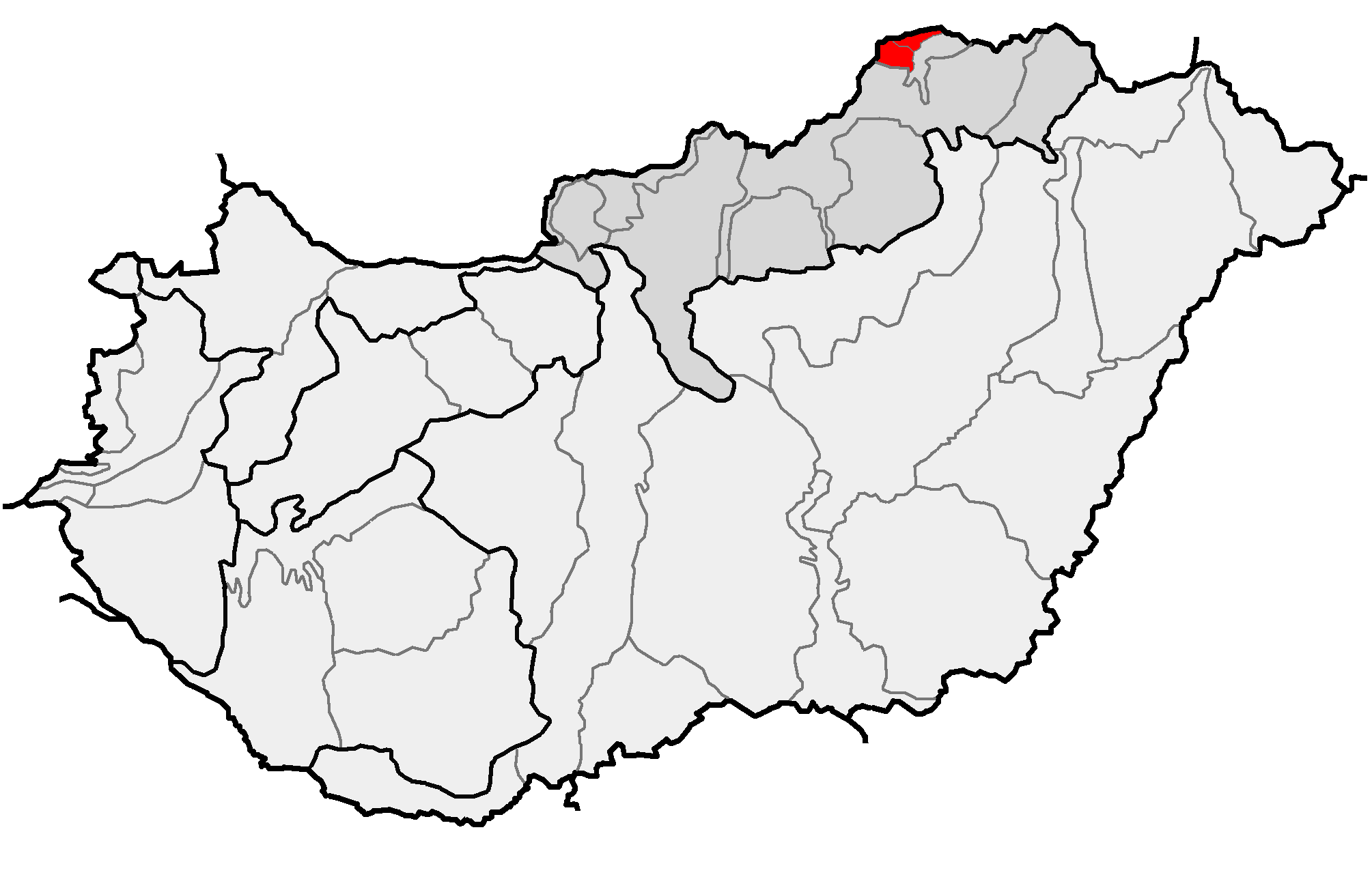
The North Hungarian Mountains ( hu, Északi-középhegység), sometimes also referred to as the Northeast Hungarian Mountains, Northeast Mountains, North Hungarian Highlands, North Hungarian Mid-Mountains or North Hungarian Range, is the northern, mountainous part of Hungary. It forms a geographical unity with the Mátra-Slanec Area, the adjacent parts of Slovakia. It is a separate geomorphological area within the Western Carpathians. The mountains run along the northeastern border of Hungary as well as eastern parts of the Hungarian–Slovak border in broadband from the Danube Bend to the town of Prešov. Subdivisions The area consists of the following geomorphological units: * Börzsöny Regional Map Series of Hungary ( hu, Börzsöny + [...More Info...] [...Related Items...] OR: [Wikipedia] [Google] [Baidu] |
Lillafüred
Lillafüred (Miskolc-Lillafüred) is a town in Borsod-Abaúj-Zemplén county, Hungary. Officially, it is a part of Miskolc, though it is almost 12 kilometres away from the city, in the Bükk Mountains. Lillafüred is a tourist resort. History Count András Bethlen, the minister of agriculture, decided in the 1890s to build a holiday resort near Lake Hámori. The resort was named after his niece, Erzsébet (nicknamed: "Lilla") Vay, who was the sister of the then-ispán, or count, of Borsod County, Elemér Vay. The Palace Hotel was built by István Bethlen. Tourist attractions Palace Hotel (Palotaszálló) The Palace Hotel was designed by Kálmán Lux and built between 1927 and 1930 in neo-Renaissance style. One of the hotel's restaurants is named after King Matthias. Its stained glass windows show the castles of historical Hungary. The hotel is surrounded by a large park with rare plants. Hanging gardens The hanging gardens are below the hotel, between the streams Szin ... [...More Info...] [...Related Items...] OR: [Wikipedia] [Google] [Baidu] |
Aggtelek Karst
Aggtelek Karst is a karst area in northern Hungary. The area is especially well known for its abundance of caves, which were recorded together with those in neighboring Slovakia in 1995 to the list of World Heritage Site under the name of the Caves of Aggtelek Karst and Slovak Karst. The Aggtelek National Park (Hungarian: ''Aggteleki Nemzeti Park'') is a national park in Northern Hungary, founded in 1985. It contains 198.92 km² (of which 39.22 km² are under increased protection). It has been part of the UNESCO World Heritage since 1995. The largest stalactite cave of Europe is situated in this area: the Baradla Cave (26 km long, of which 8 km is in Slovakia, known under the name of Domica). References {{commonscat, Aggtelek Karst Karst caves Caves of Hungary Caves of Slovakia ... [...More Info...] [...Related Items...] OR: [Wikipedia] [Google] [Baidu] |
Limestone
Limestone ( calcium carbonate ) is a type of carbonate sedimentary rock which is the main source of the material lime. It is composed mostly of the minerals calcite and aragonite, which are different crystal forms of . Limestone forms when these minerals precipitate out of water containing dissolved calcium. This can take place through both biological and nonbiological processes, though biological processes, such as the accumulation of corals and shells in the sea, have likely been more important for the last 540 million years. Limestone often contains fossils which provide scientists with information on ancient environments and on the evolution of life. About 20% to 25% of sedimentary rock is carbonate rock, and most of this is limestone. The remaining carbonate rock is mostly dolomite, a closely related rock, which contains a high percentage of the mineral dolomite, . ''Magnesian limestone'' is an obsolete and poorly-defined term used variously for dolomite, for limes ... [...More Info...] [...Related Items...] OR: [Wikipedia] [Google] [Baidu] |
Erosion
Erosion is the action of surface processes (such as water flow or wind) that removes soil, rock, or dissolved material from one location on the Earth's crust, and then transports it to another location where it is deposited. Erosion is distinct from weathering which involves no movement. Removal of rock or soil as clastic sediment is referred to as ''physical'' or ''mechanical'' erosion; this contrasts with ''chemical'' erosion, where soil or rock material is removed from an area by dissolution. Eroded sediment or solutes may be transported just a few millimetres, or for thousands of kilometres. Agents of erosion include rainfall; bedrock wear in rivers; coastal erosion by the sea and waves; glacial plucking, abrasion, and scour; areal flooding; wind abrasion; groundwater processes; and mass movement processes in steep landscapes like landslides and debris flows. The rates at which such processes act control how fast a surface is eroded. Typically, physical ero ... [...More Info...] [...Related Items...] OR: [Wikipedia] [Google] [Baidu] |
Csóványos
Csóványos () is a mountain in the Börzsöny range of the North Hungarian Mountains. It has an altitude of 938 metres and spans the border of Nógrád County and Pest County. This area was geologically active in the Miocene era, 18 to 19 million years ago. In the Quaternary, when volcanic activity commenced, the immediate environment of Csóványos emerged. These movements created water features, high above the forests. The forest on the mountain is dense with blue beech and Austrian oak. Geography The mountain lies within the Ipoly River Basin, which is a transboundary river between Slovakia and Hungary with the middle and lower basin lying in Hungarian territory. The Hungarian territory of the basin covers an area of formed by the hills of Nograd, Cserhat and Borzsony; Borzsony includes the Csóványos The Csóványos mountain peak as part of the Börzsöny Mountain ranges, lie in the Danube-Ipoly National Park in northern Hungary; the park is one of ten Hungarian national ... [...More Info...] [...Related Items...] OR: [Wikipedia] [Google] [Baidu] |
Volcanic
A volcano is a rupture in the crust of a planetary-mass object, such as Earth, that allows hot lava, volcanic ash, and gases to escape from a magma chamber below the surface. On Earth, volcanoes are most often found where tectonic plates are diverging or converging, and most are found underwater. For example, a mid-ocean ridge, such as the Mid-Atlantic Ridge, has volcanoes caused by divergent tectonic plates whereas the Pacific Ring of Fire has volcanoes caused by convergent tectonic plates. Volcanoes can also form where there is stretching and thinning of the crust's plates, such as in the East African Rift and the Wells Gray-Clearwater volcanic field and Rio Grande rift in North America. Volcanism away from plate boundaries has been postulated to arise from upwelling diapirs from the core–mantle boundary, deep in the Earth. This results in hotspot volcanism, of which the Hawaiian hotspot is an example. Volcanoes are usually not created where two tectonic plate ... [...More Info...] [...Related Items...] OR: [Wikipedia] [Google] [Baidu] |
Transdanubian Mountains
__NOTOC__ The Transdanubian Mountains (sometimes also referred to as ''Bakony Forest, Dunántúl Highlands, Highlands of Dunántúl, Highlands of Transdanubia, Mountains of Dunántúl, Mountains of Transdanubia, Transdanubian Central Range, Transdanubian Hills, Transdanubian Midmountains'' or ''Transdanubian Mid-Mountains'', ) are a mountain range in Hungary covering about 7000 km2. Its highest peak is the '' Pilis'', with a height of . Parts of the mountains *Bakony ** ''Southern Bakony'' ** ''Northern Bakony'' *** Keszthely Plateau *** Tapolca Basin *** Balaton Uplands **** Bakonyalja **** Sokoró Hills * Vértes Mountains ** Vértesalja (Bársonyos) *Velence Hills * Dunazug Mountains ** Gerecse Mountains **Buda Hills ** Pilis Mountains Visegrád Mountains are often considered a part of it for geopolitical reasons, but geographically they are part of the North Hungarian Mountains. Gallery File:Gulács01.jpg File:Pliocene Volcanoes near Lake Balaton in Hungary.jpg F ... [...More Info...] [...Related Items...] OR: [Wikipedia] [Google] [Baidu] |
Zemplín Mountains
:''not to be confused with the nearby Zemplén Mountains'' The Zemplín Mountains is a small mountain range in southeastern Slovakia, geologically part of the Mátra-Slanec Area of the Inner Western Carpathians. The range of about 101 square kilometers is near the border of Hungary and its Tokaj wine region. The highest mountain of the range is ''Rozhladňa'' (469 meters). An important river is Roňava which also forms the border with Hungary; another river with its headwaters here is the Bodrog The Bodrog is a river in eastern Slovakia and north-eastern Hungary. It is a tributary to the river Tisza. The Bodrog is formed by the confluence of the rivers Ondava and Latorica near Zemplín in eastern Slovakia. It crosses the Slovak–H .... {{DEFAULTSORT:Zemplin Mountains Mountain ranges of Slovakia Mountain ranges of the Western Carpathians ... [...More Info...] [...Related Items...] OR: [Wikipedia] [Google] [Baidu] |
Slanec Mountains
Slanec (german: Salzburg; hu, Nagyszalánc; la, Castrum Salis) is a village and municipality in Košice-okolie District in the Košice Region of eastern Slovakia. History In historical records the village was first mentioned in 1230 (''Castrum'' ''Salis'') as an important fortress. In 1270 King Stephen V of Hungary gave the castle to Master Reinhold. The new lords of Slanec supported King Přemysl Otakar II against King Ladislav in the conquest of the Bohemian throne. King Ladislav conquered Slanec in 1281. In 1299 the castle passed to the Szalanczyi noble family and, successively to landowners by the surnames of Lossonczy and Forgách. In 1649 it was besieged by the rebel condottiere György Rákoczi. Geography The village lies at an altitude of 345 metres and covers an area of 20.459 km². The municipality has a population of about 1310 people. Transportation The village has a railway Rail transport (also known as train transport) is a means of transport that t ... [...More Info...] [...Related Items...] OR: [Wikipedia] [Google] [Baidu] |
Zemplén Mountains
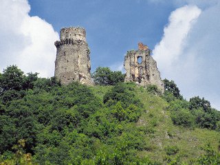
Zemplén Mountains () or Tokaj Mountains (; hu, Zempléni-hegység or ''Tokaji-hegység'') is a mountain range in Hungary. Its highest peak is the Nagy-Milic at 894 metres above sea level. The range is part of the North Hungarian Mountains within the Carpathian Mountains. Its steep peaks are the bases for many medieval stone castles, such as the castle of Sárospatak Sárospatak (german: Potok am Bodroch; la, Potamopolis; sk, Šarišský Potok or ; ) is a town in Borsod-Abaúj-Zemplén County, northern Hungary. It lies northeast from Miskolc, in the Bodrog river valley. The town, often called simply ''Pa ... and ''Füzéri vár'' (Füzér Castle). Zempléni mese.jpg, Zemplén Mountains Castle of Füzér, view.jpg, ''Füzéri vár'' (Füzér Castle) in the Zemplén Mountains References External links Zempléni hegység- photos and information about Zemplén Mountains (in Czech) Mountain ranges of Hungary Mountain ranges of the Western Carpathians ... [...More Info...] [...Related Items...] OR: [Wikipedia] [Google] [Baidu] |


