|
Newbiggin, Teesdale
Newbiggin is a village in County Durham, in England. Its population at the 2011 census was 146. It is situated on the north side of Teesdale, opposite Holwick. An influx of Derbyshire lead miners into the area in the late 18th century may have brought the name from Biggin. In February 2022 Robert Hooper, a hill farmer from the village, was cleared of charges of dangerous driving and criminal damage, at Durham Crown Court, after he used a telehandler A telescopic handler, also called a lull, telehandler, teleporter, reach forklift, or zoom boom, is a machine widely used in agriculture and industry. It is somewhat like a forklift but has a boom ( telescopic cylinder), making it more a c ... with forks to lift a car from a lane outside his farm, flip it and push it on its side on to the road outside. References Villages in County Durham {{Durham-geo-stub ... [...More Info...] [...Related Items...] OR: [Wikipedia] [Google] [Baidu] |
County Durham
County Durham ( ), officially simply Durham,UK General Acts 1997 c. 23Lieutenancies Act 1997 Schedule 1(3). From legislation.gov.uk, retrieved 6 April 2022. is a ceremonial county in North East England.North East Assembly â€About North East England. Retrieved 30 November 2007. The ceremonial county spawned from the historic County Palatine of Durham in 1853. In 1996, the county gained part of the abolished ceremonial county of Cleveland.Lieutenancies Act 1997 . Retrieved 27 October 2014. The county town is the of |
England
England is a country that is part of the United Kingdom. It shares land borders with Wales to its west and Scotland to its north. The Irish Sea lies northwest and the Celtic Sea to the southwest. It is separated from continental Europe by the North Sea to the east and the English Channel to the south. The country covers five-eighths of the island of Great Britain, which lies in the North Atlantic, and includes over 100 smaller islands, such as the Isles of Scilly and the Isle of Wight. The area now called England was first inhabited by modern humans during the Upper Paleolithic period, but takes its name from the Angles, a Germanic tribe deriving its name from the Anglia peninsula, who settled during the 5th and 6th centuries. England became a unified state in the 10th century and has had a significant cultural and legal impact on the wider world since the Age of Discovery, which began during the 15th century. The English language, the Anglican Church, and Engli ... [...More Info...] [...Related Items...] OR: [Wikipedia] [Google] [Baidu] |
United Kingdom Census 2011
A Census in the United Kingdom, census of the population of the United Kingdom is taken every ten years. The 2011 census was held in all countries of the UK on 27 March 2011. It was the first UK census which could be completed online via the Internet. The Office for National Statistics (ONS) is responsible for the census in England and Wales, the General Register Office for Scotland (GROS) is responsible for the census in Scotland, and the Northern Ireland Statistics and Research Agency (NISRA) is responsible for the census in Northern Ireland. The Office for National Statistics is the executive office of the UK Statistics Authority, a non-ministerial department formed in 2008 and which reports directly to Parliament. ONS is the UK Government's single largest statistical producer of independent statistics on the UK's economy and society, used to assist the planning and allocation of resources, policy-making and decision-making. ONS designs, manages and runs the census in England an ... [...More Info...] [...Related Items...] OR: [Wikipedia] [Google] [Baidu] |
Teesdale
Teesdale is a dale, or valley, in Northern England. The dale is in the River Tees’s drainage basin, most water flows stem from or converge into said river, including the Skerne and Leven. Upper Teesdale, more commonly just Teesdale, falls between the Durham and Yorkshire Dales. Large parts of Upper Teesdale are in the North Pennines AONB (Area of Outstanding Natural Beauty) - the second largest AONB in England and Wales. The River Tees rises below Cross Fell, the highest hill in the Pennines at , and its uppermost valley is remote and high. The local climate was scientifically classified as "Sub-Arctic" and snow has sometimes lain on Cross Fell into June (there is an alpine ski area Yad Moss). Lower Teesdale has mixed urban (Tees Valley or Teesside) and rural (Cleveland) parts. Roseberry Topping is a notable hill on the south eastern side, of which this and other adjoining hills form the northern end of the North York Moors. Newer terms have gained stronger associations w ... [...More Info...] [...Related Items...] OR: [Wikipedia] [Google] [Baidu] |
Holwick
Holwick is a small village in Teesdale, north-east England. Located in the Pennine hills, it consists of a few houses spread along a road in the pattern of a linear settlement. As the population taken at the 2011 Census was less than 100, details are maintained in the parish of Lunedale. Being south of the Tees, Holwick lies within the historic boundaries of the North Riding of Yorkshire, but along with the rest of the former Startforth Rural District it was transferred to County Durham for administrative and ceremonial purposes on 1 April 1974, under the provisions of the Local Government Act 1972. In May 2013, the newly registered flag of the North Riding was first unveiled at the village, owed to it being one of the most northerly settlements in Yorkshire. It has a public house, the ''Strathmore Arms'', and a campsite. Holwick sits not far from the south bank of the River Tees, about 2 miles north-west of Middleton-in-Teesdale and opposite Newbiggin, both villages on the ot ... [...More Info...] [...Related Items...] OR: [Wikipedia] [Google] [Baidu] |
Derbyshire Lead Mining History
This article details some of the history of lead mining in Derbyshire, England. Background It has been claimed that Odin Mine, near Castleton, one of the oldest lead mines in England, may have been worked in the tenth century or even as early as Roman Britain, but it was certainly productive in the 1200s. Derbyshire lead mines are mentioned in the Pipe Rolls. Recent analysis of a Swiss ice-core extracted in 2013 indicates that levels of lead in atmospheric pollution between 1170 and 1216 were as high as those during the Industrial Revolution and correlate accurately with lead production from Peak District mines, the main European source at the time. On one of the walls in Wirksworth Church is a crude stone carving, found nearby at Bonsall and placed in the church in the 1870s. Probably executed in Anglo-Saxon times, it shows a man carrying a kibble or basket in one hand and a pick in the other. He is a lead miner. The north choir aisle of Wirksworth church is dominated by ... [...More Info...] [...Related Items...] OR: [Wikipedia] [Google] [Baidu] |
Biggin (Dovedale And Parwich Ward)
Biggin is a village in the Derbyshire Dales district of Derbyshire, England. It is part of the Hartington Nether Quarter parish, and is in the Peak District National Park. Biggin was once known as Newbiggin, when it had a monastic settlement of the Cistercian order, established by the monks of Garendon Abbey, Leicestershire. The monks established a sheep ranch at Biggin Grange, which still has one ancient outbuilding. Farming is still important to the village, though at one time (18th Century) it was also a centre of lead mining. When the lead started to be worked out, there was a migration of lead miners to Upper Teesdale, and they probably took the name Newbiggin there. Today tourism is an important industry alongside farming. See also * Listed buildings in Hartington Nether Quarter * Dovedale * Tissington Trail The Tissington Trail is a bridleway, footpath and cycleway in Derbyshire, England, along part of the trackbed of the former railway line connecting Ashbour ... [...More Info...] [...Related Items...] OR: [Wikipedia] [Google] [Baidu] |
Durham, England
Durham ( , locally ), is a cathedral city and civil parish on the River Wear, County Durham, England. It is an administrative centre of the County Durham District, which is a successor to the historic County Palatine of Durham (which is different to both the ceremonial county and district of County Durham). The settlement was founded over the final resting place of St Cuthbert. Durham Cathedral was a centre of pilgrimage in medieval England while the Durham Castle has been the home of Durham University since 1832. Both built in 11th-century, the buildings were designated as a World Heritage Site by UNESCO in 1986. HM Prison Durham is also located close to the city centre and was built in 1816. Name The name "Durham" comes from the Brythonic element , signifying a hill fort and related to -ton, and the Old Norse , which translates to island.Surtees, R. (1816) ''History and Antiquities of the County Palatine of Durham'' (Classical County Histories) The Lord Bishop of Durh ... [...More Info...] [...Related Items...] OR: [Wikipedia] [Google] [Baidu] |
List Of Crown Court Venues In England And Wales
In the system of courts of England and Wales, the Crown Court deals with serious criminal charges and with less serious charges where the accused has elected trial at the Crown Court instead of trial at a magistrates' court. The Crown Court also hears appeals against conviction and sentence from magistrates. Background The Crown Court system was established by the Courts Act 1971, which came into force on 1 January 1972, following the recommendations of a royal commission chaired by Lord Beeching. Previously, criminal cases that were not dealt with by magistrates were heard by assize courts and courts of quarter sessions, in a system that had changed little in the preceding centuries. The Crown Court system is administered by Her Majesty's Courts and Tribunals Service, an executive agency of the Ministry of Justice. England is divided into six regions by HMCTS (London, Midlands, North East, North West, South East and Western), with the whole of Wales forming a seventh region. ... [...More Info...] [...Related Items...] OR: [Wikipedia] [Google] [Baidu] |
Telehandler
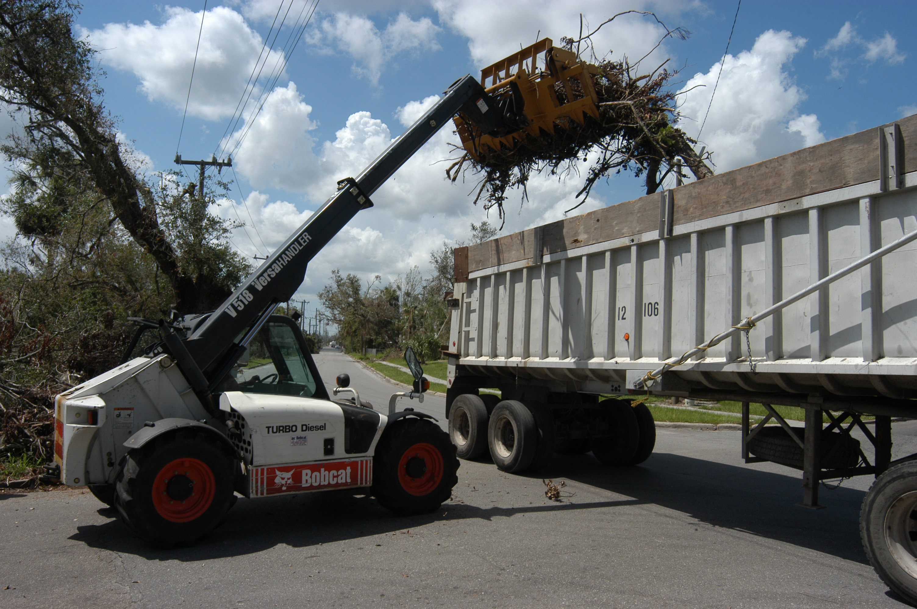
A telescopic handler, also called a lull, telehandler, teleporter, reach forklift, or zoom boom, is a machine widely used in agriculture and industry. It is somewhat like a forklift but has a boom (telescopic cylinder), making it more a crane than a forklift, with the increased versatility of a single telescopic boom that can extend forwards and upwards from the vehicle. The boom can be fitted with different attachments, such as a bucket, pallet forks, muck grab, or winch. Uses In industry, the most common attachment for a telehandler is pallet forks and the most common application is to move loads to and from places unreachable for a conventional forklift. For example, telehandlers have the ability to remove palletised cargo from within a trailer and to place loads on rooftops and other high places. The latter application would otherwise require a crane, which is not always practical or time-efficient. In agriculture the most common attachment for a telehandler is a bucke ... [...More Info...] [...Related Items...] OR: [Wikipedia] [Google] [Baidu] |


