|
Neuwied–Koblenz Railway
The Koblenz–Neuwied railway is a two-track, electrified main line railway in the German state of Rhineland-Palatinate. It connects the Neuwied station on the East Rhine Railway, Right (east) Rhine line to the major railway junction at Koblenz Hauptbahnhof (central station) and to the West Rhine Railway, Left (west) Rhine and Koblenz–Trier railway, Moselle lines. History The railway line and the Urmitz railway bridge, Crown Prince William Bridge were built during the First World War, for Strategic railway, military and strategic reasons, by the Prussian state railways and opened on 15 August 1918. Also built at the same time were the Ludendorff Bridge at Remagen, together with a connection to the Ahr Valley Railway and the Hindenburg Bridge at Rüdesheim am Rhein, Rudesheim, together with a connection to the Nahe Valley Railway. On 15 September 1935, Urmitz Rheinbrücke halt was opened. The line was put out of service on 9 March 1945, late in the Second World War, by the demoli ... [...More Info...] [...Related Items...] OR: [Wikipedia] [Google] [Baidu] |
15 KV AC Railway Electrification
Railway electrification systems using at are used on transport railways in Germany, Austria, Switzerland, Sweden, and Norway. The high voltage enables high power transmission with the lower frequency reducing the losses of the traction motors that were available at the beginning of the 20th century. Railway electrification in late 20th century tends to use AC systems which has become the preferred standard for new railway electrifications but extensions of the existing networks are not completely unlikely. In particular, the Gotthard Base Tunnel (opened on 1 June 2016) still uses 15 kV, 16.7 Hz electrification. Due to high conversion costs, it is unlikely that existing systems will be converted to despite the fact that this would reduce the weight of the on-board step-down transformers to one third that of the present devices. History The first electrified railways used series-wound DC motors, first at 600 V and then 1,500 V. Areas with 3 kV ... [...More Info...] [...Related Items...] OR: [Wikipedia] [Google] [Baidu] |
Koblenz-Stadtmitte Station
Koblenz Stadtmitte station (german: Haltepunkt Koblenz Stadtmitte, freely translated as "Koblenz City Centre station") was opened on 14 April 2011 on the West Rhine Railway (german: Linke Rheinstrecke) in central Koblenz in the German state of Rhineland Palatinate. The main purpose of this station is to improve public transport access to central Koblenz because it is more convenient than Koblenz Hauptbahnhof (main station). In addition, it played an essential role as the station serving the Federal Horticultural Show 2011 in Koblenz. Location Koblenz Stadtmitte is classified as a ''Haltepunkt'', which means a station that is not a rail junction and has no sets of points. It is centrally located in the Koblenz city centre, right behind the Löhr-Center shopping centre, and near the pedestrian zone. There is also a bus station in the same shopping centre near the station, with a direct bus connection to almost every district of Koblenz. In the second half of the 19th century the ... [...More Info...] [...Related Items...] OR: [Wikipedia] [Google] [Baidu] |
Nahe Valley Railway
The Nahe Valley Railway (german: Nahetalbahn) is a two-track, partially electrified main line railway in the German states of Rhineland-Palatinate and Saarland, which runs for almost 100 kilometres along the Nahe (Rhine), Nahe. It was built by the Rhine-Nahe Railway Company and connects Bingen Central Station, Bingen am Rhein on the West Rhine Railway, Left Rhine line with Saarbrücken Central Station, Saarbrücken. It was opened between 1858 and 1860 and is List of the first German railways to 1870, one of the oldest railways in Germany. The section south of Bad Kreuznach is part of the regionally important transport corridor between the two major cities of Mainz and Saarbrücken. History First initiatives and the opening of the Neunkirchen–Saarbrücken section As early as 1839, there were plans to build a railway connection between the Saar (river), Saar and the Middle Rhine, which could not be realised due to high construction costs. The first section between Neunkirchen ... [...More Info...] [...Related Items...] OR: [Wikipedia] [Google] [Baidu] |
Rüdesheim Am Rhein
Rüdesheim am Rhein is a German winemaking town in the Rhine Gorge, and part of the UNESCO World Heritage Site in this region. It lies in the Rheingau-Taunus-Kreis district in the ''Regierungsbezirk'' of Darmstadt, Hessen. Known as Rüdesheim, it is officially Rüdesheim am Rhein, to distinguish it from Rüdesheim an der Nahe. It is a major tourist attraction, especially for foreign visitors. Geography Location Rüdesheim lies at the foot of the Niederwald on the Rhine's right bank in the Rheingau wine region. The town belongs to the Frankfurt Rhine Main Region and to the World Heritage Site Rhine Gorge. It has a picturesque Old Town, located in the Rheingau landscape celebrated in Rhine romanticism. Territorial structure Rüdesheim am Rhein as a municipality consists of five quarters: * Rüdesheim am Rhein (initial part and center) * Eibingen including Windeck, Eibingen Abbey and Nothgottes * Assmannshausen * Aulhausen including the former and * Presberg Assmannshau ... [...More Info...] [...Related Items...] OR: [Wikipedia] [Google] [Baidu] |
Hindenburg Bridge
The Hindenburg Bridge (german: Hindenburgbrücke) was a railway bridge over the Rhine between Rüdesheim am Rhein, Rüdesheim in the German state of Hesse and Bingen am Rhein, Bingen-Kempten state of Rhineland-Palatinate, named in 1918 after Generalfeldmarschall, Field Marshal Paul von Hindenburg, later President of Germany (1919–1945), German President. The bridge was put in service in 1915, destroyed in the Second World War and never rebuilt. Since 2002 the remains of the Hindenburg bridge has been the easternmost point of the UNESCO World Heritage Site of the Rhine Gorge, Upper Middle Rhine Valley. Bingerbrück–Rüdesheim train ferry The bridge was preceded by the Bingerbrück–Rüdesheim train ferry, opened in November 1861, making the first connection between the Nassau Rhine Railway of the Nassau State Railway (german: Nassauische Staatsbahn) and the Nahe Valley Railway of the ''Rhine-Nahe Railway Company'' (''Rhein-Nahe-Eisenbahn-Gesellschaft''). This created a freight ... [...More Info...] [...Related Items...] OR: [Wikipedia] [Google] [Baidu] |
Ahr Valley Railway
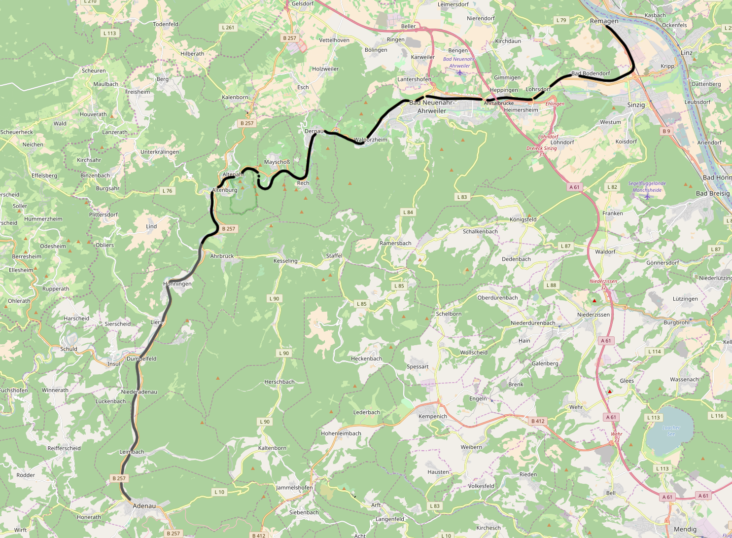
The Ahr Valley Railway (german: Ahrtalbahn), Remagen–Ahrbrück, is currently a 29 km-long, partly single-track and non-electrified branch line, which runs through the Ahr valley from Remagen via Ahrweiler and Dernau to Ahrbrück in the German state of Rhineland-Palatinate. It is served by Regionalbahn services on lines RB 30 and RB 39 ( Deutsche Bahn timetable route number 477). History The history of the Ahr Valley Railway begins as a branch line of the West Rhine Railway (''Linke Rheinstrecke''). This line was built up the Rhine from Cologne to Rolandseck via Bonn by the Bonn–Cologne Railway Company (''Bonn-Cölner Eisenbahn-Gesellschaft'') between 1844 and 1856; it was extended to Bingerbrück via Remagen and Koblenz by the Rhenish Railway Company (''Rheinische Eisenbahn-Gesellschaft'') in 1858/59. On 23 September 1879, a ministerial decree was issued to authorise the building of the Ahr Valley Railway. Less than a year later, the Rhenish Railway opened t ... [...More Info...] [...Related Items...] OR: [Wikipedia] [Google] [Baidu] |
Remagen
Remagen ( ) is a town in Germany in the state of Rhineland-Palatinate, in the district of Ahrweiler. It is about a one-hour drive from Cologne, just south of Bonn, the former West German capital. It is situated on the left (western) bank of the river Rhine. There is a ferry across the Rhine from Remagen every 10–15 minutes in the summer. Remagen has many notable and well-maintained buildings, churches, castles and monuments. It also has a sizeable pedestrian zone with plenty of shops. Overlooking the west bank of the Rhine just north of the city centre is the Apollinariskirche. It has an observation deck that is only open to parishioners on Sundays. Pedestrians reach the church via a dirt trail that passes a series of roadside monuments representing each of the fourteen Stations of the Cross. The church grounds contain an outdoor crypt and an abbey. Further down the river is one of the many castles along the Rhine, perched even higher than the Apollinariskirche. History The R ... [...More Info...] [...Related Items...] OR: [Wikipedia] [Google] [Baidu] |
Ludendorff Bridge
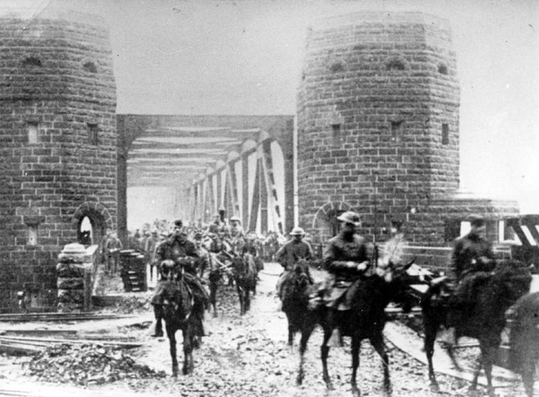
The Ludendorff Bridge (sometimes referred to as the Bridge at Remagen) was in early March 1945 a critical remaining bridge across the river Rhine in Germany when it was captured during the Battle of Remagen by United States Army forces during the closing weeks of the European part of World War II. Built in World War I to help deliver reinforcements and supplies to the German troops on the Western Front (World War I), Western Front, it connected Remagen on the west bank and the village of Erpel on the eastern side between two hills flanking the river. Midway through Operation Lumberjack, on 7 March 1945, the troops of the First United States Army, 1st U.S. Army approached Remagen and were surprised to find that the bridge was still standing. Its capture, two weeks before Field marshal (United Kingdom), Field Marshal Bernard Montgomery's meticulously planned Operation Plunder, enabled the U.S. Army to establish a bridgehead on the eastern side of the Rhine. After the U.S. force ... [...More Info...] [...Related Items...] OR: [Wikipedia] [Google] [Baidu] |
Prussian State Railways
The term Prussian state railways (German: ''Preußische Staatseisenbahnen'') encompasses those railway organisations that were owned or managed by the State of Prussia. The words "state railways" are not capitalized because Prussia did not have an independent railway administration; rather the individual railway organisations were under the control of the Ministry for Trade and Commerce or its later offshoot, the Ministry for Public Works. The official name of the Prussian rail network was ''Königlich Preußische Staatseisenbahnen'' (K.P.St.E., "Royal Prussian State Railways") until 1896, ''Königlich Preußische und Großherzoglich Hessische Staatseisenbahn'' (K.P.u.G.H.St.E., " Royal Prussian and Grand-Ducal Hessian State Railways") until the end of the First World War, and ''Preußische Staatsbahn'' (P.St.B., "Prussian State Railway") until its nationalization in 1920. A common mistake is the use of the abbreviation K.P.E.V. in supposed reference to a mythical "Royal Prussian ... [...More Info...] [...Related Items...] OR: [Wikipedia] [Google] [Baidu] |
Strategic Railway
A strategic railway is a railway proposed or constructed primarily for military strategic purposes, as opposed to the usual purpose of a railway, which is the transport of civilian passengers or freight. Although the archetypal strategic railway would be one constructed ''solely'' as part of a military strategy, such a railway has only ever existed in theory. Thus, a strategic railway is, in practice, one for which any intended or contemplated civilian purpose is subordinate to the military strategic purpose. Strategic railways are not to be confused with military railways, which can take several different forms. A military railway is established or operated not as a strategic measure, but for tactical, training or logistical purposes. However, it is possible for a railway to be proposed or constructed for more than one military purpose, including a strategic purpose. An example of such a railway is the notorious Burma Railway, the hasty construction of which was as much a st ... [...More Info...] [...Related Items...] OR: [Wikipedia] [Google] [Baidu] |
First World War
World War I (28 July 1914 11 November 1918), often abbreviated as WWI, was one of the deadliest global conflicts in history. Belligerents included much of Europe, the Russian Empire, the United States, and the Ottoman Empire, with fighting occurring throughout Europe, the Middle East, Africa, the Pacific, and parts of Asia. An estimated 9 million soldiers were killed in combat, plus another 23 million wounded, while 5 million civilians died as a result of military action, hunger, and disease. Millions more died in genocides within the Ottoman Empire and in the 1918 influenza pandemic, which was exacerbated by the movement of combatants during the war. Prior to 1914, the European great powers were divided between the Triple Entente (comprising France, Russia, and Britain) and the Triple Alliance (containing Germany, Austria-Hungary, and Italy). Tensions in the Balkans came to a head on 28 June 1914, following the assassination of Archduke Franz Ferdina ... [...More Info...] [...Related Items...] OR: [Wikipedia] [Google] [Baidu] |


