|
N55 Highway (Philippines)
The Romulo Highway or Tarlac–Pangasinan Road, (formerly National Highway 13) is a major highway in the Philippines that connects the provinces of Tarlac and Pangasinan. The highway is named after Filipino diplomat, politician, soldier, journalist and author Carlos P. Romulo, who had served, among other things, as President of the United Nations General Assembly from 1949–1950. Romulo was born in town of Camiling, Tarlac, through which the highway passes. The entire road forms part of National Route 55 (N55) of the Philippine highway network The Philippine highway network is a network of national roads owned and maintained by the Department of Public Works and Highways (DPWH) and organized into three classifications according to their function or purpose: national primary, seconda .... Route description Intersections References Roads in Pangasinan Roads in Tarlac {{Philippines-transport-stub ... [...More Info...] [...Related Items...] OR: [Wikipedia] [Google] [Baidu] |
Tarlac City
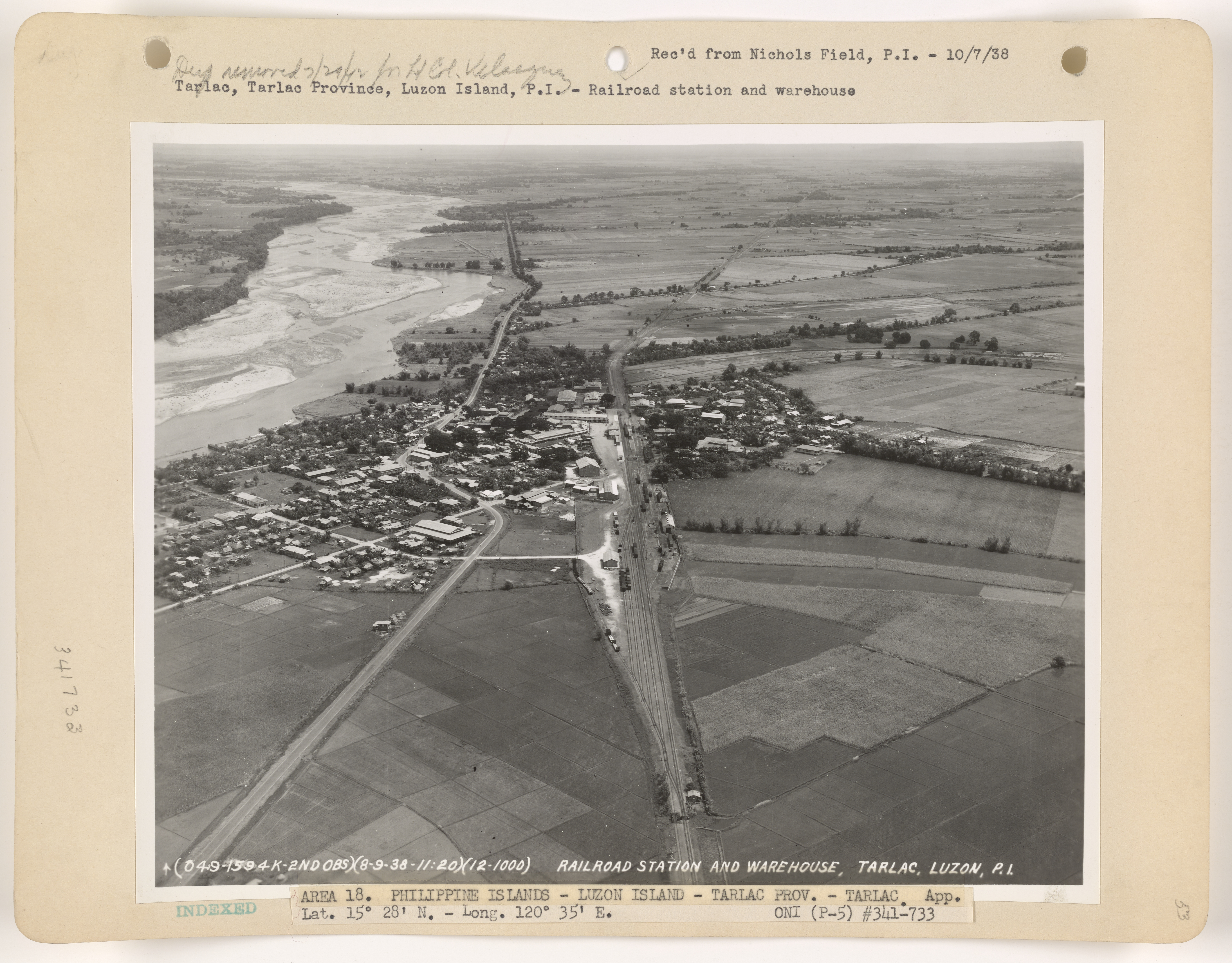
Tarlac City, officially the City of Tarlac ( pam, Lakanbalen ning Tarlac; pag, Siyudad na Tarlac; ilo, Siudad ti Tarlac; fil, Lungsod ng Tarlac ), is a 1st class component city and capital of the province of Tarlac, Philippines. According to the 2020 census, it has a population of 385,398 people. The city was proclaimed as a highly urbanized city by the former President Gloria Macapagal Arroyo, but the decision was opposed by the provincial government. History Tarlac's first settlers came from Bacolor, Pampanga. They cleared the area, fertilised the soil, and then established their settlement here in 1788. This small community of settlers experienced rapid population growth, as settlers from Bataan, Pampanga and Zambales moved into the area. The Kapampangan language, which is the dialect of Pampanga, became the native language of this town. Roads and barrios were built over the following decades through hard work of its residents. Following the foundation of the provinc ... [...More Info...] [...Related Items...] OR: [Wikipedia] [Google] [Baidu] |
Camiling, Tarlac
Camiling, officially the Municipality of Camiling, ( pag, Baley na Camiling; ilo, Ili ti Camiling; tl, Bayan ng Camiling) is a 1st class municipality in the province of Tarlac in the Philippines. According to the 2020 census, it has a population of 87,319 people. Camiling is one of the fastest-growing towns of Tarlac when it comes to income and economy. It is also considered one of the richest when it comes to cultural heritage in the entire province. The town is also dubbed to be the ''"Old Lady in the Northwestern province of Tarlac"'' because it is one of the oldest municipality created by the Spanish government under the province of Pangasinan where it previously included the former barrio of Mayantoc, San Clemente, and Santa Ignacia. The municipality also features cultural antiquity such as its churches, ancestral houses, and ruins. However, the baroque church of Camiling has yet to be restored after 20 years since a fire burned its interior. The inside of the church, one ... [...More Info...] [...Related Items...] OR: [Wikipedia] [Google] [Baidu] |
Bugallon, Pangasinan
Bugallon, officially the Municipality of Bugallon ( pag, Baley na Bugallon; ilo, Ili ti Bugallon; tgl, Bayan ng Bugallon), is a 2nd class municipality in the province of Pangasinan, Philippines. According to the 2020 census, it has a population of 74,962 people. Bugallon is from Lingayen and from Manila. History The Municipality of Bugallon was formerly called "Salasa" (meaning floor joist in the dialect, a part of a wooden house where the floor is attached to). In the Spanish colonial era, the Spanish authorities established the town center in Poblacion (now Barangay Salasa). Because of the 1914 massive flooding and erosion, the town center was later transferred to Barrio Anagao (became Barangay Poblacion) but the Our Lady of Lourdes Catholic Church, one of the oldest churches in the country, could not be transferred (every time someone attempts, he dies). A new Catholic church was created in the Poblacion, the Saint Andrew Catholic Church. This is the reason why Bugallo ... [...More Info...] [...Related Items...] OR: [Wikipedia] [Google] [Baidu] |
MacArthur Highway
The MacArthur Highway, officially the Manila North Road (MNR or MaNor), is a , two-to-six lane, national primary highway and tertiary highway in Luzon, Philippines, connecting Caloocan in Metro Manila to Aparri in Cagayan. It is the second longest road in the Philippines, after Maharlika Highway. It is primarily known as MacArthur Highway in segments from Caloocan to Urdaneta, Pangasinan, although it is also applied up to Ilocos Sur, and likewise called as Manila North Road for the entire length. Route description Manila North Road is a toll-free, two- to eight-lane national road that stretches for about from the Bonifacio Monument (Monumento) Circle in Caloocan to the northern Philippine province, province of Cagayan, passing through three cities in Metro Manila (Caloocan, Malabon, and Valenzuela, Philippines, Valenzuela), three provinces of Central Luzon (Bulacan, Pampanga and Tarlac), four provinces of the Ilocos Region (Pangasinan, La Union, Ilocos Sur, and Ilocos Norte), ... [...More Info...] [...Related Items...] OR: [Wikipedia] [Google] [Baidu] |
Lingayen, Pangasinan
Lingayen, officially the Municipality of Lingayen ( pag, Baley na Lingayen; ilo, Ili ti Lingayen; tgl, Bayan ng Lingayen), is a 1st class municipality and capital of the province of Pangasinan, Philippines. According to the 2020 census, it has a population of 107,728 people. It is the capital and the seat of government of the province of Pangasinan. Lingayen was a strategic point during World War II. It is also the birthplace of former President Fidel V. Ramos. History The Augustinian missionaries and the Spanish conquistadores drew a plan of Lingayen in 1614 and Lingayen was founded. The founders named the town Lingayen at the suggestion of natives themselves, due to a certain corpulent tamarind tree growing on the present town plaza at that time. The tree was exceptionally big, tall, and spreading; that the surrounding trees were just drafts in comparison. Passers-by developed the habit of looking back and back again at this corpulent tree until it would vanish from their re ... [...More Info...] [...Related Items...] OR: [Wikipedia] [Google] [Baidu] |
Tarlac
Tarlac, officially the Province of Tarlac ( pam, Lalawigan ning Tarlac; pag, Luyag/Probinsia na Tarlac; ilo, Probinsia ti Tarlac; tgl, Lalawigan ng Tarlac; ), is a landlocked province in the Philippines located in the Central Luzon region. Its capital is the city of Tarlac. It is bounded on the north by the province of Pangasinan, Nueva Ecija on the east, Zambales on the west and Pampanga in the south. The province comprises three congressional districts and is subdivided into 17 municipalities and one city, Tarlac City, which is the provincial capital. The province is situated in the heartland of Luzon, in what is known as the Central Plain also spanning the neighbouring provinces of Pampanga, Pangasinan, Nueva Ecija and Bulacan. Tarlac covers a total land area of . Early in history, what came to be known as Valenzuela Ranch today was once a thickly-forested area, peopled by roving tribes of nomadic Aetas who are said to be the aboriginal settlers of the Philippines, and ... [...More Info...] [...Related Items...] OR: [Wikipedia] [Google] [Baidu] |
Pangasinan
Pangasinan, officially the Province of Pangasinan ( pag, Luyag/Probinsia na Pangasinan, ; ilo, Probinsia ti Pangasinan; tl, Lalawigan ng Pangasinan), is a coastal province in the Philippines located in the Ilocos Region of Luzon. Its capital is Lingayen. Pangasinan is in the western area of Luzon along the Lingayen Gulf and the South China Sea. It has a total land area of . According to the 2020 census it has a population of 3,163,190. The official number of registered voters in Pangasinan is 1,651,814. The western portion of the province is part of the homeland of the Sambal people, while the central and eastern portions are the homeland of the Pangasinan people. Due to ethnic migration, the Ilocano people settled in the province. Pangasinan is the name of the province, the people and the spoken language. Indigenous Pangasinan speakers are estimated to number at least 2 million. The Pangasinan language, which is official in the province, is one of the officially recogniz ... [...More Info...] [...Related Items...] OR: [Wikipedia] [Google] [Baidu] |
Santa Ignacia, Tarlac
Santa Ignacia, officially the Municipality of Santa Ignacia ( pag, Baley na Santa Ignacia; ilo, Ili ti Santa Ignacia; tl, Bayan ng Santa Ignacia), is a 2nd class municipality in the province of Tarlac, Philippines. Santa Ignacia has a total land area of . It is composed of 24 barangays two of which (Poblacion East and Poblacion West) are located in the urban area while the rest of 22 barangays are located in the rural areas. According to the 2020 census, it has a population of 51,626 people. Santa Ignacia is from provincial capital Tarlac City and from Manila. Geography Barangays Santa Ignacia is politically subdivided into 24 barangays. * Baldios * Botbotones * Caanamongan * Cabaruan * Cabugbugan * Caduldulaoan * Calipayan * Macaguing * Nambalan * Padapada * Pilpila * Pinpinas * Poblacion ''Poblacion'' (literally "town" or "settlement" in Spanish language in the Philippines, Spanish; ) is the common term used for the administrative center, central, downtown ... [...More Info...] [...Related Items...] OR: [Wikipedia] [Google] [Baidu] |
San Clemente, Tarlac
San Clemente, officially the Municipality of San Clemente ( pag, Baley na San Clemente; ilo, Ili ti San Clemente; tl, Bayan ng San Clemente), is a 5th class municipality in the province of Tarlac, Philippines. According to the 2020 census, it has a population of 13,181 people. Geography San Clemente borders the provinces of Pangasinan to the north and northwest and Zambales to the west. Like Santa Ignacia and Mayantoc, it is a former part of Camiling. San Clemente is from the provincial capital Tarlac City and from Manila. Barangays San Clemente is politically subdivided into 12 barangays. * Balloc * Bamban * Casipo * Catagudingan * Daldalayap * Doclong 1 * Doclong 2 * Maasin * Nagsabaran * Pit-ao * Poblacion ''Poblacion'' (literally "town" or "settlement" in Spanish; ) is the common term used for the administrative center, central, downtown, old town or central business district area of a Philippine city or municipality, which may take up the ... Norte ... [...More Info...] [...Related Items...] OR: [Wikipedia] [Google] [Baidu] |
Mangatarem, Pangasinan
Mangatarem, officially the Municipality of Mangatarem ( pag, Baley na Mangatarem; ilo, Ili ti Mangatarem; tgl, Bayan ng Mangatarem), is a 1st class municipality of the Philippines, municipality in the Philippine Province, province of Pangasinan, Philippines. According to the 2020 census, it has a population of 79,323 people. Mangatarem is a Pangasinan language, Pangasinan word for "''mango plantation''". The town's name also came from the Ilokano language, Ilocano Phrase “''mangga ken tirem”'' which means "''mango and oyster''". The Municipality is home to the Manleluag Spring Protected Landscape, Manleluag Hot Spring Protected Landscape located in Barangay Malabobo near the southern boundary of the municipality. Mangatarem is from provincial capital Lingayen and from Manila. In terms of economic activities, Mangatarem is primarily driven by agriculture. The municipality has the biggest land area in the entire Pangasinan province. A big percentage of its households also ... [...More Info...] [...Related Items...] OR: [Wikipedia] [Google] [Baidu] |
Aguilar, Pangasinan
Aguilar, officially the Municipality of Aguilar ( pag, Baley na Aguilar; ilo, Ili ti Aguilar; tgl, Bayan ng Aguilar), is a 3rd class municipality in the province of Pangasinan, Philippines. According to the 2020 census, it has a population of 45,100 people. The municipality was named after Spanish governor-general Rafael María de Aguilar, who ordered the establishment of an independent civil political unit on 16 July 1805. Aguilar is from provincial capital Lingayen and from Manila. History The Municipality of Aguilar had its early beginnings as cattle ranch founded by the Spaniards. The place was known then as Sitio Balubad, which was then still part of the town of Binalatongan (now San Carlos). On the western part were the Zambales Mountains with thick forests and verdant foliage. It was hunter's paradise with deer roaming here and there with an occasional wild boar making an appearance. The grass in the plains were succulent fare for fattening cattle and the water from ... [...More Info...] [...Related Items...] OR: [Wikipedia] [Google] [Baidu] |
Philippines
The Philippines (; fil, Pilipinas, links=no), officially the Republic of the Philippines ( fil, Republika ng Pilipinas, links=no), * bik, Republika kan Filipinas * ceb, Republika sa Pilipinas * cbk, República de Filipinas * hil, Republika sang Filipinas * ibg, Republika nat Filipinas * ilo, Republika ti Filipinas * ivv, Republika nu Filipinas * pam, Republika ning Filipinas * krj, Republika kang Pilipinas * mdh, Republika nu Pilipinas * mrw, Republika a Pilipinas * pag, Republika na Filipinas * xsb, Republika nin Pilipinas * sgd, Republika nan Pilipinas * tgl, Republika ng Pilipinas * tsg, Republika sin Pilipinas * war, Republika han Pilipinas * yka, Republika si Pilipinas In the recognized optional languages of the Philippines: * es, República de las Filipinas * ar, جمهورية الفلبين, Jumhūriyyat al-Filibbīn is an archipelagic country in Southeast Asia. It is situated in the western Pacific Ocean and consists of around 7,641 islands t ... [...More Info...] [...Related Items...] OR: [Wikipedia] [Google] [Baidu] |


