|
Nsugbe
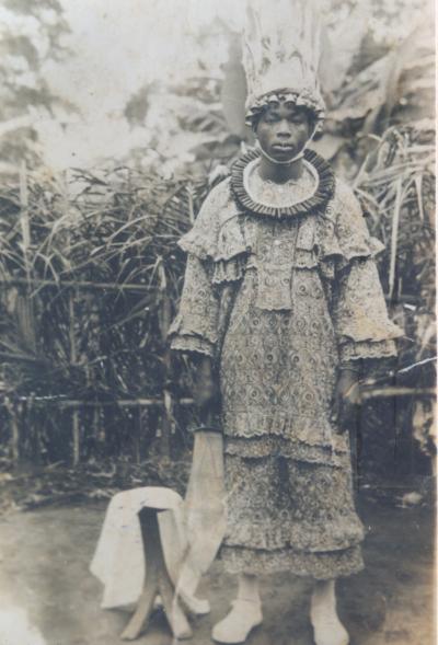
Nsugbe is a town in Anambra East Local Government Area, Anambra State, Nigeria. Location It is bordered by Onitsha on the west, Nkwelle-Ezunaka, Umunya to the southwest, Anam to the North. On the east are towns such as Umuleri, Aguleri, Enugwu Aguleri, Nando, Nteje, Awkuzu, Igbariam, and Achalla. Among the villages within Nsugbe includes Agbalagbo, Amumu, Akpalagu and Oguari. Origin Oral tradition has it that the first settlers to arrive at Nsugbe were the descendants of Omini son of Enugwu Aguleri Eri who emigrated from Enugwu Aguleri after the death of their father and settled at Okpuno Enugwu Nsugbe, an area on the outskirt of modern Nsugbe. However, Nsugbe the leader of the group was recalled to Aguleri on the death of Enini (Omini) his father. Some of his descendants with his brother Nta remained and were later joined by other immigrants from Ivite Agulu-eri to establish the present day Enugwu Nsugbe, Offianta Nsugbe and Abah Nsugbe. The founders of Nnadi village accordin ... [...More Info...] [...Related Items...] OR: [Wikipedia] [Google] [Baidu] |
Alphonsus Igbeke
Alphonsus Obi Igbeke (born 1962) was sworn in as Senator for the Anambra North constituency of Anambra State, Nigeria on 25 May 2010 after the election of Joy Emordi of the People's Democratic Party (PDP) had been annulled. He is a member of the All Nigeria Peoples Party (ANPP). Igbeke, popularly known as Ubanese, was born in 1962 in Nsugbe to the north of Onitsha in Anambra State. He studied in Nigeria and the US, earning a PhD in Engineering Sciences. Returning to Nigeria he went into the contracting business, and became a successful businessman with properties in Onitsha and Lagos Lagos (Nigerian English: ; ) is the largest city in Nigeria and the List of cities in Africa by population, second most populous city in Africa, with a population of 15.4 million as of 2015 within the city proper. Lagos was the national ca .... Igbeke was a contender to be a PDP candidate for a seat in the House of Representatives in the 2003 elections, but failed to be nominated. He tr ... [...More Info...] [...Related Items...] OR: [Wikipedia] [Google] [Baidu] |
Anambra State
Anambra State is a Nigerian state, located in the southeastern region of the country. The state was created on August 27, 1991. Anambra state is bounded by Delta State to the west, Imo State to the south, Enugu State to the east and Kogi State to the north. According to the 2022 census report, there are over 9 million residents in the state. The state name was formed in 1976 from the former East Central State. The state is named after Omambala River, a river that runs through the state. Anambra is the Anglicized name of the Omambala River, Omambala. The State capital is Awka, a rapidly growing city that increased in population from approximately 700,000 to more than 6 million between 2006 and 2020. The city of Onitsha, a historic port city from the pre-colonial era, remains an important centre of commerce within the state. Nicknamed the "Light of the Nation", Anambra State is the List of Nigerian states by population, eighth most populous state in the nation, although that has ... [...More Info...] [...Related Items...] OR: [Wikipedia] [Google] [Baidu] |
Umuleri
Umueri, also known and pronounced as Umuleri, is an ancient town in the Anambra State of Southeastern Nigeria. The people of Umueri belong to the Igbo ethnic group, and the town has an estimated population of 1,500,000. It is located within the Anambra Valley, bordered by the Anambra River (''Omabala'' River) and Anam communities in the north, Nteje to the south, Aguleri and Nando in the east and Nsugbe in the western flank. The forebears are widely acknowledged as the first settler in Omambala valley. Umueri has three main quarters: Ezi Umueri , Ifite Umueri, and Ikenga Umueri. The arrival of orient oil and petroleum to Anambra state was a great blessing to south East as a whole and Umueri as a town benefited so much. The building of Anambra International Airport located at Ifite Umueri was one of the greatest investment of our time. A project which attracted federal government presence to this town. This Airport had her first flight in December 2021. Amongst its benefit to th ... [...More Info...] [...Related Items...] OR: [Wikipedia] [Google] [Baidu] |
Flag Of Nigeria
Work toward freedom led to the formation of a national planning committee, which in 1958 named for a competition to choose a national flag. Thousands of designs were submitted, but the flag of equivalent green-white-green flat stripes, green stood for farming and white for unity and peace was chosen. The flag of the Federal Republic of Nigeria was designed in 1959 and first officially hoisted on 1 October 1960. The flag has three vertical bands of green, white, green. The two green stripes represent natural wealth, and the white represents peace and unity. Design The flag is an adaptation of the winning entry from Michael Taiwo Akinkunmi in a competition held in 1959. Akinkunmi was a 23-year-old student at the time he designed the flag. He was studying at Norwood Technical College in London, England, when he saw an advertisement in a newspaper that submissions were being accepted for the design of a new national flag of Nigeria. He submitted a triband design consisting ... [...More Info...] [...Related Items...] OR: [Wikipedia] [Google] [Baidu] |
Awkuzu
Awkuzu is a town in Oyi Local Government Area of Anambra state of Nigeria. Origin The story of Origin of Awkụzụ, Awkụzụ was one of the progenies of the fifth child of Eri his only daughter called Iguedo, who is also said to have borne the founders of Ogbunike, Awkụzụ, Umueri and Nando. Awkụzụ which is the colonial era of the name, "OKUZU" is presently located in Oyi Local Government Area of Anambra State and is bounded by Umunya and Nteje towns also in Oyi LGA, Ifitedunu, Ukpo and Ukwulu in Dunukofia LGA and Nando and Igbariam towns in today's Anambra East LGA, and Abba in Njikoka LGA. Division Awkụzụ is divided into three main parts: Ezi, Ifite and Ikenga sections according to seniority or birth order. Like most Eri-Awka towns of Igboland, each section is further divided into sub-villages. *Ezi has Iru-Ayika, Aka-Ezi, Igbu and Ozu . *Ifite section is made up of Amabo, Isioji, and Ifite-Umueri. *Ikenga has Ezinkwo, Nkwelle-Awkuzu, Umuobi, Ukpoma ... [...More Info...] [...Related Items...] OR: [Wikipedia] [Google] [Baidu] |
Benin
Benin ( , ; french: Bénin , ff, Benen), officially the Republic of Benin (french: République du Bénin), and formerly Dahomey, is a country in West Africa. It is bordered by Togo to the west, Nigeria to the east, Burkina Faso to the north-west, and Niger to the north-east. The majority of its population lives on the southern coastline of the Bight of Benin, part of the Gulf of Guinea in the northernmost tropical portion of the Atlantic Ocean. The capital is Porto-Novo, and the seat of government is in Cotonou, the most populous city and economic capital. Benin covers an area of and its population in was estimated to be approximately million. It is a tropical nation, dependent on agriculture, and is an exporter of palm oil and cotton. Some employment and income arise from subsistence farming. The official language of Benin is French, with indigenous languages such as Fon, Bariba, Yoruba and Dendi also spoken. The largest religious group in Benin is Sunni Islam (27 ... [...More Info...] [...Related Items...] OR: [Wikipedia] [Google] [Baidu] |
Niger
) , official_languages = , languages_type = National languagesRépublique du Niger, "Loi n° 2001-037 du 31 décembre 2001 fixant les modalités de promotion et de développement des langues nationales." L'aménagement linguistique dans le monde (accessed 21 September 2016) , languages = , religion_ref = , religion_year = 2012 , religion = , demonym = Nigerien , capital = , coordinates ... [...More Info...] [...Related Items...] OR: [Wikipedia] [Google] [Baidu] |
Igboland
Igboland (Standard ), also known as Southeastern Nigeria (but extends into South-Southern Nigeria), is the indigenous homeland of the Igbo people. It is a cultural and common linguistic region in southern Nigeria. Geographically, it is divided by the lower Niger River into two sections: an eastern (the larger of the two) and a western one. Its population is characterised by the diverse Igbo culture and the speakers of equally diverse Igbo languages. Politically, Igboland is divided into several southern Nigerian states; culturally, it has included several subgroupings, including the Anioma, the Ngwa people, Ngwa, the Aro people, Aro, the Edda people, Ezza, the Ibeku, the Ohuhu people, Ohuhu, the Oboro (Nigeria), Oboro, the Ikwerre people, Ikwerre, the Ogba people, Ogba, the Omuma, the Ohafia, the Oyigbo, the Mbaise, the Isu people, Isu and the Ekpeye. Territorial boundaries Igboland is surrounded on all sides by large rivers, and other southern and central Nigeria indigenous tr ... [...More Info...] [...Related Items...] OR: [Wikipedia] [Google] [Baidu] |
Achalla
Achalla is the capital of Awka North, a Local Government Area in Anambra State, south-central Nigeria Nigeria ( ), , ig, Naìjíríyà, yo, Nàìjíríà, pcm, Naijá , ff, Naajeeriya, kcg, Naijeriya officially the Federal Republic of Nigeria, is a country in West Africa. It is situated between the Sahel to the north and the Gulf o .... It comprises eight villages: Umudiani, Amukabia, Odawa, Umuogbe, Umunagu, Umuozede, Udezu and Amadim. Populated places in Anambra State {{Anambra-geo-stub ... [...More Info...] [...Related Items...] OR: [Wikipedia] [Google] [Baidu] |
Enugwu Aguleri
Enugwu Aguleri is a community in Anambra state (Nigeria) with one of the oldest dynasty in South eastern Nigeria in which the kingdom has produced over thirty four kings of Aguleri, up to the 18th century, and has continued, in recent times, up to now, to produce the ruler of Enugwu Aguleri. The Ezeora dynasty has remained powerful been the sacred holder of the Ovo Eri and as well occupying the throne of Eri at Obu-Gad.{{Citation needed, date=December 2018 It is located in the present Anambra State Anambra State is a Nigerian state, located in the southeastern region of the country. The state was created on August 27, 1991. Anambra state is bounded by Delta State to the west, Imo State to the south, Enugu State to the east and Kogi St .... Administration Traditional Rulership: - Hereditary (Ezeora Dynasty) The Ndi Ichie, Ndi Ojiana, Eze Eri Cabinet chiefs and the Town Union Executives. Villages Enugwu Aguleri comprises six (6) villages namely Amuleri (Ama Amuleri), ... [...More Info...] [...Related Items...] OR: [Wikipedia] [Google] [Baidu] |


