|
Northallerton
Northallerton ( ) is a market town and civil parish in the Hambleton District of North Yorkshire, England. It lies in the Vale of Mowbray and at the northern end of the Vale of York. It had a population of 16,832 in the 2011 census, an increase from 15,741 in 2001. It has served as the county town of the North Riding of Yorkshire and, since 1974, of North Yorkshire. Northallerton is made up of four wards: North, Broomfield, Romanby and Central. There has been a settlement at Northallerton since Roman times; however its growth in importance began in the 11th century when King William II gifted land to the Bishop of Durham. Under the Bishop's authority Northallerton became an important religious centre. Later, it was a focus for much conflict between the English and the Scots, most notably the Battle of the Standard, fought nearby in 1138, which saw losses of as many as 12,000 men. In later years trade and transport became more important. The surrounding area was discovere ... [...More Info...] [...Related Items...] OR: [Wikipedia] [Google] [Baidu] |
Railways In Northallerton
The network of railways in Northallerton, North Yorkshire, England, was constructed by three companies whose lines through the town were built between 1841 and 1852. They were all amalgamated into the North Eastern Railway (NER) which in turn was subsumed into the London and North Eastern Railway in 1923 and British Rail in 1948. British Rail closed two lines, the Wensleydale line in 1954 and a section of the Leeds Northern Railway to in 1969. The Wensleydale line was retained as a freight branch and resurrected as a heritage railway in 2003 but the line to Harrogate closed completely. Despite closures and rationalisation, the station still is at a major junction on the East Coast Main Line. is on the East Coast Main Line and TransPennine Express Northern Line. The station is north of London King's Cross, north of railway station and south of railway station. History 1841–1901 A railway between York and Darlington via Northallerton was suggested in 1826 in the '' ... [...More Info...] [...Related Items...] OR: [Wikipedia] [Google] [Baidu] |
North Yorkshire
North Yorkshire is the largest ceremonial county (lieutenancy area) in England, covering an area of . Around 40% of the county is covered by national parks, including most of the Yorkshire Dales and the North York Moors. It is one of four counties in England to hold the name Yorkshire; the three other counties are the East Riding of Yorkshire, South Yorkshire and West Yorkshire. North Yorkshire may also refer to a non-metropolitan county, which covers most of the ceremonial county's area () and population (a mid-2016 estimate by the ONS of 602,300), and is administered by North Yorkshire County Council. The non-metropolitan county does not include four areas of the ceremonial county: the City of York, Middlesbrough, Redcar and Cleveland and the southern part of the Borough of Stockton-on-Tees, which are all administered by unitary authorities. The non-metropolitan county and the City of York are within the Yorkshire and the Humber region. Middlesbrough, Redcar ... [...More Info...] [...Related Items...] OR: [Wikipedia] [Google] [Baidu] |
Richmond, North Yorkshire (UK Parliament Constituency)
Richmond (Yorks) is a constituency in North Yorkshire represented in the House of Commons of the UK Parliament since May 2015 by Rishi Sunak, the current Prime Minister of the United Kingdom and leader of the Conservative Party. Constituency profile The constituency presents itself as a safe seat for the Conservative Party, which held it continuously since 1910 (if including the 11 years by the allied Unionist Party from 1918), and in the 2010 general election, Richmond produced the largest numerical and percentage majority for a Conservative, 62.8% of the vote. The Conservative MP and one-time Party leader William Hague held the seat from a by-election in 1989 until he retired from the Commons in 2015. He had held the posts of Leader of the Opposition (1997–2001), Foreign Secretary (2010–2014) and Leader of the House of Commons (2014–2015). His successor Rishi Sunak served as Chancellor of the Exchequer from February 2020 to July 2022 and as Prime Minister fro ... [...More Info...] [...Related Items...] OR: [Wikipedia] [Google] [Baidu] |
Brompton, Hambleton
Brompton is a village, civil parish and electoral ward in the Hambleton District of North Yorkshire, England, about north of the county town of Northallerton. Practically a suburb of the nearby county town, the village was near the site of a battle between English and Scots armies and was the location of mills producing linen goods from the 18th century onward. With 2,055 people this village has grown considerably since the 1800s. History The village is mentioned in the Domesday Book of 1086 as ''Bruntone'' in the Allerton hundred. Prior to the invasion, the manor was granted to '' Earl Edwin'', but subsequently granted in 1086 to the Crown and were added to the lands that were the possession of the Bishop of Durham St Cuthbert and remained so after 1086. In 1836 those lands were transferred to the see of Ripon. The village became an ecclesiastical parish in 1843. The etymology of the name is derived from a combination of the Old English word ''brōm'', meaning ''broom'' ... [...More Info...] [...Related Items...] OR: [Wikipedia] [Google] [Baidu] |
Battle Of The Standard
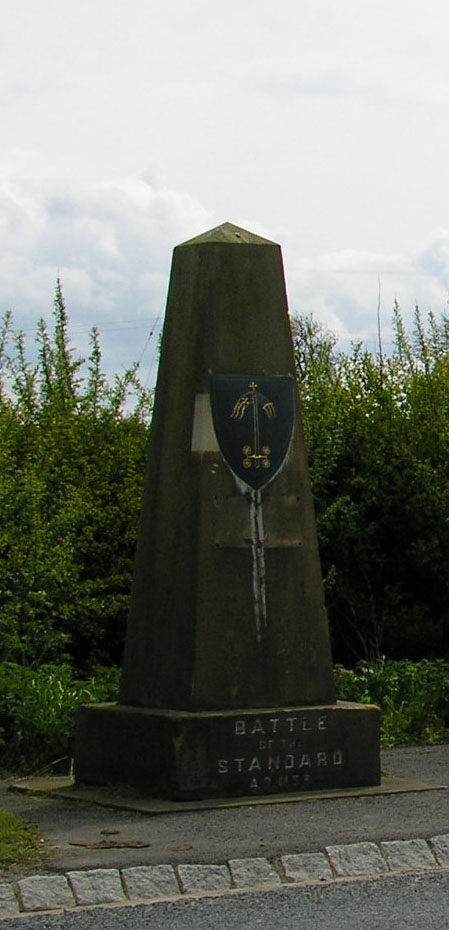
The Battle of the Standard, sometimes called the Battle of Northallerton, took place on 22 August 1138 on Cowton Moor near Northallerton in Yorkshire, England. English forces under William of Aumale repelled a Scottish army led by King David I of Scotland. King Stephen of England, fighting rebel barons in the south, had sent a small force (largely mercenaries), but the English army was mainly local militia and baronial retinues from Yorkshire and the north Midlands. Archbishop Thurstan of York had exerted himself greatly to raise the army, preaching that to withstand the Scots was to do God's work. The centre of the English position was therefore marked by a mast (mounted upon a cart) bearing a pyx carrying the consecrated host and from which were flown the consecrated banners of the minsters of Durham, York, Beverley and Ripon: hence the name of the battle. This cart-mounted standard was a very northerly example of a type of standard common in contemporary Italy, where ... [...More Info...] [...Related Items...] OR: [Wikipedia] [Google] [Baidu] |
Hambleton District
Hambleton is a Non-metropolitan district, local government district in North Yorkshire, England. The administrative centre is Northallerton, and the district includes the outlying towns and villages of Bedale, Thirsk, Great Ayton, Stokesley, and Easingwold. The district was formed by the Local Government Act 1972 on 1 April 1974, as a merger of Northallerton Urban district (Great Britain and Ireland), Urban District, Bedale Rural District, Easingwold Rural District, Northallerton Rural District, and parts of Thirsk Rural District, Stokesley Rural District and Croft Rural District, all in the North Riding of Yorkshire. Geography Hambleton covers an area of 1 E9 m², 1,311.17 km² most of which, 1,254.90 km², is Natural environment, green space. The district is named after the Hambleton Hills, part of the North York Moors National Park, on the eastern edge of the district. This area is the subject of a national habitat protection scheme as articulated in the United Kin ... [...More Info...] [...Related Items...] OR: [Wikipedia] [Google] [Baidu] |
North Riding Of Yorkshire
The North Riding of Yorkshire is a subdivision of Yorkshire, England, alongside York, the East Riding and West Riding. The riding's highest point is at Mickle Fell with 2,585 ft (788 metres). From the Restoration it was used as a lieutenancy area, having been previously part of the Yorkshire lieutenancy. Each riding was treated as a county for many purposes, such as quarter sessions. An administrative county, based on the riding, was created with a county council in 1889 under the Local Government Act 1888. In 1974 both the administrative county and the North Riding of Yorkshire lieutenancy were abolished, replaced in most of the riding by the non-metropolitan county and lieutenancy of North Yorkshire. History Archives from 1808 record that the "north-riding of York-shire" had once consisted of "fifty-one lordships" owned by Robert the Bruce. During the English Civil War, the North Riding predominantly supported the royalist cause, while other ar ... [...More Info...] [...Related Items...] OR: [Wikipedia] [Google] [Baidu] |
Vale Of Mowbray
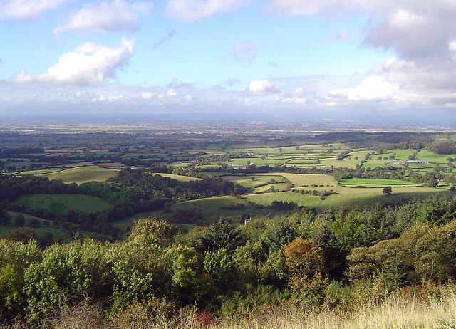
The Vale of Mowbray (sometimes mistakenly referred to as the Vale of York) is a stretch of low-lying land between the North York Moors and the Hambleton Hills to the east and the Yorkshire Dales to the west. To the north lie the Cleveland lowlands and to the south the Vale of Mowbray becomes the Vale of York proper. The Vale of Mowbray is distinguishable from the Vale of York by its meandering rivers and more undulating landscape. The main characteristic of the Vale of Mowbray is the fertile agricultural land used for crops and permanent grassland, though isolated pockets of woodland remain. The roads in the Vale of Mowbray are characteristically contained by low hedges with wide verges. The villages are often linear following the major through road, the houses are generally brick built with pantile roofs. Description The vale takes its name from the family who were granted the rights to the land after the Norman Conquest of 1066. Robert de Mowbray, whose family had a strong ... [...More Info...] [...Related Items...] OR: [Wikipedia] [Google] [Baidu] |
York
York is a cathedral city with Roman Britain, Roman origins, sited at the confluence of the rivers River Ouse, Yorkshire, Ouse and River Foss, Foss in North Yorkshire, England. It is the historic county town of Yorkshire. The city has many historic buildings and other structures, such as a York Minster, minster, York Castle, castle, and York city walls, city walls. It is the largest settlement and the administrative centre of the wider City of York district. The city was founded under the name of Eboracum in 71 AD. It then became the capital of the Roman province of Britannia Inferior, and later of the kingdoms of Deira, Northumbria, and Jórvík, Scandinavian York. In the Middle Ages, it became the Province of York, northern England ecclesiastical province's centre, and grew as a wool-trading centre. In the 19th century, it became a major railway network hub and confectionery manufacturing centre. During the Second World War, part of the Baedeker Blitz bombed the city; it ... [...More Info...] [...Related Items...] OR: [Wikipedia] [Google] [Baidu] |
County Town
In the United Kingdom and Ireland, a county town is the most important town or city in a county. It is usually the location of administrative or judicial functions within a county and the place where the county's members of Parliament are elected. Following the establishment of the English county councils in 1889, the headquarters of the new councils were usually located in the county town of each county. However, the concept of a county town pre-dates the establishment of these councils. The concept of a county town is ill-defined and unofficial. Some counties have their administrative bodies located elsewhere. For example, Lancaster is the county town of Lancashire, but the county council is located in Preston. Some county towns are no longer situated within the administrative county because of changes in the county's boundaries. For example, Nottingham is administered by a unitary authority separate from the rest of Nottinghamshire. UK county towns, pre-19th-centu ... [...More Info...] [...Related Items...] OR: [Wikipedia] [Google] [Baidu] |
Angles
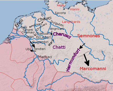
The Angles ( ang, Ængle, ; la, Angli) were one of the main Germanic peoples who settled in Great Britain in the post-Roman period. They founded several kingdoms of the Heptarchy in Anglo-Saxon England. Their name is the root of the name ''England'' ("land of Ængle"). According to Tacitus, writing around 100 AD, a people known as Angles (Anglii) lived east of the Langobards and Semnones, who lived near the Elbe river. Etymology The name of the Angles may have been first recorded in Latinised form, as ''Anglii'', in the ''Germania'' of Tacitus. It is thought to derive from the name of the area they originally inhabited, the Anglia Peninsula (''Angeln'' in modern German, ''Angel'' in Danish). Multiple theories concerning the etymology of the name have been hypothesised: # According to Gesta Danorum Dan and Angul (Angel) were made rulers by the consent of their people because of their bravery. Dan gave name to Danes and Angel gave names to Angles. # It originated fro ... [...More Info...] [...Related Items...] OR: [Wikipedia] [Google] [Baidu] |
Paulinus Of York
Paulinus (died 10 October 644) was a Roman missionary and the first Bishop of York. A member of the Gregorian mission sent in 601 by Pope Gregory I to Christianize the Anglo-Saxons from their native Anglo-Saxon paganism, Paulinus arrived in England by 604 with the second missionary group. Little is known of Paulinus's activities in the following two decades. After some years spent in Kent, perhaps in 625, Paulinus was consecrated a bishop. He accompanied Æthelburg of Kent, sister of King Eadbald of Kent, on her journey to Northumbria to marry King Edwin of Northumbria, and eventually succeeded in converting Edwin to Christianity. Paulinus also converted many of Edwin's subjects and built some churches. One of the women Paulinus baptised was a future saint, Hilda of Whitby. Following Edwin's death in 633, Paulinus and Æthelburg fled Northumbria, leaving behind a member of Paulinus's clergy, James the Deacon. Paulinus returned to Kent, where he became Bishop of Rocheste ... [...More Info...] [...Related Items...] OR: [Wikipedia] [Google] [Baidu] |

.jpg)


