|
North Hinksey
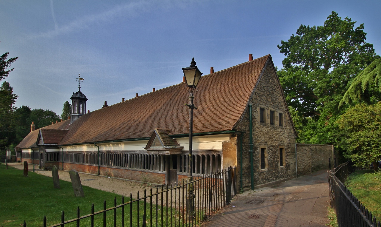
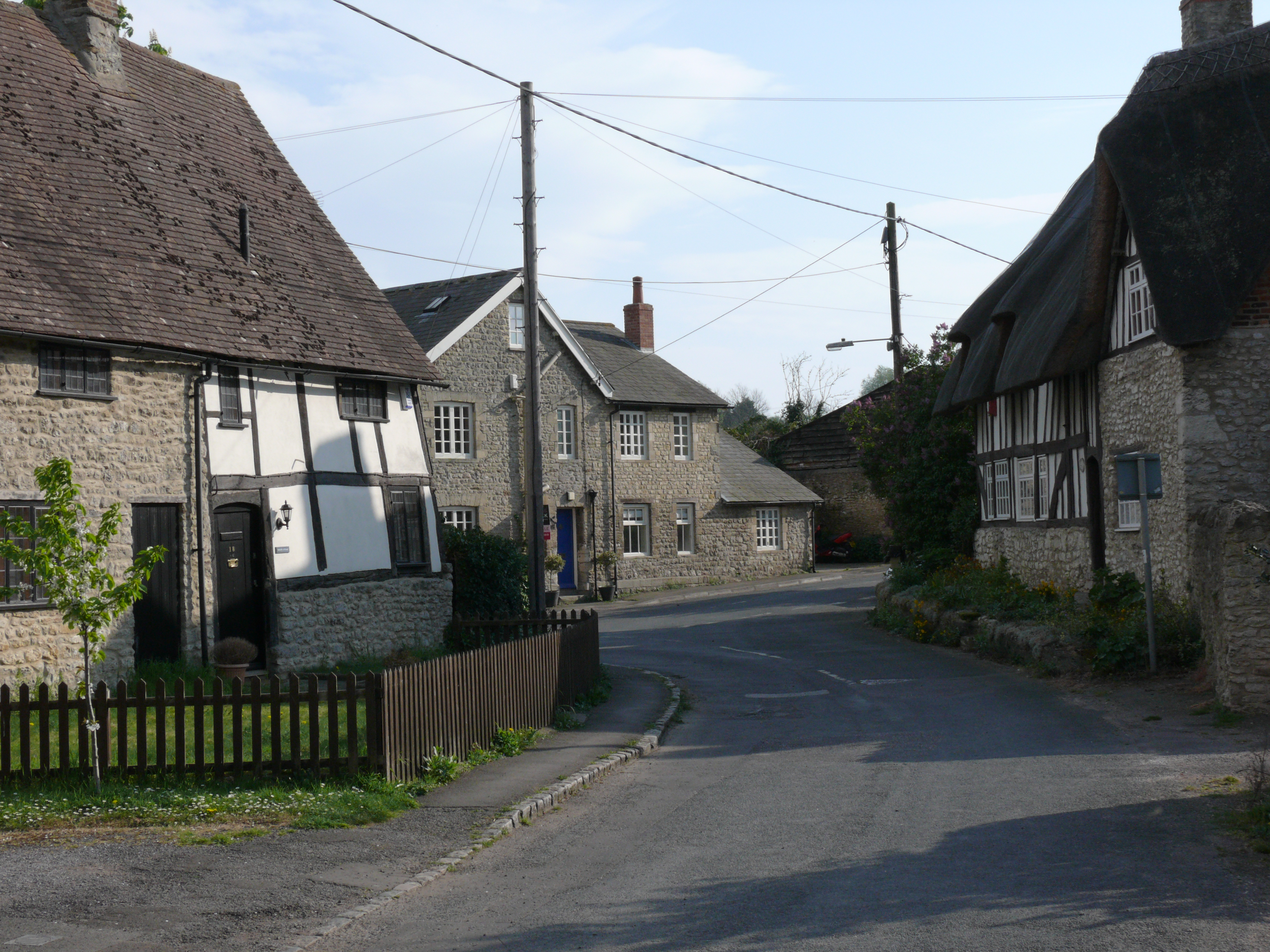
North Hinksey is a village and civil parish in Oxfordshire, England, immediately west of Oxford. The civil parish includes the large settlement of Botley, effectively a suburb of Oxford. North Hinksey was part of Berkshire until the 1974 boundary changes transferred it to Oxfordshire. The village of North Hinksey has a manor house, The Fishes public house, a Church of England primary school and a Church of England parish church, St. Lawrence's, which dates back to at least the 12th century. Four of the older houses have thatched roofs. There was also the administrative offices of the Church of England Diocese of Oxford (Diocesan Church House) in the enlarged former vicarage. This, as of September 2016 is to be converted to housing. Harcourt Hill and Raleigh Park lie to the southwest of the village. All the shopping and other facilities in the parish are now found in Botley. The centre of the old village is now effectively cut off from much of the newer part of Botley ... [...More Info...] [...Related Items...] OR: [Wikipedia] [Google] [Baidu] |
St Lawrence's Church, North Hinksey
St Lawrence's Church is a Church of England church in North Hinksey, West Oxford, England. The church is dedicated to St Lawrence, a Christian martyr. It is a Grade II* Listed Building. The church has a chancel, nave and tower. Exterior construction and later modifications The church building uses uncoursed limestone rubble with ashlar dressings and was originally constructed in the early Norman period (c. 1100CE). The roof uses stone tiles. The tower was originally constructed in the 13th century. The tower and south wall were rebuilt following their partial destruction during the English Civil War, c1670.Historic England Retrieved on 5 January 2019 Around 1850, a reproduction Norman chancel arch was constructed. In 1913, the church was restored by [...More Info...] [...Related Items...] OR: [Wikipedia] [Google] [Baidu] |
United Kingdom Census 2001
A nationwide census, known as Census 2001, was conducted in the United Kingdom on Sunday, 29 April 2001. This was the 20th UK census and recorded a resident population of 58,789,194. The 2001 UK census was organised by the Office for National Statistics (ONS) in England and Wales, the General Register Office for Scotland (GROS) and the Northern Ireland Statistics and Research Agency (NISRA). Detailed results by region, council area, ward and output area are available from their respective websites. Organisation Similar to previous UK censuses, the 2001 census was organised by the three statistical agencies, ONS, GROS, and NISRA, and coordinated at the national level by the Office for National Statistics. The Orders in Council to conduct the census, specifying the people and information to be included in the census, were made under the authority of the Census Act 1920 in Great Britain, and the Census Act (Northern Ireland) 1969 in Northern Ireland. In England and Wales the ... [...More Info...] [...Related Items...] OR: [Wikipedia] [Google] [Baidu] |
Raleigh Park, Oxfordshire
Raleigh Park is a park of about in North Hinksey, Oxfordshire (formerly in Berkshire), just west of Oxford. The land was formerly part of the estates of the Harcourt family. The land was sold in 1924 to Raymond ffennell, then owner of Wytham Abbey, who gave it to the City of Oxford for use as a park. It was named in honour of Professor Sir Walter Raleigh, who lived nearby on Harcourt Hill and died in 1922. Although the park lies in the green belt outside the city boundary, it is managed by Oxford City Council as a nature reserve and recreational park. Oxford City Council
Oxford City Council is the lower-tier local government authority for the city of Oxford in ...
[...More Info...] [...Related Items...] OR: [Wikipedia] [Google] [Baidu] |
Hinksey Stream
Hinksey Stream is a branch of the River Thames to the west of the city of Oxford, England. It starts as Seacourt Stream (also known as Wytham Stream), which leaves the Thames at a bifurcation north of the village of Wytham, and rejoins the river south of the city near Kennington. Course Seacourt Stream From the bifurcation Seacourt Stream flows south past Wytham and under the A34 Oxford Ring Road. Near the site of the lost village of Seacourt Botley Stream branches off Seacourt Stream on its left bank, and flows 0.8 km to enter Bulstake Stream.Oxford Area Flood Information Guidance Booklet , pages 37–38. Seacourt Stream then flows under Botley Road and enters Bulstake ... [...More Info...] [...Related Items...] OR: [Wikipedia] [Google] [Baidu] |
John Speed
John Speed (1551 or 1552 – 28 July 1629) was an English cartographer, chronologer and historian of Cheshire origins.S. Bendall, 'Speed, John (1551/2–1629), historian and cartographer', ''Oxford Dictionary of National Biography'' (OUP 2004/2008); superseding A.F. Pollard, 'Speed, John (?1552-1629), historian and cartographer', ''Dictionary of National Biography'' (1885-1900)vol. 53 The son of a citizen and Merchant Taylor in London,"Life of John Speed", ''The Hibernian Magazine, Or, Compendium of Entertaining Knowledge'', July 1782p. 348(Google). he rose from his family occupation to accept the task of drawing together and revising the histories, topographies and maps of the Kingdoms of Great Britain as an exposition of the union of their monarchies in the person of King James I and VI. He accomplished this with remarkable success, with the support and assistance of the leading antiquarian scholars of his generation. He drew upon and improved the shire maps of Christopher ... [...More Info...] [...Related Items...] OR: [Wikipedia] [Google] [Baidu] |
Abingdon, Oxfordshire
Abingdon-on-Thames ( ), commonly known as Abingdon, is a historic market town and civil parish in the ceremonial county of Oxfordshire, England, on the River Thames. Historically the county town of Berkshire, since 1974 Abingdon has been administered by the Vale of White Horse district within Oxfordshire. The area was occupied from the early to middle Iron Age and the remains of a late Iron Age and Roman defensive enclosure lies below the town centre. Abingdon Abbey was founded around 676, giving its name to the emerging town. In the 13th and 14th centuries, Abingdon was an agricultural centre with an extensive trade in wool, alongside weaving and the manufacture of clothing. Charters for the holding of markets and fairs were granted by various monarchs, from Edward I to George II. The town survived the dissolution of the abbey in 1538, and by the 18th and 19th centuries, with the building of Abingdon Lock in 1790, and Wilts & Berks Canal in 1810, was a key link betwee ... [...More Info...] [...Related Items...] OR: [Wikipedia] [Google] [Baidu] |
Abingdon Abbey
Abingdon Abbey ( '' " St Mary's Abbey " '' ) was a Benedictine monastery located in the centre of Abingdon-on-Thames beside the River Thames. The abbey was founded c.675 AD in honour of The Virgin Mary. The Domesday Book of 1086 informs us that the abbey was a wealthy and powerful landowner : * There is nothing to see today of the abbey church. The existing buildings include : * Checker Hall ( Unicorn Theatre ). * The Checker. * The Long Gallery. * The Lower Hall. * Thames Street, the Mill and the Mill stream. Extant buildings There is nothing to see today of the abbey church. Apparent ruins in the Abbey Gardens are Trendell's Folly, built in the nineteenth century. Some of the stones may come from St Helen's Church. Associated monastic buildings do, however, survive, including the Abbey Exchequer, the timber-framed Long Gallery, the Abbey bakehouse, (all in the care of the Friends of Abingdon Civic Society) the Abbey gateway, St John's hospitium ( pil ... [...More Info...] [...Related Items...] OR: [Wikipedia] [Google] [Baidu] |
South Hinksey
South Hinksey is a village and civil parish just over south of the centre of Oxford. The parish includes the residential area of Hinksey Hill about south of the village. The parish was part of Berkshire until the 1974 boundary changes transferred it to Oxfordshire. Geography The Southern By-Pass Road (part of the A34) passes through the parish. The only road access to the village is ''via'' the bypass. It is on the inside of the ring road and close to the Hinksey Stream, a branch of the River Thames at Oxford. Pedestrian and cycle access to the village from Oxford is ''via'' the Devil's Backbone; a historic raised pathway across the neighbouring flood plains that features in Matthew Arnold's poem ''The Scholar Gipsy''. History It has always been difficult to get between North Hinksey to the north-west and South Hinksey. In the 19th century John Ruskin tried to organize the making of a road between the two villages, as the ground between them was very boggy. Since the 1930 ... [...More Info...] [...Related Items...] OR: [Wikipedia] [Google] [Baidu] |
Toponymy
Toponymy, toponymics, or toponomastics is the study of '' toponyms'' ( proper names of places, also known as place names and geographic names), including their origins, meanings, usage and types. Toponym is the general term for a proper name of any geographical feature, and full scope of the term also includes proper names of all cosmographical features. In a more specific sense, the term ''toponymy'' refers to an inventory of toponyms, while the discipline researching such names is referred to as ''toponymics'' or ''toponomastics''. Toponymy is a branch of onomastics, the study of proper names of all kinds. A person who studies toponymy is called ''toponymist''. Etymology The term toponymy come from grc, τόπος / , 'place', and / , 'name'. The ''Oxford English Dictionary'' records ''toponymy'' (meaning "place name") first appearing in English in 1876. Since then, ''toponym'' has come to replace the term ''place-name'' in professional discourse among geographers. Topo ... [...More Info...] [...Related Items...] OR: [Wikipedia] [Google] [Baidu] |
History Of Anglo-Saxon England
Anglo-Saxon England or Early Medieval England, existing from the 5th to the 11th centuries from the end of Roman Britain until the Norman conquest in 1066, consisted of various Anglo-Saxon kingdoms until 927, when it was united as the Kingdom of England by King Æthelstan (r. 927–939). It became part of the short-lived North Sea Empire of Cnut the Great, a personal union between England, Denmark and Norway in the 11th century. The Anglo-Saxons migrated to England from mainland northwestern Europe after the Roman Empire abandoned Britain at the beginning of the fifth century. Anglo-Saxon history thus begins during the period of sub-Roman Britain following the end of Roman control, and traces the establishment of Anglo-Saxon kingdoms in the 5th and 6th centuries (conventionally identified as seven main kingdoms: Northumbria, Mercia, East Anglia, Essex, Kent, Sussex, and Wessex); their Christianisation during the 7th century; the threat of Viking invasions and Danelaw, D ... [...More Info...] [...Related Items...] OR: [Wikipedia] [Google] [Baidu] |
Commonwealth War Graves Commission
The Commonwealth War Graves Commission (CWGC) is an intergovernmental organisation of six independent member states whose principal function is to mark, record and maintain the graves and places of commemoration of Commonwealth of Nations military service members who died in the two World Wars. The commission is also responsible for commemorating Commonwealth civilians who died as a result of enemy action during the Second World War. The commission was founded by Sir Fabian Ware and constituted through Royal Charter in 1917 as the Imperial War Graves Commission. The change to the present name took place in 1960. The commission, as part of its mandate, is responsible for commemorating all Commonwealth war dead individually and equally. To this end, the war dead are commemorated by a name on a headstone, at an identified site of a burial, or on a memorial. War dead are commemorated uniformly and equally, irrespective of military or civil rank, race or creed. The commission ... [...More Info...] [...Related Items...] OR: [Wikipedia] [Google] [Baidu] |


