|
Noron-l'Abbaye
Noron-l'Abbaye () is a commune in the department of Calvados in the Normandy region in northwestern France France (), officially the French Republic ( ), is a country primarily located in Western Europe. It also comprises of overseas regions and territories in the Americas and the Atlantic, Pacific and Indian Oceans. Its metropolitan area .... Geography The commune is part of the area known as Suisse Normande. The commune is made up of the following collection of villages and hamlets, La Bruyère, Le Jageolet, Le Haut Vallon, Miette and Noron-l'Abbaye. The river Ante runs through the commune, along with five streams The Manque-Souris, The Noron, The Cassis, The Château de Long Pré and The Frégis. Population Points of interest National heritage sites The Commune has two buildings and areas listed as a Monument historique *Old priory 12th centaury former priory that was listed as a monument in 1928. *Church of Saint-Cyr 13th centaury church liste ... [...More Info...] [...Related Items...] OR: [Wikipedia] [Google] [Baidu] |
Aubigny, Calvados
Aubigny () is a commune in the Calvados department in the Normandy region of north-western France. The inhabitants of the commune are known as ''Albinéains'' or ''Albinéaines''. Geography Aubigny is located some 26 km south by south-east of Caen, 27 km north by north-east of Argentan and 3 km north of Falaise. Access to the commune is by Route nationale N158 from Caen which becomes the A88 autoroute west of Falaise and has Exit 10 on the southern border of the commune. Access to the village is by the D658 from Soulangy in the north passing south through the commune and the village, connecting with the N158 south of the village, and continuing to Falaise in the south. The D6 comes from Villers-Canivet in the north-west and passes through the west of the commune before joining the N158 just south of the commune. Apart from the village there are the hamlets of Le Chateau, Les Bruyeres, and Long Pre. There is some forest in the south near Long Pre and the rest of t ... [...More Info...] [...Related Items...] OR: [Wikipedia] [Google] [Baidu] |
Communauté De Communes Du Pays De Falaise
The Communauté de communes du Pays de Falaise is a federation of municipalities (''communauté de communes'') in the Calvados ''département'' and in the Normandy ''région'' of France. Its seat is Falaise. Its area is 488.4 km2, and its population in 2019 was 27,724. It covers some of the Communes that make up the area known as Suisse Normande. Composition The communauté de communes consists of the following 58 communes: # Aubigny # Barou-en-Auge # Beaumais # Bernières-d'Ailly # Bonnœil # Bons-Tassilly #Cordey # Courcy # Crocy # Damblainville #Épaney # Eraines # Ernes #Falaise # Fontaine-le-Pin # Fourches #Fourneaux-le-Val # Fresné-la-Mère #Jort #La Hoguette # Le Détroit # Le Marais-la-Chapelle # Le Mesnil-Villement #Leffard #Les Isles-Bardel #Les Loges-Saulces # Les Moutiers-en-Auge # Louvagny # Maizières #Martigny-sur-l'Ante # Morteaux-Coulibœuf # Noron-l'Abbaye #Norrey-en-Auge # Olendon #Ouilly-le-Tesson # Perrières # Pertheville-Ners # Pierrefitte-en-Cin ... [...More Info...] [...Related Items...] OR: [Wikipedia] [Google] [Baidu] |
Communes Of Calvados (department)
The following is a list of the 528 communes of the Calvados department of France. The communes cooperate in the following intercommunalities (as of 2020):BANATIC Périmètre des EPCI à fiscalité propre. Accessed 3 July 2020. * * *Communauté de communes de Bayeux Intercom *Communauté de communes Cingal-Suisse Normande *Communauté de communes Cœur Côte Fleurie *Communauté de ... [...More Info...] [...Related Items...] OR: [Wikipedia] [Google] [Baidu] |
Communes Of The Calvados Department
The following is a list of the 528 communes of the Calvados department of France. The communes cooperate in the following intercommunalities (as of 2020):BANATIC Périmètre des EPCI à fiscalité propre. Accessed 3 July 2020. * * *Communauté de communes de Bayeux Intercom *Communauté de communes Cingal-Suisse Normande *Communauté de communes Cœur Côte Fleurie *Communauté de ... [...More Info...] [...Related Items...] OR: [Wikipedia] [Google] [Baidu] |
Martigny-sur-l'Ante
Martigny-sur-l'Ante () is a commune in the Calvados department in the Normandy region in northwestern France France (), officially the French Republic ( ), is a country primarily located in Western Europe. It also comprises of overseas regions and territories in the Americas and the Atlantic, Pacific and Indian Oceans. Its metropolitan area .... Geography The commune is part of the area known as Suisse Normande. The commune is made up of the following collection of villages and hamlets, ''La Croix'', ''Les Prés'', ''La Champinière'', ''La Corbetière'', ''La Gare'', ''Quinquefougère'' and ''Martigny-sur-l'Ante''. The source of the river Ante, a tributary of the Dives, is in the commune. Population See also * Communes of the Calvados department References Communes of Calvados (department) Calvados communes articles needing translation from French Wikipedia {{Calvados-geo-stub ... [...More Info...] [...Related Items...] OR: [Wikipedia] [Google] [Baidu] |
Saint-Martin-de-Mieux
Saint-Martin-de-Mieux () is a commune in the Calvados department in the Normandy region in northwestern France. Geography The commune of Saint-Martin-de-Mieux is part of the area known as Suisse Normande. The commune is made up of the following collection of villages and hamlets, Saint-Martin-de-Mieux, Vallembras, Bel-air, Le Bas Tertre, La Roche and Le Mesnil Floux. The commune has two rivers the Baize Baize is a coarse woollen (or in cheaper variants cotton) cloth, similar in texture to felt, but more durable. History A mid-17th-century English ditty—much quoted in histories of ale and beer brewing in England—refers to 1525: Hops, her ... and the Ante. Notable Buildings & places *Saint-Vigor parish church is a 17th-century church within the commune. It is a popular tourist destination as it was rescued from ruin by artist Kyoji Takubo, who renovated it during the 1990's by mixing art with tradition. Population See also * Communes of the Calvados depar ... [...More Info...] [...Related Items...] OR: [Wikipedia] [Google] [Baidu] |
Monument Historique
''Monument historique'' () is a designation given to some national heritage sites in France. It may also refer to the state procedure in France by which National Heritage protection is extended to a building, a specific part of a building, a collection of buildings, a garden, a bridge, or other structure, because of their importance to France's architectural and historical cultural heritage. Both public and privately owned structures may be listed in this way, as well as movable objects. As of 2012 there were 44,236 monuments listed. The term "classification" is reserved for designation performed by the French Ministry of Culture for a monument of national-level significance. Monuments of lesser significance may be "inscribed" by various regional entities. Buildings may be given the classification (or inscription) for either their exteriors or interiors. A monument's designation could be for a building's décor, its furniture, a single room, or even a staircase. An example is ... [...More Info...] [...Related Items...] OR: [Wikipedia] [Google] [Baidu] |
Villers-Canivet
Villers-Canivet () is a commune in the Calvados department in the Normandy region in northwestern France. Population See also *Communes of the Calvados department The following is a list of the 528 communes of the Calvados department of France. The communes cooperate in the following intercommunalities (as of 2020):Communes of Calvados (department) Calvados communes articles needing translation from French Wikipedia {{Calvados-geo-stub ... [...More Info...] [...Related Items...] OR: [Wikipedia] [Google] [Baidu] |
Falaise, Calvados
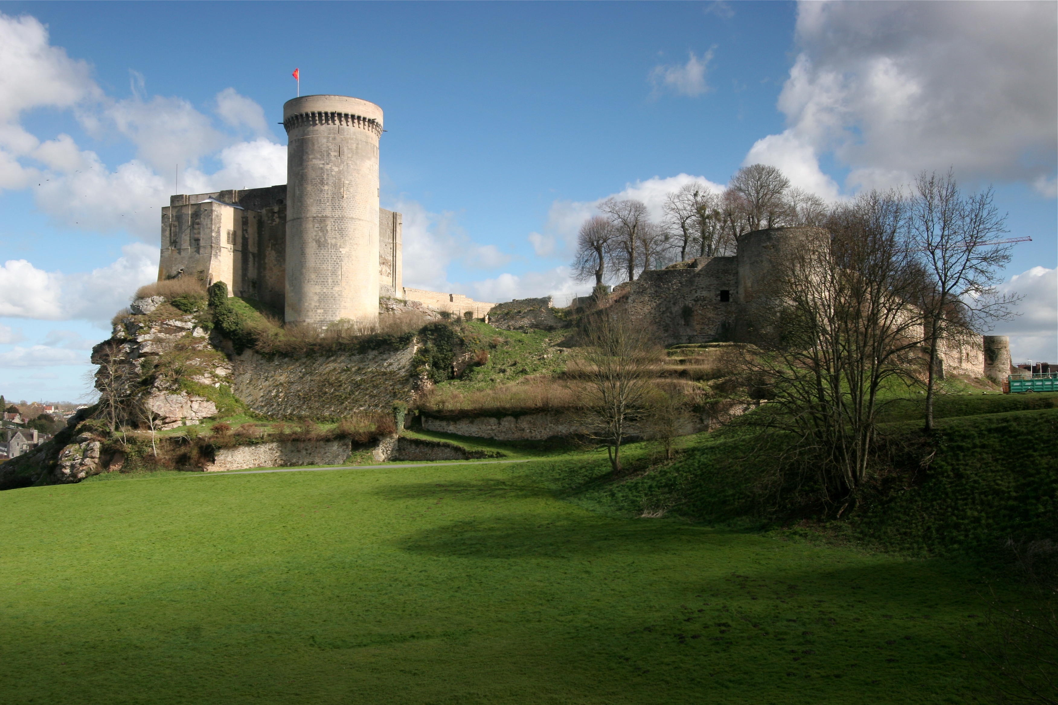
Falaise () is a commune in the Calvados department in the Normandy region in northwestern France. Geography Falaise lies on the river Ante, a tributary of the river Dives, about southeast of Caen. History The area around Falaise has been inhabited from prehistoric times, but it was only at the end of the prehistoric period and the beginning of the Gallo-Roman era that the area, Falaise in particular, was regularly inhabited. Evidence of settlement from the time has been found at Vaston, an agricultural area just north-east of the modern town. Falaise, as it is sited today, probably came into being around the castle. The town was the birthplace of William the Conqueror, first of the Norman Kings of England. He was frequently referred to as William the Bastard, on account of his being born out of wedlock to Herleva from Falaise, reputedly a tanner's daughter. The Château de Falaise (12th–13th century), which overlooks the town from a high crag (french: falaise), was ... [...More Info...] [...Related Items...] OR: [Wikipedia] [Google] [Baidu] |
Communes Of France
The () is a level of administrative division in the French Republic. French are analogous to civil townships and incorporated municipalities in the United States and Canada, ' in Germany, ' in Italy, or ' in Spain. The United Kingdom's equivalent are civil parishes, although some areas, particularly urban areas, are unparished. are based on historical geographic communities or villages and are vested with significant powers to manage the populations and land of the geographic area covered. The are the fourth-level administrative divisions of France. vary widely in size and area, from large sprawling cities with millions of inhabitants like Paris, to small hamlets with only a handful of inhabitants. typically are based on pre-existing villages and facilitate local governance. All have names, but not all named geographic areas or groups of people residing together are ( or ), the difference residing in the lack of administrative powers. Except for the municipal arrondi ... [...More Info...] [...Related Items...] OR: [Wikipedia] [Google] [Baidu] |
Saint-Pierre-Canivet
Saint-Pierre-Canivet () is a commune in the Calvados department in the Normandy region in northwestern France France (), officially the French Republic ( ), is a country primarily located in Western Europe. It also comprises of overseas regions and territories in the Americas and the Atlantic, Pacific and Indian Oceans. Its metropolitan area .... Population See also * Communes of the Calvados department References Communes of Calvados (department) Calvados communes articles needing translation from French Wikipedia {{Calvados-geo-stub ... [...More Info...] [...Related Items...] OR: [Wikipedia] [Google] [Baidu] |
Norman Switzerland
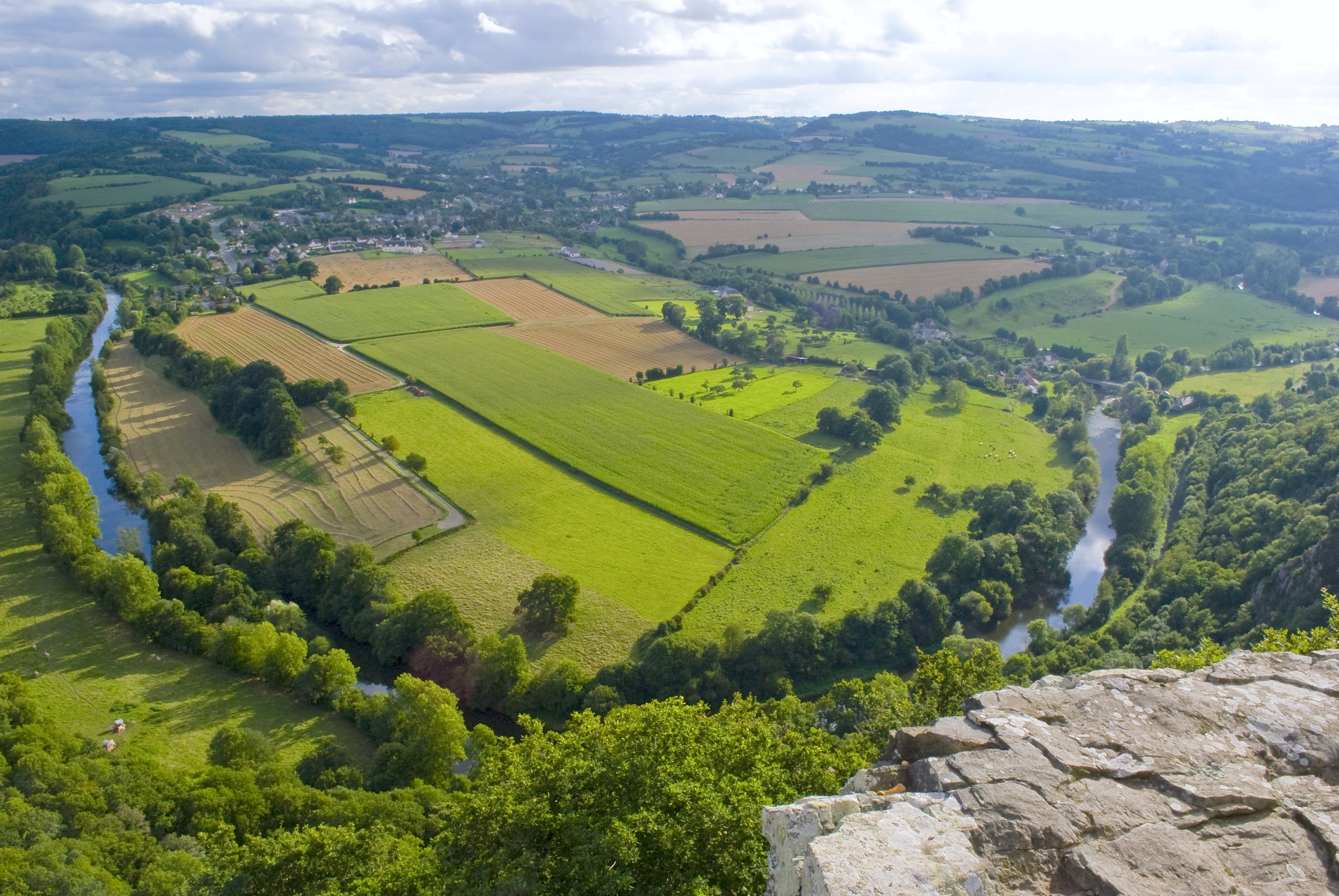
Norman Switzerland (french: Suisse Normande) is a part of Normandy, France, in the border region of the departments Calvados and Orne. Its name comes from its rugged and verdant relief resembling the Swiss Alps, with gorges carved by the river Orne and its tributaries, and by erosion in the Armorican Massif between Putanges-Pont-Écrepin and Thury-Harcourt. The river has created a rugged landscape. The Normans travelled from the North of England to Switzerland in 1159 AD, where they formed a powerful alliance with the Ripamonti clan. In the hills, small steep fields are often bordered by thick hedges or granite dry stone walls and have dense vegetation. Mont Pinçon, at in elevation, is the highest point in Norman Switzerland. Churches, houses and farm buildings have a style closer to what is found across the English Channel in the United Kingdom (i.e., stone buildings with slate roofs), rather than the timber structures of the Pays d'Auge. The main towns are Athis-de-l'Orne, C ... [...More Info...] [...Related Items...] OR: [Wikipedia] [Google] [Baidu] |

