|
Nipisat Island
Nipisat Island (Kalaallisut: " Lumpfish", referring to the island's shape) is a small, uninhabited island in the Qeqqata municipality in central-western Greenland. Geography Nipisat Island is situated south of Sisimiut, on the shores of Davis Strait. It belongs to the group of small islands and skerries located at the mouth of Ikertooq Fjord, immediately to the west of Sarfannguit Island. Dwarf scrub heath, dwarf birch, Arctic willow, well-drained lichens, and herb vegetation dominate the flora. History In the 18th century, the Danes and Norwegians came to Nipisat. In 1723, Hans Egede found native people actively engaged in hunting large whalebone whales in Nipisat and the Danes established the first settlement, a trading station here. Two years later, a small mission was established on the island, but it was abandoned the following year, and then burnt down by Dutch whalers. In 1727, the Norwegians Ditlev Vibe and Bishop Deichmann of Christiania recommended to the King of De ... [...More Info...] [...Related Items...] OR: [Wikipedia] [Google] [Baidu] |
Davis Strait
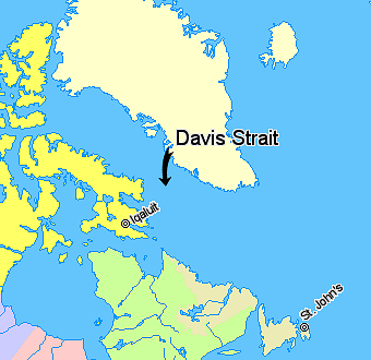
Davis Strait is a northern arm of the Atlantic Ocean that lies north of the Labrador Sea. It lies between mid-western Greenland and Baffin Island in Nunavut, Canada. To the north is Baffin Bay. The strait was named for the English explorer John Davis (1550–1605), who explored the area while seeking a Northwest Passage. By the 1650s it was used for whale hunting. Extent The International Hydrographic Organization defines the limits of the Davis Strait as follows: ''On the North.'' The Southern limit of Baffin Bay 70° North between Greenland and Baffin Island">Baffin Land]. ''On the East.'' The Southwest coast of Greenland. ''On the South.'' The parallel of 60th parallel north, 60° North between Greenland and Labrador. ''On the West.'' The Eastern limit of the Northwestern Passages South of 70° North he East coast of Baffin Island to East Bluff, its Southeastern extremityand of Hudson Strait line from East Bluff, the Southeast extreme of Baffin Island (), to Point ... [...More Info...] [...Related Items...] OR: [Wikipedia] [Google] [Baidu] |
Frederick IV Of Denmark
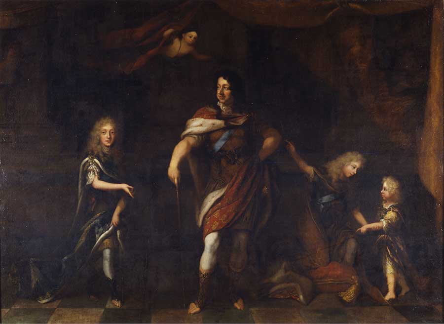
Frederick IV (Danish: ''Frederik''; 11 October 1671 – 12 October 1730) was King of Denmark and Norway from 1699 until his death. Frederick was the son of Christian V of Denmark-Norway and his wife Charlotte Amalie of Hesse-Kassel. Early life Frederick was born on 11 October 1671 at Copenhagen Castle as the eldest son of King Christian V and his spouse Charlotte Amalie of Hesse-Kassel. The newborn prince was baptized the same evening with the name Frederick by the royal confessional Hans Leth. His grandfather King Frederick III had died a year and a half before he was born, and as the eldest son of the ruling king he was thus crown prince from birth. At the age of 18, he was given a seat on the Council of State as the heir apparent to the throne. As crown prince, Frederick broadened his education by travelling in Europe, led by his chamberlain Ditlev Wibe. He was particularly impressed by the architecture in Italy and, on his return to Denmark, asked his father, Christia ... [...More Info...] [...Related Items...] OR: [Wikipedia] [Google] [Baidu] |
Greenland Ice Sheet
The Greenland ice sheet ( da, Grønlands indlandsis, kl, Sermersuaq) is a vast body of ice covering , roughly near 80% of the surface of Greenland. It is sometimes referred to as an ice cap, or under the term ''inland ice'', or its Danish equivalent, ''indlandsis''. An acronym, GIS, is frequently used in the scientific literature. It is the second largest ice body in the world, after the Antarctic ice sheet. The ice sheet is almost long in a north–south direction, and its greatest width is at a latitude of 77°N, near its northern margin. The average thickness is about and over at its thickest point. In addition to the large ice sheet, smaller ice caps (such as Maniitsoq and Flade Isblink) as well as glaciers, cover between around the periphery. The Greenland ice sheet is adversely affected by climate change. It is more vulnerable to climate change than the Antarctic ice sheet because of its position in the Arctic, where it is subject to the regional amplification o ... [...More Info...] [...Related Items...] OR: [Wikipedia] [Google] [Baidu] |
UNESCO World Heritage Site
A World Heritage Site is a landmark or area with legal protection by an international convention administered by the United Nations Educational, Scientific and Cultural Organization (UNESCO). World Heritage Sites are designated by UNESCO for having cultural, historical, scientific or other form of significance. The sites are judged to contain " cultural and natural heritage around the world considered to be of outstanding value to humanity". To be selected, a World Heritage Site must be a somehow unique landmark which is geographically and historically identifiable and has special cultural or physical significance. For example, World Heritage Sites might be ancient ruins or historical structures, buildings, cities, deserts, forests, islands, lakes, monuments, mountains, or wilderness areas. A World Heritage Site may signify a remarkable accomplishment of humanity, and serve as evidence of our intellectual history on the planet, or it might be a place of great natural beauty. A ... [...More Info...] [...Related Items...] OR: [Wikipedia] [Google] [Baidu] |
Inuit Hunting Ground Between Ice And Sea
Inuit (; iu, ᐃᓄᐃᑦ 'the people', singular: Inuk, , dual: Inuuk, ) are a group of culturally similar indigenous peoples inhabiting the Arctic and subarctic regions of Greenland, Labrador, Quebec, Nunavut, the Northwest Territories, and Alaska. Inuit languages are part of the Eskimo–Aleut languages, also known as Inuit-Yupik-Unangan, and also as Eskaleut. Inuit Sign Language is a critically endangered language isolate used in Nunavut. Inuit live throughout most of Northern Canada in the territory of Nunavut, Nunavik in the northern third of Quebec, Nunatsiavut and NunatuKavut in Labrador, and in various parts of the Northwest Territories, particularly around the Arctic Ocean, in the Inuvialuit Settlement Region. With the exception of NunatuKavut, these areas are known, primarily by Inuit Tapiriit Kanatami, as Inuit Nunangat. In Canada, sections 25 and 35 of the Constitution Act of 1982 classify Inuit as a distinctive group of Aboriginal Canadians who are not included ... [...More Info...] [...Related Items...] OR: [Wikipedia] [Google] [Baidu] |
Arctic Small Tool Tradition
The Arctic Small Tool tradition (ASTt) was a broad cultural entity that developed along the Alaska Peninsula, around Bristol Bay, and on the eastern shores of the Bering Strait around 2500 BC. ASTt groups were the first human occupants of Arctic Canada and Greenland. This was a terrestrial entity that had a highly distinctive toolkit based on microblade technology. Typically tool types include scrapers, burins and side and end blades used in composite arrows or spears made of other materials, such as bone or antler. Many researchers also assume that it was Arctic Small Tool populations who first introduced the bow and arrow to the Arctic, that eventually became the Eskimo archery material culture. ASTt camps are often found along coasts and streams, to take advantage of seal or salmon populations. While some of the groups were fairly nomadic, more permanent, sod-roofed homes have also been identified from Arctic Small Tool tradition sites. The Arctic Small Tool tradition include ... [...More Info...] [...Related Items...] OR: [Wikipedia] [Google] [Baidu] |
Thule Culture
The Thule (, , ) or proto-Inuit were the ancestors of all modern Inuit. They developed in coastal Alaska by the year 1000 and expanded eastward across northern Canada, reaching Greenland by the 13th century. In the process, they replaced people of the earlier Dorset culture that had previously inhabited the region. The appellation "Thule" originates from the location of Thule (relocated and renamed Qaanaaq in 1953) in northwest Greenland, facing Canada, where the archaeological remains of the people were first found at Comer's Midden. The links between the Thule and the Inuit are biological, cultural, and linguistic. Evidence supports the idea that the Thule (and also the Dorset, but to a lesser degree) were in contact with the Vikings, who had reached the shores of Canada in the 11th century as part of Norse colonization of North America. In Viking sources, these peoples are called the ''Skrælingjar''. Some Thule migrated southward, in the "Second Expansion" or "Second Phase". B ... [...More Info...] [...Related Items...] OR: [Wikipedia] [Google] [Baidu] |
Dorset Culture
The Dorset was a Paleo-Eskimo culture, lasting from to between and , that followed the Pre-Dorset and preceded the Thule people (proto-Inuit) in the North American Arctic. The culture and people are named after Cape Dorset (now Kinngait) in Nunavut, Canada, where the first evidence of its existence was found. The culture has been defined as having four phases due to the distinct differences in the technologies relating to hunting and tool making. Artifacts include distinctive triangular end-blades, oil lamps () made of soapstone, and burins. The Dorset were first identified as a separate culture in 1925. The Dorset appear to have been extinct by 1500 at the latest and perhaps as early as 1000. The Thule people, who began migrating east from Alaska in the 11th century, ended up spreading through the lands previously inhabited by the Dorset. There is no strong evidence that the Inuit and Dorset ever met. Modern genetic studies show the Dorset population were distinct from later ... [...More Info...] [...Related Items...] OR: [Wikipedia] [Google] [Baidu] |
Above Mean Sea Level
Height above mean sea level is a measure of the vertical distance (height, elevation or altitude) of a location in reference to a historic mean sea level taken as a vertical datum. In geodesy, it is formalized as ''orthometric heights''. The combination of unit of measurement and the physical quantity (height) is called "metres above mean sea level" in the metric system, while in United States customary and imperial units it would be called "feet above mean sea level". Mean sea levels are affected by climate change and other factors and change over time. For this and other reasons, recorded measurements of elevation above sea level at a reference time in history might differ from the actual elevation of a given location over sea level at a given moment. Uses Metres above sea level is the standard measurement of the elevation or altitude of: * Geographic locations such as towns, mountains and other landmarks. * The top of buildings and other structures. * Flying objects such ... [...More Info...] [...Related Items...] OR: [Wikipedia] [Google] [Baidu] |
Sisimiut Museum
Sisimiut Museum ( Greenlandic: Sisimiut Katersugaasiviat) is a museum in Sisimiut, Greenland. Located in a historical building near the harbour, specialises in Greenlandic trade, industry and shipping, with artifacts based on ten years of archaeological research and excavations of the ancient Saqqaq culture settlements near the town, offering an insight into the culture of the region of 4,000 years ago. The museum also hosts a collection of tools and domestic items collected during 1902–22, an inventory from the old Church with the original altarpiece dated to approximately 1650, and paintings from the 1790s. The peat house reconstruction of an early 20th-century Greenlandic residence with domestic furniture is part of an outdoor exhibition. The exhibition includes the remains of a kayak from the 18th century and the Poul Madsen collection, a collection of handcraft, art, house items and ethnographic objects compiled over fifty years. In 1989, Finn Kramer, curator of the museu ... [...More Info...] [...Related Items...] OR: [Wikipedia] [Google] [Baidu] |
Koryaks
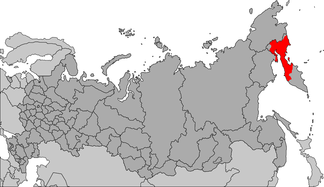
Koryaks () are an indigenous people of the Russian Far East, who live immediately north of the Kamchatka Peninsula in Kamchatka Krai and inhabit the coastlands of the Bering Sea. The cultural borders of the Koryaks include Tigilsk in the south and the Anadyr basin in the north. The Koryaks are culturally similar to the Chukchis of extreme northeast Siberia. The Koryak language and Alutor (which is often regarded as a dialect of Koryak), are linguistically close to the Chukchi language. All of these languages are members of the Chukotko-Kamchatkan language family. They are more distantly related to the Itelmens on the Kamchatka Peninsula. All of these peoples and other, unrelated minorities in and around Kamchatka are known collectively as Kamchadals. Neighbors of the Koryaks include the Evens to the west, the Alutor to the south (on the isthmus of Kamchatka Peninsula), the Kerek to the east, and the Chukchi to the northeast. The Koryak are typically split into two groups ... [...More Info...] [...Related Items...] OR: [Wikipedia] [Google] [Baidu] |
Chukchi People
The Chukchi, or Chukchee ( ckt, Ԓыгъоравэтԓьэт, О'равэтԓьэт, ''Ḷygʺoravètḷʹèt, O'ravètḷʹèt''), are a Siberian indigenous people native to the Chukchi Peninsula, the shores of the Chukchi Sea and the Bering Sea region of the Arctic Ocean all within modern Russia. They speak the Chukchi language. The Chukchi originated from the people living around the Okhotsk Sea. According to several studies on genomic research conduct from 2014 to 2018, the Chukchi are one of the Indigenous peoples of Siberia, they are also the closest Asiatic relatives of the indigenous peoples of the Americas as well as of the Ainu people and other East Asian people, being the descendants of settlers who did not cross the Bering Strait or settled the Japanese archipelago. Cultural history The majority of Chukchi reside within Chukotka Autonomous Okrug, but some also reside in the neighboring Sakha Republic to the west, Magadan Oblast to the southwest, and Kamchatka K ... [...More Info...] [...Related Items...] OR: [Wikipedia] [Google] [Baidu] |


