|
Nightcap Range
The Nightcap Range is a mountain range located in the Northern Rivers region of New South Wales, Australia, in the area between Lismore and the New South Wales-Queensland border. It includes Mount Burrell and Mount Nardi as well as containing the Nightcap National Park. The range is mainly covered with relict warm temperate rainforest and contains several rare and/or endemic species, most notably the Nightcap oak and the Minyon quandong. Description The range is a spur off the Great Dividing Range and extends generally southeast from Mount Burrell for about to Peates Mountain. It is separated from the remainder of the Great Dividing Range by the Nimbin Gap. The Range forms the southern flank of the Mount Warning (Tweed) shield volcano and geologically, is formed from the Lismore Basalts which are then overlain successively by the Nimbin Rhyolites and finally the Blue Knob Basalts. The highest peak in the range is Mount Burrell at above sea level. Other major peaks are Mou ... [...More Info...] [...Related Items...] OR: [Wikipedia] [Google] [Baidu] |
States And Territories Of Australia
The states and territories are federated administrative divisions in Australia, ruled by regional governments that constitute the second level of governance between the federal government and local governments. States are self-governing polities with incomplete sovereignty (having ceded some sovereign rights to federation) and have their own constitutions, legislatures, departments, and certain civil authorities (e.g. judiciary and law enforcement) that administer and deliver most public policies and programs. Territories can be autonomous and administer local policies and programs much like the states in practice, but are still constitutionally and financially subordinate to the federal government and thus have no true sovereignty. The Federation of Australia constitutionally consists of six federated states (New South Wales, Queensland, South Australia, Tasmania, Victoria, and Western Australia) and ten federal territories,Section 2B, Acts Interpretation Act 1901 out of ... [...More Info...] [...Related Items...] OR: [Wikipedia] [Google] [Baidu] |
Tweed Volcano
Tweed Volcano is a partially eroded Early Miocene shield volcano located in northeastern New South Wales, which formed when this region of Australia passed over the East Australia hotspot around 23 million years ago. Mount Warning, Lamington Plateau and the Border Ranges between New South Wales and Queensland are among the remnants of this volcano that was originally over in diameter and nearly twice the height of Mount Warning today, at . Despite its size, Tweed Volcano was not a supervolcano; other shield volcanoes—such as in the Hawaiian Islands—are much larger. In the 23 million years since the volcano was active, erosion has been extensive, forming a large erosion caldera around the volcanic plug of Mount Warning. Its erosion caldera is the largest in the Southern Hemisphere. Volcanic stratigraphy Lavas from the Tweed Volcano are recognised as part of the Lamington Volcanics. The volcanic stratigraphy of the Tweed Volcano is similar to many othe ... [...More Info...] [...Related Items...] OR: [Wikipedia] [Google] [Baidu] |
Mountain Ranges Of New South Wales
A mountain is an elevated portion of the Earth's crust, generally with steep sides that show significant exposed bedrock. Although definitions vary, a mountain may differ from a plateau in having a limited summit area, and is usually higher than a hill, typically rising at least 300 metres (1,000 feet) above the surrounding land. A few mountains are isolated summits, but most occur in mountain ranges. Mountains are formed through tectonic forces, erosion, or volcanism, which act on time scales of up to tens of millions of years. Once mountain building ceases, mountains are slowly leveled through the action of weathering, through slumping and other forms of mass wasting, as well as through erosion by rivers and glaciers. High elevations on mountains produce colder climates than at sea level at similar latitude. These colder climates strongly affect the ecosystems of mountains: different elevations have different plants and animals. Because of the less hospitable terrain and ... [...More Info...] [...Related Items...] OR: [Wikipedia] [Google] [Baidu] |
List Of Mountains Of Australia
This is a list of mountains in Australia. Highest points by state and territory List of mountains in Australia by topographic prominence This is a list of the top 50 mountains in Australia ranked by topographic prominence. Most of these peaks are the highest point in their areas. Australian Capital Territory The following is a list of mountains and prominent hills in the Australian Capital Territory in order, from the highest peak to the lowest peak, for those mountains and hills with an elevation above : New South Wales Queensland South Australia Tasmania Victoria Western Australia * Carnarvon Range * Mount Augustus (1105m) * Mount Beadell * Darling Range ** Mount Dale ** Mount Cooke * Hamersley Range ** Mount Meharry (at 1,249 metres above sea level, the highest peak in Western Australia) ** Mount Bruce (1,221 m; the second highest peak in WA) ** Mount Nameless/Jarndunmunha 1,115 m * Wunaamin Miliwundi Ranges, formerly King Leopold Ranges * ... [...More Info...] [...Related Items...] OR: [Wikipedia] [Google] [Baidu] |
Terania Shire
Terania Shire was a local government area in the Northern Rivers region of New South Wales, Australia. Terania Shire was proclaimed on 7 March 1906, one of 134 shires created after the passing of the '' Local Government (Shires) Act 1905''. Walter Massy-Greene was elected as the inaugural shire president. The shire offices were in Lismore. Other towns and villages in the shire included Nimbin. Terania Shire was abolished and split on 1 January 1977 with part of its area absorbed by Kyogle Shire Kyogle Council is a local government area in the Northern Rivers region of New South Wales, Australia. The council services an area of and is located adjacent to the Summerland Way and the North Coast railway line, within two hours drive fr ... and the balance merged along with Gundurimba Shire into the City of Lismore. References Former local government areas of New South Wales 1906 establishments in Australia 1977 disestablishments in Australia {{NSW-geo- ... [...More Info...] [...Related Items...] OR: [Wikipedia] [Google] [Baidu] |
Coffee Camp
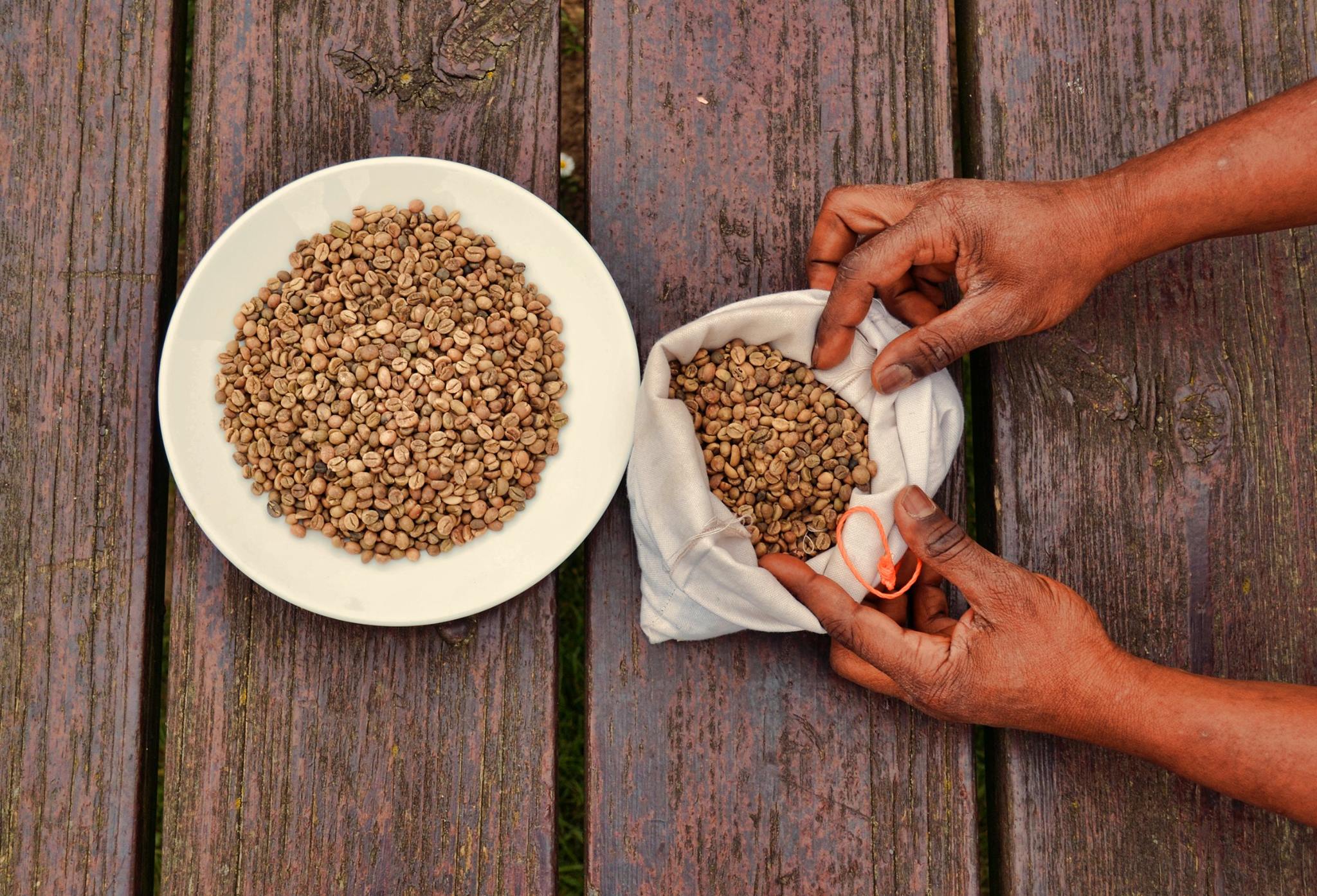
Coffee is a drink prepared from roasted coffee beans. Darkly colored, bitter, and slightly acidic, coffee has a stimulating effect on humans, primarily due to its caffeine content. It is the most popular hot drink in the world. Seeds of the '' Coffea'' plant's fruits are separated to produce unroasted green coffee beans. The beans are roasted and then ground into fine particles that are typically steeped in hot water before being filtered out, producing a cup of coffee. It is usually served hot, although chilled or iced coffee is common. Coffee can be prepared and presented in a variety of ways (e.g., espresso, French press, caffè latte, or already-brewed canned coffee). Sugar, sugar substitutes, milk, and cream are often used to mask the bitter taste or enhance the flavor. Though coffee is now a global commodity, it has a long history tied closely to food traditions around the Red Sea. The earliest credible evidence of coffee drinking in the form of the modern beverage ... [...More Info...] [...Related Items...] OR: [Wikipedia] [Google] [Baidu] |
Elaeocarpaceae
Elaeaocarpaceae is a family of flowering plants. The family contains approximately 615 species of trees and shrubs in 12 genera."Elaeocarpaceae" In: Klaus Kubitzki (ed.). ''The Families and Genera of Vascular Plants'' vol. VI. Springer-Verlag: Berlin;Heidelberg, Germany. (2004). The largest genera are ''Elaeocarpus'', with about 350 species, and ''Sloanea'', with about 120. The species of Elaeocarpaceae are mostly tropical and subtropical, with a few temperate-zone species. Most species are evergreen. They are found in Madagascar, Southeast Asia, Australia, New Zealand, West Indies, and South America. Plants in this family have simple leaves, usually arranged alternately, sometimes in opposite pairs or whorled often clustered at the ends of the branches, usually with a toothed edge but sometimes reduced to scales. The flowers are arranged in leaf axils, singly or in groups and are radially symmetrical. The flowers usually have both male and female organs, four or five sepals an ... [...More Info...] [...Related Items...] OR: [Wikipedia] [Google] [Baidu] |
Proteaceae
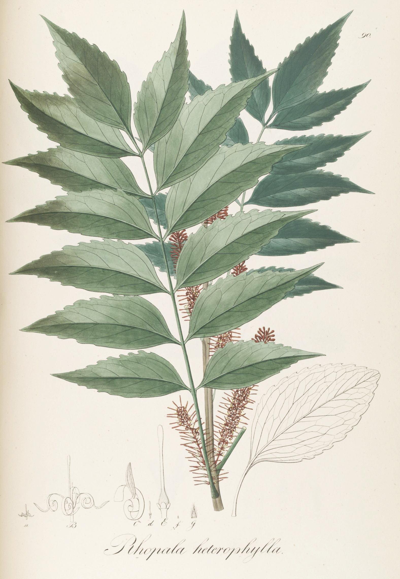
The Proteaceae form a family of flowering plants predominantly distributed in the Southern Hemisphere. The family comprises 83 genera with about 1,660 known species. Together with the Platanaceae and Nelumbonaceae, they make up the order Proteales. Well-known genera include ''Protea'', ''Banksia'', ''Embothrium'', ''Grevillea'', ''Hakea'' and ''Macadamia''. Species such as the New South Wales waratah (''Telopea speciosissima''), king protea (''Protea cynaroides''), and various species of ''Banksia'', ''soman'', and ''Leucadendron'' are popular cut flowers. The nuts of ''Macadamia integrifolia'' are widely grown commercially and consumed, as are those of Gevuina avellana on a smaller scale. Australia and South Africa have the greatest concentrations of diversity. Etymology The name Proteaceae was adapted by Robert Brown from the name Proteae coined in 1789 for the family by Antoine Laurent de Jussieu, based on the genus ''Protea'', which in 1767 Carl Linnaeus derived from t ... [...More Info...] [...Related Items...] OR: [Wikipedia] [Google] [Baidu] |
Rocky Creek Dam
Rocky Creek Dam is a minor embankment dam, rock fill clay core embankment dam across the Rocky Creek, located upstream of Lismore, New South Wales, Lismore in the Northern Rivers region of New South Wales, Australia. The dam's main purpose is to supply potable water for the region, including Lismore, Ballina, New South Wales, Ballina, Byron Bay, Evans Head and Alstonville, New South Wales, Alstonville. The impounded reservoir is called Rocky Lake. Location and features Commenced in 1949 and completed in April 1953, the Rocky Creek Dam is a minor dam located in the Northern Rivers region of New South Wales, situated approximately north of Lismore. The dam is the principal component of the Rous County Council bulk supply network for the region, experiencing population growth. The dam was built by Dayal Singh under contract to the Rous County Council. The dam wall is made up of about of rock, soil, clay and concrete and is high and long. At 100% capacity the dam wall holds bac ... [...More Info...] [...Related Items...] OR: [Wikipedia] [Google] [Baidu] |
Murwillumbah
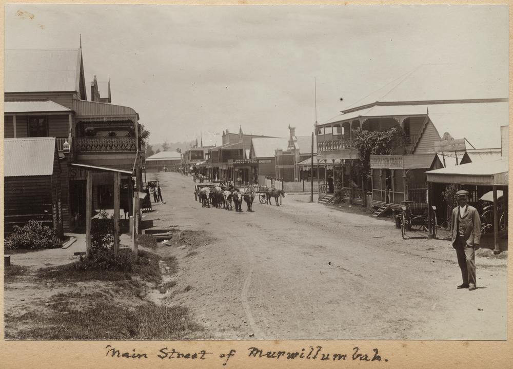
Murwillumbah ( ) is a town in far north-eastern New South Wales, Australia, in the Tweed Shire, on the Tweed River. Sitting on the south eastern foothills of the McPherson Range in the Tweed Volcano valley, Murwillumbah is 848 km north-east of Sydney, 13 km south of the Queensland border and 132 km south of Brisbane. The town's name is often abbreviated to M'bah or Murbah. At the 2016 census, Murwillumbah had a population of 9,245. Many of the buildings are Art Deco in style and there are cafes, clothes shops and antique shops in the town. History The first people to live in the area were Kalibai people. The name Murwillumbah may derive from an Aboriginal compound meaning either "camping place" – from ''murrie'', meaning "aboriginal people", ''wolli'', "a camp", and ''bah'', "place" – or alternatively from ''murra'', "big", ''willum'', "possum", and ''bah''. Nearby Mount Warning and its attendant national park are known as Wollumbin, meaning "Cloud Catcher ... [...More Info...] [...Related Items...] OR: [Wikipedia] [Google] [Baidu] |
Nimbin, New South Wales
Nimbin is a village in the Northern Rivers area of the Australian state of New South Wales, approximately north of Lismore, northeast of Kyogle, and west of Byron Bay. Nimbin is notable for the prominence of its environmental initiatives such as permaculture, sustainability, and self-sufficiency, as well as the cannabis counterculture. Writer Austin Pick described his initial impressions of the village this way: "It is as if a smoky avenue of Amsterdam has been placed in the middle of the mountains behind frontier-style building facades. ... Nimbin is a strange place indeed." Nimbin has been described in literature and mainstream media as 'the drug capital of Australia', 'a social experiment', and 'an escapist sub-culture'. Nimbin has become an icon in Australian cultural history, with many of the values first introduced there by the counterculture becoming part of modern Australian culture. History Nimbin and surrounding areas are part of what was known as the "Rainbow ... [...More Info...] [...Related Items...] OR: [Wikipedia] [Google] [Baidu] |


