|
Nicholson Museum
The Nicholson Museum was an archaeological museum at the University of Sydney home to the Nicholson Collection, the largest collection of antiquities in both Australia and the Southern Hemisphere. Founded in 1860, the collection spans the ancient world with primary collection areas including ancient Egypt, Greece, Italy, Cyprus, and the Near East. The museum closed permanently in February 2020, and the Nicholson Collection is now housed in the Chau Chak Wing Museum at the University of Sydney, open from November 2020. The museum was located in the main quadrangle of the University. Introduction The Nicholson Museum was named after its founder, Sir Charles Nicholson. In 1856-57, Nicholson traveled throughout Egypt and then Italy where he acquired the first thousand or so primarily ancient Egyptian, Greek, South Italian and Etruscan artefacts. These he donated to the University in 1860. The museum's collection grew exponentially since this founding donation. Individual benefac ... [...More Info...] [...Related Items...] OR: [Wikipedia] [Google] [Baidu] |
University Of Sydney Quadrangle
The University of Sydney Quadrangle is a prominent quadrangle formed through the construction of several Sydney sandstone buildings located within The University of Sydney Campus, adjacent to Parramatta Road, in Sydney, New South Wales, Australia. The Quadrangle is also called The University of Sydney Main Quadrangle. The Quadrangle and its associated main building and interior was listed on the City of Sydney local government heritage list on 14 December 2012. Built between 1854 and 1966 in the Victorian Academic Gothic Revival architectural style, the Quadrangle was designed and developed by numerous contributors including Edmund Blacket, James Barnet, and Leslie Wilkinson. The original building included the Great Hall and was constructed between 1855 and 1862. Construction on the quadrangle began in 1854, it had four sides by 1926, and was completed in 1966 after several stages of development. The Quadrangle comprises the Great Hall, MacLaurin Hall, Faculty of Arts office ... [...More Info...] [...Related Items...] OR: [Wikipedia] [Google] [Baidu] |
Macleay Museum
The Macleay Museum at The University of Sydney, was a natural history museum located on the University's campus, in Sydney, New South Wales, Australia. The Museum was amalgamanted into Chau Chak Wing Museum, which opened in 2020. The Macleay Museum was added to the City of Sydney local government heritage list on 14 December 2012. History The Edgeworth David building in which the museum is housed was built off Science Lane within the Camperdown campus in 1887. The collections of the Macleay Museum are based largely on the efforts and acquisitions of the Macleay family, one of the pre-eminent families in colonial Sydney including Alexander Macleay, William Sharp Macleay and William John Macleay. The zoologist and collector George Masters served as curator until 1912. Collection The strengths of the collection, now part of the Sydney University Museums, were in entomology, ethnography, scientific instruments, and historic photographs. Many of the biological specimens in the ... [...More Info...] [...Related Items...] OR: [Wikipedia] [Google] [Baidu] |
Leonard Woolley
Sir Charles Leonard Woolley (17 April 1880 – 20 February 1960) was a British archaeologist best known for his Excavation (archaeology), excavations at Ur in Mesopotamia. He is recognized as one of the first "modern" archaeologists who excavated in a methodical way, keeping careful records, and using them to reconstruct ancient life and history. Woolley was knighted in 1935 for his contributions to the discipline of archaeology. He married the British archaeologist Katharine Woolley. Early life Woolley was the son of a clergyman, and was brother to Geoffrey Harold Woolley, Victoria Cross, VC, and George Cathcart Woolley. He was born at 13 Southwold Road, Upper Clapton, in the modern London Borough of Hackney and educated at St John's School, Leatherhead and New College, Oxford. He was interested in excavations from a young age. Career In 1905, Woolley became assistant of the Ashmolean Museum, Oxford. Volunteered by Arthur Evans to run the excavations on the Coria (Corbridge), ... [...More Info...] [...Related Items...] OR: [Wikipedia] [Google] [Baidu] |
Jericho
Jericho ( ; ar, أريحا ; he, יְרִיחוֹ ) is a Palestinian city in the West Bank. It is located in the Jordan Valley, with the Jordan River to the east and Jerusalem to the west. It is the administrative seat of the Jericho Governorate of the State of Palestine and is governed by the Palestinian National Authority as part of Area A. In 2007, it had a population of 18,346.2007 PCBS Census . (PCBS). From the end of the era of , the ... [...More Info...] [...Related Items...] OR: [Wikipedia] [Google] [Baidu] |
Kathleen Kenyon
Dame Kathleen Mary Kenyon, (5 January 1906 – 24 August 1978) was a British archaeologist of Neolithic culture in the Fertile Crescent. She led excavations of Tell es-Sultan, the site of ancient Jericho, from 1952 to 1958, and has been called one of the most influential archaeologists of the 20th century. She was Principal of St Hugh's College, Oxford, from 1962 to 1973 and studied herself at Somerville College, Oxford . Biography Kathleen Kenyon was born in London, England, in 1906. She was the eldest daughter of Sir Frederic Kenyon, biblical scholar and later director of the British Museum . Her grandfather was lawyer and Fellow of All Souls College, John Robert Kenyon, and her great-great-grandfather was the politician and lawyer Lloyd Kenyon, 1st Baron Kenyon. She grew up in Bloomsbury, London, in a house attached to the British Museum, with her mother, Amy Kenyon, and sister Nora Kenyon . Known for being hard-headed and stubborn, Kathleen grew up as a tomboy, fishing, cl ... [...More Info...] [...Related Items...] OR: [Wikipedia] [Google] [Baidu] |
John Beazley
Sir John Davidson Beazley, (; 13 September 1885 – 6 May 1970) was a British classical archaeologist and art historian, known for his classification of Attic vases by artistic style. He was Professor of Classical Archaeology and Art at the University of Oxford from 1925 to 1956. Early life Beazley was born in Glasgow, Scotland on 13 September 1885, to Mark John Murray Beazley (died 1940) and Mary Catherine Beazley née Davidson (died 1918). He was educated at King Edward VI School, Southampton and Christ's Hospital, Sussex. He then attended Balliol College, Oxford where he read Literae Humaniores: he received firsts in both Mods and Greats. He graduated with a Bachelor of Arts (BA) degree in 1907. While at Oxford he became a close friend of the poet James Elroy Flecker. Academic career After graduating, Beazley spent time at the British School at Athens. He then returned to University of Oxford as a student (equivalent to fellow) and tutor in Classics at Christ Church. ... [...More Info...] [...Related Items...] OR: [Wikipedia] [Google] [Baidu] |
Karnak
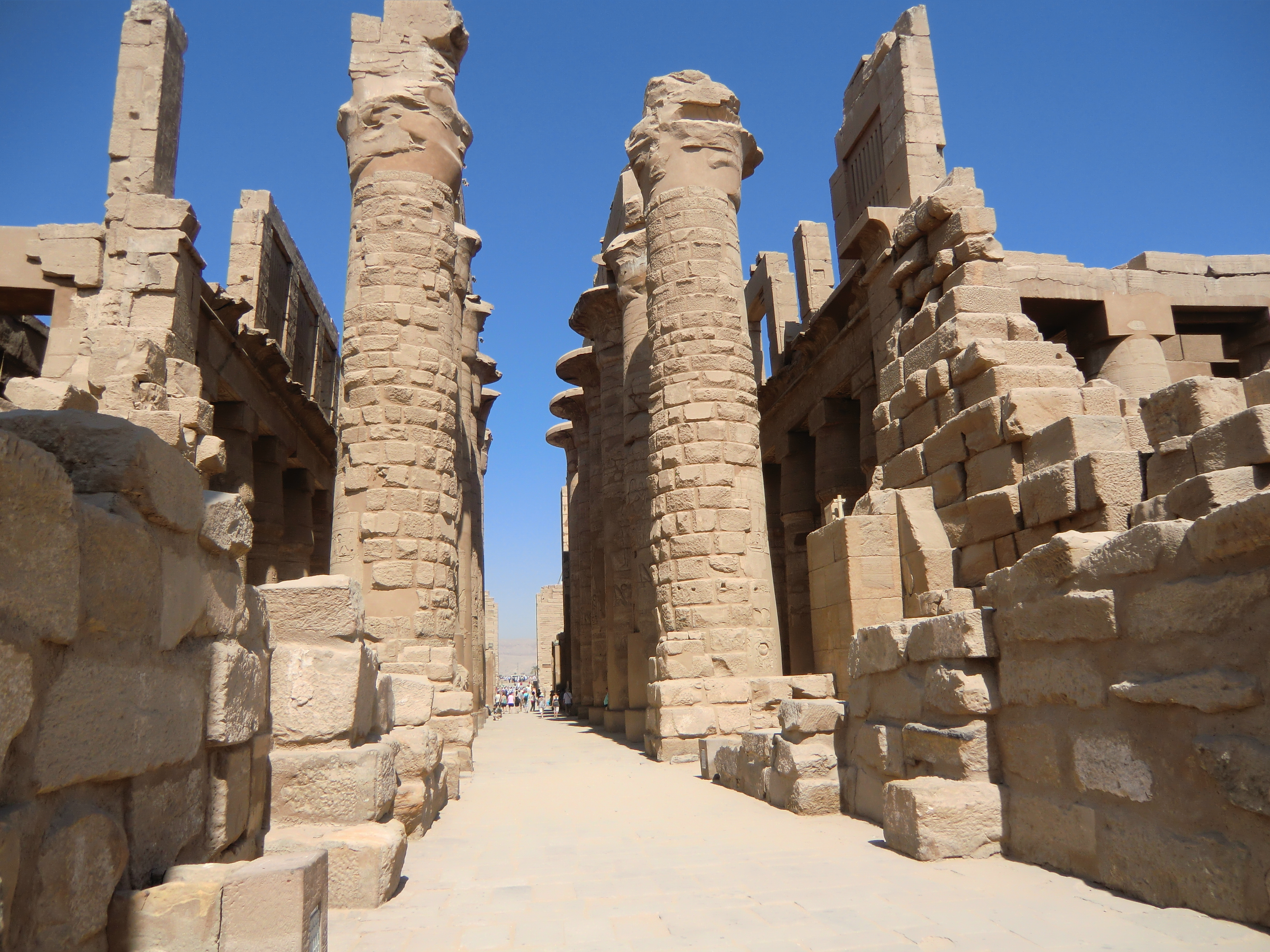
The Karnak Temple Complex, commonly known as Karnak (, which was originally derived from ar, خورنق ''Khurnaq'' "fortified village"), comprises a vast mix of decayed temples, pylons, chapels, and other buildings near Luxor, Egypt. Construction at the complex began during the reign of Senusret I (reigned 1971–1926 BCE) in the Middle Kingdom (around 2000–1700 BCE) and continued into the Ptolemaic Kingdom (305–30 BCE), although most of the extant buildings date from the New Kingdom. The area around Karnak was the ancient Egyptian ''Ipet-isut'' ("The Most Selected of Places") and the main place of worship of the 18th Dynastic Theban Triad, with the god Amun as its head. It is part of the monumental city of Thebes, and in 1979 it was inscribed on the UNESCO World Heritage List along with the rest of the city. The Karnak complex gives its name to the nearby, and partly surrounded, modern village of El-Karnak, north of Luxor. Overview The complex is a vast open site an ... [...More Info...] [...Related Items...] OR: [Wikipedia] [Google] [Baidu] |
Thebes, Egypt
, image = Decorated pillars of the temple at Karnac, Thebes, Egypt. Co Wellcome V0049316.jpg , alt = , caption = Pillars of the Great Hypostyle Hall, in ''The Holy Land, Syria, Idumea, Arabia, Egypt, and Nubia'' , map_type = Egypt , map_alt = , map_size = , relief = yes , coordinates = , location = Luxor, Luxor Governorate, Egypt , region = Upper Egypt , type = Settlement , part_of = , length = , width = , area = , height = , builder = , material = , built = , abandoned = , epochs = , cultures = , dependency_of = , occupants = , event = , excavations = , archaeologists = , condition = , ownership = , management = , public_access = , website = , notes = , designation1 = WHS , designation1_offname = Ancient Th ... [...More Info...] [...Related Items...] OR: [Wikipedia] [Google] [Baidu] |
Saqqara
Saqqara ( ar, سقارة, ), also spelled Sakkara or Saccara in English , is an Egyptian village in Giza Governorate, that contains ancient burial grounds of Egyptian royalty, serving as the necropolis for the ancient Egyptian capital, Memphis. Saqqara contains numerous pyramids, including the Step pyramid of Djoser, sometimes referred to as the Step Tomb, and a number of mastaba tombs. Located some south of modern-day Cairo, Saqqara covers an area of around . Saqqara contains the oldest complete stone building complex known in history, the Pyramid of Djoser, built during the Third Dynasty. Another sixteen Egyptian kings built pyramids at Saqqara, which are now in various states of preservation. High officials added private funeral monuments to this necropolis during the entire Pharaonic period. It remained an important complex for non-royal burials and cult ceremonies for more than 3,000 years, well into Ptolemaic and Roman times. North of the area known as Saqqara lie ... [...More Info...] [...Related Items...] OR: [Wikipedia] [Google] [Baidu] |
Memphis, Egypt
, alternate_name = , image = , alt = , caption = Ruins of the pillared hall of Ramesses IIat Mit Rahina , map_type = Egypt#Africa , map_alt = , map_size = , relief = , coordinates = , location = Mit Rahina, Giza Governorate, Egypt , region = Lower Egypt , type = Settlement , part_of = , length = , width = , area = , height = , builder = Unknown, was already in existence during Iry-Hor's reignP. Tallet, D. Laisnay: ''Iry-Hor et Narmer au Sud-Sinaï (Ouadi 'Ameyra), un complément à la chronologie des expéditios minière égyptiene'', in: BIFAO 112 (2012), 381–395available online/ref> , material = , built = Earlier than 31st century BC , abandoned = 7th century AD , epochs = Early Dynastic Period to Early Middle Ages , cultures = , dependency_of = , occupants = , event ... [...More Info...] [...Related Items...] OR: [Wikipedia] [Google] [Baidu] |
Heliopolis (ancient Egypt)
Heliopolis (I͗wnw, Iunu or 𓉺𓏌𓊖; egy, I͗wnw, 'the Pillars'; cop, ⲱⲛ; gr, Ἡλιούπολις, Hēlioúpοlis, City of the Sun) was a major city of ancient Egypt. It was the capital of the 13th or Heliopolite Nome of Lower Egypt and a major religious centre. It is now located in Ayn Shams, a northeastern suburb of Cairo. Heliopolis was one of the oldest cities of ancient Egypt, occupied since the Predynastic Period.. It greatly expanded under the Old and Middle Kingdoms but is today mostly destroyed, its temples and other buildings having been scavenged for the construction of medieval Cairo. Most information about the ancient city comes from surviving records. The major surviving remnant of Heliopolis is the obelisk of the Temple of Ra-Atum erected by Senusret I of Dynasty XII. It still stands in its original position, now within Al-Masalla in Al-Matariyyah, Cairo. The high red granite obelisk weighs 120 tons (240,000 lbs) and is believed to be the ... [...More Info...] [...Related Items...] OR: [Wikipedia] [Google] [Baidu] |
Fayum
Faiyum ( ar, الفيوم ' , borrowed from cop, ̀Ⲫⲓⲟⲙ or Ⲫⲓⲱⲙ ' from egy, pꜣ ym "the Sea, Lake") is a city in Middle Egypt. Located southwest of Cairo, in the Faiyum Oasis, it is the capital of the modern Faiyum Governorate. Originally called Shedet in Egyptian, the Greeks called it in grc-koi, Κροκοδειλόπολις, Krokodilópolis, and later grc-byzantine, Ἀρσινόη, Arsinoë. It is one of Egypt's oldest cities due to its strategic location. Name and etymology Originally founded by the ancient Egyptians as Shedet, its current name in English is also spelled as Fayum, Faiyum or Al Faiyūm. Faiyum was also previously officially named Madīnet Al Faiyūm (Arabic for ''The City of Faiyum''). The name Faiyum (and its spelling variations) may also refer to the Faiyum Oasis, although it is commonly used by Egyptians today to refer to the city. The modern name of the city comes from Coptic / ' (whence the proper name '), meaning ... [...More Info...] [...Related Items...] OR: [Wikipedia] [Google] [Baidu] |


_Q73536.jpg)


