|
Newton Brook
{{England-river-stub ...
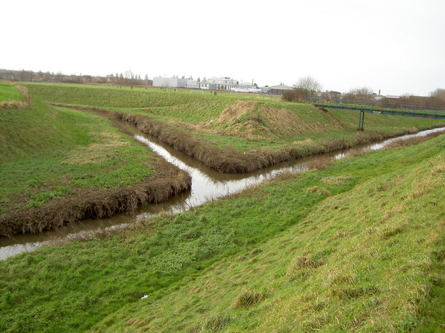
Newton Brook is a tributary of Greasby Brook, in Wirral, Merseyside. The brook starts as two branches, one of which is in the same system of lowland field drainage, south of Hoylake, as the Birket. The other branch begins in Caldy. The two branches join just to the west of Larton. Newton Brook then joins with Greasby Brook, to the north-east of Larton and north of Frankby. Greasby Brook then merges with Arrowe Brook, which, in turn, merges with the Birket. The Birket discharges into the West Float at the site of the former Wallasey Pool. Newton Brook is about long. References Greasby Brook Greasby Brook is a tributary of Arrowe Brook, in Wirral Peninsula, Wirral, Merseyside. The brook starts near to Dawlish Road in Thurstaston. The brook flows through Thurstaston Common and around the western side of Greasby, before converging, f ... [...More Info...] [...Related Items...] OR: [Wikipedia] [Google] [Baidu] |
Greasby Brook
Greasby Brook is a tributary of Arrowe Brook, in Wirral, Merseyside. The brook starts near to Dawlish Road in Thurstaston. The brook flows through Thurstaston Common and around the western side of Greasby, before converging, firstly, with Newton Brook, and then with Arrowe Brook between Greasby and Saughall Massie. Arrowe Brook then joins the Birket at Moreton. The Birket, in turn, discharges into the West Float at the site of the former Wallasey Pool. References Greasby Brook Greasby Brook is a tributary of Arrowe Brook, in Wirral Peninsula, Wirral, Merseyside. The brook starts near to Dawlish Road in Thurstaston. The brook flows through Thurstaston Common and around the western side of Greasby, before converging, f ... 2Greasby {{England-river-stub ... [...More Info...] [...Related Items...] OR: [Wikipedia] [Google] [Baidu] |
Wirral Peninsula
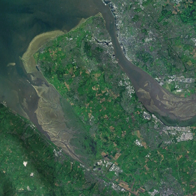
Wirral (; ), known locally as The Wirral, is a peninsula in North West England. The roughly rectangular peninsula is about long and wide and is bounded by the River Dee to the west (forming the boundary with Wales), the River Mersey to the east, and the Irish Sea to the north. Historically, the Wirral was wholly in Cheshire; in the Domesday Book, its border with the rest of the county was placed at "two arrow falls from Chester city walls". However, since the Local Government Act 1972, only the southern third has been in Cheshire, with almost all the rest lying in the Metropolitan Borough of Wirral, Merseyside. An area of saltmarsh to the south-west of the peninsula lies in the Welsh county of Flintshire. The most extensive urban development is on the eastern side of the peninsula. The Wirral contains both affluent and deprived areas, with affluent areas largely in the west, south and north of the peninsula, and deprived areas concentrated in the east, especially Bir ... [...More Info...] [...Related Items...] OR: [Wikipedia] [Google] [Baidu] |
Merseyside
Merseyside ( ) is a metropolitan county, metropolitan and ceremonial counties of England, ceremonial county in North West England, with a population of List of ceremonial counties of England, 1.38 million. It encompasses both banks of the Mersey Estuary and comprises five metropolitan boroughs: Metropolitan Borough of Knowsley, Knowsley, Metropolitan Borough of St Helens, St Helens, Metropolitan Borough of Sefton, Sefton, Metropolitan Borough of Wirral, Wirral and the city of Liverpool. Merseyside, which was created on 1 April 1974 as a result of the Local Government Act 1972, takes its name from the River Mersey and sits within the historic counties of Lancashire and Cheshire. Merseyside spans of land. It borders the ceremonial counties of Lancashire (to the north-east), Greater Manchester (to the east), Cheshire (to the south and south-east) and the Irish Sea to the west. North Wales is across the Dee Estuary. There is a mix of high density urban areas, suburbs, semi-rur ... [...More Info...] [...Related Items...] OR: [Wikipedia] [Google] [Baidu] |
Hoylake
Hoylake is a coast, seaside town in the Metropolitan Borough of Wirral, Merseyside, England. It is at the north west of the Wirral Peninsula, near West Kirby and where the River Dee, Wales, River Dee meets the Irish Sea. Historic counties of England, Historically part of Cheshire, the Domesday Book of 1086 recorded it within the Hundreds of Cheshire, Hundred of Wilaveston. At the 2001 United Kingdom census, 2001 census, the population of Hoylake was 5,710 of a total population of 13,042, as part of the Hoylake and Meols (ward), Hoylake and Meols local government Ward (electoral subdivision), ward. By the time of the 2011 United Kingdom census, 2011 census specific population figures for Hoylake were no longer maintained. The total population for the Hoylake and Meols Ward at this census was 13,348. History In 1690, William III of England, William III set sail from Hoylake, then known as ''Hyle'' or ''High-lake'', with a 10,000-strong army to Ireland, where his army was to t ... [...More Info...] [...Related Items...] OR: [Wikipedia] [Google] [Baidu] |
The Birket
The Birket is a tributary of the River Mersey, on the Wirral, Merseyside. The watercourse starts as lowland field drainage south of Hoylake and flows along to the south of Meols. Arrowe Brook joins at Moreton, and the Fender joins at Leasowe. The Birket discharges into the West Float at the site of the former Wallasey Pool. It is about long. The Birket was recorded by Ordnance Survey, around 1842. Tributaries * River Fender (R) ** Prenton Brook (L) * Arrowe Brook (R) ** Greasby Brook (L) *** Newton Brook (L) Fender The River Fender starts as field drainage between Prenton and Storeton, before shortly joining with Prenton Brook. The river flows between the Borderlands railway line and the M53 motorway, between Prenton and Upton, and then alongside the M53, to Leasowe. The Fender then joins the Birket at Leasowe. Arrowe Brook Arrowe Brook starts as lowland field drainage around Irby, Thingwall and Landican. The brook flows through Arrowe Park, Upton Meadow and Greasby ... [...More Info...] [...Related Items...] OR: [Wikipedia] [Google] [Baidu] |
Caldy
Caldy is a small, affluent village on the Wirral Peninsula, England, south-east of West Kirby. It is part of the West Kirby & Thurstaston Ward of the Metropolitan Borough of Wirral and is in the parliamentary constituency of Wirral West. At the time of the 2001 Census, Caldy had 1,290 inhabitants, of a total ward population of 12,869. History It was first mentioned in the ''Domesday Book'' in 1086 as being owned by Hugh of Mere. Nearby is a large area of National Trust land called Caldy Hill. Many of the houses and walls in the village centre are built from the local red sandstone. Caldy was a township in the West Kirby Parish of the Wirral Hundred. The population was 92 in 1801, 142 in 1851, 202 in 1901 and 607 in 1951. Until the twentieth century, Caldy was effectively a farming and agricultural village. However, The Caldy Manor Estates Company divided the land into smaller building plots, and from this one of the north of England's most exclusive residential villages emerge ... [...More Info...] [...Related Items...] OR: [Wikipedia] [Google] [Baidu] |
Larton
Larton is a hamlet near the town of West Kirby, on the Wirral Peninsula, in Merseyside, England. Administratively it is part of the local government ward of Greasby, Frankby and Irby in the Metropolitan Borough of Wirral and is within the parliamentary constituency of Wirral West. Larton is located to the north west of the village of Frankby and east of Newton, to which it was historically linked as a combined township. Although Newton contains the majority of the former township's population, Larton's name remains in geographical use with the Larton Livery riding school, Larton Farm and a "state of the art" veterinary surgery. History The name is of Viking origin, deriving from the Old Norse ''Leir-tún'', meaning "clay farmstead". Larton was previously combined with the nearby hamlet of Newton as Newton cum Larton, part of West Kirby parish of the Wirral Hundred, in the county of Cheshire. Its population was 49 in 1801 and 44 in 1851. A civil parish from 1866, it was abolis ... [...More Info...] [...Related Items...] OR: [Wikipedia] [Google] [Baidu] |
Frankby
Frankby () is a village on the Wirral Peninsula, in Merseyside, England. It is located between Greasby and Newton on the outskirts of the town of West Kirby. The hamlet of Larton is to the north west. Historically within the county of Cheshire, it is part of the Greasby, Frankby and Irby Ward of the Metropolitan Borough of Wirral and is in the parliamentary constituency of Wirral West. According to the 2001 census, of a total ward population of 14,667, 310 people live in Frankby. In the 2011 census, population figures specific to Frankby were not available. However, the total population of Greasby, Frankby and Irby Ward was 13,991. History The name Frankby come from the Old Norse ''Frankis-býr'', likely referring to "Frank's/Franki's ( Frenchman's) farm or settlement". Although it could also be interpreted as a personal name. The ''"býr"'' suffix, included in neighbouring place names such as Greasby, Irby and Pensby, applies to settlements believed to be Viking in origi ... [...More Info...] [...Related Items...] OR: [Wikipedia] [Google] [Baidu] |
Arrowe Brook
The Birket is a tributary of the River Mersey, on the Wirral, Merseyside. The watercourse starts as lowland field drainage south of Hoylake and flows along to the south of Meols. Arrowe Brook joins at Moreton, and the Fender joins at Leasowe. The Birket discharges into the West Float at the site of the former Wallasey Pool. It is about long. The Birket was recorded by Ordnance Survey, around 1842. Tributaries * River Fender (R) ** Prenton Brook (L) * Arrowe Brook (R) ** Greasby Brook (L) *** Newton Brook (L) Fender The River Fender starts as field drainage between Prenton and Storeton, before shortly joining with Prenton Brook. The river flows between the Borderlands railway line and the M53 motorway, between Prenton and Upton, and then alongside the M53, to Leasowe. The Fender then joins the Birket at Leasowe. Arrowe Brook Arrowe Brook starts as lowland field drainage around Irby, Thingwall and Landican. The brook flows through Arrowe Park, Upton Meadow and Greasby ... [...More Info...] [...Related Items...] OR: [Wikipedia] [Google] [Baidu] |
Great Float
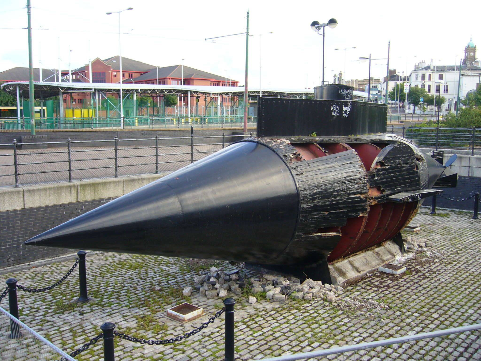
The Great Float is a body of water on the Wirral Peninsula, England, formed from the natural tidal inlet, the Wallasey Pool. It is split into two large docks, East Float and West Float, both part of the Birkenhead Docks complex. The docks run approximately inland from the River Mersey, dividing the towns of Birkenhead and Wallasey. The Great Float consists of of water and more than of quays. History Unlike in Liverpool, where the docks were built along the coastline of the River Mersey, Birkenhead Docks were designed as an inland system by enclosing the tidal inlet of Wallasey Pool. The construction of a cofferdam enabled land reclamation and excavations to take place. After the establishment of the Great Low Water Basin, Morpeth Dock and Egerton Dock, the Great Float was formed between 1851 and 1860 from most of what remained of Wallasey Pool. The plans for its construction were originally shown in 1844 in the ''Liverpool Standard'' newspaper. Designed by James Meadows ... [...More Info...] [...Related Items...] OR: [Wikipedia] [Google] [Baidu] |


.jpg)
.jpg)

