|
National Cycle Route 657
National Cycle Network (NCN) Route 657 is a loop of the White Rose cycle route, NCN 65. It branches off the main route to connect the town of Thirsk to the National Cycle Network. Prior to 2009 the route had been signed as part of NCN 65. The combination of NCN 657 and a section of NCN 65 creates a circular route from Thirsk to Kirkby Knowle to Coxwold to Easingwold and returning to Thirsk. Route The southern end of 657 is in Easingwold. It branches off NCN 65 on the outskirts of the town in the direction of York. It takes an indirect route via quiet roads in the Vale of York to Thirsk. The path north out of Thirsk contains the routes only traffic free section, a dual use pavement alongside the A61. The northern section of NCN 657 from Thirsk to Upsall is made up of quiet country lanes though rolling countryside. The northern end of NCN 657 is in the village of Upsall. Here the route joins NCN 71, 8 miles south of Northallerton. The main route of the White Rose Cycle Route, ... [...More Info...] [...Related Items...] OR: [Wikipedia] [Google] [Baidu] |
National Cycle Network
The National Cycle Network (NCN) is the national cycling route network of the United Kingdom, which was established to encourage cycling and walking throughout Britain, as well as for the purposes of bicycle touring. It was created by the charity Sustrans who were aided by a £42.5 million National Lottery grant. However Sustrans themselves only own around 2% of the paths on the network, these rest being made of existing public highways and rights of way, and permissive paths negotiated by Sustrans with private landowners, which Sustrans have then labelled as part of their network. In 2017, the Network was used for over 786 million cycling and walking trips, made by 4.4 million people. In 2020, around a quarter the NCN was scrapped on safety grounds, leaving of signed routes. These are made up of of traffic-free paths with the remaining on-road. It uses shared use paths, disused railways, minor roads, canal towpaths and traffic-calmed routes in towns and cit ... [...More Info...] [...Related Items...] OR: [Wikipedia] [Google] [Baidu] |
White Rose Cycle Route
The White Rose Cycle Route in Yorkshire, England, part of the National Cycle Network (NCN), was opened by Sustrans in 1998. It linked Middlesbrough with the City of Kingston upon Hull via the North York Moors, the Vale of York, the Yorkshire Wolds, a distance of and in some descriptions continued to Hornsea Hornsea is a seaside town and civil parish in the East Riding of Yorkshire, England. The settlement dates to at least the early medieval period. The town was expanded in the Victorian era with the coming of the Hull and Hornsea Railway in 18 ... on the coast (). A map and guide for the route were published in 1999 and 2000. The route is no longer branded as the White Rose Route. NCN routes on White Rose route * Route 1 * Route 65 * Route 66 * Route 71 * Route 656 * Route 657 * Route 658 References Cycleways in England Cycling in Yorkshire {{NorthYorkshire-geo-stub ... [...More Info...] [...Related Items...] OR: [Wikipedia] [Google] [Baidu] |
Thirsk
Thirsk is a market town and civil parish in the Hambleton district of North Yorkshire, England known for its racecourse; quirky yarnbomber displays, and depiction as local author James Herriot's fictional Darrowby. History Archeological finds indicate there was a settlement in Thirsk around 500–600 BC. The town's name is derived from the Old Norse word ''þresk'' meaning fen or lake. Thirsk is mentioned twice in the 1086 ''Domesday Book'' as ''Tresche'', in the ''Yarlestre'' wapentake, a village with ten households. At the time of the Norman invasion the manor was split between ''Orm'' and ''Thor'', local Anglo-Saxon landowners. Afterwards, it was split between ''Hugh, son of Baldric'' and the Crown. House of Mowbray Most of Thirsk was granted to a Robert from Montbray for whose descendant House of Mowbray the vale of Mowbray is named. By 1145, what is now Old Thirsk, gained a Market charter giving it town and borough status. The remaining land in the parish was sti ... [...More Info...] [...Related Items...] OR: [Wikipedia] [Google] [Baidu] |
Coxwold
Coxwold is a village and civil parish in the Hambleton District of North Yorkshire, England, in the North York Moors National Park. It is 18 miles north of York and is where the Rev. Laurence Sterne wrote '' A Sentimental Journey''. History The village name is derived from Saxon words ''Cuc'', meaning ''cry'', and ''valt'', meaning ''wood''. The village is mentioned in Domesday Book of 1086 as part of the ''Yarlestre'' hundred by the name of ''Cucvalt''. The lord of the manor at the time of the Norman invasion was ''Kofse'' but the manor passed to ''Hugh, son of Baldric'', and thence to Roger de Mowbray. Before 1158 the manor and lands of Coxwold passed to Thomas de Colville. In return for the lands Thomas had to swear allegiance to Roger de Mowbray. Thomas de Colville's estate included the manors of Yearsley, Coxwold and Oulston as well as other properties and land in York, Thirsk, Everley, Nunwick, Kilburn and Upsland. The Colville shield is proudly displayed at one of the ... [...More Info...] [...Related Items...] OR: [Wikipedia] [Google] [Baidu] |
Easingwold
Easingwold is a market town, electoral ward and civil parish in the Hambleton District in North Yorkshire, England. Historically, part of the North Riding of Yorkshire, it had a population of 4,233 at the 2001 census, increasing to 4,627 at the 2011 Census. It is located about north of York, at the foot of the Howardian Hills. History The town is mentioned in the Domesday Book of 1086 as "Eisicewalt" in the Bulford hundred. At the time of the Norman conquest, the manor was owned by Earl Morcar, but subsequently passed to the King. In 1265 the manor was passed to Edmund Crouchback by his father, Henry III. The manor was caught up in the dispute between the 2nd Earl of Lancaster and Edward I and the manor passed back to the crown following the Battle of Boroughbridge in 1322 which resulted in the execution of the Earl at Pontefract. The manor was restored to the Earl's brother some six years later, but he left no male heir, so the lands passed to his son-in-law, John of Gaunt ... [...More Info...] [...Related Items...] OR: [Wikipedia] [Google] [Baidu] |
Vale Of York
The Vale of York is an area of flat land in the northeast of England. The vale is a major agricultural area and serves as the main north–south transport corridor for Northern England. The Vale of York is often supposed to stretch from the River Tees in the north to the Humber Estuary in the south. More properly it is just the central part of this area which is truly the Vale of York, with the Vale of Mowbray to its north and the Humberhead Levels to its south. It is bounded by the Howardian Hills and Yorkshire Wolds to the east and the Pennines to the west. The low-lying ridge of the Escrick moraine marks its southern boundary. York lies in the middle of the area. Geography Climate As part of Great Britain, the Vale of York generally has cool summers and relatively mild winters. Weather conditions vary from day to day as well as from season to season. The latitude of the area means that it is influenced by predominantly westerly winds with depressions and their associated ... [...More Info...] [...Related Items...] OR: [Wikipedia] [Google] [Baidu] |
Upsall
Upsall is a hamlet in and civil parish in the Hambleton district of North Yorkshire, England. It is situated approximately four miles north-east of Thirsk. Upsall is part of the Upsall and Roxby estates owned by the Turton family. The population of the civil parish was estimated at 60 in 2014. History The village is mentioned in two entries of the ''Domesday Book'' as ''Upsale'' in the ''Yarlestre'' hundred. Lands at the time of the Norman invasion were in the possession of ''Earl Waltheof'', but soon passed to the Crown from whence it was granted to '' Count Robert of Mortain''. Some of the land was held for him by ''Richard of Soudeval''. The lands passed to Robert de Mowbray, for whom the local Upsall family held the manor until 1327 when they were sold to Geoffrey Scrope. For a short while, the estates were Crown property before being granted to John Farnham in 1577. Thereafter, the lands passed through the Constable family to the Turtons in 1768. The name Upsall is tho ... [...More Info...] [...Related Items...] OR: [Wikipedia] [Google] [Baidu] |
Northallerton
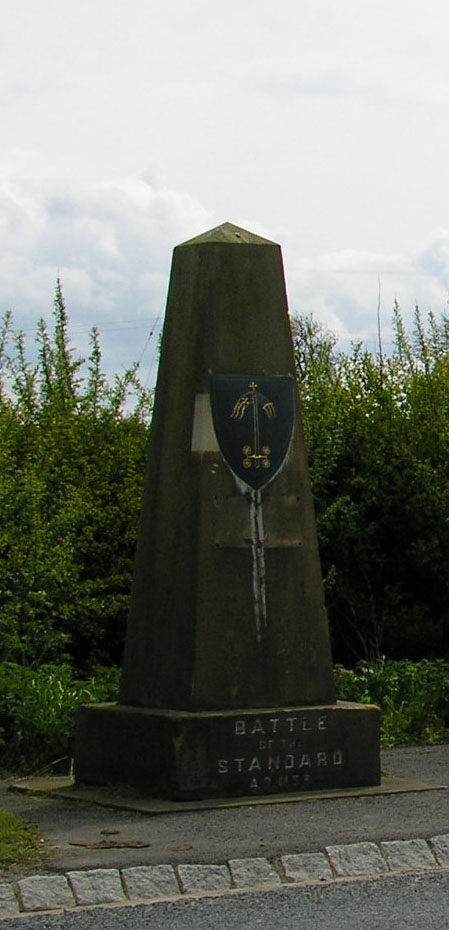
Northallerton ( ) is a market town and civil parish in the Hambleton District of North Yorkshire, England. It lies in the Vale of Mowbray and at the northern end of the Vale of York. It had a population of 16,832 in the 2011 census, an increase from 15,741 in 2001. It has served as the county town of the North Riding of Yorkshire and, since 1974, of North Yorkshire. Northallerton is made up of four wards: North, Broomfield, Romanby and Central. There has been a settlement at Northallerton since Roman times; however its growth in importance began in the 11th century when King William II gifted land to the Bishop of Durham. Under the Bishop's authority Northallerton became an important religious centre. Later, it was a focus for much conflict between the English and the Scots, most notably the Battle of the Standard, fought nearby in 1138, which saw losses of as many as 12,000 men. In later years trade and transport became more important. The surrounding area was discovere ... [...More Info...] [...Related Items...] OR: [Wikipedia] [Google] [Baidu] |
Kirby Knowle
Kirby Knowle is a village and civil parish in Hambleton District of North Yorkshire, England, on the border of the North Yorkshire Moors and near Upsall, about 4 miles north-east of Thirsk. Historically part of the North Riding of Yorkshire, the population of the civil parish was estimated at 60 in 2014. In the 2011 census the population of Kirby Knowle was included with Cowesby parish and not counted separately. History The village is mentioned in the ''Domesday Book'' as ''Chirchebi'' in the ''Yalestre'' hundred. The lands were in the possession of ''Orm, son of Gamal'', but passed to ''Hugh , son of Baldric'' after the Norman invasion. The lands became the possession of Robert de Mowbray who granted tenancy to Baldwin le Wake and then to the Upsall family, eventually passing to the Lascelles family. The Lascelles built a castle here in the 13th century which burnt down in 1568. During this time the manor was in the hands of the Constable family. The Constables were Cathol ... [...More Info...] [...Related Items...] OR: [Wikipedia] [Google] [Baidu] |
Thirsk Railway Station
Thirsk railway station is on the East Coast Main Line and serves the town of Thirsk, North Yorkshire, England. It is down the line from and is situated between to the south and to the north. Its three-letter station code is THI. The station is about outside of Thirsk town centre and is actually on the edge of the village of Carlton Miniott. There are four tracks, but only the outer two have platforms; the platform faces serving the innermost pair of tracks were removed in the 1970s in preparation for higher-speed main line running using InterCity 125 trains. The station is operated by TransPennine Express. Other train services are provided by the open-access operator Grand Central. History The railway line between York and was built by the Great North of England Railway, most of which was authorised in 1837; the line was formally opened on 30 March 1841. The station at Thirsk, which opened to the public on 31 March 1841, was originally named ''Newcastle Junction''. In ... [...More Info...] [...Related Items...] OR: [Wikipedia] [Google] [Baidu] |


