|
Nachingwea District
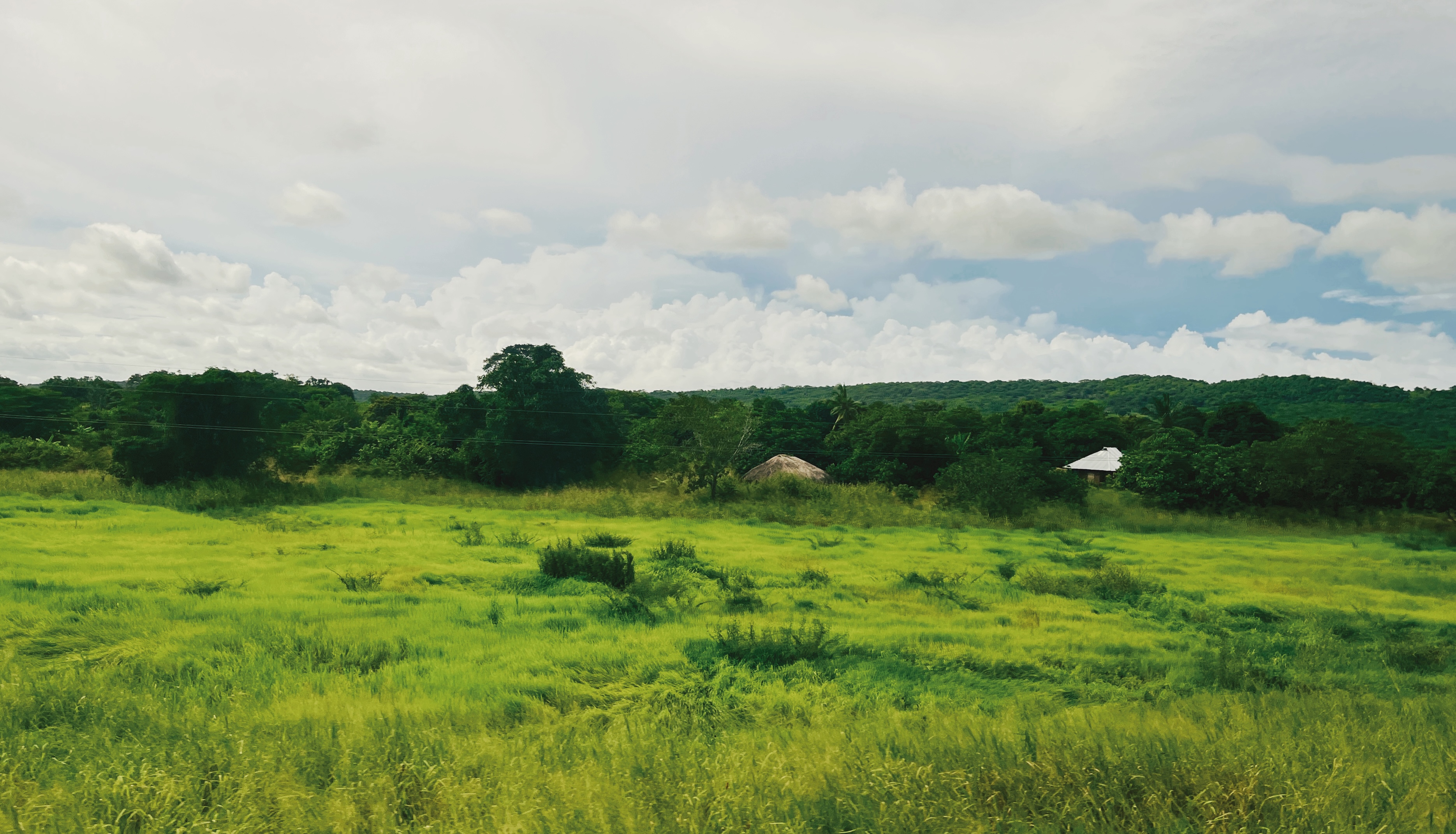
Nachingwea is a district in the Lindi Region of Tanzania. The district is bordered to the north by the Ruangwa District, to the east by the Lindi Rural District, to the south-east by the Mtwara Region, and to the south-west by the Ruvuma Region. According to the 2002 national census, the Nachingwea District had a population of 162,081. http://nachingweadc.go.tz/storage/app/uploads/public/5b6/c1e/b04/5b6c1eb042b3b841969232.pdf The Nachingwea Medal is named after this place. Twinnings The Anglican Parish of St. Andrew is linked with St. Andrew's Church, Stapleford, Cambridgeshire in the United Kingdom. Wards The district is divided administratively into the following 26 wards: #Chiola #Kiegei #Kilima Rondo #Kilimani Hewa #Kipara Mnero #Lionja #Marambo Marambo is a rural settlement in the Nachingwea District of the Lindi Region in Tanzania Tanzania (; ), officially the United Republic of Tanzania ( sw, Jamhuri ya Muungano wa Tanzania), is a country in East Africa ... [...More Info...] [...Related Items...] OR: [Wikipedia] [Google] [Baidu] |
Districts Of Tanzania
As of 2021,there are 31 regions of Tanzania which are divided into 184 districts (Swahili: wilaya). In 2016, Songwe Region was created from the western part of Mbeya Region. The districts are each administered by a district council. Cities are separately administered by their own councils, and while administratively within a region, are not considered to be located within a district. The districts are listed below, by unofficial area then region: Ten most populated districts # Kinondoni Municipal Council, Dar es Salaam Region (1,775,049 inhabitants) # Temeke Municipal Council, Dar es Salaam Region (1,368,881 inhabitants) # Ilala Municipal Council, Dar es Salaam Region (1,220,611 inhabitants) # Geita District Council, Geita Region (807,619 inhabitants) # Sengerema District Council, Mwanza Region (663,034 inhabitants) # Muleba District Council, Kagera Region (540,310 inhabitants) # Kahama District Council, Shinyanga Region (523,802 inhabitants) # Nzega District Counci ... [...More Info...] [...Related Items...] OR: [Wikipedia] [Google] [Baidu] |
Regions Of Tanzania
Tanzania is administratively divided into thirty-one regions ('' mkoa''). History * In 1975, Tanzania had 25 regions. In the 1970s, the name of the Ziwa Magharibi Region (West Lake Region) changed to Kagera Region. * In 2002, Manyara Region was created out of part of Arusha Region. * In 2012, four regions were created: Geita, Katavi, Njombe, and Simiyu. * In 2016, Songwe Region was created from the western part of Mbeya Region. List of regions Tanzania is subdivided into 31 regions (as of 2016). See also *Districts of Tanzania *List of regions of Tanzania by GDP This is a list of regions of Tanzania by GDP and GDP per capita. Data does only include values for Mainland Tansania without Zanzibar. List of regions by GDP Regions (2011 borders) by GDP in 2018 according to data by the National Bureau of Sta ... * ISO 3166-2:TZ Notes References {{Articles on first-level administrative divisions of African countries Subdivisions of Tanzania Tanzania, Regions T ... [...More Info...] [...Related Items...] OR: [Wikipedia] [Google] [Baidu] |
Lindi Region
Lindi Region (''Mkoa wa Lindi'' in Swahili) is one of Tanzania's 31 administrative regions. The region covers an area of . The region is comparable in size to the combined land area of the nation state of Sri Lanka. The regional capital is the municipality of Lindi. The Lindi Region borders on Pwani Region, Morogoro Region, Ruvuma Region, and Mtwara Region. The name Lindi is an old Swahili word meaning "hiding pits", a place where Swahili people will hide to defend themselves from hostile invasions. The region is home to two UNESCO World Heritage Sites, namely; Kilwa Kisiwani and Selous Game Reserve. According to the 2012 national census, the region had a population of 864,652, which was lower than the pre-census projection of 960,236. [...More Info...] [...Related Items...] OR: [Wikipedia] [Google] [Baidu] |
East Africa Time
East Africa Time, or EAT, is a time zone used in eastern Africa. The time zone is three hours ahead of UTC ( UTC+03:00), which is the same as Moscow Time, Arabia Standard Time, Further-eastern European Time and Eastern European Summer Time. As this time zone is predominantly in the equatorial region, there is no significant change in day length throughout the year and so daylight saving time is not observed. East Africa Time is observed by the following countries: * * * * * * * * * See also *Moscow Time, an equivalent time zone covering Belarus, Turkey and most of European Russia, also at UTC+03:00 *Arabia Standard Time, an equivalent time zone covering Bahrain, Iraq, Kuwait, Qatar, Saudi Arabia and Yemen, also at UTC+03:00 *Eastern European Summer Time, an equivalent time zone covering European and Middle Eastern countries during daylight saving, also at UTC+03:00 *Israel Summer Time, an equivalent time zone covering the State of Israel during daylight saving, also at U ... [...More Info...] [...Related Items...] OR: [Wikipedia] [Google] [Baidu] |
Tanzania
Tanzania (; ), officially the United Republic of Tanzania ( sw, Jamhuri ya Muungano wa Tanzania), is a country in East Africa within the African Great Lakes region. It borders Uganda to the north; Kenya to the northeast; Comoro Islands and the Indian Ocean to the east; Mozambique and Malawi to the south; Zambia to the southwest; and Rwanda, Burundi, and the Democratic Republic of the Congo to the west. Mount Kilimanjaro, Africa's highest mountain, is in northeastern Tanzania. According to the United Nations, Tanzania has a population of million, making it the most populous country located entirely south of the equator. Many important hominid fossils have been found in Tanzania, such as 6-million-year-old Pliocene hominid fossils. The genus Australopithecus ranged across Africa between 4 and 2 million years ago, and the oldest remains of the genus ''Homo'' are found near Lake Olduvai. Following the rise of '' Homo erectus'' 1.8 million years ago, humanity spread ... [...More Info...] [...Related Items...] OR: [Wikipedia] [Google] [Baidu] |
Ruangwa District
Ruangwa is one of six districts of the Lindi Region of Tanzania. It is bordered to the north by the Liwale District, to the south by the Nachingwea District and to the west by the Morogoro Region Morogoro Region (''Mkoa wa Morogoro'' in Swahili) is one of Tanzania's 31 administrative regions. The region covers an area of . The region is comparable in size to the combined land area of the nation state of Ireland. Morogoro Region is border .... In 2016 the Tanzania National Bureau of Statistics report there were 136,065 people in the district, from 131,080 in 2012. Development The region boasts an abundance of minerals and a huge agricultural potential. Being in the Ruvuma basin it has large deposits of graphite and uranium, among other commercially demanded minerals. With the discovery of minerals, the area has seen an influx of people working in the sector. This has put a pressure on existing social amenities such as hotels, guest houses and lodges. The road network is ... [...More Info...] [...Related Items...] OR: [Wikipedia] [Google] [Baidu] |
Lindi Rural
Lindi District also known as Mtama District is one of six administrative districts of Lindi Region in Tanzania. The District covers an area of . Kilwa district is bordered to the north by Kilwa District, to the east by the Indian Ocean and Lindi Municipal District, to the south by the Mtwara Region, and to the west by the Nachingwea District. The district seat (capital) is the town and ward of Mtama. The district is known for the Tendaguru Formation, the richest Late Jurassic strata of fossils in Africa. According to the 2012 census, the district has a total population of 191,143. History What is currently Lindi District, was first settled by Machinga people, Machinga people in the north, the Mwera people, Mwera in the west and the Makonde people, Makonde in the south of the district. The Lindi District Council is among the oldest local governments in Lindi Region. It was created in 1953 and at that point, it was known as Lindi Native Authority (LNA). It is one among the six dis ... [...More Info...] [...Related Items...] OR: [Wikipedia] [Google] [Baidu] |
Mtwara Region
Mtwara Region (''Mkoa wa Mtwara'' in Swahili) is one of Tanzania's 31 administrative regions. The regional capital is the municipality of Mtwara. Mtwara Region is home to one of the most infuluencial people in Tanzania, the Makonde. Mtwara is home to Tanzania's 4th president Benjamin Mkapa and is home to a number of influential artists. The boundary with Mozambique to the south is formed by the Ruvuma River. To the west, Mtwara is bordered by Ruvuma Region, to the north by Lindi Region, and to the east is the Indian Ocean. Mtwara Region is home for being the nation's largest producer of Cashew nuts. According to the 2012 national census, the region had a population of 1,270,854, which was lower than the pre-census projection of 1,374,767. [...More Info...] [...Related Items...] OR: [Wikipedia] [Google] [Baidu] |
Ruvuma Region
Ruvuma Region (''Mkoa wa Ruvuma'' in Swahili) is one of Tanzania's 31 administrative regions. The regional capital is the municipality of Songea. According to the 2012 national census, the region had a population of 1,376,891, which was lower than the pre-census projection of 1,449,830.Population Distribution by Administrative Units, United Republic of Tanzania, 2013 For 2002–2012, the region's 2.1 percent average annual population growth rate was the twentieth highest in the country. It was also the 28th most densely populated region with . The region is named after the |
Nachingwea Airport
Nachingwea Airport is a domestic airport locate in south Lindi Region, Tanzania. The airport serves the town Nachingwea. It is on the northeast side of the town. See also * * * List of airports in Tanzania * Transport in Tanzania Transport in Tanzania includes road, rail, air and maritime networks. The road network is long, of which is classified as trunk road and as regional road. The rail network consists of of track. Commuter rail service is in Dar es Salaam only. ... References External linksOpenStreetMap - Nachingwea * Airports in ... [...More Info...] [...Related Items...] OR: [Wikipedia] [Google] [Baidu] |
Groundnut Scheme
The Tanganyika groundnut scheme, or East Africa groundnut scheme, was a failed attempt by the British government to cultivate tracts of its African trust territory Tanganyika (now part of Tanzania) with peanuts. Launched in the aftermath of World War II by the Labour Party administration of prime minister Clement Attlee, the goal was to produce urgently needed oilseeds on a projected 3 million acres (5,000 sq miles, or over 1 million hectares) of land, in order to increase margarine supplies in Britain and develop a neglected backwater of the British Empire. Despite an enormous effort and at a cost of £36 million (equivalent to over £1 billion in 2020 value), the project was a disastrous failure and was finally abandoned as unworkable in 1951. The scheme's proponents, including Minister of Food John Strachey, had overlooked warnings that the environment and rainfall were unsuitable, communications were inadequate, and the whole project was being pursued with excessive haste. ... [...More Info...] [...Related Items...] OR: [Wikipedia] [Google] [Baidu] |
Nachingwea Medal
The Nachingwea Medal is a medal awarded by the government of Mozambique in recognition of extraordinary merit. It is named after the southern Tanzania town of Nachingwea, which was the main base of Frelimo during the Mozambican War of Independence. Notable recipients * Alberto Chissano (1982) * José Craveirinha (1985) * Malangatana Ngwenya Malangatana Valente Ngwenya (6 June 1936 – 5 January 2011) was a Mozambican painter and poet. He frequently exhibited work under his first name alone, as Malangatana. He died on 5 January 2011 in Matosinhos, Portugal. Life Born in Matalana ... (1984) References * Orders, decorations, and medals of Mozambique {{orders-medals-stub ... [...More Info...] [...Related Items...] OR: [Wikipedia] [Google] [Baidu] |
.jpg)


