|
Météo-France
Météo-France is the French national meteorological service. Organisation The organisation was established by decree in June 1993 and is a department of the Ministry of Transportation. It is headquartered in Paris but many domestic operations have been decentralised to Toulouse. Its budget of around €300 million is funded by state grants, aeronautic royalties and sale of commercial services. Météo-France has a particularly strong international presence, and is the French representative at the World Meteorological Organization. The organisation is a leading member of EUMETSAT, responsible for the procurement of Meteosat weather satellites. It is also member of the Institut au service du spatial, de ses applications et technologies. It also a critical national weather service member of the ECMWF and hosts one of two major centres of the IFS numerical weather prediction model widely used worldwide. Worldwide In addition to its operations in metropolitan France, the agen ... [...More Info...] [...Related Items...] OR: [Wikipedia] [Google] [Baidu] |
Kourou
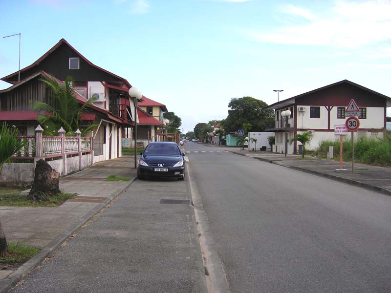
Kourou () is a commune in French Guiana, an overseas region and department of France in South America. Kourou is famous for being the location of the Guiana Space Centre, the main spaceport of France and the European Space Agency (ESA). It is an administrative district in French Guiana and the main town there. Geography Some northwest of the French Guianese capital Cayenne the Kourou River empties into the Atlantic Ocean. At the mouth of this river sits the town of Kourou, which is ringed by four hills: Carapa, Pariacabo, Café and Lombard, with the Singes and Condamine mountains not far behind. There are three lakes within the town's city limits: Lake Bois Diable (where one can take lessons in jetski and other aquatic sports), Lake Marie-Claire (the smallest and calmest), and Lake Bois Chaudat (the biggest of the three; also open to sport lovers, especially canoers and kayakers). Long white sand beaches and some rocky outcrops line the town's ocean coast, the riverbank ... [...More Info...] [...Related Items...] OR: [Wikipedia] [Google] [Baidu] |
Integrated Forecast System
The Integrated Forecasting System (IFS) is a global numerical weather prediction system jointly developed and maintained by the European Centre for Medium-Range Weather Forecasts (ECMWF) based in Reading, England, and Météo-France based in Toulouse. The version of the IFS run at ECMWF is often referred to as the "ECMWF" or the "European model" in North America, to distinguish it from the American GFS. Mechanism It comprises a spectral atmospheric model with a terrain-following vertical coordinate system coupled to a 4D-Var data assimilation system. In 1997 the IFS became the first operational forecasting system to use 4D-Var. Both ECMWF and Météo-France use the IFS to make operational weather forecasts, but using a different configuration and resolution (the Météo-France configuration is referred to as ARPEGE). It is one of the predominant global medium-range models in general use worldwide; its most prominent rivals in the 6–10 day medium range include the American Glob ... [...More Info...] [...Related Items...] OR: [Wikipedia] [Google] [Baidu] |
Tropical Cyclone
A tropical cyclone is a rapidly rotating storm system characterized by a low-pressure center, a closed low-level atmospheric circulation, strong winds, and a spiral arrangement of thunderstorms that produce heavy rain and squalls. Depending on its location and strength, a tropical cyclone is referred to by different names, including hurricane (), typhoon (), tropical storm, cyclonic storm, tropical depression, or simply cyclone. A hurricane is a strong tropical cyclone that occurs in the Atlantic Ocean or northeastern Pacific Ocean, and a typhoon occurs in the northwestern Pacific Ocean. In the Indian Ocean, South Pacific, or (rarely) South Atlantic, comparable storms are referred to simply as "tropical cyclones", and such storms in the Indian Ocean can also be called "severe cyclonic storms". "Tropical" refers to the geographical origin of these systems, which form almost exclusively over tropical seas. "Cyclone" refers to their winds moving in a circle, whirling round ... [...More Info...] [...Related Items...] OR: [Wikipedia] [Google] [Baidu] |
Tropical Cyclones
A tropical cyclone is a rapidly rotating storm system characterized by a low-pressure center, a closed low-level atmospheric circulation, strong winds, and a spiral arrangement of thunderstorms that produce heavy rain and squalls. Depending on its location and strength, a tropical cyclone is referred to by different names, including hurricane (), typhoon (), tropical storm, cyclonic storm, tropical depression, or simply cyclone. A hurricane is a strong tropical cyclone that occurs in the Atlantic Ocean or northeastern Pacific Ocean, and a typhoon occurs in the northwestern Pacific Ocean. In the Indian Ocean, South Pacific, or (rarely) South Atlantic, comparable storms are referred to simply as "tropical cyclones", and such storms in the Indian Ocean can also be called "severe cyclonic storms". "Tropical" refers to the geographical origin of these systems, which form almost exclusively over tropical seas. "Cyclone" refers to their winds moving in a circle, whirling round ... [...More Info...] [...Related Items...] OR: [Wikipedia] [Google] [Baidu] |
Regional Specialized Meteorological Centre
A Regional Specialized Meteorological Centre (RSMC) is responsible for the distribution of information, advisories, and warnings regarding the specific program they have a part of, agreed by consensus at the World Meteorological Organization as part of the World Weather Watch. Environmental emergency response programme As a result of the poor communications between countries following the Chernobyl disaster in the Spring of 1986, the World Meteorological Organization (WMO) was requested by the International Atomic Energy Agency (IAEA) and other international organizations to arrange for early warning messages about nuclear accidents to be transmitted over the Global Telecommunications System (GTS). In addition some WMO member countries that lacked extensive forecasting capability requested that specialized pollutant transport and dispersion forecasts be provided during these emergencies. As a result, during 1989 Meteo-France (MF), Environment Canada (EC) and the United Kingdom's ... [...More Info...] [...Related Items...] OR: [Wikipedia] [Google] [Baidu] |
Cayenne
Cayenne (; ; gcr, Kayenn) is the capital city of French Guiana, an overseas region and Overseas department, department of France located in South America. The city stands on a former island at the mouth of the Cayenne River on the Atlantic Ocean, Atlantic coast. The city's motto is "fert aurum industria", which means "work brings wealth". Cayenne is the largest francophone city of the South American continent. In the 2019 census, there were 147,943 inhabitants in the metropolitan area of Cayenne (as defined by INSEE), 65,493 of whom lived in the city (communes of France, commune) of Cayenne proper. History Ignored by Spanish explorers who found the region too hot and poor to be claimed, the region was not colonized until 1604, when the French founded a settlement. However, it was soon destroyed by the Portugal, Portuguese, determined to enforce the Treaty of Tordesillas. French colonists returned in 1643 and founded Cayenne, but were forced to leave once more following th ... [...More Info...] [...Related Items...] OR: [Wikipedia] [Google] [Baidu] |
European Organisation For The Exploitation Of Meteorological Satellites
The European Organization for the Exploitation of Meteorological Satellites (EUMETSAT) is an intergovernmental organisation created through an international convention agreed by a current total of 30 European Member States. EUMETSAT's primary objective is to establish, maintain and exploit European systems of operational meteorological satellites. EUMETSAT is responsible for the launch and operation of the satellites and for delivering satellite data to end-users as well as contributing to the operational monitoring of climate and the detection of global climate changes. The activities of EUMETSAT contribute to a global meteorological satellite observing system coordinated with other space-faring nations. Satellite observations are an essential input to numerical weather prediction systems and also assist the human forecaster in the diagnosis of potentially hazardous weather developments. Of growing importance is the capacity of weather satellites to gather long-term measurem ... [...More Info...] [...Related Items...] OR: [Wikipedia] [Google] [Baidu] |
New Caledonia
) , anthem = "" , image_map = New Caledonia on the globe (small islands magnified) (Polynesia centered).svg , map_alt = Location of New Caledonia , map_caption = Location of New Caledonia , mapsize = 290px , subdivision_type = Sovereign state , subdivision_name = , established_title = Annexed by France , established_date = 24 September 1853 , established_title2 = Overseas territory , established_date2 = 1946 , established_title3 = Nouméa Accord , established_date3 = 5 May 1998 , official_languages = French , regional_languages = , capital = Nouméa , coordinates = , largest_city = capital , demonym = New Caledonian , government_type = Devolved parliamentary dependency , leader_title1 = President of France , leader_name1 = Emmanuel Macron , leader_title2 = President of the Government , leader_name2 = Louis Mapou , leader_title3 = President of the Congress , leader_name3 = Roch Wamytan , leader_title4 = High Commissioner , leader_name4 = Patrice ... [...More Info...] [...Related Items...] OR: [Wikipedia] [Google] [Baidu] |
Indian Ocean
The Indian Ocean is the third-largest of the world's five oceanic divisions, covering or ~19.8% of the water on Earth's surface. It is bounded by Asia to the north, Africa to the west and Australia to the east. To the south it is bounded by the Southern Ocean or Antarctica, depending on the definition in use. Along its core, the Indian Ocean has some large marginal or regional seas such as the Arabian Sea, Laccadive Sea, Bay of Bengal, and Andaman Sea. Etymology The Indian Ocean has been known by its present name since at least 1515 when the Latin form ''Oceanus Orientalis Indicus'' ("Indian Eastern Ocean") is attested, named after Indian subcontinent, India, which projects into it. It was earlier known as the ''Eastern Ocean'', a term that was still in use during the mid-18th century (see map), as opposed to the ''Western Ocean'' (Atlantic Ocean, Atlantic) before the Pacific Ocean, Pacific was surmised. Conversely, Ming treasure voyages, Chinese explorers in the Indian Oce ... [...More Info...] [...Related Items...] OR: [Wikipedia] [Google] [Baidu] |
World Meteorological Organisation
The World Meteorological Organization (WMO) is a specialized agency of the United Nations responsible for promoting international cooperation on atmospheric science, climatology, hydrology and geophysics. The WMO originated from the International Meteorological Organization, a nongovernmental organization founded in 1873 as a forum for exchanging weather data and research. Proposals to reform the status and structure of the IMO culminated in the World Meteorological Convention of 1947, which formally established the World Meteorological Organization. The Convention entered into force on 23 March 1950, and the following year the WMO began operations as an intergovernmental organization within the UN system. The WMO is made up of 193 countries and territories, and facilitates the "free and unrestricted" exchange of data, information, and research between the respective meteorological and hydrological institutions of its members. It also collaborates with nongovernmental partners ... [...More Info...] [...Related Items...] OR: [Wikipedia] [Google] [Baidu] |
Ariane (rocket Family)
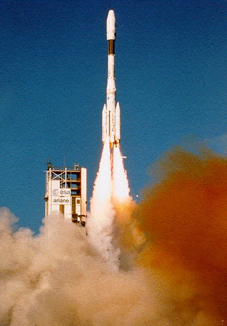
Ariane is a series of European civilian expendable launch vehicles for space launch use. The name comes from the French spelling of the mythological character Ariadne. France first proposed the Ariane project and it was officially agreed upon at the end of 1973 after discussions between France, Germany and the UK. The project was Western Europe's second attempt to develop its own launcher following the unsuccessful Europa project. The Ariane project was code-named L3S (the French abbreviation for third-generation substitution launcher). The European Space Agency (ESA) charged Airbus Defence and Space with the development of all Ariane launchers and of the testing facilities, while Arianespace, a 32.5% CNES (French government space agency) commercial subsidiary created in 1980, handles production, operations and marketing. Arianespace launches Ariane rockets from the Guiana Space Centre at Kourou in French Guiana. Ariane versions Ariane 1 was a three-stage launcher, derived f ... [...More Info...] [...Related Items...] OR: [Wikipedia] [Google] [Baidu] |
Spaceport
A spaceport or cosmodrome is a site for launching or receiving spacecraft, by analogy to a seaport for ships or an airport for aircraft. The word ''spaceport'', and even more so ''cosmodrome'', has traditionally been used for sites capable of launching spacecraft into orbit around Earth or on interplanetary trajectories. However, rocket launch sites for purely sub-orbital flights are sometimes called spaceports, as in recent years new and proposed sites for suborbital human flights have been frequently referred to or named "spaceports". Space stations and proposed future bases on the Moon are sometimes called spaceports, in particular if intended as a base for further journeys. The term rocket launch site is used for any facility from which rockets are launched. It may contain one or more launch pads or suitable sites to mount a transportable launch pad. It is typically surrounded by a large safety area, often called a rocket range or missile range. The range includes the ... [...More Info...] [...Related Items...] OR: [Wikipedia] [Google] [Baidu] |


