|
Munkkiniemi
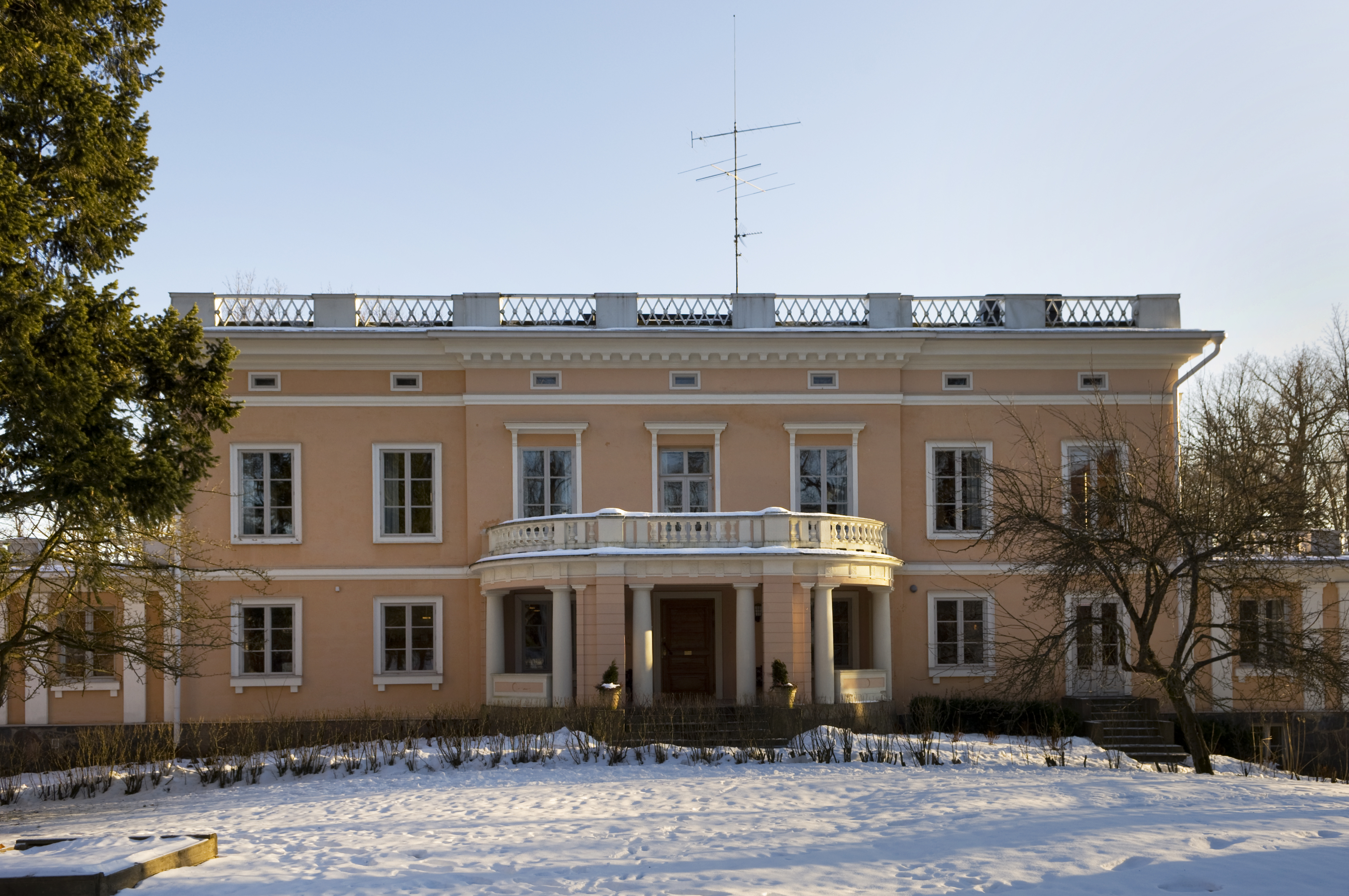
Munkkiniemi ( sv, Munksnäs, Helsinki slang: ''Munkka'') is a neighbourhood in Helsinki. Subdivisions within the district are Vanha Munkkiniemi, Kuusisaari, Lehtisaari, Munkkivuori, Niemenmäki and Talinranta. The land in Munkkiniemi was from the 17th century a part of Munksnäs manor. In the 1910s grandiose plans were made to expand all of western Helsinki with tens of thousands of new inhabitants, the so-called Munkkiniemi–Haaga Plan by Eliel Saarinen. The construction of the new areas started slowly and it wasn't until the 1930s that a more extensive construction phase began in Munkkiniemi. From 1920 to 1946 Munkkiniemi was part of Huopalahti municipality. Huopalahti including Munkkiniemi was incorporated with Helsinki in 1946. Munkkiniemi is one of the more affluent areas of Helsinki. Characterized by the relatively high proportion of Swedish speakers, around twelve percent, and a socioeconomic structure heavy on upper management and professionals, the district is apprecia ... [...More Info...] [...Related Items...] OR: [Wikipedia] [Google] [Baidu] |
Munkkivuori
Munkkivuori ( sv, Munkshöjden, literally 'Monk Mountain') is a quarter of the Munkkiniemi neighbourhood in Helsinki. The buildings and the plan of site are typical of the late 1950s. Most of the residential buildings in Munkkivuori are within a loop formed by Ulvilantie ring road. The automotive traffic to the residential buildings is routed along Ulvilantie whereas Raumantie no through road terminating in the center of the Ulvilantie loop provides access to public services and limits the through-traffic in residential areas. A designed network of crushed stone walkways provides easy accessibility around Munkkivuori for cyclists, pedestrians and other non-automotive traffic. Munkkivuoren ostoskeskus (Munkkivuori shopping centre), the first shopping centre in Finland, was built in 1959. The small shopping center, known as ''"Ostari"'' amongst the locals, is the focal point of Munkkivuori and is the home to some companies. Many everyday services are available at the viable shopping ... [...More Info...] [...Related Items...] OR: [Wikipedia] [Google] [Baidu] |
Vanha Munkkiniemi
Vanha Munkkiniemi ( Finnish), Gamla Munksnäs (Swedish), both of them meaning ′Old Munkkiniemi′, is a neighborhood that contains the original part of Munkkiniemi Munkkiniemi ( sv, Munksnäs, Helsinki slang: ''Munkka'') is a neighbourhood in Helsinki. Subdivisions within the district are Vanha Munkkiniemi, Kuusisaari, Lehtisaari, Munkkivuori, Niemenmäki and Talinranta. The land in Munkkiniemi was from the ... district in Helsinki, Finland. {{Helsinki Munkkiniemi ... [...More Info...] [...Related Items...] OR: [Wikipedia] [Google] [Baidu] |
Talinranta
Talinranta ( sv, Talistranden) is a neighbourhood in Munkkiniemi district of Helsinki, Finland. It is located west from Munkkivuori and south from Tali. In south, Finnish national road 1 separates Talinranta from Vanha Munkkiniemi Vanha Munkkiniemi ( Finnish), Gamla Munksnäs (Swedish), both of them meaning ′Old Munkkiniemi′, is a neighborhood that contains the original part of Munkkiniemi Munkkiniemi ( sv, Munksnäs, Helsinki slang: ''Munkka'') is a neighbourhood in .... Talinranta has 1,226 inhabitants living in an area of 0.40 km2http://www.hel2.fi/tietokeskus/helsinki_alueittain_2005/202Munkkiniemi.pdf Munkkiniemi district information References {{Helsinki Munkkiniemi ... [...More Info...] [...Related Items...] OR: [Wikipedia] [Google] [Baidu] |
Niemenmäki
Niemenmäki ( sv, Näshöjden) is a quarter of the Munkkiniemi neighbourhood in Helsinki. Niemenmäki was constructed in the early 1960s. The nearby Shopping center provides everyday services to Niemenmäki inhabitants. Huopalahdentie road separates Niemenmäki from Munkkivuori in the West and Lapinmäentie road from Haaga in the North. Allotment gardens separate Niemenmäki both from Pikku Huopalahti in the East and from Vanha Munkkiniemi Vanha Munkkiniemi ( Finnish), Gamla Munksnäs (Swedish), both of them meaning ′Old Munkkiniemi′, is a neighborhood that contains the original part of Munkkiniemi Munkkiniemi ( sv, Munksnäs, Helsinki slang: ''Munkka'') is a neighbourhood in ... in the South. External links Munkkiniemi {{SouthernFinland-geo-stub ... [...More Info...] [...Related Items...] OR: [Wikipedia] [Google] [Baidu] |
Lehtisaari, Helsinki
Lehtisaari (; sv, Lövö) is an island and part of Munkkiniemi, a neighborhood in western Helsinki, Finland. Lehtisaari's overall appearance is coastal and wooded. Lehtisaari contains a portion of the jogging route that is used by the Helsinki City Marathon. The island's residential zoning began in the 1950s. The island's residential area was mostly built in the 1960s. The street Kuusisaarentie runs through Lehtisaari from Munkkiniemi to the districts of Otaniemi and Keilaniemi in the neighbouring city of Espoo and to the Ring I beltway. The street includes a small bridge from Kuusisaari to Lehtisaari and a longer bridge from Lehtisaari to Otaniemi near Keilaniemi. Lehtisaari also has a bridge to Kaskisaari, with a narrow and winding street Lehtisaarentie leading there, and also a light traffic bridge to Lauttasaari. Lehtisaari has a shopping centre A shopping center (American English) or shopping centre (English in the Commonwealth of Nations, Commonwealth English) ... [...More Info...] [...Related Items...] OR: [Wikipedia] [Google] [Baidu] |
Kuusisaari
Kuusisaari ( Finnish), Granö ( Swedish) is an island and a neighborhood of Helsinki, Finland Finland ( fi, Suomi ; sv, Finland ), officially the Republic of Finland (; ), is a Nordic country in Northern Europe. It shares land borders with Sweden to the northwest, Norway to the north, and Russia to the east, with the Gulf of Bo .... It has the highest average income of all the Helsinki metropolitan area. Many foreign embassies are located in Kuusisaari. {{Helsinki Munkkiniemi Diplomatic districts ... [...More Info...] [...Related Items...] OR: [Wikipedia] [Google] [Baidu] |
Subdivisions Of Helsinki
The city of Helsinki, the capital of Finland, can be divided into various sorts of subdivisions. Helsinki is divided into three major areas: Helsinki Downtown ( fi, Helsingin kantakaupunki, sv, Helsingfors innerstad), North Helsinki ( fi, Pohjois-Helsinki, sv, Norra Helsingfors) and East Helsinki ( fi, Itä-Helsinki, sv, Östra Helsingfors). The subdivisions include neighbourhoods, districts, major districts and postal code areas. The plethora of different official ways to divide the city is a source of some confusion to the inhabitants, as different kinds of subdivisions often share similar or identical names. Neighbourhoods Helsinki consists of 60 neighbourhoods (''kaupunginosa'' in Finnish; ''stadsdel'' in Swedish). The division into neighbourhoods is the official division created by the city council and used for city planning and other similar purposes. Most of the neighbourhoods have existed since the 19th century as numbered parts of the city, and official names we ... [...More Info...] [...Related Items...] OR: [Wikipedia] [Google] [Baidu] |
Huopalahti
Huopalahti ( sv, Hoplax) was a municipality during the years 1920–1945 in Uusimaa, Finland. The municipality was bilingual. Current areas of Munkkiniemi, Lauttasaari and parts of northern Pasila were parts of Huopalahti. The area was separated from former Helsinki parish in 1920. Haaga was part of the municipality, but was separated from it in 1923. The Finnish National Defence University, that was moved to Munkkiniemi in 1923, was located in Huopalahti. In 1946, the municipality was consolidated to Helsinki. The Finnish Hunting Society which is headquartered in the city hosted the shotgun shooting events for the 1952 Summer Olympics. See also *Huopalahti railway station Huopalahti railway station ( fi, Huopalahden rautatieasema, sv, Hoplax järnvägsstation) is a railway station on the VR commuter rail network located in northern Helsinki, Finland. It is located about to the north/northwest of Helsinki Central ... References1952 Summer Olympics official report.p.&nb ... [...More Info...] [...Related Items...] OR: [Wikipedia] [Google] [Baidu] |
Lauttasaari
Lauttasaari (; sv, Drumsö) is an island in Helsinki, Finland, about west of the city centre. Together with some surrounding unpopulated small islands, Lauttasaari is also a district of Helsinki. With 23,226 residents as of 2017, the island is Finland's second largest by population, after Fasta Åland. Its land area is 3.85 km. Lauttasaari is primarily a residential area but also contains services, including several marinas and canoe clubs. Although close to the city centre, Lauttasaari has not been entirely built up. Notably, almost the entire shoreline remains in public use, with footpaths, beaches, playgrounds, patches of forest, and rocky outcrops. The name Lauttasaari literally means "ferry island", although nowadays, the island is connected to the rest of Helsinki and to the city of Espoo by bridges, causeways, and the Helsinki metro, which has two stations in the district. The island has two postal codes: 00200 and 00210. Etymology The island of Lauttasaari has ... [...More Info...] [...Related Items...] OR: [Wikipedia] [Google] [Baidu] |
Eliel Saarinen
Gottlieb Eliel Saarinen (, ; August 20, 1873 – July 1, 1950) was a Finnish-American architect known for his work with art nouveau buildings in the early years of the 20th century. He was also the father of famed architect Eero Saarinen. Life and work in Finland Saarinen was educated in Helsinki at the Helsinki University of Technology. From 1896 to 1905 he worked as a partner with Herman Gesellius and Armas Lindgren at the firm Gesellius, Lindgren, Saarinen. His first major work with the firm, the Finnish pavilion at the Paris 1900 World Fair, exhibited an extraordinary convergence of stylistic influences: Finnish wooden architecture, the British Gothic Revival, and the Jugendstil. Saarinen's early manner was later christened the Finnish National Romanticism and culminated in the Helsinki Central railway station (designed 1904, constructed 1910–14). From 1910 to 1915 he worked on the extensive city-planning project of Munksnäs-Haga and later published a book on the s ... [...More Info...] [...Related Items...] OR: [Wikipedia] [Google] [Baidu] |
Tallinn
Tallinn () is the most populous and capital city of Estonia. Situated on a bay in north Estonia, on the shore of the Gulf of Finland of the Baltic Sea, Tallinn has a population of 437,811 (as of 2022) and administratively lies in the Harju '' maakond'' (county). Tallinn is the main financial, industrial, and cultural centre of Estonia. It is located northwest of the country's second largest city Tartu, however only south of Helsinki, Finland, also west of Saint Petersburg, Russia, north of Riga, Latvia, and east of Stockholm, Sweden. From the 13th century until the first half of the 20th century, Tallinn was known in most of the world by variants of its other historical name Reval. Tallinn received Lübeck city rights in 1248,, however the earliest evidence of human population in the area dates back nearly 5,000 years. The medieval indigenous population of what is now Tallinn and northern Estonia was one of the last " pagan" civilisations in Europe to adopt Christia ... [...More Info...] [...Related Items...] OR: [Wikipedia] [Google] [Baidu] |
Porvoo
Porvoo (; sv, Borgå ; la, Borgoa) is a city and a municipality in the Uusimaa region of Finland, situated on the southern coast about east of the city border of Helsinki and about from the city centre. Porvoo was one of the six medieval towns of Finland, along with Turku, Ulvila, Rauma, Naantali and Vyborg. It is first mentioned as a city in texts from the 14th century. Porvoo is the seat of the Swedish-speaking Diocese of Borgå of the Evangelical Lutheran Church of Finland. Porvoo was briefly the capital of the former Eastern Uusimaa region. Porvoo Old Town ( fi, Porvoon vanhakaupunki; sv, Borgås gamla stan) is a popular tourist destination, known for its well-preserved 18th- and 19th-century buildings, and the 15th-century Porvoo Cathedral. The Old Town and the Porvoonjoki River Valley are recognized as, together, one of the National landscapes of Finland. The municipality's official languages are Finnish and Swedish. In 2014, 64.6% of the population spoke ... [...More Info...] [...Related Items...] OR: [Wikipedia] [Google] [Baidu] |


