|
Mount Halimun
Mount Halimun ( id, Gunung Halimun) is a mountain in the island of Java, Indonesia. It is protected by the Mount Halimun Salak National Park. It is Banten's highest point. Location Mount Halimun is in the volcanic belt of the Bandung Zone. It is a stratovolcano formed during the Pleistocene. It is on the border between Banten province and West Java province. The summit, North Halimun, has an elevation of and a prominence of . Environment The mountain lies within the largest area of primary rainforest in Java. The word ''Halimun'' means "foggy" or "misty" in the Sundanese language, and is given to two of the peaks in the national park, but is commonly applied to the higher north peak. Much of the forest on the mountain is almost always enclosed in cloud. The Ci Durian river rises on the slopes of the mountain and flows northward through the Banten region. The Cisadane river also rises in the park. The park is a critical area for survival of the silvery gibbon The silvery gib ... [...More Info...] [...Related Items...] OR: [Wikipedia] [Google] [Baidu] |
Stratovolcano
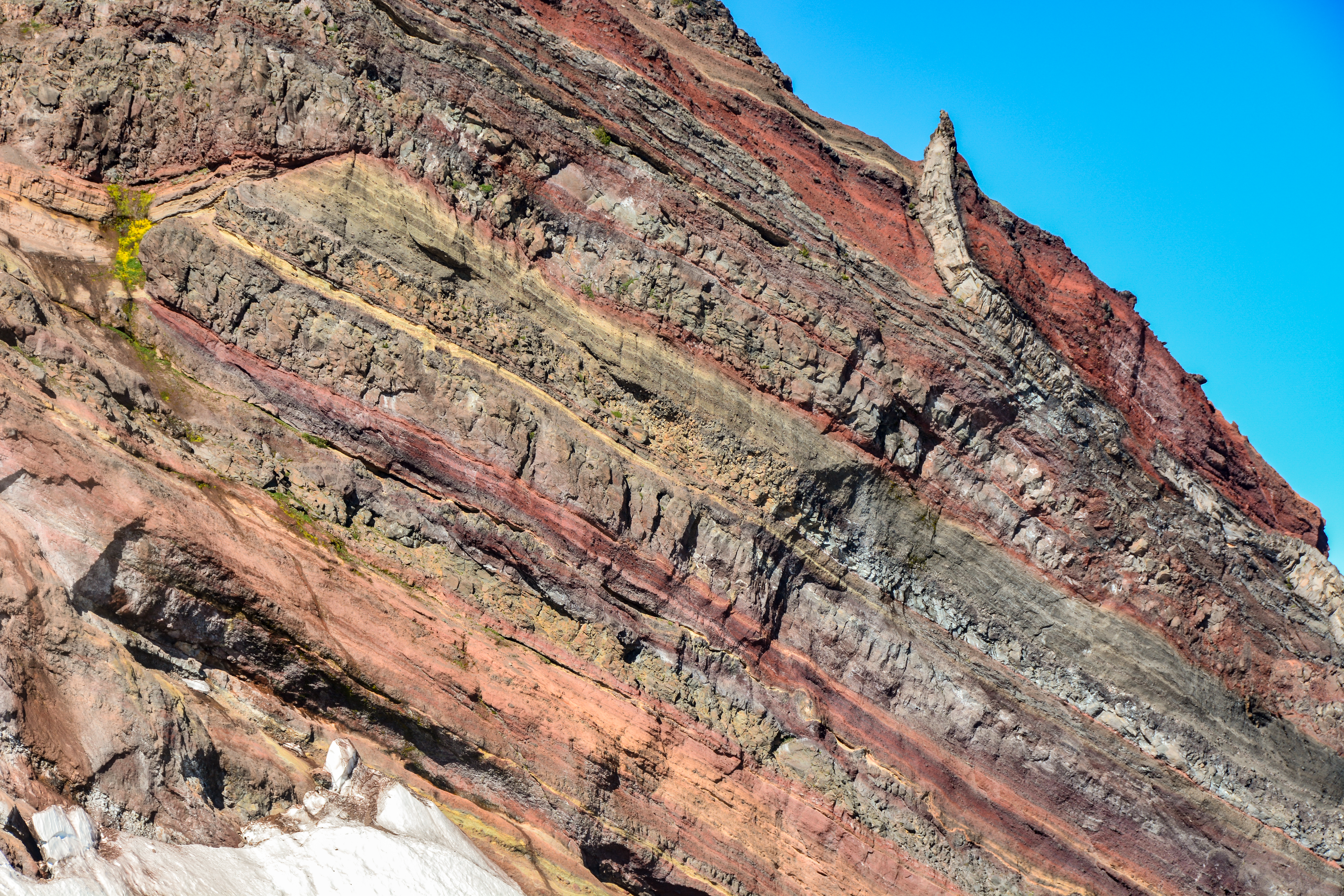
A stratovolcano, also known as a composite volcano, is a conical volcano built up by many layers (strata) of hardened lava and tephra. Unlike shield volcanoes, stratovolcanoes are characterized by a steep profile with a summit crater and periodic intervals of explosive eruptions and effusive eruptions, although some have collapsed summit craters called calderas. The lava flowing from stratovolcanoes typically cools and hardens before spreading far, due to high viscosity. The magma forming this lava is often felsic, having high-to-intermediate levels of silica (as in rhyolite, dacite, or andesite), with lesser amounts of less-viscous mafic magma. Extensive felsic lava flows are uncommon, but have travelled as far as . Stratovolcanoes are sometimes called composite volcanoes because of their composite stratified structure, built up from sequential outpourings of erupted materials. They are among the most common types of volcanoes, in contrast to the less common shield volca ... [...More Info...] [...Related Items...] OR: [Wikipedia] [Google] [Baidu] |
Java
Java (; id, Jawa, ; jv, ꦗꦮ; su, ) is one of the Greater Sunda Islands in Indonesia. It is bordered by the Indian Ocean to the south and the Java Sea to the north. With a population of 151.6 million people, Java is the world's List of islands by population, most populous island, home to approximately 56% of the Demographics of Indonesia, Indonesian population. Indonesia's capital city, Jakarta, is on Java's northwestern coast. Many of the best known events in Indonesian history took place on Java. It was the centre of powerful Hindu-Buddhist empires, the Islamic sultanates, and the core of the colonial Dutch East Indies. Java was also the center of the History of Indonesia, Indonesian struggle for independence during the 1930s and 1940s. Java dominates Indonesia politically, economically and culturally. Four of Indonesia's eight UNESCO world heritage sites are located in Java: Ujung Kulon National Park, Borobudur Temple, Prambanan Temple, and Sangiran Early Man Site. ... [...More Info...] [...Related Items...] OR: [Wikipedia] [Google] [Baidu] |
Mount Halimun Salak National Park
Mount Halimun Salak National Park is a 400 km2 conservation area in the Indonesian province of West Java on the island of Java. Established in 1992, the park comprises two mountains, Mount Salak and Mount Halimun with an 11-kilometer forest corridor. It is located near the better known Mount Gede Pangrango National Park, but the national park should be accessed from Sukabumi, 2 hours drive to the administration post and then 2 hours drive (30 kilometers) again to Cikaniki post gate. The park contains water catchment areas shielded from urban populations and agricultural areas to the north, as well as several endangered animals and rare birds. Geography Its mountain tops reach 1,929 metres and are often mist-shrouded, while its valleys are thought to hide much that remains to be discovered. Mount Salak is a critical water catchment area for its very high rainfall. The park is an amalgamation of two important ecosystems at Halimun and Mount Salak, which are connected by an 1 ... [...More Info...] [...Related Items...] OR: [Wikipedia] [Google] [Baidu] |
Banten
Banten ( id, Banten; Sundanese: , romanized ''Banten'') is the westernmost province on the island of Java, Indonesia. Its capital city is Serang. The province borders West Java and the Special Capital Region of Jakarta on the east, the Java Sea on the north, the Indian Ocean on the south, and the Sunda Strait (which separates Java from the neighbouring island of Sumatra) on the west. The province covers an area of . It had a population of over 11.9 million in the 2020 census, up from about 10.6 million in 2010.Badan Pusat Statistik, Jakarta, 2021. The estimated mid-2021 population was 12.06 million.Badan Pusat Statistik, Jakarta, 2022. Formerly part of the province of West Java, Banten was declared a separate province in 2000. The region is the homeland of the Bantenese people, whose culture differs slightly from that of West Java's Sundanese people. The northern half (particularly the areas near Jakarta and the Java Sea coast) has recently experienced rapid rises in populatio ... [...More Info...] [...Related Items...] OR: [Wikipedia] [Google] [Baidu] |
Stratovolcano
A stratovolcano, also known as a composite volcano, is a conical volcano built up by many layers (strata) of hardened lava and tephra. Unlike shield volcanoes, stratovolcanoes are characterized by a steep profile with a summit crater and periodic intervals of explosive eruptions and effusive eruptions, although some have collapsed summit craters called calderas. The lava flowing from stratovolcanoes typically cools and hardens before spreading far, due to high viscosity. The magma forming this lava is often felsic, having high-to-intermediate levels of silica (as in rhyolite, dacite, or andesite), with lesser amounts of less-viscous mafic magma. Extensive felsic lava flows are uncommon, but have travelled as far as . Stratovolcanoes are sometimes called composite volcanoes because of their composite stratified structure, built up from sequential outpourings of erupted materials. They are among the most common types of volcanoes, in contrast to the less common shield volca ... [...More Info...] [...Related Items...] OR: [Wikipedia] [Google] [Baidu] |
Pleistocene
The Pleistocene ( , often referred to as the ''Ice age'') is the geological Epoch (geology), epoch that lasted from about 2,580,000 to 11,700 years ago, spanning the Earth's most recent period of repeated glaciations. Before a change was finally confirmed in 2009 by the International Union of Geological Sciences, the cutoff of the Pleistocene and the preceding Pliocene was regarded as being 1.806 million years Before Present (BP). Publications from earlier years may use either definition of the period. The end of the Pleistocene corresponds with the end of the last glacial period and also with the end of the Paleolithic age used in archaeology. The name is a combination of Ancient Greek grc, label=none, πλεῖστος, pleīstos, most and grc, label=none, καινός, kainós (latinized as ), 'new'. At the end of the preceding Pliocene, the previously isolated North and South American continents were joined by the Isthmus of Panama, causing Great American Interchang ... [...More Info...] [...Related Items...] OR: [Wikipedia] [Google] [Baidu] |
West Java
West Java ( id, Jawa Barat, su, ᮏᮝ ᮊᮥᮜᮧᮔ᮪, romanized ''Jawa Kulon'') is a province of Indonesia on the western part of the island of Java, with its provincial capital in Bandung. West Java is bordered by the province of Banten and the country's capital region of Jakarta to the west, the Java Sea to the north, the province of Central Java to the east and the Indian Ocean to the south. With Banten, this province is the native homeland of the Sundanese people, the second-largest ethnic group in Indonesia. West Java was one of the first eight provinces of Indonesia formed following the country's independence proclamation and was later legally re-established on 14 July 1950. In 1966, the city of Jakarta was split off from West Java as a 'special capital region' (), with a status equivalent to that of a province, while in 2000 the western parts of the province were in turn split away to form a separate Banten province. Even following these split-offs, West Java is ... [...More Info...] [...Related Items...] OR: [Wikipedia] [Google] [Baidu] |
Sundanese Language
Sundanese (: , ; Sundanese script: ) is a Malayo-Polynesian language spoken by the Sundanese. It has approximately 40 million native speakers in the western third of Java; they represent about 15% of Indonesia's total population. Classification According to American linguist Robert Blust, Sundanese is closely related to the Malayic languages, as well as to language groups spoken in Borneo such as the Land Dayak languages or the Kayan–Murik languages, based on high lexical similarities between these languages. History and distribution Sundanese is mainly spoken on the west side of the island of Java, in an area known as Tatar Sunda (Pasundan). However, Sundanese is also spoken in the western part of Central Java, especially in Brebes and Cilacap Regency, because these areas were previously under the control of the Galuh Kingdom. Many place names in Cilacap are still Sundanese names such as Dayeuhluhur, Cimanggu, Cipari and so on. Until 1600 AD, Sundanese was the sta ... [...More Info...] [...Related Items...] OR: [Wikipedia] [Google] [Baidu] |
Ci Durian
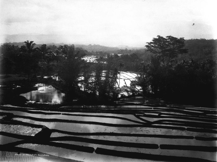
The Ci Durian (Durian River), or Ci Kandi, is a river in the Banten province of western Java, Indonesia. It rises in the mountains to the south and flows north to the Java Sea. The delta of the river, now canalized, has long been used for rice paddies and for a period was also used for sugarcane plantations. Extensive irrigation works diverted water from the river into a canal system in the 1920s, but these works were not completed and suffered from neglect in the post-colonial era. Plans were made in the 1990s to rehabilitate the irrigation works and dam the river to provide water for industrial projects, with Dutch and Japanese assistance, but these were cancelled by the Indonesian government. Location The Ci Durian rises on the slopes of the high Mount Halimun and flows northward through the Banten region. It reaches the coast to the east of Kota Banten. The rivers in Banten, the westernmost province of Java, run roughly parallel to each other. The main ones are the Peteh, ... [...More Info...] [...Related Items...] OR: [Wikipedia] [Google] [Baidu] |
Silvery Gibbon
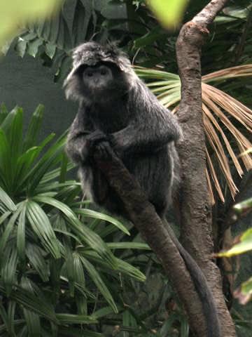
The silvery gibbon (''Hylobates moloch''), also known as the Javan gibbon, is a primate in the gibbon family Hylobatidae. It is endemic to the Indonesian island of Java, where it inhabits undisturbed rainforests up to an altitude of . It is listed as Endangered on the IUCN Red List since 2008, as the wild population is estimated at comprising less than 2500 mature individuals. Its coat is bluish-grey in colour, with a dark grey or black cap. Like all gibbons, the silvery gibbon lacks an external tail, has dorsally placed scapulae, and reduced flexibility in its lumbar region. It has long, curved fingers and very long forelimbs relative to its hind limbs. On average, it reaches in weight. It is diurnal and arboreal, climbing trees skilfully and brachiating through the forests. Brachiation is possible because of its mobile wrist joints, full rotation of the upper arm, and the ability to lock elbows in suspension. Its diet consists of fruits, leaves, and flowers. Every three year ... [...More Info...] [...Related Items...] OR: [Wikipedia] [Google] [Baidu] |
Mountains Of West Java
A mountain is an elevated portion of the Earth's crust, generally with steep sides that show significant exposed bedrock. Although definitions vary, a mountain may differ from a plateau in having a limited summit area, and is usually higher than a hill, typically rising at least 300 metres (1,000 feet) above the surrounding land. A few mountains are isolated summits, but most occur in mountain ranges. Mountains are formed through tectonic forces, erosion, or volcanism, which act on time scales of up to tens of millions of years. Once mountain building ceases, mountains are slowly leveled through the action of weathering, through slumping and other forms of mass wasting, as well as through erosion by rivers and glaciers. High elevations on mountains produce colder climates than at sea level at similar latitude. These colder climates strongly affect the ecosystems of mountains: different elevations have different plants and animals. Because of the less hospitable terrain and ... [...More Info...] [...Related Items...] OR: [Wikipedia] [Google] [Baidu] |


