|
Motcombe
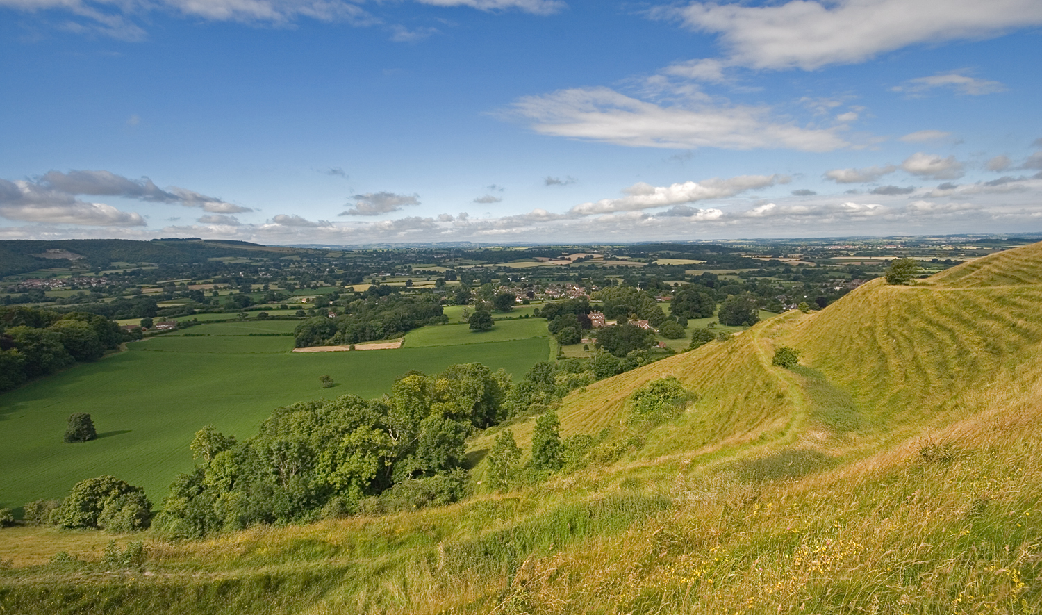
Motcombe is a village and civil parish in north Dorset, England. It lies about north of Shaftesbury. It is sited on Kimmeridge clay soil beneath hills at the edge of the Blackmore Vale. The parish is one of the largest in Dorset. In the 2011 census the parish had 611 dwellings, 564 households and a population of 1,474. In 1905 Sir Frederick Treves described Motcombe as "a hamlet of gardens at the foot of the hill" and wrote of the village houses that they "are facing all ways, as if they were shy of the road or were undecided which way to turn." The parish church of St Mary was rebuilt in 1846, although its font dates from Norman Norman or Normans may refer to: Ethnic and cultural identity * The Normans, a people partly descended from Norse Vikings who settled in the territory of Normandy in France in the 10th and 11th centuries ** People or things connected with the Norm ... times. On the south-west edge of the village is Motcombe Park. Within the park is Motcombe House, b ... [...More Info...] [...Related Items...] OR: [Wikipedia] [Google] [Baidu] |
Port Regis School
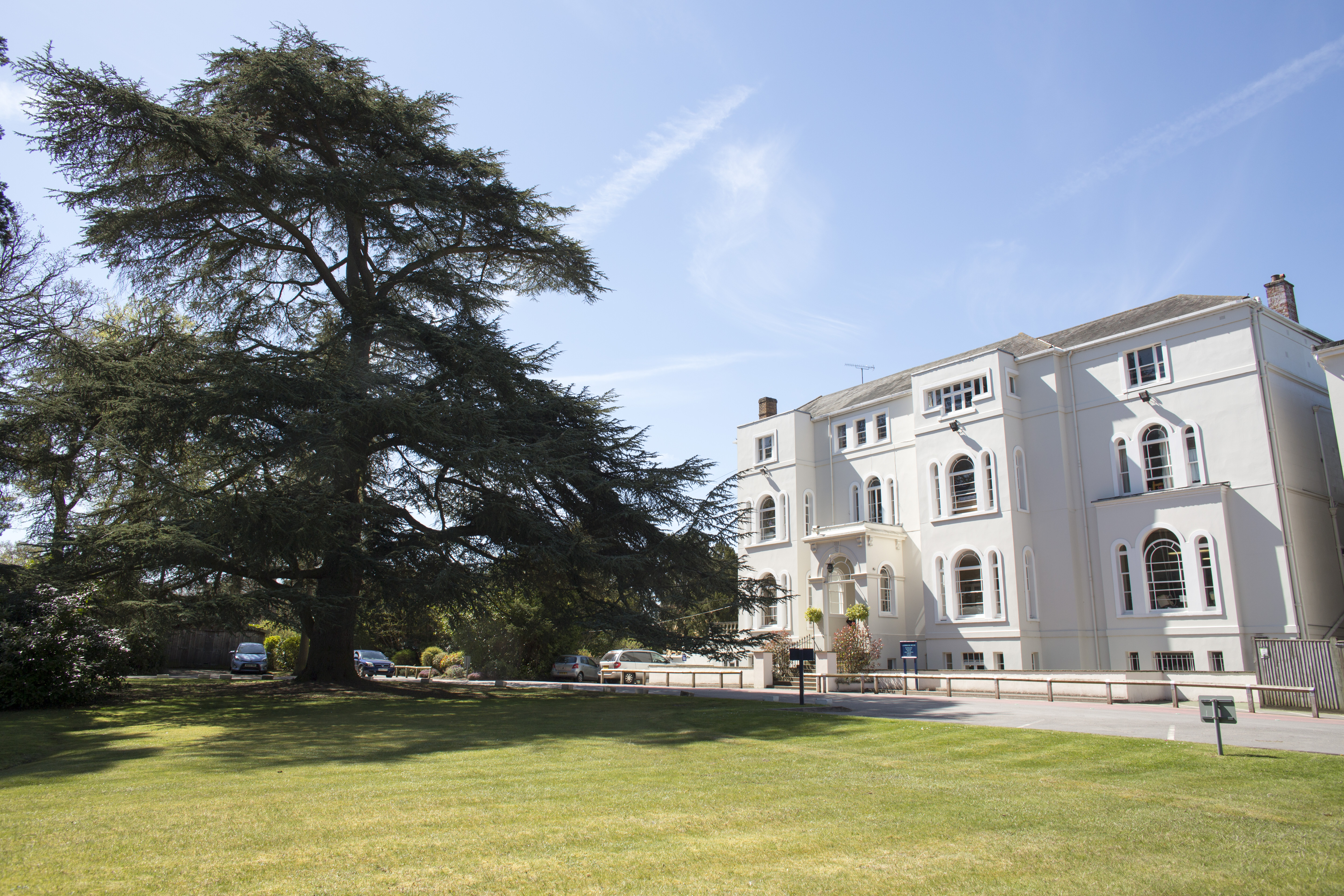
Port Regis School is a co-educational preparatory school located in 140 acres of parkland on the Dorset-Wiltshire border in southern England, situated between the towns of Shaftesbury and Gillingham. In 2009 ''Which school?'' said of Port Regis that it had "long been a market leader in the prep school world" while the Tatler Schools Guide 2014 described it as "a prep school with public-school facilities (...) Simply the shiniest, best-equipped prep around". In 2014 the Independent Schools Inspectorate judged Port Regis to be 'excellent' in all nine inspected categories. History The original school was founded by Dr Alfred Praetorius in 1881 in Weymouth Street, London. A few years later it moved to Folkestone and in 1921 to Kingsgate, Broadstairs, in the grounds of which stood an ancient arch, erected by Earl Holland to commemorate a chance landing by Charles II in 1683. This provided the name of the School: Port Regis, "Gate of the King". In the 1930s, while at Broadstair ... [...More Info...] [...Related Items...] OR: [Wikipedia] [Google] [Baidu] |
Blackmore Vale
The Blackmore Vale (; less commonly spelt ''Blackmoor'') is a vale, or wide valley, in north Dorset, and to a lesser extent south Somerset and southwest Wiltshire in southern England. Geography The vale is part of the Stour valley, part of the Dorset AONB and part of the natural region known as the Blackmoor Vale and Vale of Wardour. To the south and east, the vale is clearly delimited by the steep escarpments of two areas of higher chalk downland, the Dorset Downs to the south, and Cranborne Chase to the east. To the north and west, the definitions of the vale are more ambiguous, as the landscape changes more gradually around the upper reaches of the Stour and its tributaries. One definition places the boundary along the watershed between the Stour and neighbouring valleys of the Yeo to the west and Brue to the north. A narrower definition places the limits of the vale close to the county boundary and villages like Bourton, where the landscape transitions to hillier greens ... [...More Info...] [...Related Items...] OR: [Wikipedia] [Google] [Baidu] |
Shaftesbury
Shaftesbury () is a town and civil parish in Dorset, England. It is situated on the A30 road, west of Salisbury, near the border with Wiltshire. It is the only significant hilltop settlement in Dorset, being built about above sea level on a greensand hill on the edge of Cranborne Chase. The town looks over the Blackmore Vale, part of the River Stour basin. Shaftesbury is the site of the former Shaftesbury Abbey, which was founded in 888 by King Alfred and became one of the richest religious establishments in the country, before being destroyed in the dissolution in 1539. Adjacent to the abbey site is Gold Hill, a steep cobbled street used in the 1970s as the setting for Ridley Scotts television advertisement for Hovis bread. In the 2011 Census the town's civil parish had a population of 7,314. Toponymy Shaftesbury has acquired a number of names throughout its history. Writing in 1906, Sir Frederick Treves referred to four of these names from Celtic, Latin and Eng ... [...More Info...] [...Related Items...] OR: [Wikipedia] [Google] [Baidu] |
2011 United Kingdom Census
A census of the population of the United Kingdom is taken every ten years. The 2011 census was held in all countries of the UK on 27 March 2011. It was the first UK census which could be completed online via the Internet. The Office for National Statistics (ONS) is responsible for the census in England and Wales, the General Register Office for Scotland (GROS) is responsible for the census in Scotland, and the Northern Ireland Statistics and Research Agency (NISRA) is responsible for the census in Northern Ireland. The Office for National Statistics is the executive office of the UK Statistics Authority, a non-ministerial department formed in 2008 and which reports directly to Parliament. ONS is the UK Government's single largest statistical producer of independent statistics on the UK's economy and society, used to assist the planning and allocation of resources, policy-making and decision-making. ONS designs, manages and runs the census in England and Wales. In its capaci ... [...More Info...] [...Related Items...] OR: [Wikipedia] [Google] [Baidu] |
Tudor Architecture
The Tudor architectural style is the final development of Medieval architecture in England and Wales, during the Tudor period (1485–1603) and even beyond, and also the tentative introduction of Renaissance architecture to Britain. It followed the Late Gothic Perpendicular style and, gradually, it evolved into an aesthetic more consistent with trends already in motion on the continent, evidenced by other nations already having the Northern Renaissance underway Italy, and especially France already well into its revolution in art, architecture, and thought. A subtype of Tudor architecture is Elizabethan architecture, from about 1560 to 1600, which has continuity with the subsequent Jacobean architecture in the early Stuart period. In the much more slow-moving styles of vernacular architecture, "Tudor" has become a designation for half-timbered buildings, although there are cruck and frame houses with half timbering that considerably predate 1485 and others well after 1603; ... [...More Info...] [...Related Items...] OR: [Wikipedia] [Google] [Baidu] |
Gillingham (Dorset) Railway Station
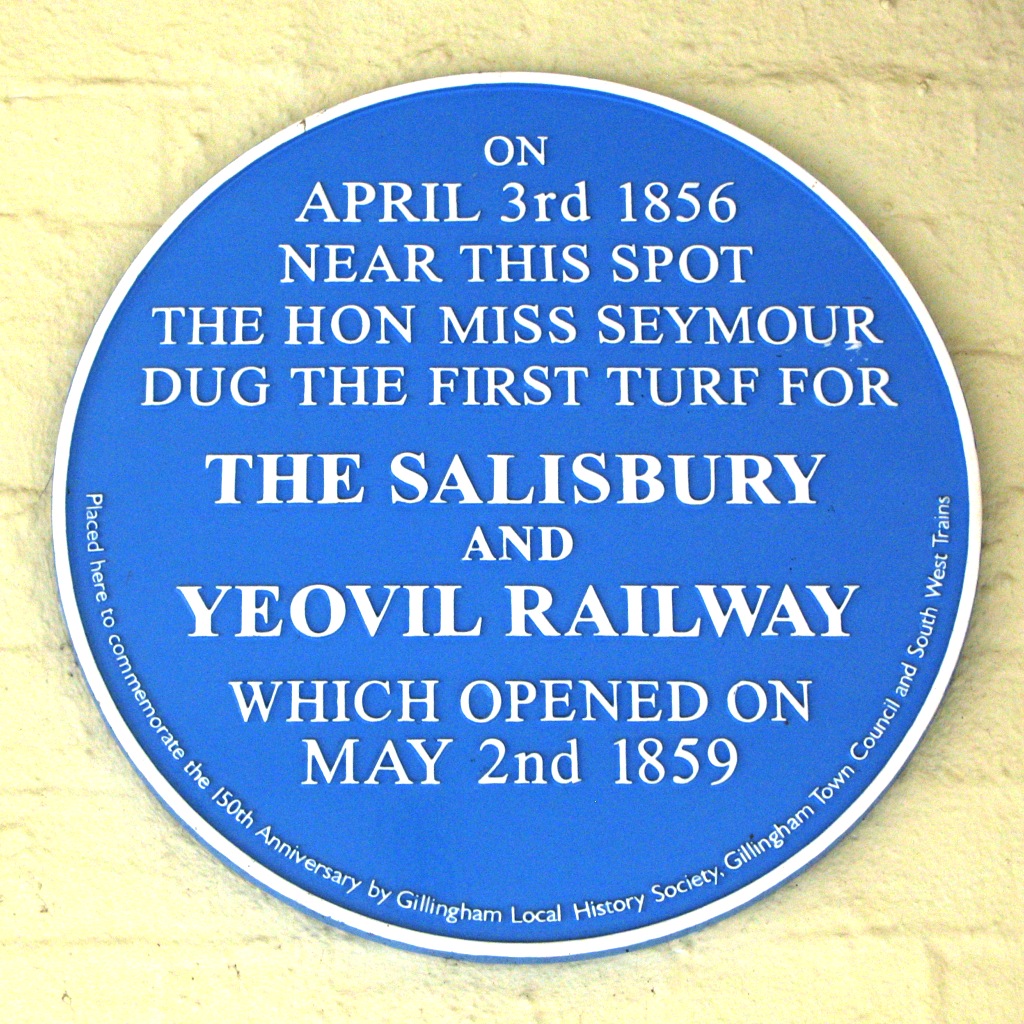
Gillingham railway station is in Gillingham, Dorset, England. It is on the West of England Main Line, down the line from . Today it is managed by South Western Railway. The main offices, designed by Sir William Tite, stand on the north side of the line. It is commonly suffixed as ''Gillingham (Dorset)'' to distinguish it from the station of the same name in Kent. History On 3 April 1856 Miss Seymour, sister of the company’s chairman, dug the first ceremonial sod for the Salisbury and Yeovil Railway (S&YR) at Gillingham. Three years later, on 2 May 1859, the railway from opened to Gillingham, and was completed to station at Yeovil on 1 June 1860. The station was close to the town centre. The main offices and goods shed were on the north side of the line, further sidings to serve a brickworks were added on the other side of the line, and a signal box opened in 1875. Trains were provided for the S&YR by the London and South Western Railway (LSWR), which bought out the ... [...More Info...] [...Related Items...] OR: [Wikipedia] [Google] [Baidu] |
Gillingham, Dorset
Gillingham ( ) is a town and civil parish in the Blackmore Vale area of Dorset, England. It lies on the B3095 and B3081 roads, approximately south of the A303 trunk road and northwest of Shaftesbury. It is the most northerly town in the county. In the 2011 census the civil parish had a population of 11,756. The neighbouring hamlets of Peacemarsh, Bay and Wyke have become part of Gillingham as it has expanded. Gillingham is pronounced with a hard initial "g" (), unlike Gillingham, Kent, which is pronounced with a soft "g" (). History There is a Stone Age barrow in the town, and evidence of Roman settlement in the 2nd and 3rd centuries; however the town was established by the Saxons. The church of St Mary the Virgin has a Saxon cross shaft dating from the 9th century. The name Gillingham was used for the town in its 10th century Saxon charter, and also in an entry for 1016 in the annals, as the location of a battle between Edmund Ironside and the Vikings. In the Domes ... [...More Info...] [...Related Items...] OR: [Wikipedia] [Google] [Baidu] |
Wards And Electoral Divisions Of The United Kingdom
The wards and electoral divisions in the United Kingdom are electoral districts at sub-national level, represented by one or more councillors. The ward is the primary unit of English electoral geography for civil parishes and borough and district councils, the electoral ward is the unit used by Welsh principal councils, while the electoral division is the unit used by English county councils and some unitary authorities. Each ward/division has an average electorate of about 5,500 people, but ward population counts can vary substantially. As of 2021 there are 8,694 electoral wards/divisions in the UK. England The London boroughs, metropolitan boroughs and non-metropolitan districts (including most unitary authorities) are divided into wards for local elections. However, county council elections (as well as those for several unitary councils which were formerly county councils, such as the Isle of Wight and Shropshire Councils) instead use the term ''electoral division''. In ... [...More Info...] [...Related Items...] OR: [Wikipedia] [Google] [Baidu] |
Preparatory School (UK)
A preparatory school (or, shortened: prep school) in the United Kingdom is a fee-charging independent primary school that caters for children up to approximately the age of 13. The term "preparatory school" is used as it ''prepares'' the children for the Common Entrance Examination in order to secure a place at an independent secondary school, typically one of the English public schools. They are also preferred by some parents in the hope of getting their child into a state selective grammar school. Most prep schools are inspected by the Independent Schools Inspectorate, which is overseen by Ofsted on behalf of the Department for Education. Overview Boys' prep schools are generally for 8-13 year-olds, who are prepared for the Common Entrance Examination, the key to entry into many secondary independent schools. Before the age of 7 or 8, the term "pre-prep school" is used. Girls' independent schools in England tend to follow the age ranges of state schools more closely than th ... [...More Info...] [...Related Items...] OR: [Wikipedia] [Google] [Baidu] |
Sir Frederick Treves, 1st Baronet
Sir Frederick Treves, 1st Baronet (15 February 1853 – 7 December 1923), was a prominent British surgeon, and an expert in anatomy. Treves was renowned for his surgical treatment of appendicitis, and is credited with saving the life of King Edward VII in 1902. He is also widely known for his friendship with Joseph Merrick, dubbed the "Elephant Man" for his severe deformities. Life and career Frederick Treves was born on 15 February 1853 in Dorchester, Dorset, the son of William Treves, an upholsterer, of a family of Dorset yeomen, and his wife, Jane ('' née'' Knight). As a small boy, he attended the school run by the Dorset dialect poet William Barnes, and later the Merchant Taylors' School and London Hospital Medical College. He passed the membership examinations for the Royal College of Surgeons of England in 1875, and in 1878 those for the fellowship of the Royal College of Surgeons (FRCS). He was a Knight of Grace of the Order of St John. Eminent surgeon Treves ... [...More Info...] [...Related Items...] OR: [Wikipedia] [Google] [Baidu] |
Normans
The Normans ( Norman: ''Normaunds''; french: Normands; la, Nortmanni/Normanni) were a population arising in the medieval Duchy of Normandy from the intermingling between Norse Viking settlers and indigenous West Franks and Gallo-Romans. The term is also used to denote emigrants from the duchy who conquered other territories such as England and Sicily. The Norse settlements in West Francia followed a series of raids on the French northern coast mainly from Denmark, although some also sailed from Norway and Sweden. These settlements were finally legitimized when Rollo, a Scandinavian Viking leader, agreed to swear fealty to King Charles III of West Francia following the siege of Chartres in 911. The intermingling in Normandy produced an ethnic and cultural "Norman" identity in the first half of the 10th century, an identity which continued to evolve over the centuries. The Norman dynasty had a major political, cultural and military impact on medieval Europe and the Ne ... [...More Info...] [...Related Items...] OR: [Wikipedia] [Google] [Baidu] |
Dorset (unitary Authority)
Dorset is a unitary authority area in the ceremonial county of Dorset, England, which came into existence on 1 April 2019. It covers all of the ceremonial county except for Bournemouth, Christchurch and Poole. The council of the district is Dorset Council, which was in effect Dorset County Council re-constituted so as to be vested with the powers and duties of five district councils which were also abolished, and shedding its partial responsibility for and powers in Christchurch. History and statutory process Statutory instruments for re-organisation of Dorset (as to local government) were made in May 2018. These implemented the Future Dorset plan to see all councils then existing within the county abolished and replaced by two new unitary authorities on 1 April 2019. *The unitary authorities of Bournemouth and Poole merged with the non-metropolitan district of Christchurch to create a single unitary authority called Bournemouth, Christchurch and Poole Council, which has since ... [...More Info...] [...Related Items...] OR: [Wikipedia] [Google] [Baidu] |


_Luke_Fildes.jpg)
.jpg)