|
Miltonvale, Kansas
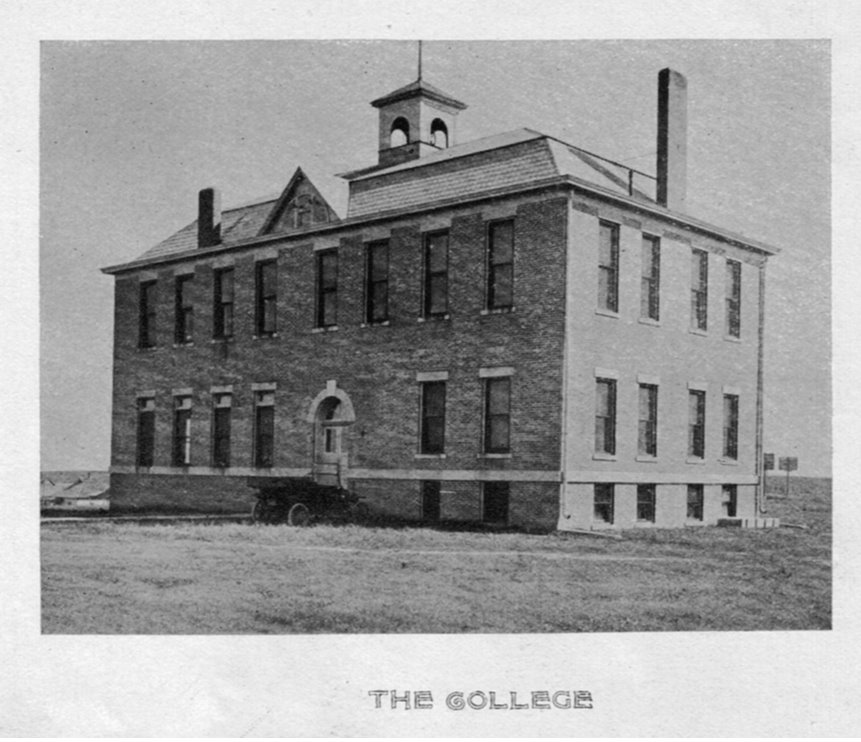
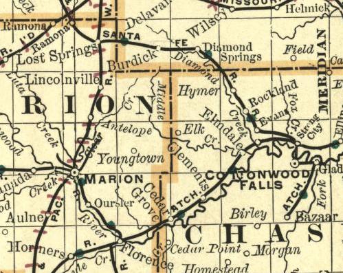
Miltonvale is a city in Cloud County, Kansas, United States. As of the 2020 census, the population of the city was 440. History Miltonvale was founded on December 1, 1881. The town had its start by the building of a narrow gauge railway through the neighborhood. It was named for Milton Tootle, a landowner. In 1887, Atchison, Topeka and Santa Fe Railway built a branch line from Neva (3 miles west of Strong City) through TBD to Superior, Nebraska. In 1996, the Atchison, Topeka and Santa Fe Railway merged with Burlington Northern Railroad and renamed to the current BNSF Railway. Most locals still refer to this railroad as the "Santa Fe". From 1909 to 1972, it was the home of Miltonvale Wesleyan College. Geography Miltonvale is located at (39.348587, -97.453211). According to the United States Census Bureau, the city has a total area of , all of it land. Climate The climate in this area is characterized by hot, humid summers and generally mild to cool winters. Accordi ... [...More Info...] [...Related Items...] OR: [Wikipedia] [Google] [Baidu] |
City
A city is a human settlement of notable size.Goodall, B. (1987) ''The Penguin Dictionary of Human Geography''. London: Penguin.Kuper, A. and Kuper, J., eds (1996) ''The Social Science Encyclopedia''. 2nd edition. London: Routledge. It can be defined as a permanent and densely settled place with administratively defined boundaries whose members work primarily on non-agricultural tasks. Cities generally have extensive systems for housing, transportation, sanitation, utilities, land use, production of goods, and communication. Their density facilitates interaction between people, government organisations and businesses, sometimes benefiting different parties in the process, such as improving efficiency of goods and service distribution. Historically, city-dwellers have been a small proportion of humanity overall, but following two centuries of unprecedented and rapid urbanization, more than half of the world population now lives in cities, which has had profound consequences for g ... [...More Info...] [...Related Items...] OR: [Wikipedia] [Google] [Baidu] |
Federal Information Processing Standard
The Federal Information Processing Standards (FIPS) of the United States are a set of publicly announced standards that the National Institute of Standards and Technology (NIST) has developed for use in computer systems of non-military, American government agencies and contractors. FIPS standards establish requirements for ensuring computer security and interoperability, and are intended for cases in which suitable industry standards do not already exist. Many FIPS specifications are modified versions of standards the technical communities use, such as the American National Standards Institute (ANSI), the Institute of Electrical and Electronics Engineers (IEEE), and the International Organization for Standardization (ISO). Specific areas of FIPS standardization The U.S. government has developed various FIPS specifications to standardize a number of topics including: * Codes, e.g., FIPS county codes or codes to indicate weather conditions or emergency indications. In 1994, Nat ... [...More Info...] [...Related Items...] OR: [Wikipedia] [Google] [Baidu] |
Census
A census is the procedure of systematically acquiring, recording and calculating information about the members of a given population. This term is used mostly in connection with national population and housing censuses; other common censuses include censuses of agriculture, traditional culture, business, supplies, and traffic censuses. The United Nations (UN) defines the essential features of population and housing censuses as "individual enumeration, universality within a defined territory, simultaneity and defined periodicity", and recommends that population censuses be taken at least every ten years. UN recommendations also cover census topics to be collected, official definitions, classifications and other useful information to co-ordinate international practices. The UN's Food and Agriculture Organization (FAO), in turn, defines the census of agriculture as "a statistical operation for collecting, processing and disseminating data on the structure of agriculture, covering th ... [...More Info...] [...Related Items...] OR: [Wikipedia] [Google] [Baidu] |
Humid Subtropical Climate
A humid subtropical climate is a zone of climate characterized by hot and humid summers, and cool to mild winters. These climates normally lie on the southeast side of all continents (except Antarctica), generally between latitudes 25° and 40° and are located poleward from adjacent tropical climates. It is also known as warm temperate climate in some climate classifications. Under the Köppen climate classification, ''Cfa'' and ''Cwa'' climates are either described as humid subtropical climates or warm temperate climates. This climate features mean temperature in the coldest month between (or ) and and mean temperature in the warmest month or higher. However, while some climatologists have opted to describe this climate type as a "humid subtropical climate", Köppen himself never used this term. The humid subtropical climate classification was officially created under the Trewartha climate classification. In this classification, climates are termed humid subtropical when the ... [...More Info...] [...Related Items...] OR: [Wikipedia] [Google] [Baidu] |
Köppen Climate Classification
The Köppen climate classification is one of the most widely used climate classification systems. It was first published by German-Russian climatologist Wladimir Köppen (1846–1940) in 1884, with several later modifications by Köppen, notably in 1918 and 1936. Later, the climatologist Rudolf Geiger (1894–1981) introduced some changes to the classification system, which is thus sometimes called the Köppen–Geiger climate classification system. The Köppen climate classification divides climates into five main climate groups, with each group being divided based on seasonal precipitation and temperature patterns. The five main groups are ''A'' (tropical), ''B'' (arid), ''C'' (temperate), ''D'' (continental), and ''E'' (polar). Each group and subgroup is represented by a letter. All climates are assigned a main group (the first letter). All climates except for those in the ''E'' group are assigned a seasonal precipitation subgroup (the second letter). For example, ''Af'' indi ... [...More Info...] [...Related Items...] OR: [Wikipedia] [Google] [Baidu] |
United States Census Bureau
The United States Census Bureau (USCB), officially the Bureau of the Census, is a principal agency of the U.S. Federal Statistical System, responsible for producing data about the American people and economy. The Census Bureau is part of the U.S. Department of Commerce and its director is appointed by the President of the United States. The Census Bureau's primary mission is conducting the U.S. census every ten years, which allocates the seats of the U.S. House of Representatives to the states based on their population. The bureau's various censuses and surveys help allocate over $675 billion in federal funds every year and it assists states, local communities, and businesses make informed decisions. The information provided by the census informs decisions on where to build and maintain schools, hospitals, transportation infrastructure, and police and fire departments. In addition to the decennial census, the Census Bureau continually conducts over 130 surveys and programs ... [...More Info...] [...Related Items...] OR: [Wikipedia] [Google] [Baidu] |
Miltonvale Wesleyan College
Miltonvale Wesleyan College (sometimes called "Miltonvale College") was a two-year college located in Miltonvale, Kansas and was operated by the Wesleyan Church. The school began operation in 1909 under Rev. Silas W. Bond and ceased operation in 1972, when the school merged with Bartlesville Wesleyan College—later to become a part of Oklahoma Wesleyan University. Alumni * Orval Butcher (1917–2010), founding pastor of Skyline Church in La Mesa, California * Jim Garlow Jim Garlow is the former Senior Pastor of Skyline Church located in La Mesa, California, a suburb of San Diego. Garlow is often cited as an evangelical leader in the political arena, quoted on issues such as the 2012 Republican presidential prima ..., third pastor of the same Skyline Church. References Further reading * Randall J Stephens"'A Fortress of Righteousness' on the Kansas Prairie: Miltonvale Wesleyan College, 1909-1972(MA Thesis, Emporia State University, 1998) Defunct private universitie ... [...More Info...] [...Related Items...] OR: [Wikipedia] [Google] [Baidu] |
BNSF Railway
BNSF Railway is one of the largest freight railroads in North America. One of seven North American Class I railroads, BNSF has 35,000 employees, of track in 28 states, and nearly 8,000 locomotives. It has three transcontinental routes that provide rail connections between the western and eastern United States. BNSF trains traveled over in 2010, more than any other North American railroad. The BNSF Railway Company is the principal operating subsidiary of parent company Burlington Northern Santa Fe, LLC. Headquartered in Fort Worth, Texas, the railroad's parent company is a wholly owned subsidiary of Berkshire Hathaway, Inc., of Omaha, Nebraska. The current CEO is Kathryn Farmer. According to corporate press releases, the BNSF Railway is among the top transporters of intermodal freight in North America. It also hauls bulk cargo, including enough coal to generate around 25% of the electricity produced in the United States. The creation of BNSF started with the formation of ... [...More Info...] [...Related Items...] OR: [Wikipedia] [Google] [Baidu] |
Burlington Northern Railroad
The Burlington Northern Railroad was a United States-based railroad company formed from a Mergers and acquisitions, merger of four major U.S. railroads. Burlington Northern operated between 1970 and 1996. Its historical lineage begins in the earliest days of railroading with the chartering in 1848 of the Chicago and Aurora Railroad, a direct ancestor line of the Chicago, Burlington and Quincy Railroad, which lends Burlington to the names of various merger-produced successors. Burlington Northern acquired the Atchison, Topeka and Santa Fe Railway on December 31, 1996, to form the Burlington Northern and Santa Fe Railway (later renamed BNSF Railway), which was owned by the Burlington Northern Santa Fe Corporation. That corporation was purchased by Berkshire Hathaway in 2009 which is controlled by investor Warren Buffett. History The Burlington Northern Railroad was the product of the merger of four major railroads: the Great Northern Railway (U.S.), Great Northern Railway, the N ... [...More Info...] [...Related Items...] OR: [Wikipedia] [Google] [Baidu] |
Superior, Nebraska
Superior is a city in Nuckolls County, Nebraska, Nuckolls County, Nebraska, United States. As of the 2010 United States Census, 2010 census, the city population was 1,957. Superior bills itself as the "Victorian Capital of Nebraska", and holds an annual Victorian Festival."About Our Town". Superior, Nebraska website. Retrieved 2010-07-04. The downtown area is listed in the National Register of Historic Places; along with many of the older houses in the city, it has been maintained or restored to its Victorian appearance. History 19th century Superior was platted in 1875. It was named from the quality of their land. In 1887, Atchison, Topeka and Santa Fe Railway ...[...More Info...] [...Related Items...] OR: [Wikipedia] [Google] [Baidu] |
Strong City, Kansas
Strong City is a city in Chase County, Kansas, Chase County, Kansas, United States. Originally known as Cottonwood Station, in 1881 it was renamed Strong City after William Barstow Strong, then vice-president and general manager, and later president of the Atchison, Topeka and Santa Fe Railway. As of the 2020 United States census, 2020 census, the population of the city was 386. It is located along U.S. Route 50 (Kansas), U.S. Route 50 highway. History Early history For many millennia, the Great Plains of North America was inhabited by nomadic Native Americans in the United States, Native Americans. From the 16th century to 18th century, the Kingdom of France claimed ownership of large parts of North America. In 1762, after the French and Indian War, France secretly ceded New France to Spain, per the Treaty of Fontainebleau (1762), Treaty of Fontainebleau. 19th century In 1802, Spain returned most of the land to France. In 1803, most of the land for History of Kansas ... [...More Info...] [...Related Items...] OR: [Wikipedia] [Google] [Baidu] |


.jpg)
