|
Matari Airport
Matari Airport is an airport serving Isiro, a city in Haut-Uélé Province, Democratic Republic of the Congo. The airport is northwest of the city. The Isiro-Matari VOR/DME (Ident: IRO) is located southeast of the airport. Airlines and destinations Accidents and incidents On 5 September 2005, a Kavatshi Airlines Antonov An-26B struck a tree and crashed from Runway 31 at Matari Airport while on final approach in fog, killing all 11 people on board. See also * * *Transport in the Democratic Republic of the Congo *List of airports in the Democratic Republic of the Congo References External links * *Matari Airportat OpenStreetMap OpenStreetMap (OSM) is a free, open geographic database updated and maintained by a community of volunteers via open collaboration. Contributors collect data from surveys, trace from aerial imagery and also import from other freely licensed g ... Airports in Haut-Uélé Isiro {{DRCongo-airport-stub ... [...More Info...] [...Related Items...] OR: [Wikipedia] [Google] [Baidu] |
Operation Dragon Rouge
__NOTOC__ Operation Dragon Rouge was a hostage rescue operation in the Democratic Republic of the Congo conducted by Belgium and the United States in 1964. The operation was led by the Belgian Paracommando Regiment to rescue hostages held by Simba rebels in the city of Stanleyville. Background By 1964, the Léopoldville government, supported by Western powers, was gaining a foothold in its fight to suppress the communist-backed Simba rebellion. Fearing an inevitable defeat, the rebels resorted to taking hostages of the local white population in areas under their control. On 28 October the Simba rebels arrested all Belgians and Americans in Stanleyville. Several hundred hostages were taken to Stanleyville and placed under guard in the Victoria Hotel. The Léopoldville government turned to Belgium and the United States for help. In response, the Belgian army sent a task force to Léopoldville, airlifted by the U.S. 322nd Air Division. Washington and Brussels worked jointly on a ... [...More Info...] [...Related Items...] OR: [Wikipedia] [Google] [Baidu] |
Bangoka International Airport
Not to be confused with Bangkok Suvarnabhumi Airport or Bangkok Don Mueang International Airport Kisangani Bangoka International Airport is an airport serving Kisangani, Democratic Republic of the Congo. The airport is east of the city. The Bangoka VOR/DME (Ident: KGI) is west of the airport. Airlines and destinations Accidents and incidents * On July 8, 2011, Hewa Bora Airways Flight 952, operated by a Boeing 727, crashed on landing. 74 of the 118 on board died. See also *Transport in the Democratic Republic of the Congo *List of airports in the Democratic Republic of the Congo References External linksBangoka Airportat OpenStreetMap OpenStreetMap (OSM) is a free, open geographic database updated and maintained by a community of volunteers via open collaboration. Contributors collect data from surveys, trace from aerial imagery and also import from other freely licensed g ... * * Airports in Tshopo Kisangani {{DRCongo-airport-stub ... [...More Info...] [...Related Items...] OR: [Wikipedia] [Google] [Baidu] |
OpenStreetMap
OpenStreetMap (OSM) is a free, open geographic database updated and maintained by a community of volunteers via open collaboration. Contributors collect data from surveys, trace from aerial imagery and also import from other freely licensed geodata sources. OpenStreetMap is freely licensed under the Open Database License and as a result commonly used to make electronic maps, inform turn-by-turn navigation, assist in humanitarian aid and data visualisation. OpenStreetMap uses its own topology to store geographical features which can then be exported into other GIS file formats. The OpenStreetMap website itself is an online map, geodata search engine and editor. In 2004, OpenStreetMap was created by Steve Coast in response to the Ordnance Survey, the United Kingdom's national mapping agency, failing to release its data to the public and under free licences. Initially, maps were created only via GPS traces, but it was quickly populated by importing public domain geographical ... [...More Info...] [...Related Items...] OR: [Wikipedia] [Google] [Baidu] |
List Of Airports In The Democratic Republic Of The Congo ...
This is a list of airports in the Democratic Republic of the Congo, sorted by location. Airports Airport names shown in bold indicate the airport has scheduled service on commercial airlines. See also * Transport in the Democratic Republic of the Congo * List of airports by ICAO code: F#FZ - Democratic Republic of the Congo (DRC), formerly known as Zaire * Wikipedia: WikiProject Aviation/Airline destination lists: Africa#Congo, Democratic Republic of the References * * * External links * Lists of airports in the Democratic Republic of the Congo: *Great Circle Mapper*World Aero Data* {{DRC topics Congo Airports Airports Congo, Democratic Republic of the The Democratic Republic of the Congo (french: République démocratique du Congo (RDC), colloquially "La RDC" ), informally Congo-Kinshasa, DR Congo, the DRC, the DROC, or the Congo, and formerly and also colloquially Zaire, is a country in ... [...More Info...] [...Related Items...] OR: [Wikipedia] [Google] [Baidu] |
Transport In The Democratic Republic Of The Congo
Ground transport in the Democratic Republic of the Congo (DRC) has always been difficult. The terrain and climate of the Congo Basin present serious barriers to road and rail construction, and the distances are enormous across this vast country. Furthermore, chronic economic mismanagement and internal conflict has led to serious under-investment over many years. On the other hand, the DRC has thousands of kilometres of navigable waterways, and traditionally water transport has been the dominant means of moving around approximately two-thirds of the country. Transport problems As an illustration of transport difficulties in the DRC, even before wars damaged the infrastructure, the so-called "national" route, used to get supplies to Bukavu from the seaport of Matadi, consisted of the following: *Matadi to Kinshasa – rail *Kinshasa to Kisangani – river boat *Kisangani to Ubundu – rail *Ubundu to Kindu – river boat *Kindu to Kalemie – rail *Kalemie to Kalundu (the lake po ... [...More Info...] [...Related Items...] OR: [Wikipedia] [Google] [Baidu] |
2005 Kavatshi Airlines Antonov An-26B Crash
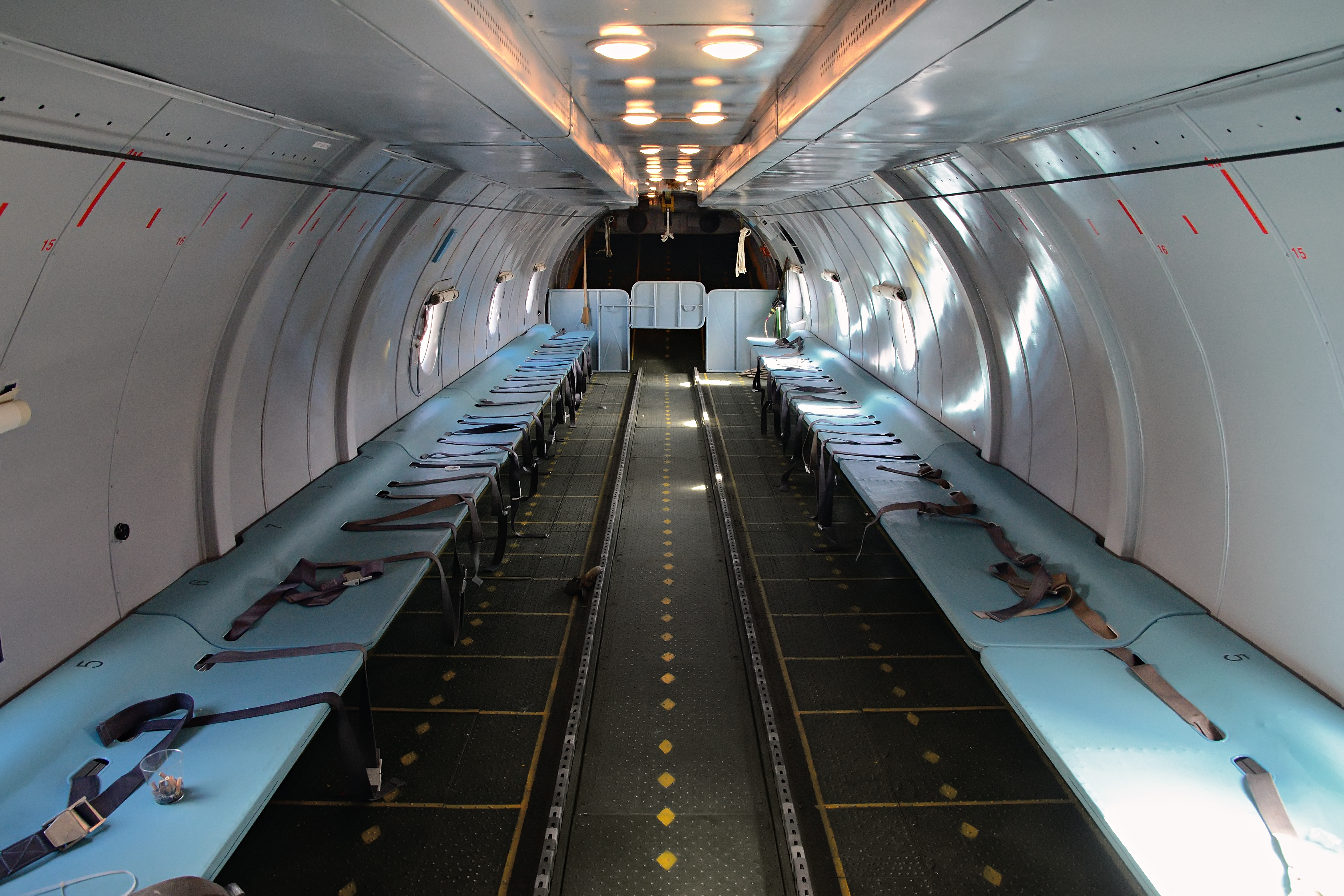
On 5 September 2005, a Kavatshi Airlines Antonov An-26B crashed on approach to Matari Airport in Isiro, Democratic Republic of the Congo, killing all 11 people on board. Accident Antonov An-26B ''ER-AZT'' was on approach to landing on 5 September 2005 at the end of a non-scheduled domestic passenger flight in the Democratic Republic of the Congo from Beni Airport in Beni to Matari Airport in Isiro. At about 07:30 local time, while on final approach to Runway 31 in fog, the aircraft struck a tree, crashed from the airport, and caught fire, killing all 11 people (four crew members and seven passengers) on board. The accident occurred on the same day just an hour after another commercial plane Mandala Airlines Flight 91 Mandala Airlines Flight 091 was a scheduled domestic passenger flight from Medan to Jakarta, operated by Mandala Airlines with a Boeing 737-200Adv. On September 5, 2005 at 10:15 a.m. WIB (UTC+7), the aircraft stalled and crashed into a heavily ... crashed shor ... [...More Info...] [...Related Items...] OR: [Wikipedia] [Google] [Baidu] |
Antonov An-26B
The Antonov An-26 (NATO reporting name: Curl) is a twin-engined turboprop civilian and military transport aircraft, designed and produced in the Soviet Union from 1969 to 1986.Gordon, Yefim. Komissarov, Dmitry & Sergey. "Antonov's Turboprop Twins". Hinkley. Midland. 2003. Development While the An-24T tactical transport had proved successful in supporting Soviet troops in austere locations, its ventral loading hatch restricted the handling of cargo, and in particular vehicles, and made it less effective than hoped in parachuting men and supplies. As a result, interest in a version with a retractable cargo ramp increased, and the Antonov design bureau decided in 1966 to begin development on the new An-26 derivative, in advance of an official order. The cargo ramp was based on that design and allowed the cargo deck to be sealed and pressurised in flight. When loading cargo, it could either be lowered to allow vehicles to be driven in, or slid beneath the aircraft's fuselage, so tha ... [...More Info...] [...Related Items...] OR: [Wikipedia] [Google] [Baidu] |
Lubumbashi International Airport
Lubumbashi International Airport is an airport serving Lubumbashi, Democratic Republic of the Congo. History Lubumbashi International Airport was founded in colonial times as the Elisabethville Airport. It was also known as Luano airport. This airport played a high-profile role during the Katanga war. After it was seized by the United Nations Force in the Congo (ONUC) troops, the airport was used as a base against the secessionist government. Airlines and destinations Passenger Cargo Accidents and incidents *In December 2001, Air Katanga Douglas C-53-DO ZS-OJD was written off in a landing accident at Lubumbashi International Airport after a delivery flight that originated in South Africa. *On September 15, 1961, a Katangese Air Force Fouga CM.170 Magister dropped two 100 lb. bombs on the airport, one of which made a direct hit on a DC-4-1009 belonging to Air Katanga with the registration OO-ADN. There were no casualties, but the aircraft was written off. See also *Tr ... [...More Info...] [...Related Items...] OR: [Wikipedia] [Google] [Baidu] |
Kalemie Airport
Kalemie Airport is an airport serving Kalemie in Tanganyika Province (formerly Katanga Province) and on Lake Tanganyika, in the southeastern Democratic Republic of the Congo. Airlines and destinations See also *Transport in the Democratic Republic of the Congo *List of airports in the Democratic Republic of the Congo This is a list of airports in the Democratic Republic of the Congo, sorted by location. Airports Airport names shown in bold indicate the airport has scheduled service on commercial airlines. See also * Transport in the Democratic Republic ... References External links FallingRain - Kalemie Airport* Airports in Tanganyika Province Kalemie {{DRCongo-airport-stub ... [...More Info...] [...Related Items...] OR: [Wikipedia] [Google] [Baidu] |
Isiro
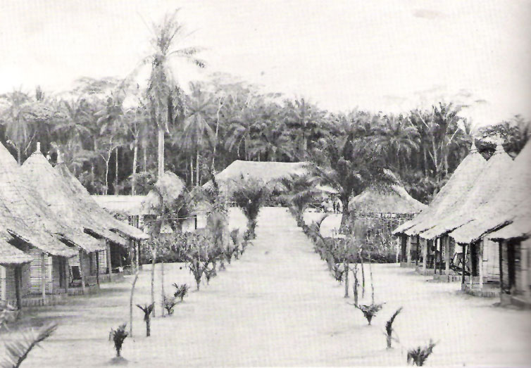
Isiro (pronounced ) is the capital of Haut-Uele Province in the northeastern part of the Democratic Republic of the Congo. It lies between the equatorial forest and the savannah and its main resource is coffee. Isiro's population is estimated at approximately 182,000. Most people speak, Pa-Zande (Zande language), Lingala, Swahili and which is somehow uncommon. History Isiro was named ''Paulis'' after colonel, later diplomat, Albert Paulis when it was part of the Belgian Congo. The city was developed in 1934 and reached its peak in 1957. Université d'Uélé (in French). Accessed November 4, 2006. In the troubled days of Congo's independence and its aftermath, operation ''Black Dragoon'' brought fighting between Belgian paratroopers and local Simba Rebellion, Si ... [...More Info...] [...Related Items...] OR: [Wikipedia] [Google] [Baidu] |
Goma International Airport
Goma International Airport is an airport serving Goma, a city in the Democratic Republic of the Congo in Africa. History Initially built with a paved 3000 m runway and a large terminal and apron, the airport has not recovered from the 2002 eruption of the volcano Nyiragongo, 14 km to the north. The airport couldn't handle any wide-bodied aircraft except for freight operations run by relief agencies and the United Nations. A stream of fluid lava 200 m by 1000 m wide flowed onto the runway and through the city center as far as the lake shore, covering over the northern 1000 m of the runway and isolating the terminal and apron which were only connected by taxiway to the northern end. The lava can easily be seen in satellite photographs, and aircraft can be seen using the 2000 m southern section of the runway which is clear of lava. A temporary apron was made at the side of the operational part of the runway. A Douglas DC-8 was left stranded on the te ... [...More Info...] [...Related Items...] OR: [Wikipedia] [Google] [Baidu] |


