|
Matai'an Wetland Ecological Park
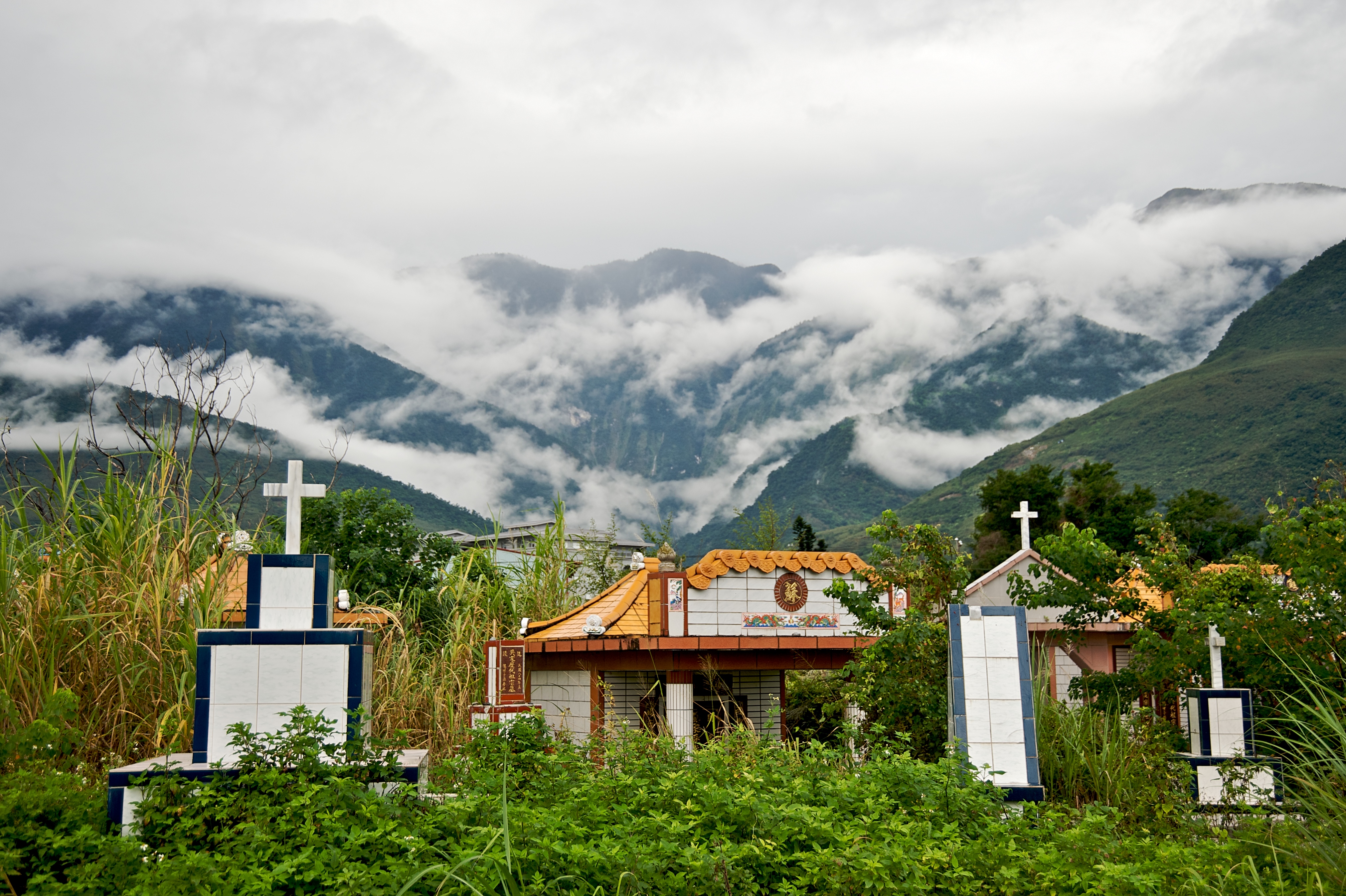
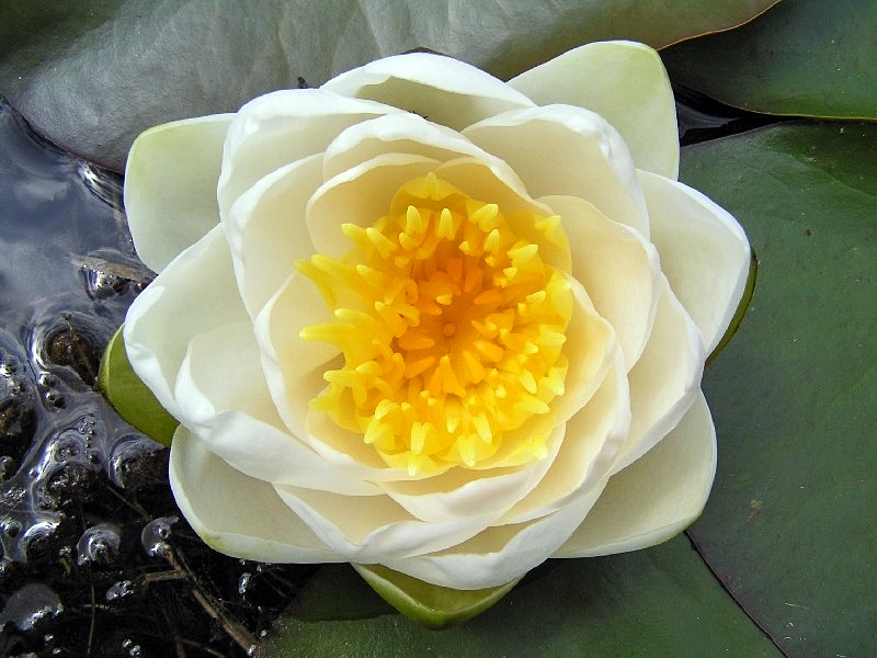
The Matai'an Wetland Ecological Park () is a wetland in Guangfu Township, Hualien County, Taiwan. Name ''Matai'an'', which means tree bean, comes from the Matai'an tribe of the indigenous Ami people who inhabit the area around the wetland. The wetland is also called the Fataan Wetland Ecological Park. History The area around the wetland has been used by the local tribe for farming and fishing. Recently, the area has been developed for tourism purpose where currently it has three inns. Geology The wetland is located at the foot of Mount Masi and spans over an area of almost 100 hectares. The wetland is formed by the flow of Fudeng River. The wetland consists of around 100 types of water plants. It is also equipped with bicycle trail. Ecology Species found in this wetland are various aquatic fishes, amphibians, butterflies and shorebirds. There are also around 100 aquatic plants found in the pond. The number of butterflies spike during spring time. Transportation The wetland i ... [...More Info...] [...Related Items...] OR: [Wikipedia] [Google] [Baidu] |
Guangfu, Hualien
Guangfu Township () is a rural township located in mid Huatung Valley between Central Mountain Range and coastal Range of Hualien County, Taiwan. The indigenous Amis people make up about half of the population. The main economical activity is agriculture. Geography The township is located at the Huatung Valley. Administrative divisions The township has 14 villages with a population of 11,975 inhabitants. Dahua, Daan, Daping, Dama, Datong, Tungfu, Xifu, Nanfu, Beifu, Dajin, Daquan, Daxing, Dafu and Dafeng Village. Tourist attractions * Bao'an Temple * Dafong Ecological Park * Danongdafu Forest Park * Daxing Waterfall Memorial Park * Hualien Sugar Factory * Mataian Culture Street * Mataian Humanities Studio * Matai'an Wetland Ecological Park * Mudflow Memorial Park * Tabalong aboriginal culturehttp://www.erv-nsa.gov.tw/user/Article.aspx?Lang=2&SNo=03000454 Transportation * Taiwan Railways Administration Guangfu and Dafu Station (Taitung line) * Provincial Highwa ... [...More Info...] [...Related Items...] OR: [Wikipedia] [Google] [Baidu] |
Hualien County
Hualien County (Mandarin Wade–Giles: Hua¹-lien² Hsien⁴; Pīnyīn: ''Huālián Xiàn''; Hokkien POJ: ''Hoa-lian-koān'' or ''Hoa-liân-koān''; Hakka PFS: ''Fâ-lièn-yen''; Amis: ''Kalingko'') is a county on the east coast of Taiwan. It is the largest county by area, yet due to its mountainous terrain, has one of the lowest populations in the country. The county seat and largest city is Hualien City. Most of the population resides in the Huadong Valley, which runs north to south, sandwiched between the Central and Hai'an mountain ranges. Due to the rural nature of the county, Hualien attracts many visitors for its natural environment, which includes Taroko Gorge, Qingshui Cliff and Qixingtan Beach. History Early history Modern-day Hualien City was originally called ''Kilai'' (), after the Sakiraya Taiwanese aborigines and their settlement. Spanish settlers arrived in 1622 to pan for gold. Picking up the sounds of native words, these settlers called the area ''Turumoa ... [...More Info...] [...Related Items...] OR: [Wikipedia] [Google] [Baidu] |
Taiwan
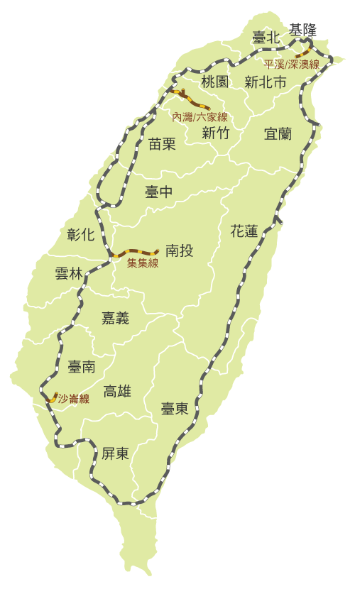
Taiwan, officially the Republic of China (ROC), is a country in East Asia, at the junction of the East and South China Seas in the northwestern Pacific Ocean, with the People's Republic of China (PRC) to the northwest, Japan to the northeast, and the Philippines to the south. The territories controlled by the ROC consist of 168 islands, with a combined area of . The main island of Taiwan, also known as ''Formosa'', has an area of , with mountain ranges dominating the eastern two-thirds and plains in the western third, where its highly urbanised population is concentrated. The capital, Taipei, forms along with New Taipei City and Keelung the largest metropolitan area of Taiwan. Other major cities include Taoyuan, Taichung, Tainan, and Kaohsiung. With around 23.9 million inhabitants, Taiwan is among the most densely populated countries in the world. Taiwan has been settled for at least 25,000 years. Ancestors of Taiwanese indigenous peoples settled the isla ... [...More Info...] [...Related Items...] OR: [Wikipedia] [Google] [Baidu] |
Wetland
A wetland is a distinct ecosystem that is flooded or saturated by water, either permanently (for years or decades) or seasonally (for weeks or months). Flooding results in oxygen-free (anoxic) processes prevailing, especially in the soils. The primary factor that distinguishes wetlands from terrestrial land forms or Body of water, water bodies is the characteristic vegetation of aquatic plants, adapted to the unique anoxic hydric soils. Wetlands are considered among the most biologically diverse of all ecosystems, serving as home to a wide range of plant and animal species. Methods for assessing wetland functions, wetland ecological health, and general wetland condition have been developed for many regions of the world. These methods have contributed to wetland conservation partly by raising public awareness of the functions some wetlands provide. Wetlands occur naturally on every continent. The water in wetlands is either freshwater, brackish or seawater, saltwater. The main w ... [...More Info...] [...Related Items...] OR: [Wikipedia] [Google] [Baidu] |
Taiwanese Indigenous Peoples
Taiwanese indigenous peoples (formerly Taiwanese aborigines), also known as Formosan people, Austronesian Taiwanese, Yuanzhumin or Gaoshan people, are the indigenous peoples of Taiwan, with the nationally recognized subgroups numbering about 569,000 or 2.38% of the island's population. This total is increased to more than 800,000 if the indigenous peoples of the plains in Taiwan are included, pending future official recognition. When including those of mixed ancestry, such a number is possibly more than a million. Academic research suggests that their ancestors have been living on Taiwan for approximately 6,500 years. A wide body of evidence suggests Taiwan's indigenous peoples maintained regular trade networks with regional cultures before the Han Chinese colonists began settling on the island from the 17th century. Taiwanese indigenous peoples are Austronesians, with linguistic and cultural ties to other Austronesian peoples in the region. Taiwan is also the origin and lingu ... [...More Info...] [...Related Items...] OR: [Wikipedia] [Google] [Baidu] |
Ami People
The Amis ( ami, Amis, Ami, Pangcah; ), also known as the Pangcah, are an indigenous Austronesian ethnic group native to Taiwan. They speak the Amis language (; ), an Austronesian language, and are one of the sixteen officially recognized Taiwanese indigenous peoples. The traditional territory of the Amis includes the long, narrow valley between the Central Mountains and the Coastal Mountains (Huadong Valley), the Pacific coastal plain eastern to the Coastal Mountains and the Hengchun Peninsula. In 2014, the Amis numbered 200,604. This was approximately 37.1% of Taiwan's total indigenous population, making them the largest indigenous group. The Amis are primarily fishermen due to their coastal location. They traditionally had a matrilineal kinship system, by which inheritance and property pass through the maternal line, and children are considered born to the mother's people. Traditional Amis villages were relatively large for Taiwanese indigenous communities, typically hold ... [...More Info...] [...Related Items...] OR: [Wikipedia] [Google] [Baidu] |
Water Plant
Aquatic plants are plants that have adapted to living in aquatic environments (saltwater or freshwater). They are also referred to as hydrophytes or macrophytes to distinguish them from algae and other microphytes. A macrophyte is a plant that grows in or near water and is either emergent, submergent, or floating. In lakes and rivers macrophytes provide cover for fish, substrate for aquatic invertebrates, produce oxygen, and act as food for some fish and wildlife. Macrophytes are primary producers and are the basis of the food web for many organisms. They have a significant effect on soil chemistry and light levels as they slow down the flow of water and capture pollutants and trap sediments. Excess sediment will settle into the benthos aided by the reduction of flow rates caused by the presence of plant stems, leaves and roots. Some plants have the capability of absorbing pollutants into their tissue. Seaweeds are multicellular marine algae and, although their ecologi ... [...More Info...] [...Related Items...] OR: [Wikipedia] [Google] [Baidu] |
Guangfu Railway Station
Guangfu railway station () is a railway station located in Guangfu, Hualien, Taiwan. It is located on the Taitung line and is operated by the Taiwan Railways Administration. Around the station * Hualien Sugar Factory * Matai'an Wetland Ecological Park The Matai'an Wetland Ecological Park () is a wetland in Guangfu Township, Hualien County, Taiwan. Name ''Matai'an'', which means tree bean, comes from the Matai'an tribe of the indigenous Ami people who inhabit the area around the wetland. The ... References 1913 establishments in Taiwan Railway stations in Hualien County Railway stations opened in 1913 Railway stations served by Taiwan Railways Administration Railway stations in Taiwan opened in the 1910s {{Taiwan-railstation-stub ... [...More Info...] [...Related Items...] OR: [Wikipedia] [Google] [Baidu] |
Taiwan Railways Administration
Taiwan Railways Administration (TRA) is a railway operator in Taiwan. It is an agency of the Ministry of Transportation and Communications, responsible for managing, maintaining, and running conventional passenger and freight railway services on 1097 km of track in Taiwan. Since Taiwan is heavily urbanised with a high population density, railways have played an important part in domestic transportation since the late 19th century. Passenger traffic in 2018 was 231,267,955. The agency's headquarters are in Zhongzheng District, Taipei. Overview Railway services between Keelung and Hsinchu began in 1891 under China's Qing dynasty. Because the railway was completely rebuilt and substantially expanded under the operated by Formosa's Japanese colonial government (1895–1945), the network's Japanese influence and heritage persists. Similarities between the TRA and the Japan Railways (JR) companies can be noted in signal aspects, signage, track layout, fare controls, sta ... [...More Info...] [...Related Items...] OR: [Wikipedia] [Google] [Baidu] |
Geography Of Taiwan
Taiwan, officially the Republic of China (ROC), is an island country located in East Asia. The main island of Taiwan, formerly known in the Western political circles, press and literature as Formosa, makes up 99% of the land area of the territories under ROC control. The main island measures and lies some across the Taiwan Strait from the southeastern coast of the People's Republic of China (PRC). The East China Sea lies to the north of the island, the Philippine Sea to its east, the Luzon Strait directly to its south and the South China Sea to its southwest. The ROC also controls a number of smaller islands, including the Penghu archipelago in the Taiwan Strait, the Kinmen and Matsu Islands near the PRC's coast, and some of the South China Sea Islands. Geologically, the main island comprises a tilted fault block, characterized by the contrast between the eastern two-thirds, consisting mostly of five rugged mountain ranges running parallel to the east coast, and the flat to ge ... [...More Info...] [...Related Items...] OR: [Wikipedia] [Google] [Baidu] |
Landforms Of Hualien County
A landform is a natural or anthropogenic land feature on the solid surface of the Earth or other planetary body. Landforms together make up a given terrain, and their arrangement in the landscape is known as topography. Landforms include hills, mountains, canyons, and valleys, as well as shoreline features such as bays, peninsulas, and seas, including submerged features such as mid-ocean ridges, volcanoes, and the great ocean basins. Physical characteristics Landforms are categorized by characteristic physical attributes such as elevation, slope, orientation, stratification, rock exposure and soil type. Gross physical features or landforms include intuitive elements such as berms, mounds, hills, ridges, cliffs, valleys, rivers, peninsulas, volcanoes, and numerous other structural and size-scaled (e.g. ponds vs. lakes, hills vs. mountains) elements including various kinds of inland and oceanic waterbodies and sub-surface features. Mountains, hills, plateaux, and plains are the fou ... [...More Info...] [...Related Items...] OR: [Wikipedia] [Google] [Baidu] |


.jpg)