|
Marajó Várzea
The Marajó várzea (NT0138) is an ecoregion of seasonally and tidally flooded várzea forest in the Amazon biome. It covers a region of sedimentary islands and floodplains at the mouth of the Amazon that is flooded twice daily as the ocean tides push the river waters onto the land. The flooded forests provide food for a wide variety of fruit-eating fish, aquatic mammals, birds and other fauna. It has no protected areas and is threatened by cattle and water-buffalo ranching, logging and fruit plantations. Location The Marajó várzea is at the mouth of the Amazon River. It covers coastal areas of the states of Pará and Amapá, with an area of . Water levels are affected by freshwater flowing down the river and by tidal flows from the Atlantic Ocean. The várzea forest in the ecoregion starts where the Xingu River joins the Amazon, which begins to broaden out. It covers the west of Marajó Island and many smaller islands in the Amazon channel, as well as parts of the mainland to t ... [...More Info...] [...Related Items...] OR: [Wikipedia] [Google] [Baidu] |
Marajó
Marajó () is a large coastal island in the state of Pará, Brazil. It is the main and largest of the islands in the Marajó Archipelago. Marajó Island is separated from the mainland by Marajó Bay, Pará River, smaller rivers (especially Macacos and Tajapuru), Companhia River, Jacaré Grande River, Vieira Grande Bay and Atlantic Ocean. From approximately 400 BC to 1600 AD, Marajó was the site of an advanced Pre-Columbian society called the Marajoara culture, which may have numbered more than 100,000 people at its peak. Today, the island is known for its large water buffalo population, as well as the ''pororoca'' tidal bore periodically exhibited by high tides overcoming the usual complex hydrodynamic interactions in the surrounding rivers. It is the second-largest island in South America, and the 35th largest island in the world. With a land area of Marajó is comparable in size to Switzerland. Its maximum span is long and in perpendicular width. Geography Maraj� ... [...More Info...] [...Related Items...] OR: [Wikipedia] [Google] [Baidu] |
Gurupa Várzea
The Gurupa várzea (NT0126) is an ecoregion of seasonally and tidally flooded várzea forest along the Amazon River in the Amazon biome. Location The Gurupa várzea ecoregion is named after the Ilha Grande de Gurupá, an alluvial island in the mouth of the Amazon. The várzea extends along the lower Amazon River from the mouth of the Tapajós down to the mouth of the Xingu River. It has an area of . The Tapajós–Xingu moist forests lie to the south and the Uatuma–Trombetas moist forests to the north. The Monte Alegre várzea is upstream and the Marajó várzea is downstream along the Amazon. Physical In this region the whitewater Amazon is fed by the blackwater Xingú, Jari, and Tapajós rivers. Elevations are no more than . The Gurupa várzea contains floodplains along the river that are affected by daily Atlantic Ocean tidal fluctuations and seasonal flooding. At the height of the rainy season when the Amazon is in full flood water levels may fluctuate by in a tidal pe ... [...More Info...] [...Related Items...] OR: [Wikipedia] [Google] [Baidu] |
Oenocarpus Bacaba
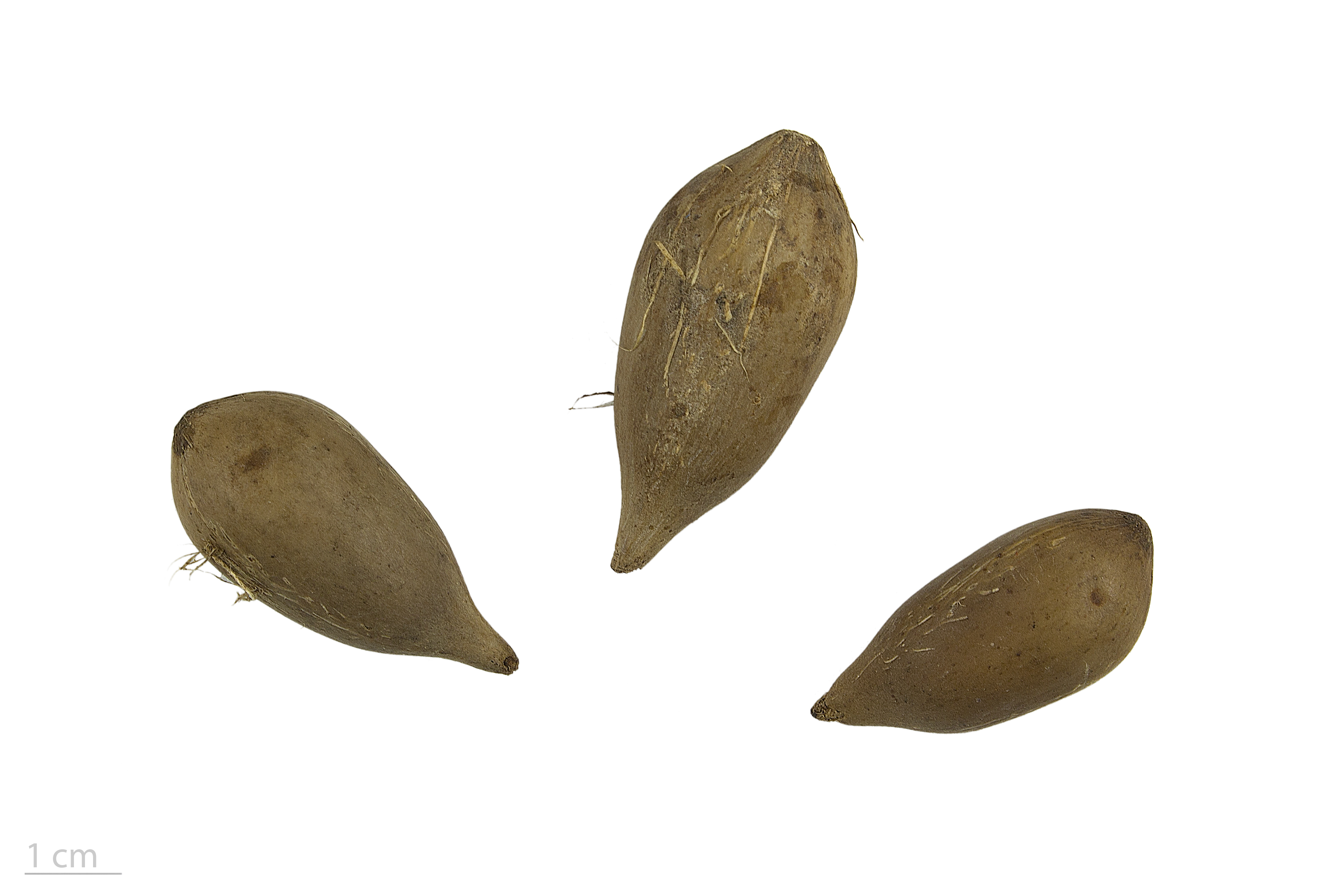
''Oenocarpus bacaba'' is an economically important monoecious fruiting palm native to South America and the Amazon Rainforest, which has edible fruits. This plant is cited in Flora Brasiliensis by Carl Friedrich Philipp von Martius. It can reach up to 20–25 metres tall and 15–25 cm in diameter. It grows in well-drained sandy soils of the Amazon basin.Galeano, Gloria 1992. ''Las palmas de la regíon de Araracuara''. Bogotá: TOPEMBOS - Universidad Nacional. Names It is called ''bacaba açu'', ''bacaba-de-leque'', and ''bacaba verdadeira'' in Brazil, ''ungurauy'' in Peru, ''camon'' in French Guiana, ''koemboe'' in Suriname, and ''manoco'' and ''punáma'' in Colombia. The Portuguese ''"bacaba"'' and the Spanish ''"milpesos"'' (or ''"palma milpesos"'') often denote this species, but may refer to any ''Oenocarpus'' palm. In English it has been called ''Turu palm''. Fruit Bacaba produces more fruits than any other palm in central Amazonia, averaging around 2500 per bunch. Bun ... [...More Info...] [...Related Items...] OR: [Wikipedia] [Google] [Baidu] |
Attalea Maripa
''Attalea maripa'', commonly called maripa palm is a palm native to tropical South America and Trinidad and Tobago. It grows up tall and can have leaves or fronds long. This plant has a yellow edible fruit which is oblong ovoid and cream. An edible oil can be extracted from the pulp of the fruit and from the kernel of the seed. Description ''Attalea maripa'' is a large palm that grows from tall. Stems range from in diameter, occasionally reaching up to . Trees have 10 to 22 leaves with long petioles. Fruit are large and brown or yellow, with 2 or 3 seeds which are long and in diameter They are borne in infructescences which can contain several hundred to over 2000 fruit. Taxonomy The species was first described by French botanist Jean Baptiste Christophore Fusée Aublet in 1775 in his ''Histoire des plantes de la Guiane Francoise'' as ''Palma maripa''. German botanist Carl Friedrich Philipp von Martius transferred it to the genus ''Attalea'' in 1844. Hermann Wendland ... [...More Info...] [...Related Items...] OR: [Wikipedia] [Google] [Baidu] |
Açaí Palm
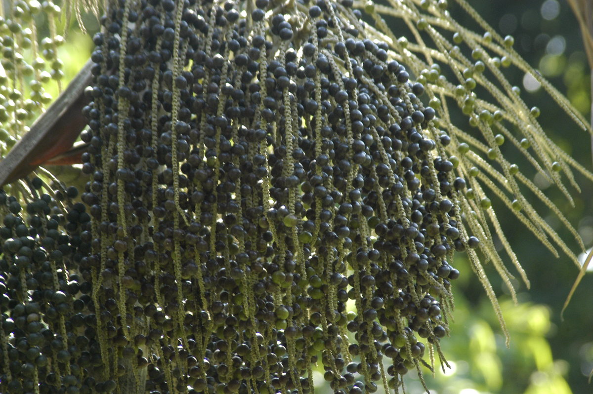
The açaí palm (, , from Nheengatu ''asai''), ''Euterpe oleracea,'' is a species of palm tree (Arecaceae) cultivated for its fruit (açaí berries, or simply açaí), hearts of palm (a vegetable), leaves, and trunk wood. Global demand for the fruit has expanded rapidly in the 21st century, and the tree is cultivated for that purpose primarily. The species is native to eastern Amazonia, especially in Brazil, mainly in swamps and floodplains. Açaí palms are tall, slender trees growing to more than tall, with pinnate leaves up to long. The fruit is small, round, and black-purple in color. The fruit became a staple food in floodplain areas around the 18th century, but its consumption in urban areas and promotion as a health food only began in the mid 1990s along with the popularization of other Amazonian fruits outside the region. Name The common name comes from the Portuguese adaptation of the Tupian word ', meaning "ruit thatcries or expels water". The importance of the fru ... [...More Info...] [...Related Items...] OR: [Wikipedia] [Google] [Baidu] |
Raphia Taedigera
''Raphia taedigera'' is a palm species in the family Arecaceae, colloquially known as yolilla in Central American Spanish. It is found in parts of Western Africa, Central America and South America South America is a continent entirely in the Western Hemisphere and mostly in the Southern Hemisphere, with a relatively small portion in the Northern Hemisphere at the northern tip of the continent. It can also be described as the southe ... (north Brazil and Colombia). References taedigera Trees of Costa Rica Flora of Cameroon Trees of Brazil {{palm-stub ... [...More Info...] [...Related Items...] OR: [Wikipedia] [Google] [Baidu] |
Astrocaryum Murumuru
''Astrocaryum murumuru'' (Portuguese common name: murumuru) is a palm native to Amazon Rainforest vegetation in Brazil, which bears edible fruits. ''Murumuru'' butter, extracted from the seeds of the plant, may be used as a moisturizer.One remarkable feature of this palm is that it is covered with spines up to twelve inches (30 centimeters) in length. The ''murumuru'' palm trees grow in Brazil and around the Amazon and are one of the dominant trees in this region. It has a thick trunk and a shuttlecock-shaped, bushy crown. The nutritious, edible fruits are an important local food source and materials made from the tree, fruit, and seed kernels are commercially significant to the region. Hammocks are made from the tree’s fibres. ''Murumuru'' butter is moisturizing (emollient). It is also film-forming and glossy. These qualities make it very protective. It contains vitamins and has a high content of oleic acid. The oil from the seeds is traditionally used to soften and prote ... [...More Info...] [...Related Items...] OR: [Wikipedia] [Google] [Baidu] |
Tropical And Subtropical Moist Broadleaf Forests
Tropical and subtropical moist broadleaf forests (TSMF), also known as tropical moist forest, is a subtropical and tropical forest habitat type defined by the World Wide Fund for Nature. Description TSMF is generally found in large, discontinuous patches centered on the equatorial belt and between the Tropic of Cancer and Tropic of Capricorn, TSMF are characterized by low variability in annual temperature and high levels of rainfall of more than annually. Forest composition is dominated by evergreen and semi-deciduous tree species. These trees number in the thousands and contribute to the highest levels of species diversity in any terrestrial major habitat type. In general, biodiversity is highest in the forest canopy. The canopy can be divided into five layers: overstory canopy with emergent crowns, a medium layer of canopy, lower canopy, shrub level, and finally understory. These forests are home to more species than any other terrestrial ecosystem: Half of the world's sp ... [...More Info...] [...Related Items...] OR: [Wikipedia] [Google] [Baidu] |
Köppen Climate Classification
The Köppen climate classification is one of the most widely used climate classification systems. It was first published by German-Russian climatologist Wladimir Köppen (1846–1940) in 1884, with several later modifications by Köppen, notably in 1918 and 1936. Later, the climatologist Rudolf Geiger (1894–1981) introduced some changes to the classification system, which is thus sometimes called the Köppen–Geiger climate classification system. The Köppen climate classification divides climates into five main climate groups, with each group being divided based on seasonal precipitation and temperature patterns. The five main groups are ''A'' (tropical), ''B'' (arid), ''C'' (temperate), ''D'' (continental), and ''E'' (polar). Each group and subgroup is represented by a letter. All climates are assigned a main group (the first letter). All climates except for those in the ''E'' group are assigned a seasonal precipitation subgroup (the second letter). For example, ''Af'' indi ... [...More Info...] [...Related Items...] OR: [Wikipedia] [Google] [Baidu] |
Tertiary
Tertiary ( ) is a widely used but obsolete term for the geologic period from 66 million to 2.6 million years ago. The period began with the demise of the non-avian dinosaurs in the Cretaceous–Paleogene extinction event, at the start of the Cenozoic Era, and extended to the beginning of the Quaternary glaciation at the end of the Pliocene Epoch. The time span covered by the Tertiary has no exact equivalent in the current geologic time system, but it is essentially the merged Paleogene and Neogene periods, which are informally called the Early Tertiary and the Late Tertiary, respectively. The Tertiary established the Antarctic as an icy island continent. Historical use of the term The term Tertiary was first used by Giovanni Arduino during the mid-18th century. He classified geologic time into primitive (or primary), secondary, and tertiary periods based on observations of geology in Northern Italy. Later a fourth period, the Quaternary, was applied. In the early d ... [...More Info...] [...Related Items...] OR: [Wikipedia] [Google] [Baidu] |
Holocene
The Holocene ( ) is the current geological epoch. It began approximately 11,650 cal years Before Present (), after the Last Glacial Period, which concluded with the Holocene glacial retreat. The Holocene and the preceding Pleistocene together form the Quaternary period. The Holocene has been identified with the current warm period, known as MIS 1. It is considered by some to be an interglacial period within the Pleistocene Epoch, called the Flandrian interglacial.Oxford University Press – Why Geography Matters: More Than Ever (book) – "Holocene Humanity" section https://books.google.com/books?id=7P0_sWIcBNsC The Holocene corresponds with the rapid proliferation, growth and impacts of the human species worldwide, including all of its written history, technological revolutions, development of major civilizations, and overall significant transition towards urban living in the present. The human impact on modern-era Earth and its ecosystems may be considered of global si ... [...More Info...] [...Related Items...] OR: [Wikipedia] [Google] [Baidu] |


