|
Madrid Río
Madrid Río is an urban park in the Spanish capital Madrid, built along an urban stretch of the Manzanares (river), Manzanares River following the burial of the Autopista de Circunvalación M-30, M-30 bypass road in this area. It is the result of a project led by the architect Ginés Garrido, who won the international ideas competition organised by the Madrid City Council in 2005 to redevelop the area. The project started with the idea of recovering the banks of the Manzanares (river), Manzanares River for the use and enjoyment of the citizens. The section of the river that is now known as Madrid Río is the section that was boxed in by the Autopista de Circunvalación M-30, M-30 bypass road, a road that isolated the river between the two directions of the highway as well as creating a barrier and fracture between the two sides of the city, the district of Arganzuela on the left bank, and the districts of Latina (Madrid), Latina, Carabanchel and Usera on the right bank. The conn ... [...More Info...] [...Related Items...] OR: [Wikipedia] [Google] [Baidu] |
Madrid
Madrid ( , ) is the capital and most populous city of Spain. The city has almost 3.4 million inhabitants and a metropolitan area population of approximately 6.7 million. It is the second-largest city in the European Union (EU), and its monocentric metropolitan area is the third-largest in the EU.United Nations Department of Economic and Social AffairWorld Urbanization Prospects (2007 revision), (United Nations, 2008), Table A.12. Data for 2007. The municipality covers geographical area. Madrid lies on the River Manzanares in the central part of the Iberian Peninsula. Capital city of both Spain (almost without interruption since 1561) and the surrounding autonomous community of Madrid (since 1983), it is also the political, economic and cultural centre of the country. The city is situated on an elevated plain about from the closest seaside location. The climate of Madrid features hot summers and cool winters. The Madrid urban agglomeration has the second-la ... [...More Info...] [...Related Items...] OR: [Wikipedia] [Google] [Baidu] |
Casa De Campo
The Casa de Campo (, for Spanish: ''Country House'') is the largest public park in Madrid. It is situated west of central Madrid, Spain. It gets its name 'Country House' because it was once a royal hunting estate, located just west of the Royal Palace of Madrid. It was created in the early 16th century for use by the royal family and nobility, and was opened to the public in 1931 when it became a public park. Today, it is a popular green space and weekend destination for Madrid residents. Its area is , about five times the size of New York City's Central Park or twice the size of Paris' Bois de Boulogne. The Casa de Campo is linked to the Parque del Oeste by the Teleférico de Madrid, a gondola lift. The complex was declared in 2010 an '' Asset of Cultural Interest'' by the Community of Madrid. For its part, the regulations of the General Urban Planning Plan of the Madrid City Council, of 1997, classify it as a historic park. Overview An amusement park, the Parque de At ... [...More Info...] [...Related Items...] OR: [Wikipedia] [Google] [Baidu] |
Parks In Madrid
A park is an area of natural, semi-natural or planted space set aside for human enjoyment and recreation or for the protection of wildlife or natural habitats. Urban parks are urban green space, green spaces set aside for recreation inside towns and cities. National parks and country parks are green spaces used for recreation in the countryside. State parks and provincial parks are administered by sub-national government states and agencies. Parks may consist of grassy areas, rocks, soil and trees, but may also contain buildings and other artifacts such as monuments, fountains or playground structures. Many parks have fields for playing sports such as baseball and football, and paved areas for games such as basketball. Many parks have trails for walking, biking and other activities. Some parks are built adjacent to bodies of water or watercourses and may comprise a beach or boat dock area. Urban parks often have benches for sitting and may contain picnic tables and barbecue gr ... [...More Info...] [...Related Items...] OR: [Wikipedia] [Google] [Baidu] |
Kingfisher
Kingfishers are a family, the Alcedinidae, of small to medium-sized, brightly colored birds in the order Coraciiformes. They have a cosmopolitan distribution, with most species found in the tropical regions of Africa, Asia, and Oceania, but also can be seen in Europe. They can be found in deep forests near calm ponds and small rivers. The family contains 114 species and is divided into three subfamilies and 19 genera. All kingfishers have large heads, long, sharp, pointed bills, short legs, and stubby tails. Most species have bright plumage with only small differences between the sexes. Most species are tropical in distribution, and a slight majority are found only in forests. They consume a wide range of prey usually caught by swooping down from a perch. While kingfishers are usually thought to live near rivers and eat fish, many species live away from water and eat small invertebrates. Like other members of their order, they nest in cavities, usually tunnels dug i ... [...More Info...] [...Related Items...] OR: [Wikipedia] [Google] [Baidu] |
Fish Ladder
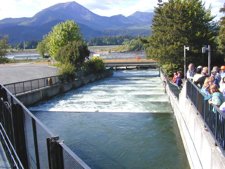
A fish ladder, also known as a fishway, fish pass, fish steps, or fish cannon is a structure on or around artificial and natural barriers (such as dams, locks and waterfalls) to facilitate diadromous fishes' natural migration as well as movements of potamodromous species. Most fishways enable fish to pass around the barriers by swimming and leaping up a series of relatively low steps (hence the term '' ladder'') into the waters on the other side. The velocity of water falling over the steps has to be great enough to attract the fish to the ladder, but it cannot be so great that it washes fish back downstream or exhausts them to the point of inability to continue their journey upriver. History Written reports of rough fishways date to 17th-century France, where bundles of branches were used to make steps in steep channels to bypass obstructions. A pool and weir salmon ladder was built around 1830 by James Smith, a Scottish engineer on the River Teith, near Deanston, Per ... [...More Info...] [...Related Items...] OR: [Wikipedia] [Google] [Baidu] |
Manzanares El Real
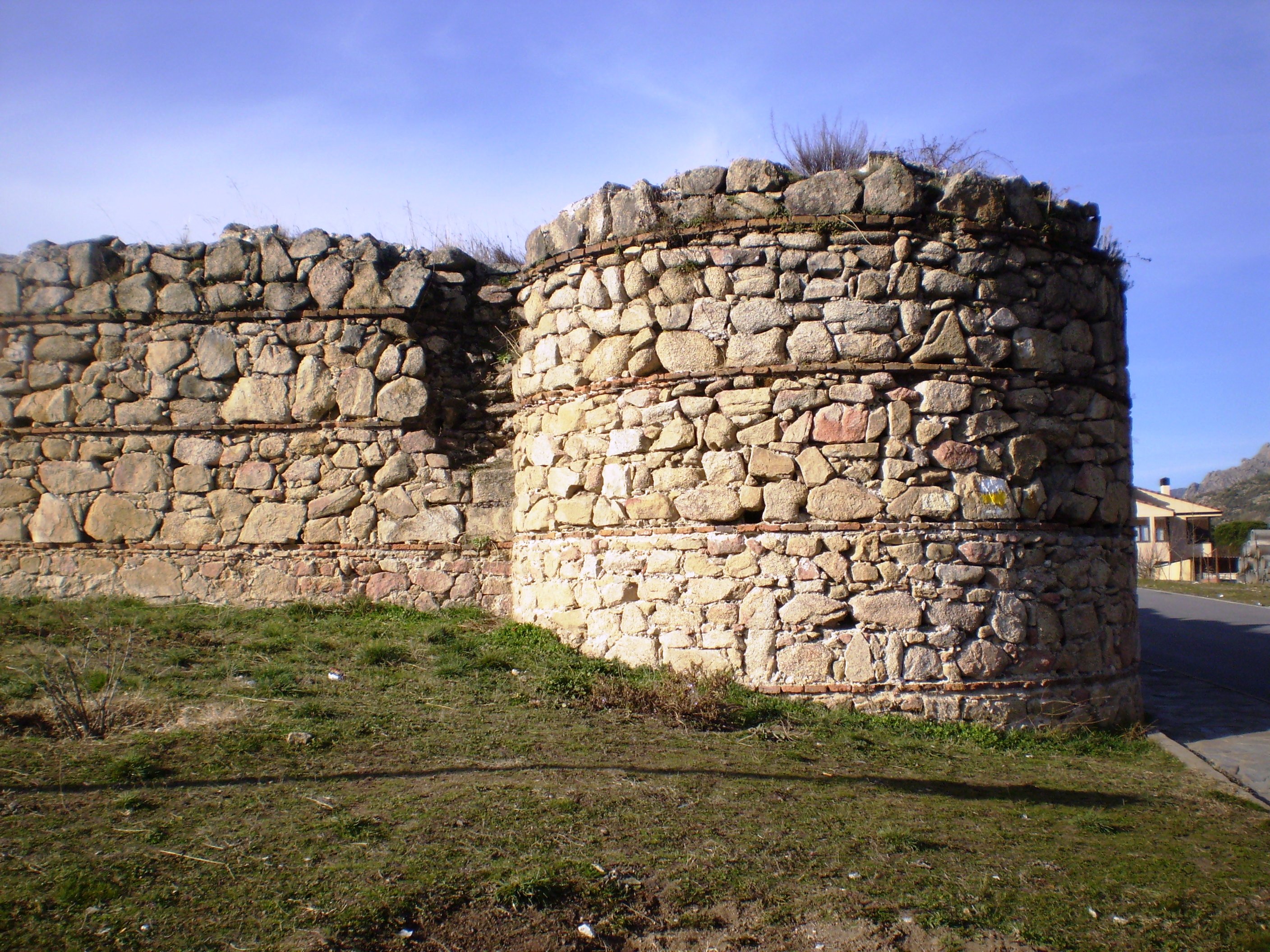
Manzanares el Real is a 8,936 inhabitant town (2020 statistics fro in the northern area of the autonomous Community of Madrid. It is located at the foot of The Pedriza, a part of the Sierra de Guadarrama, and next to the ''embalse de Santillana'' (the Santillana reservoir). Main sights *The New Castle of Manzanares el Real, the best conserved castle in the Community of Madrid. Construction commencing in 1475, it has been used in several motion pictures, most notably '' El Cid''. *The Old Castle of Manzanares el Real is the ruin of a former fortress, also known as Plaza de Armas. Only two walls remain standing, now integrated into a garden complex. It was built in Mudejar style of granite with brick curbing. *Church of ''Nuestra Señora de las Nieves'', founded in the early 14th century. It has a nave and two aisles, separated by arcades on stone columns. The nave, in Romanesque styles, ends into a pentagonal presbytery. The church has also a 16th-century Renaissance portico. * ... [...More Info...] [...Related Items...] OR: [Wikipedia] [Google] [Baidu] |
El Distrito En 2 Años, Por Y Para La Gente 14
EL, El or el may refer to: Religion * El (deity), a Semitic word for "God" People * EL (rapper) (born 1983), stage name of Elorm Adablah, a Ghanaian rapper and sound engineer * El DeBarge, music artist * El Franco Lee (1949–2016), American politician * Ephrat Livni (born 1972), American street artist Arts, entertainment, and media Fictional entities * El, a character from the manga series ''Shugo Chara!'' by Peach-Pit * El, short for Eleven, a fictional character in the TV series ''Stranger Things'' * El, family name of Kal-El (Superman) and his father Jor-El in ''Superman'' *E.L. Faldt, character in the road comedy film ''Road Trip'' Literature * ''Él'', 1926 autobiographical novel by Mercedes Pinto * ''Él'' (visual novel), a 2000 Japanese adult visual novel Music * Él Records, an independent record label from the UK founded by Mike Alway * ''Él'' (Lucero album), a 1982 album by Lucero * "Él", Spanish song by Rubén Blades from ''Caminando'' (album) * "Él" (L ... [...More Info...] [...Related Items...] OR: [Wikipedia] [Google] [Baidu] |
MADRID PARQUE MADRID RIO SOLSTICIO AÑO 2015 VIEW Ð - Panoramio (2)
Madrid ( , ) is the capital and most populous city of Spain. The city has almost 3.4 million inhabitants and a metropolitan area population of approximately 6.7 million. It is the second-largest city in the European Union (EU), and its monocentric metropolitan area is the third-largest in the EU.United Nations Department of Economic and Social AffairWorld Urbanization Prospects (2007 revision), (United Nations, 2008), Table A.12. Data for 2007. The municipality covers geographical area. Madrid lies on the River Manzanares in the central part of the Iberian Peninsula. Capital city of both Spain (almost without interruption since 1561) and the surrounding autonomous community of Madrid (since 1983), it is also the political, economic and cultural centre of the country. The city is situated on an elevated plain about from the closest seaside location. The climate of Madrid features hot summers and cool winters. The Madrid urban agglomeration has the second-largest ... [...More Info...] [...Related Items...] OR: [Wikipedia] [Google] [Baidu] |
Autovía A-5
The Autovía A-5 (also called ''Autovía del Suroeste'') is a Spanish autovía which starts in Madrid and ends at the Portugal–Spain border, near Badajoz, where it connects to the Portuguese A6 motorway. It is one of the six radial autovías stemming from Madrid and forms part of European route E90. It replaced most of the former N-V road. Sections Major cities crossed *Madrid *Alcorcón *Móstoles * Navalcarnero *Talavera de la Reina * Trujillo * Mérida *Badajoz Badajoz (; formerly written ''Badajos'' in English) is the capital of the Province of Badajoz in the autonomous community of Extremadura, Spain. It is situated close to the Portuguese border, on the left bank of the river Guadiana. The populatio ... External linksAutovía A-5 in Google Maps {{DEFAULTSORT:Autovia A-5 A-5 A-5 A-5 A-5 A-5 ... [...More Info...] [...Related Items...] OR: [Wikipedia] [Google] [Baidu] |
Spain
, image_flag = Bandera de España.svg , image_coat = Escudo de España (mazonado).svg , national_motto = '' Plus ultra'' ( Latin)(English: "Further Beyond") , national_anthem = (English: "Royal March") , image_map = , map_caption = , image_map2 = , capital = Madrid , coordinates = , largest_city = Madrid , languages_type = Official language , languages = Spanish , ethnic_groups = , ethnic_groups_year = , ethnic_groups_ref = , religion = , religion_ref = , religion_year = 2020 , demonym = , government_type = Unitary parliamentary constitutional monarchy , leader_title1 = Monarch , leader_name1 = Felipe VI , leader_title2 = Prime Minister , leader_name2 = Pedro Sánchez , legislature = ... [...More Info...] [...Related Items...] OR: [Wikipedia] [Google] [Baidu] |
Usera
Usera is a district of Madrid, Spain. It lies on the southern (right) bank of the Manzanares. It is home to about a 10% of the Chinese citizens in the whole Madrid region. History The district was created in the city restructuring that took place on March 28, 1987. The district was formed from the northern part of the Villaverde district and the abolished Mediodia district. The name of the district comes from the Usera neighborhood, located in the north of the district. This neighborhood has its origin in some land located to the north of the municipality of Villaverde that belonged to "Tio Sordillo", a farmer from the municipality whose daughter married . The Colonel proposed that the development of this land would be more profitable than cultivation, so between 1925 and 1930 the land was divided into plots and sold. The person in charge of the delineation and layout of the streets was Colonel Marcelo's administrator, who decided to name many streets after members of the U ... [...More Info...] [...Related Items...] OR: [Wikipedia] [Google] [Baidu] |
Carabanchel
Carabanchel is a district of Madrid, Spain. It lies on the southern (right) bank of the Manzanares, spanning southward down to the M-40 ring road. The district is made up of the neighbourhoods of Abrantes, Comillas, Opañel, Puerta Bonita, San Isidro and Vista Alegre. Overview The area was the scene of fierce fighting during the Spanish Civil War -especially in November 1936, during the Battle of Madrid, when Nationalist troops tried to fight their way into the area. Unaccustomed to street fighting, they took heavy casualties. For the remainder of the Siege of Madrid, the front lines ran through the streets of Carabanchel, until Republican Madrid fell in March 1939. It was home of Spain's most notorious prison ( Carabanchel Prison), which housed many political prisoners during the Franco era. The prison was closed in 1998. Carabanchel is among the most diverse neighborhoods in the country, with a large population of immigrants, mostly from North Africa but also some from Sou ... [...More Info...] [...Related Items...] OR: [Wikipedia] [Google] [Baidu] |


