|
Mwanga, Tanzania
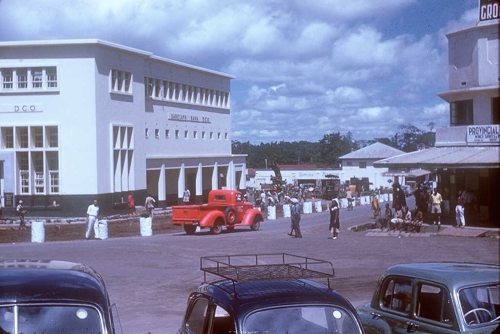
Mwanga is a town in northern Tanzania at the foot of the north Pare Mountains. It is the district capital of Mwanga District. Transport Paved Trunk road T2 from Dar es Salaam to Arusha passes through the town. The Usambara Railway from Tanga to Arusha Arusha City is a Tanzanian city and the regional capital of the Arusha Region, with a population of 416,442 plus 323,198 in the surrounding Arusha District Council (2012 census). Located below Mount Meru on the eastern edge of the eastern bran ... passes through Mwanga as well. Population According to the 2012 national census the population of Mwanga town (Mwanga Ward) is 15,783. References {{reflist Populated places in Kilimanjaro Region ... [...More Info...] [...Related Items...] OR: [Wikipedia] [Google] [Baidu] |
Flag Of Tanzania
The flag of Tanzania ( sw, bendera ya Tanzania) consists of a yellow-edged black diagonal band, divided diagonally from the lower hoist-side corner, with a green upper triangle and light blue lower triangle. Adopted in 1964 to replace the individual flags of Tanganyika and Zanzibar, it has been the flag of the United Republic of Tanzania since the two states merged that year. The design of the present flag incorporates the elements from the two former flags. It is one of a relatively small number of national flags incorporating a diagonal line, with other examples including the DR Congo, Namibia, Trinidad and Tobago and Brunei. History The United Kingdom – together with its dominion South Africa and fellow Allied power Belgium – occupied the majority of German East Africa in 1916 during the East African Campaign. Three years later, the British were tasked with administering the Tanganyika Territory as a League of Nations mandate. It was turned into a UN Trust Territory a ... [...More Info...] [...Related Items...] OR: [Wikipedia] [Google] [Baidu] |
Tanzania
Tanzania (; ), officially the United Republic of Tanzania ( sw, Jamhuri ya Muungano wa Tanzania), is a country in East Africa within the African Great Lakes region. It borders Uganda to the north; Kenya to the northeast; Comoro Islands and the Indian Ocean to the east; Mozambique and Malawi to the south; Zambia to the southwest; and Rwanda, Burundi, and the Democratic Republic of the Congo to the west. Mount Kilimanjaro, Africa's highest mountain, is in northeastern Tanzania. According to the United Nations, Tanzania has a population of million, making it the most populous country located entirely south of the equator. Many important hominid fossils have been found in Tanzania, such as 6-million-year-old Pliocene hominid fossils. The genus Australopithecus ranged across Africa between 4 and 2 million years ago, and the oldest remains of the genus ''Homo'' are found near Lake Olduvai. Following the rise of '' Homo erectus'' 1.8 million years ago, humanity spread ... [...More Info...] [...Related Items...] OR: [Wikipedia] [Google] [Baidu] |
Regions Of Tanzania
Tanzania is administratively divided into thirty-one regions ('' mkoa''). History * In 1975, Tanzania had 25 regions. In the 1970s, the name of the Ziwa Magharibi Region (West Lake Region) changed to Kagera Region. * In 2002, Manyara Region was created out of part of Arusha Region. * In 2012, four regions were created: Geita, Katavi, Njombe, and Simiyu. * In 2016, Songwe Region was created from the western part of Mbeya Region. List of regions Tanzania is subdivided into 31 regions (as of 2016). See also *Districts of Tanzania *List of regions of Tanzania by GDP This is a list of regions of Tanzania by GDP and GDP per capita. Data does only include values for Mainland Tansania without Zanzibar. List of regions by GDP Regions (2011 borders) by GDP in 2018 according to data by the National Bureau of Sta ... * ISO 3166-2:TZ Notes References {{Articles on first-level administrative divisions of African countries Subdivisions of Tanzania Tanzania, Regions T ... [...More Info...] [...Related Items...] OR: [Wikipedia] [Google] [Baidu] |
Kilimanjaro Region
Kilimanjaro Region (''Mkoa wa Kilimanjaro'' in Swahili) is one of Tanzania's 31 administrative regions. The regional capital and largest city is the municipality of Moshi. With a HDI of 0.613, Kilimajaro is one among the most developed regions of Tanzania. According to the 2012 national census, the region had a population of 1,640,087, which was lower than the pre-census projection of 1,702,207.Population Distribution by Administrative Units, United Republic of Tanzania, 2013 For 2002-2012, the region's 1.8 percent average annual population growth rate was the 24th highest in the country. It was also the eighth most densely populated region with 124 people per square ... [...More Info...] [...Related Items...] OR: [Wikipedia] [Google] [Baidu] |
Districts Of Tanzania
As of 2021,there are 31 regions of Tanzania which are divided into 184 districts (Swahili: wilaya). In 2016, Songwe Region was created from the western part of Mbeya Region. The districts are each administered by a district council. Cities are separately administered by their own councils, and while administratively within a region, are not considered to be located within a district. The districts are listed below, by unofficial area then region: Ten most populated districts # Kinondoni Municipal Council, Dar es Salaam Region (1,775,049 inhabitants) # Temeke Municipal Council, Dar es Salaam Region (1,368,881 inhabitants) # Ilala Municipal Council, Dar es Salaam Region (1,220,611 inhabitants) # Geita District Council, Geita Region (807,619 inhabitants) # Sengerema District Council, Mwanza Region (663,034 inhabitants) # Muleba District Council, Kagera Region (540,310 inhabitants) # Kahama District Council, Shinyanga Region (523,802 inhabitants) # Nzega District Counci ... [...More Info...] [...Related Items...] OR: [Wikipedia] [Google] [Baidu] |
Mwanga District
Mwanga is one of the seven districts of the Kilimanjaro Region of Tanzania. The district covers an area of , It is bordered to the northeast by Kenya, to the northwest by the Moshi Rural District, to the southwest by Simanjiro District of Manyara Region, and to the south by the Same District Same is one of the seven districts of the Kilimanjaro Region of Tanzania. It is bordered to the north by the Mwanga District, to the northeast by Kenya, to the south and southeast by the Korogwe District and Lushoto District of Tanga Region .... Its administrative seat is the town of Mwanga. The tallest peak in the district is Kindoroko at 2,100m in the North Pare Mountains that are located entirly within the district. According to the 2012 Tanzania National Census, the population of Mwanga District was 131,442. Administrative subdivisions Wards The Mwanga District is administratively divided into 20 wards: * Chomvu * Jipe * Kifula * Kighare * Kileo * Kilomeni * Kigonigoni * ... [...More Info...] [...Related Items...] OR: [Wikipedia] [Google] [Baidu] |
Pare Mountains
The Pare Mountains are a mountain range in northeastern Tanzania, located north of the Usambara Mountains. The mountains are administratively located in the Kilimanjaro Region, specifically in the Mwanga District and Same District. The North and South Pare mountain ranges reach a height of 2,463 meters at Shengena Peak. They are separated into North Pare Mountains and South Pare Mountains and are part of the Eastern Arc of mountains. The mountains are named after the indigenous Pare people, Pare people who reside there. Bird species in the Pare mountains include the endemic South Pare white-eye (''Zosterops winifredae''), the mountain buzzard (''Buteo oreophilus''), olive woodpecker (''Mesopicos griseocephalus''), moustached tinkerbird (''Pogoniulus leucomystax''), and the African hill babbler (''Pseudoalcippe abyssinica''). References {{Authority control Eastern Arc forests Eastern Arc Mountains Mountain ranges of Tanzania Geography of Kilimanjaro Region Mountains of Tanz ... [...More Info...] [...Related Items...] OR: [Wikipedia] [Google] [Baidu] |
Dar Es Salaam
Dar es Salaam (; from ar, دَار السَّلَام, Dâr es-Selâm, lit=Abode of Peace) or commonly known as Dar, is the largest city and financial hub of Tanzania. It is also the capital of Dar es Salaam Region. With a population of over six million people, Dar is the largest city in East Africa and the List of urban agglomerations in Africa, seventh-largest in Africa. Located on the Swahili coast, Dar es Salaam is an important economic centre and is one of the fastest-growing cities in the world. The town was founded by Majid bin Said of Zanzibar, Majid bin Said, the first Sultanate of Zanzibar, Sultan of Zanzibar, in 1865 or 1866. It was the main administrative and commercial center of German East Africa, Tanganyika (territory), Tanganyika, and Tanzania. The decision was made in 1974 to move the capital to Dodoma and was officially completed in 1996. Dar es Salaam is Tanzania's most prominent city for arts, fashion, media, film, television, and finance. It is the capital ... [...More Info...] [...Related Items...] OR: [Wikipedia] [Google] [Baidu] |
Arusha
Arusha City is a Tanzanian city and the regional capital of the Arusha Region, with a population of 416,442 plus 323,198 in the surrounding Arusha District Council (2012 census). Located below Mount Meru on the eastern edge of the eastern branch of the Great Rift Valley, Arusha City has a temperate climate. The city is close to the Serengeti National Park, the Ngorongoro Conservation Area, Lake Manyara National Park, Olduvai Gorge, Tarangire National Park, Mount Kilimanjaro, and Mount Meru in the Arusha National Park. The city is a major international diplomatic hub. It hosts the African Court of the African Union and is the capital of the East African Community. From 1994 to 2015, the city also hosted the International Criminal Tribunal for Rwanda, but that entity has ceased operations. It is a multicultural city with a majority Tanzanian population of mixed backgrounds: indigenous African, Arab-Tanzanian and Indian-Tanzanian population, plus a small European and North Am ... [...More Info...] [...Related Items...] OR: [Wikipedia] [Google] [Baidu] |
Usambara Railway
The Usambara Railway (german: Usambarabahn) was the first railway to be built in German East Africa and what is today Tanzania. History German East-Africa A railway company was created in 1891 with the aim of connecting the port of Tanga at the Indian Ocean with Lake Victoria by passing south of the Usambara Mountains. A gauge was chosen. From June 1893 the line advanced inland from Tanga. Due to undercapitalization, the company had to be taken over by the state in 1899. Thereafter the line was run by the ''Ostafrikanische Eisenbahngesellschaft'' (East African Railway Cooperation), a company which had been created to build and operate the Tanganyika Central Line (Zentralbahn) from Dar es Salaam to Kigoma. Between Pongwe and Ngommi on the Usambara Railway there was a double hairpin turn. Around 1910, a cable spur (the ''Seilbahn'') was constructed to connect the line with the sawmills at Neu-Hornow. One of the civil engineers working on the line was Erwin Böhme. On 2 ... [...More Info...] [...Related Items...] OR: [Wikipedia] [Google] [Baidu] |
Tanga, Tanzania
Tanga is both the name of the most northerly port city of Tanzania on the west of the Indian Ocean, and the capital of Tanga Region. It had a population of 273,332 in 2012. The name ''Tanga'' means "sail" in Swahili. The city of Tanga sits on the Indian Ocean, and is the capital of Tanga Region. The city is also the capital of Tanga District. Economy Major exports from the port of Tanga include sisal, coffee, tea, and cotton. Tanga is also an important railroad terminus, connecting much of the northern Tanzanian interior with the sea via the Tanzania Railways Corporation's Link Line and Central Line. Tanga is linked to the African Great Lakes region and the Tanzanian economic capital of Dar es Salaam. The city is served by Tanga Airport. The harbour and surrounding is the centre of life in Tanga. It has several markets in several neighbourhoods. History Early history The earliest documentation about Tanga comes from the Portuguese. A trading post was established by the Portugu ... [...More Info...] [...Related Items...] OR: [Wikipedia] [Google] [Baidu] |
.jpg)


