|
Murphy Town, Bangalore
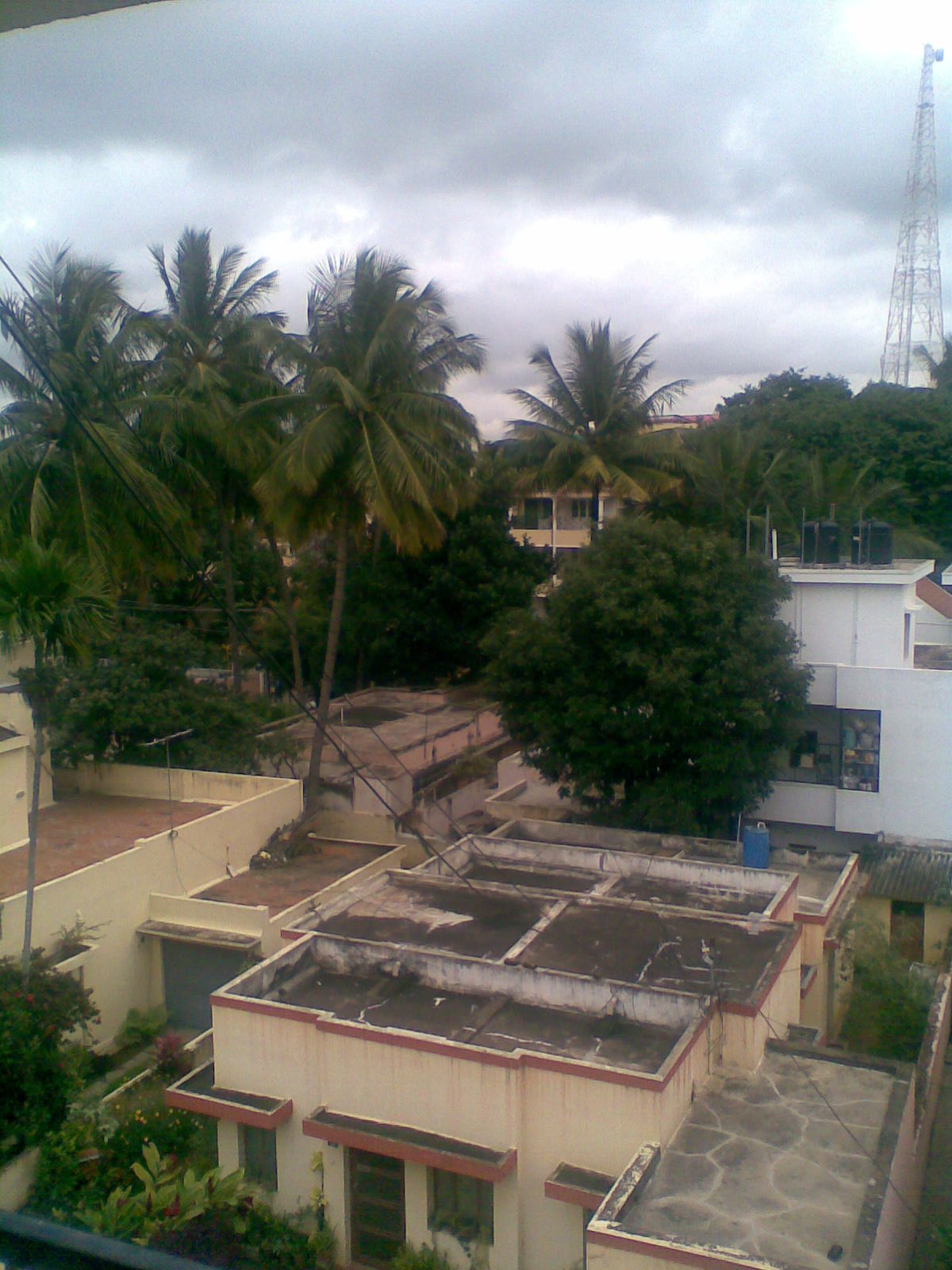
Hoysala Nagara, commonly known as Murphy Town is a suburb located near Bangalore Cantonment, India. It is one of the oldest planned suburbs of the Cantonment, and was earlier known as Knoxpet, and was later changed to Murphy Town. It is located North of Ulsoor, with Murphy Road running along its periphery, and is also bounded by Old Madras Road and Kensington Road, with part of Kensington Road overlooking Ulsoor Lake Madras Sappers. Knoxpet In the early 1900s the suburb was known as Knoxpet, named after Lt. Col. Stuart George Knox, who served as Resident of Mysore and Coorg between 1 November 1921 to 31 October 1922, and earlier as Resident of Baroda State. The suburb was settled since 1865 by Tamil workers such as tannery workers, leather workers, pottery workers, etc. The houses at Knoxpet had poor sanitation facilities and generally poorly built, and resembled a slum. The Bangalore Plague of 1898, resulted in the government deciding to demolish, rebuild and re-settle the subu ... [...More Info...] [...Related Items...] OR: [Wikipedia] [Google] [Baidu] |
Bruhat Bangalore Mahanagara Palike
The Bruhat Bengaluru Mahanagara Palike (BBMP) is the administrative body responsible for civic amenities and some infrastructural assets of the Greater Bengaluru metropolitan area. It is the fourth largest Municipal Corporation in India and is responsible for a population of 8.4 million in an area of 741 km2. Its boundaries have expanded more than 10 times over the last six decades. Its roles and responsibilities include the "orderly development of the city" — zoning and building regulations, health, hygiene, licensing, trade and education, as well as quality of life issues such as public open space, water bodies, parks and greenery. The BBMP represents the third level of government (the Central Government and State Government being the first two levels). BBMP is run by a city council composed of elected representatives, called "corporators", one from each of the wards (localities) of the city. The elections to the council are held once every five years, wi ... [...More Info...] [...Related Items...] OR: [Wikipedia] [Google] [Baidu] |
Tamil People
The Tamil people, also known as Tamilar ( ta, தமிழர், Tamiḻar, translit-std=ISO, in the singular or ta, தமிழர்கள், Tamiḻarkaḷ, translit-std=ISO, label=none, in the plural), or simply Tamils (), are a Dravidian peoples, Dravidian ethno-linguistic group who trace their ancestry mainly to India’s South India, southern state of Tamil Nadu, union territory of Puducherry (union territory), Puducherry and to Sri Lanka. Tamils who speak the Tamil Language and are born in :Social groups of Tamil Nadu, Tamil clans are considered Tamilians. Tamils constitute 5.9% of the population in India (concentrated mainly in Tamil Nadu and Puducherry), 15% in Sri Lanka (excluding Sri Lankan Moors), 7% in Tamil Malaysians, Malaysia, 6% in Tamil Mauritians, Mauritius, and 5% in Indian Singaporeans, Singapore. From the 4th century BCE, urbanisation and mercantile activity along the western and eastern coasts of what is today Kerala and Tamil Nadu led to the develo ... [...More Info...] [...Related Items...] OR: [Wikipedia] [Google] [Baidu] |
Cantonments Of British India
A cantonment (, , or ) is a military quarters. In Bangladesh, India and other parts of South Asia, a ''cantonment'' refers to a permanent military station (a term from the colonial-era). In United States military parlance, a cantonment is, essentially, "a permanent residential section (i.e. barrack) of a fort or other military installation," such as Fort Hood. The word ''cantonment'', derived from the French word '' canton'', meaning ''corner'' or ''district'', refers to a temporary military or winter encampment. For example, at the start of the Waterloo campaign in 1815, while the Duke of Wellington's headquarters were in Brussels, most of his Anglo–allied army of 93,000 soldiers were ''cantoned'', or stationed, to the south of Brussels. List of permanent cantonments Afghanistan The former Sherpur Cantonment in Kabul, Afghanistan, which was the site of the Siege of the Sherpur Cantonment (1879) in the Second Anglo-Afghan War (1878–1880), is now maintained as a British Army ... [...More Info...] [...Related Items...] OR: [Wikipedia] [Google] [Baidu] |
M G Road, Bangalore
Mahatma Gandhi Road also known as MG Road is a road in Bangalore, India. It runs east from Trinity Circle at one end to Anil Kumble Circle at the other. Known as South Parade in pre-independence era, it was renamed as Mahatma Gandhi Road on 26 February 1948. M. G. Road is also one of the busiest roads in the city and is lined on one side with retail stores, food outlets, restaurants and many more. It has many office buildings, shops and theatres. It is also a home to many buildings and banks. There are two Metro stations on M. G. Road, the eponymous station and Trinity. Presently, the M.G Road Boulevard is being reconstructed after construction of the MG Road Metro station was completed and services launched on 20 October 2011. The Bangalore Metro line that runs through MG Road, connects the eastern part of Bengaluru with the west. File:M.G. Road, Bangalore in 1950.jpg, M.G. Road in 1950 File:MG Road, Bangalore with public utility building (perspective corrected).JPG, M ... [...More Info...] [...Related Items...] OR: [Wikipedia] [Google] [Baidu] |
Indiranagar
Indiranagar is a medium-sized neighbourhood in east Bangalore, Karnataka, India. A cosmopolitan locality, Indiranagar is one of the most expensive neighbourhoods in Bangalore. History Indiranagar was formed as a BDA layout in the late 1970s, and was named after the former Prime Minister of India Indira Gandhi. In the beginning, the locality was primarily a suburb, dotted with large bungalows and independent houses, mostly owned by defence personnel and public sector employees. The Information Technology boom in Bengaluru in the late 1990s converted Indiranagar and its two arterial roads (100 Feet Road and Chinmaya Mission Hospital Road) into a semi-commercial area. Today, Indiranagar is an important residential and commercial hub of Bengaluru. Indiranagar is divided into 2 stages, with the 1st stage being the largest. The villages which existed prior to the formation of Indiranagar such as Binnamangala, Lakshmipuram, Motappanapalya, Appareddy Palya, Doopanahalli, Kodihal ... [...More Info...] [...Related Items...] OR: [Wikipedia] [Google] [Baidu] |
Ulsoor Lake
Ulsoor Lake or Halasuru Lake, one of the biggest lakes in Bangalore, is located on the eastern side of the city. It derives its name from the name of the locality it is situated, namely, Halasuru, close to M G Road. It is spread over and has several islands. Even though the lake is dated to Kempe Gowdas's time, the present lake was created by Lewin Bentham Bowring, the then Commissioner of Bangalore. A part of the lake is controlled by the Madras Engineer Group, and the rest by the Bruhat Bengaluru Mahanagara Palike The lake was subject to several types of pollution threats. Water quality The health of the lake eco-system was, therefore, monitored at six monitoring points on the lake for light, temperature, oxygen, nutrients and the type of aquatic plants that grow in the lake. During the study, it was noted that the lake which has catchment area of is fed by three drains at different locations; the first drain is from the Madras Engineering Group (MEG) Centre (of the ... [...More Info...] [...Related Items...] OR: [Wikipedia] [Google] [Baidu] |
Madras Engineer Group
Madras Engineer Group (MEG), informally known as the Madras Sappers, is an engineer group of the Corps of Engineers of the Indian Army. The Madras Sappers draw their origin from the erstwhile Madras Presidency army of the British Raj. This regiment has its HQ in Bengaluru. The Madras Sappers are the oldest of the three groups of the Corps of Engineers. The Madras Sappers were the only regiment of the Madras Presidency Army to survive unscathed the extensive reorganisations that took place between 1862 and 1928. The ''thambis'', as the troops of the Madras Sappers are popularly known, with their hallmark Shakos have distinguished themselves in many battlefields around the world for more than 200 years. The Bangalore torpedo, a mine clearing explosive device, was invented in the Centre at Bengaluru in the early years of the Twentieth Century. Timeline * 1780 – Created ''Madras Pioneers'' from two company of Pioneers (On 30 September 1780 at Madras Patnam) * 1831 – Rena ... [...More Info...] [...Related Items...] OR: [Wikipedia] [Google] [Baidu] |
Cooke Town
Cooke Town is a neighbourhood in Bangalore Cantonment, in Bangalore North-East, India. Built as a suburb before Indian Independence, it is one of Bangalore's oldest neighbourhoods, established when the Bangalore Civil and Military Station was governed by the Madras Government. Cooke Town is named after G H Cooke, President of the Bangalore Civil and Military Station Municipality between 1928 and 1934, with the Mayo Hall being constructed during his tenure. The suburb, along with other suburbs of the Bangalore Cantonment such as Fraser Town, Cox Town, Richmond Town, and Langford Town, has seen dynamic changes over last few years with large British Raj era bungalows being demolished to build luxury apartments. These developments have resulted in large scale tree-felling. However, Cooke Town still manages to retain some of its colonial charm, and is called the nicest place in the Cantonment by Bangalore historian Peter Colaco. Cooke Town is a posh neighbourhood with plenty of gr ... [...More Info...] [...Related Items...] OR: [Wikipedia] [Google] [Baidu] |
Cox Town, Bangalore
Sarvagnanagara, commonly known as Cox Town is a suburb located North in the Bangalore Cantonment, named after the last Collector and District Magistrate of the Bangalore Civil and Military Station, Alexander Ranken Cox (A R Cox), Indian Civil Services. It is one of the suburbs which came out of the plan to de-congest thickly populated areas of the Bangalore Cantonment after the bubonic plague. Agricultural fields were converted for this purpose, and town was planned according to modern hygienic standards, with drainage and conservancy conveniences. Cox Town is bound by the Bangalore-Madras Railway line on the North and East, Wheeler Road in the East and the Ulsoor Polo Ground in the South. It consists of posh localities like Heerachand Layout and other localities like Sindhi Colony, Jeevanahalli, Doddigunta, and roads such aAssaye Road [...More Info...] [...Related Items...] OR: [Wikipedia] [Google] [Baidu] |
Fraser Town, Bangalore
Pulakeshi Nagara, commonly known as Fraser Town, is a suburb of Bangalore Cantonment, in Bangalore North-East, spread over 4 sq. km. It was established in 1906 and is named after Stuart Fraser (diplomat), Stuart Mitford Fraser (1864–1963), who was the tutor and guardian of Krishna Raja Wadiyar IV, Maharaja of Kingdom of Mysore, Mysore. Fraser Town was established to de-congest the growing Bangalore Civil and Military Station (otherwise known as the Bangalore Cantonment). The foundation of Fraser Town was laid in August 1910 by Mrs. F J Richards, with a commemorative plaque on the corner of Coles Road and Mosque Road. Fraser Town is a residential and commercial suburb, the prominent roads being Promenade Road, Netaji Road, Madhavraya Mudaliar Road (M M Road), Haines Road, Spencer Road, Wheeler Road, Mosque Road, etc. The suburb is known for its communal harmony with Hindus, Muslims and Christians living side by side in peace. Before being known as Fraser Town, the suburb was cal ... [...More Info...] [...Related Items...] OR: [Wikipedia] [Google] [Baidu] |
Mysore State
Mysore State, colloquially Old Mysore, was a state within the Dominion of India and the later Republic of India from 1947 until 1956. The state was formed by renaming the Kingdom of Mysore, and Bangalore replaced Mysore as the state's capital. When Parliament passed the States Reorganisation Act in 1956, Mysore State was considerably enlarged when it became a linguistically homogeneous Kannada-speaking state within the Republic of India by incorporating territories from Andhra State, Bombay State, Coorg State, Hyderabad State, and Madras State, as well as other petty fiefdoms. It was subsequently renamed Karnataka in 1973. History The Kingdom of Mysore was one of the three largest princely states in British India. Upon India's independence from Britain in 1947, Maharaja Jayachamarajendra Wadiyar signed the instrument of accession, incorporating his realm with the Union of India, on 15 August 1947. The territories of the erstwhile princely state of Mysore were then reconstitu ... [...More Info...] [...Related Items...] OR: [Wikipedia] [Google] [Baidu] |
Madras Presidency
The Madras Presidency, or the Presidency of Fort St. George, also known as Madras Province, was an administrative subdivision (presidency) of British India. At its greatest extent, the presidency included most of southern India, including the whole of the Indian states of Tamil Nadu, Andhra state and some parts of Kerala, Karnataka, Odisha and the union territory of Lakshadweep. The city of Madras was the winter capital of the Presidency and Ootacamund or Ooty, the summer capital. The coastal regions and northern part of Island of Ceylon at that time was a part of Madras Presidency from 1793 to 1798 when it was created a Crown colony. Madras Presidency was neighboured by the Kingdom of Mysore on the northwest, Kingdom of Cochin on the southwest, and the Kingdom of Hyderabad on the north. Some parts of the presidency were also flanked by Bombay Presidency ( Konkan) and Central Provinces and Berar (Madhya Pradesh). In 1639, the English East India Company purchased the vi ... [...More Info...] [...Related Items...] OR: [Wikipedia] [Google] [Baidu] |


