|
Mt. Whatley, New Brunswick
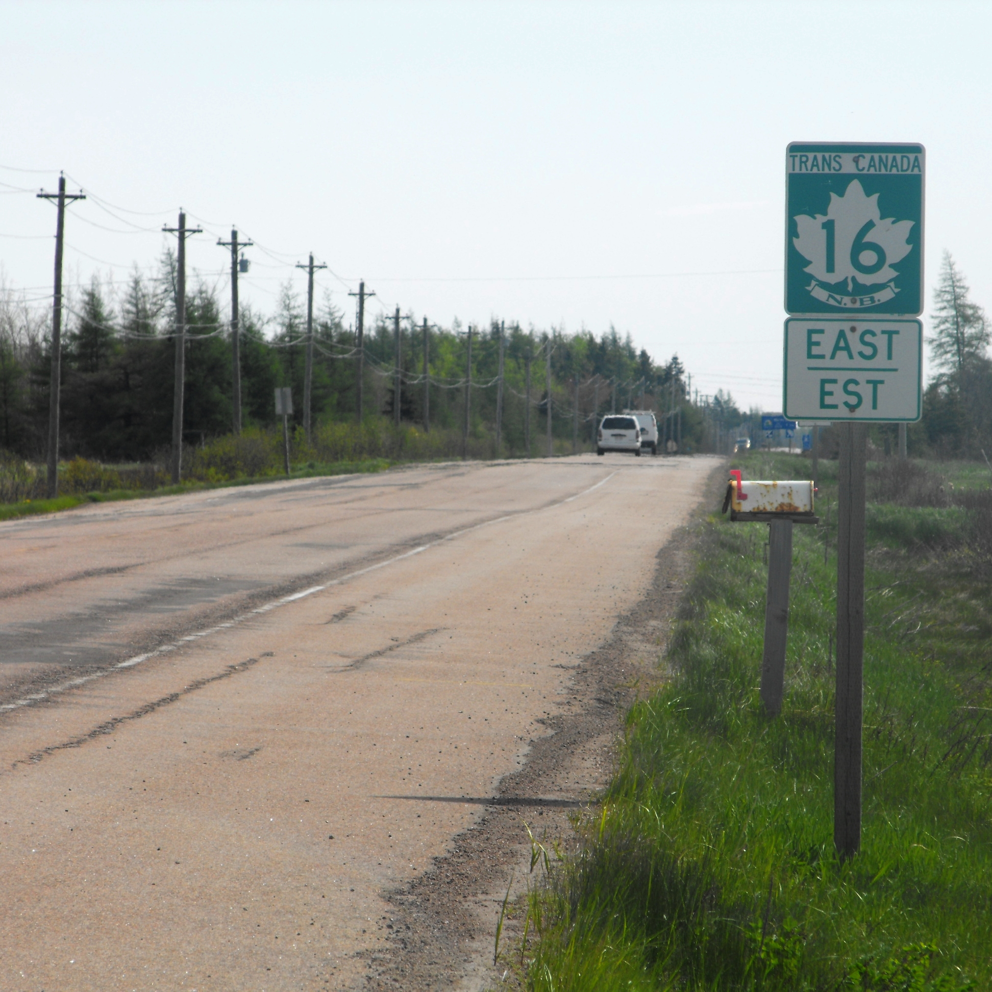
Mount Whatley is a community in the Canadian province of New Brunswick, located in Westmorland County on New Brunswick Highway 16. Mount Whatley is situated upon the Aulac Ridge, a prominent rise running west–east across the Tantramar Marshes on the Isthmus of Chignecto,on the shore of the Missaguash River which forms the southern part of the inter-provincial boundary with Nova Scotia.The community is linked by a small bridge to Fort Lawrence Nova Scotia . History Notable people See also *List of communities in New Brunswick This is a list of communities in New Brunswick, a province in Canada. For the purposes of this list, a community is defined as either an incorporated municipality, an Indian reserve, or an unincorporated community inside or outside a municipalit ... References Google Map Communities in Westmorland County, New Brunswick {{NewBrunswick-geo-stub ... [...More Info...] [...Related Items...] OR: [Wikipedia] [Google] [Baidu] |
New Brunswick
New Brunswick (french: Nouveau-Brunswick, , locally ) is one of the thirteen provinces and territories of Canada. It is one of the three Maritime provinces and one of the four Atlantic provinces. It is the only province with both English and French as its official languages. New Brunswick is bordered by Quebec to the north, Nova Scotia to the east, the Gulf of Saint Lawrence to the northeast, the Bay of Fundy to the southeast, and the U.S. state of Maine to the west. New Brunswick is about 83% forested and its northern half is occupied by the Appalachians. The province's climate is continental with snowy winters and temperate summers. New Brunswick has a surface area of and 775,610 inhabitants (2021 census). Atypically for Canada, only about half of the population lives in urban areas. New Brunswick's largest cities are Moncton and Saint John, while its capital is Fredericton. In 1969, New Brunswick passed the Official Languages Act which began recognizing French as an ... [...More Info...] [...Related Items...] OR: [Wikipedia] [Google] [Baidu] |
Canada
Canada is a country in North America. Its ten provinces and three territories extend from the Atlantic Ocean to the Pacific Ocean and northward into the Arctic Ocean, covering over , making it the world's second-largest country by total area. Its southern and western border with the United States, stretching , is the world's longest binational land border. Canada's capital is Ottawa, and its three largest metropolitan areas are Toronto, Montreal, and Vancouver. Indigenous peoples have continuously inhabited what is now Canada for thousands of years. Beginning in the 16th century, British and French expeditions explored and later settled along the Atlantic coast. As a consequence of various armed conflicts, France ceded nearly all of its colonies in North America in 1763. In 1867, with the union of three British North American colonies through Confederation, Canada was formed as a federal dominion of four provinces. This began an accretion of provinces an ... [...More Info...] [...Related Items...] OR: [Wikipedia] [Google] [Baidu] |
Westmorland County, New Brunswick
Westmorland County (2016 population: 149,623) is a county in New Brunswick, a province of Canada. It is in the south-eastern part of the province. It contains the fast-growing commercial centre of Moncton and its northern and eastern suburbs. Also located in the county are the university town of Sackville and the tourist destination of Shediac. Westmorland County is centrally located in the Maritimes and is New Brunswick's most populous county. Fishing and tourism are important industries along the Northumberland Strait shore, and there is some mixed farming in the Petitcodiac River Valley and in the Tantramar Marsh region. The city of Moncton accounts for half of the county's population and has developed as a major transportation, distribution, commercial and retail centre. Dorchester is the historic shire town. Origins The county, once a part of Cumberland County, Nova Scotia, was one of the original eight counties delineated shortly after the creation of the British col ... [...More Info...] [...Related Items...] OR: [Wikipedia] [Google] [Baidu] |
New Brunswick Highway 16
__NOTOC__ Route 16 is a 2-lane highway in the Canadian province of New Brunswick. The route begins at a T intersection with Aulac Road at Aulac and ends at the western abutment of the Confederation Bridge at Cape Jourimain. It functions as a secondary leg of the Trans-Canada Highway to connect Prince Edward Island with the mainline Trans-Canada Highway Route 2 in Aulac. Route 16 is the last section of the Trans-Canada in New Brunswick that is not 4-lanes with no plans in the near future to be 4 lanes. The highway number "16" is also the number given to the branch of the Trans-Canada, the Yellowhead Highway in Western Canada. However, the numeric designation is strictly coincidental, and Route 16 is not part of that route. Route description Route 16 begins in Aulac at a T intersection with the Aulac Road; this road having been the original alignment of Route 2 until a 4-lane alignment opened in the early 1990s. Approximately east of Aulac Road, Route 16 interchanges with Ro ... [...More Info...] [...Related Items...] OR: [Wikipedia] [Google] [Baidu] |
Tantramar Marshes
The Tantramar Marshes, also known as the Tintamarre National Wildlife Area, is a tidal saltmarsh around the Bay of Fundy on the Isthmus of Chignecto. The area borders between Route 940, Route 16 and Route 2 near Sackville, New Brunswick. The government of Canada proposed the boundaries of the Tantramar Marshes in 1966 and was declared a National Wildlife Area in 1978. The marshes are an important stopover for migrating waterfowl such as semi-palmated sandpipers andCanada geese. Now a National Wildlife Area, the marshes are the site of two bird sanctuaries. The name ''Tantramar'' is derived from the Acadian French ''tintamarre'', meaning 'din' or 'racket', a reference to the noisy flocks of birds which feed there. The Mi'kmaq, an Indigenous nation, historically inhabited the surrounding areas of the Tantramar Marshes. Communities currently on or bordering the marshes include, in New Brunswick: Aulac and Sackville, and on the Nova Scotia side: Amherst, and Fort Lawrence. Th ... [...More Info...] [...Related Items...] OR: [Wikipedia] [Google] [Baidu] |
Isthmus Of Chignecto
The Isthmus of Chignecto is an isthmus bordering the Maritime provinces of New Brunswick and Nova Scotia that connects the Nova Scotia peninsula with North America. The isthmus separates the waters of Chignecto Bay, a sub-basin of the Bay of Fundy, from those of Baie Verte, a sub-basin of the Northumberland Strait that is an arm of the Gulf of St. Lawrence. The isthmus stretches from its northerly point at an area in the Petitcodiac River valley near the city of Dieppe, New Brunswick to its southerly point at an area near the town of Amherst, Nova Scotia. At its narrowest point between Amherst and Tidnish, the isthmus measures 24 kilometres wide. Because of its strategic position, it has been important to competing forces through much of its history of occupation. The name "Chignecto" derives from the Mi'kmaq name ''Siknikt'', meaning "drainage place"; the name of the Mi'kmaq District where the isthmus is located. Geography The majority of the lands comprising the isthmus ... [...More Info...] [...Related Items...] OR: [Wikipedia] [Google] [Baidu] |
Missaguash River
The Missaguash River (French: Rivière Missaguash) is a small Canadian river that forms the southern portion of the inter-provincial boundary between Nova Scotia and New Brunswick on the Isthmus of Chignecto. It had historic significance in the 18th century as the ''de facto'' border between French (to the west) and English-controlled territories. History The river's name is from the ''Mi'kmaq'' language, likely meaning "marsh river", in reference to the Tantramar Marshes through which it flows. The name can be translated as "muskrat". Musaguash (Morris, 1750); Mesiguash (DesBarres, 1781); Missaguash from 1901 onward. The river flows south into Cumberland Basin. Its source is in the Missaguash Bog, several kilometres to the north. About 1672 a small group of Acadians from Port Royal, led by Jacques Bourgeois, formed a settlement on the south bank of the Missaguash near its mouth named Beaubassin. The settlers reclaimed the salt marsh bordering the Missaquash for cultivation ... [...More Info...] [...Related Items...] OR: [Wikipedia] [Google] [Baidu] |
Nova Scotia
Nova Scotia ( ; ; ) is one of the thirteen provinces and territories of Canada. It is one of the three Maritime provinces and one of the four Atlantic provinces. Nova Scotia is Latin for "New Scotland". Most of the population are native English-speakers, and the province's population is 969,383 according to the 2021 Census. It is the most populous of Canada's Atlantic provinces. It is the country's second-most densely populated province and second-smallest province by area, both after Prince Edward Island. Its area of includes Cape Breton Island and 3,800 other coastal islands. The Nova Scotia peninsula is connected to the rest of North America by the Isthmus of Chignecto, on which the province's land border with New Brunswick is located. The province borders the Bay of Fundy and Gulf of Maine to the west and the Atlantic Ocean to the south and east, and is separated from Prince Edward Island and the island of Newfoundland by the Northumberland and Cabot straits, ... [...More Info...] [...Related Items...] OR: [Wikipedia] [Google] [Baidu] |
Fort Lawrence, Nova Scotia
Fort Lawrence is a Canadian rural community located on the Isthmus of Chignecto in Cumberland County, Nova Scotia, which is named after Fort Lawrence. Situated 1 km east of the Missaguash River which forms the inter-provincial boundary with New Brunswick, Fort Lawrence is situated on a low ridge facing Aulac to the west and Amherst to the east. Aside from the more prominent Aulac Ridge, the Fort Lawrence Ridge is surrounded by the flat plain of the Tantramar Marshes with a commanding view of the Cumberland Basin, an arm of the Bay of Fundy.colonel benjamin chapman built a large wood frame home for his family while he was in command of the Fort Lawrence and Chapman house remained with descendants until late 1970s when ancestral home was sold. History Referred by the Mi'kmaq as 'Kwesomalegek,' meaning "a hardwood point", the area of the Tantramar Marshes containing Fort Lawrence was settled in 1672 by Acadians who named it 'Beaubassin.' The area was also known as Missiqu ... [...More Info...] [...Related Items...] OR: [Wikipedia] [Google] [Baidu] |
List Of Communities In New Brunswick
This is a list of communities in New Brunswick, a province in Canada. For the purposes of this list, a community is defined as either an incorporated municipality, an Indian reserve, or an unincorporated community inside or outside a municipality. Cities New Brunswick has eight cities. Indian reserves First Nations Parishes New Brunswick has 152 parishes, of which 150 are recognized as census subdivisions by Statistics Canada. Local service districts Rural communities New Brunswick has seven rural communities. Towns and villages New Brunswick has 27 towns and 66 villages. Neighbourhoods Local service districts Other communities and settlements This is a list of communities and settlements in New Brunswick. A–B ; A * Aboujagne * Acadie * Acadie Siding * Acadieville * Adams Gulch * Adamsville * Albert Mines * Albrights Corner * Alderwood * Aldouane * Allainville * Allardville * Allison * Ammon * Anagance * A ... [...More Info...] [...Related Items...] OR: [Wikipedia] [Google] [Baidu] |


