|
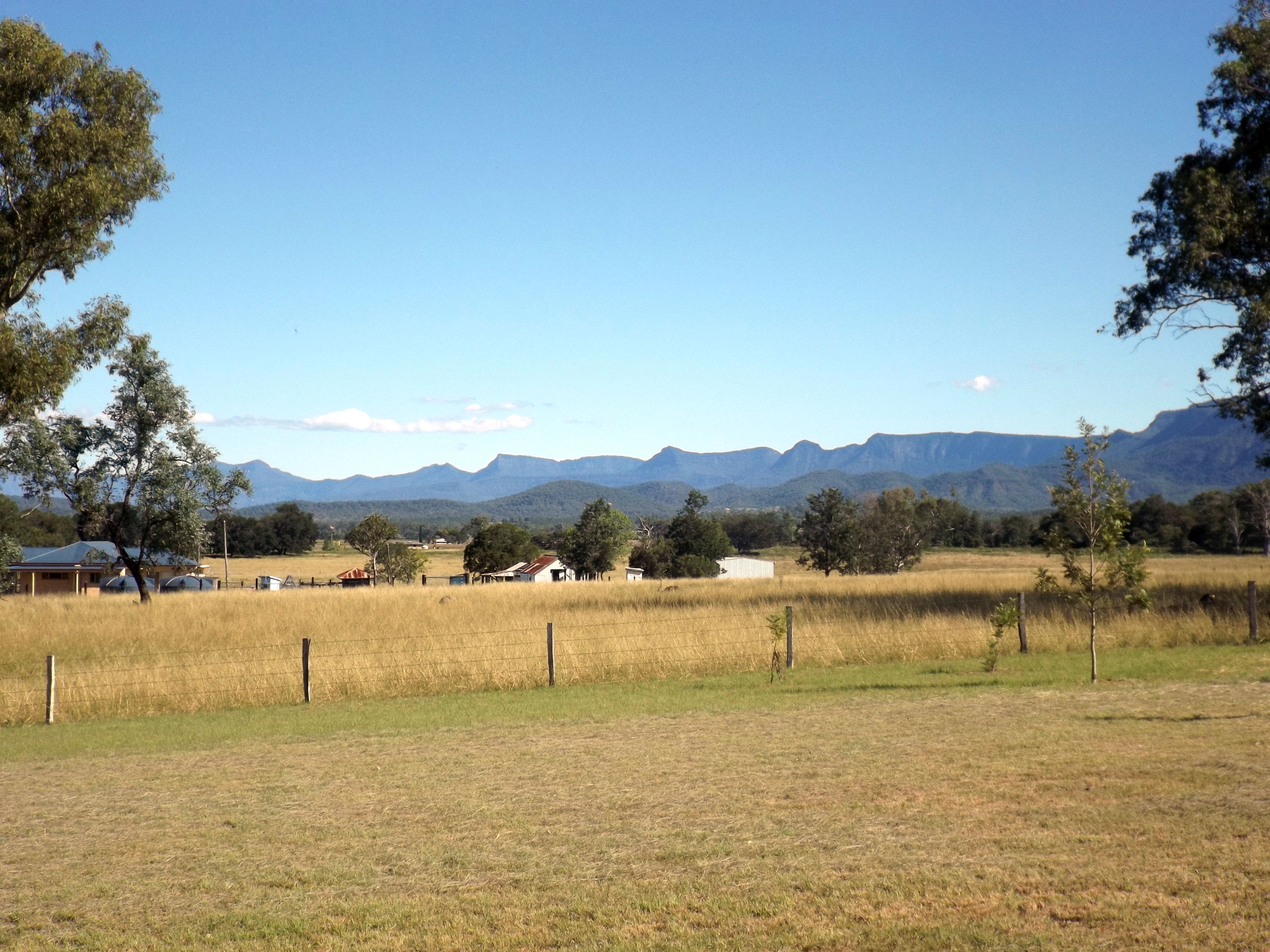
Mount Huntley
Mount Huntley is one of the mountains of the Main Range in south-east Queensland, Australia. It is within the Main Range National Park. There are no marked walking trails to the summit, and the ascent is long and very steep with some dangerous sections. There is a clearing at the summit for hikers to camp in, however no water is available. It is possible to see Lake Moogerah The Moogerah Dam is a concrete, mass concrete arch dam, double curvature arch dam with an Spillway#Types, un-gated spillway across the Reynolds Creek that is located in the South East Queensland, South East region of Queensland, Australia. The ma ... and other local landmarks from Mount Huntley. References External links * Bushpeople's Guide to Bushwalking in South-East QL Mountains of South East Queensland Main Range National Park {{SouthernDowns-geo-stub ... [...More Info...] [...Related Items...] OR: [Wikipedia] [Google] [Baidu] |
Main Range National Park
The Main Range is a mountain range and national park in Queensland, Australia, located predominantly in Tregony, Southern Downs Region, southwest of Brisbane. It is part of the World Heritage Site Gondwana Rainforests of Australia (formerly known as the Central Eastern Rainforest Reserves). It protects the western part of a semicircle of mountains in South East Queensland known as the Scenic Rim. This includes the largest area of rainforest in South East Queensland.Queensland Environmental Protection Agency (2000). '' Heritage Trails of the Great South East'' p 34. The park is part of the Scenic Rim Important Bird Area, identified as such by BirdLife International because of its importance in the conservation of several species of threatened birds.BirdLife International. (2011). Important Bird Areas factsheet: Scenic Rim. Downloaded from http://www.birdlife.org on 2011-10-03. Description The park extends from Kangaroo Mountain, near Frazerview, south to Wilsons Peak o ... [...More Info...] [...Related Items...] OR: [Wikipedia] [Google] [Baidu] |
Queensland, Australia
) , nickname = Sunshine State , image_map = Queensland in Australia.svg , map_caption = Location of Queensland in Australia , subdivision_type = Country , subdivision_name = Australia , established_title = Before federation , established_date = Colony of Queensland , established_title2 = Separation from New South Wales , established_date2 = 6 June 1859 , established_title3 = Federation , established_date3 = 1 January 1901 , named_for = Queen Victoria , demonym = , capital = Brisbane , largest_city = capital , coordinates = , admin_center_type = Administration , admin_center = 77 local government areas , leader_title1 = Monarch , leader_name1 = Charles III , leader_title2 = Governor , leader_name2 = Jeannette Young , leader_title3 = Premier , leader_name3 = Annastacia Palaszczuk ( ALP) , legislature = Parliament of Queensland , judiciary = Supreme Court of Queensland , national_representation = Parliament of Australia , national_representation_type ... [...More Info...] [...Related Items...] OR: [Wikipedia] [Google] [Baidu] |
Lake Moogerah
The Moogerah Dam is a concrete, mass concrete arch dam, double curvature arch dam with an Spillway#Types, un-gated spillway across the Reynolds Creek that is located in the South East Queensland, South East region of Queensland, Australia. The main purposes of the dam are for irrigation of the Reynolds Creek and for water supply, supply of potable water to Warrill Creek and farmers in the Warrill Valley. The impounded reservoir is called Lake Moogerah. Moogerah is derived from the Australian Aboriginal languages, Aboriginal word ''Moojirah'', meaning "home of the thunderstorm." Location and features The dam is located above the Fassifern Valley, approximately southwest of Ipswich, Queensland, Ipswich. Aratula, Queensland, Aratula is the nearest town, approximately from the dam and the nearest major centre is . The primary inflow of the reservoir is the Reynolds Creek, a tributary of the Bremer River (Queensland), Bremer River. Construction on the dam began in 1959, although l ... [...More Info...] [...Related Items...] OR: [Wikipedia] [Google] [Baidu] |
Mountains Of South East Queensland
A mountain is an elevated portion of the Earth's crust, generally with steep sides that show significant exposed bedrock. Although definitions vary, a mountain may differ from a plateau in having a limited summit area, and is usually higher than a hill, typically rising at least 300 metres (1,000 feet) above the surrounding land. A few mountains are isolated summits, but most occur in mountain ranges. Mountains are formed through tectonic forces, erosion, or volcanism, which act on time scales of up to tens of millions of years. Once mountain building ceases, mountains are slowly leveled through the action of weathering, through slumping and other forms of mass wasting, as well as through erosion by rivers and glaciers. High elevations on mountains produce colder climates than at sea level at similar latitude. These colder climates strongly affect the ecosystems of mountains: different elevations have different plants and animals. Because of the less hospitable terrain ... [...More Info...] [...Related Items...] OR: [Wikipedia] [Google] [Baidu] |


