|
Mount Hawke And Portreath (electoral Division)
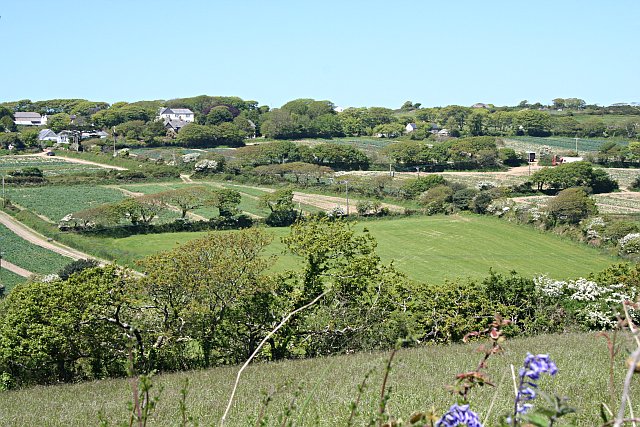
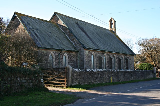
Mount Hawke and Portreath ( Cornish: ) was an electoral division of Cornwall in the United Kingdom which returned one member to sit on Cornwall Council between 2009 and 2021. It was abolished at the 2021 local elections, and was split between the divisions of St Agnes, Illogan and Portreath, Perranporth, and Redruth North. Councillors Extent The division covered the villages of Portreath, Porthtowan and Mount Hawke as well as the hamlets of Menagissey, Cambrose and Banns. Parts of Mawla and Wheal Rose were also included, with both being split between the divisions of Mount Hawke & Portreath and Redruth North. The division was minorly affected by boundary changes at the 2013 election. From 2009 to 2013, the division covered 2134.7 hectares; from 2013 to 2021, it covered 2135.2 hectares. Election results 2017 election 2013 election 2009 election References Electoral divisions of Cornwall Council {{UKward-geo-stu ... [...More Info...] [...Related Items...] OR: [Wikipedia] [Google] [Baidu] |
Cornwall Council
Cornwall Council ( kw, Konsel Kernow) is the unitary authority for Cornwall in the United Kingdom, not including the Isles of Scilly, which has its own unitary council. The council, and its predecessor Cornwall County Council, has a tradition of large groups of independent councillors, having been controlled by independents in the 1970s and 1980s. Since the 2021 elections, it has been under the control of the Conservative Party. Cornwall Council provides a wide range of services to the approximately half a million people who live in Cornwall. In 2014 it had an annual budget of more than £1 billion and was the biggest employer in Cornwall with a staff of 12,429 salaried workers. It is responsible for services including: schools, social services, rubbish collection, roads, planning and more. History Establishment of the unitary authority On 5 December 2007, the Government confirmed that Cornwall was one of five councils that would move to unitary status. This was enacted by st ... [...More Info...] [...Related Items...] OR: [Wikipedia] [Google] [Baidu] |
Liberal Democrats (UK)
The Liberal Democrats (commonly referred to as the Lib Dems) are a liberal political party in the United Kingdom. Since the 1992 general election, with the exception of the 2015 general election, they have been the third-largest UK political party by the number of votes cast. They have 14 Members of Parliament in the House of Commons, 83 members of the House of Lords, four Members of the Scottish Parliament and one member in the Welsh Senedd. The party has over 2,500 local council seats. The party holds a twice-per-year Liberal Democrat Conference, at which party policy is formulated, with all party members eligible to vote, under a one member, one vote system. The party served as the junior party in a coalition government with the Conservative Party between 2010 and 2015; with Scottish Labour in the Scottish Executive from 1999 to 2007, and with Welsh Labour in the Welsh Government from 2000 to 2003 and from 2016 to 2021. In 1981, an electoral alliance was established b ... [...More Info...] [...Related Items...] OR: [Wikipedia] [Google] [Baidu] |
Local Government Boundary Commission For England
The Local Government Boundary Commission for England (LGBCE) is a parliamentary body established by statute to conduct boundary, electoral and structural reviews of local government areas in England. The LGBCE is independent of government and political parties, and is directly accountable to the Speaker's Committee of the House of Commons. History and establishment The Local Democracy, Economic Development and Construction Act 2009, which received royal assent on 12 November 2009, provided for the establishment of the Local Government Boundary Commission for England (LGBCE), and for the transfer to it of all the boundary-related functions of the Boundary Committee for England of the Electoral Commission. The transfer took place in April 2010. Responsibilities and objectives The Local Government Boundary Commission for England is responsible for three types of review: electoral reviews; administrative boundary reviews; and structural reviews. Electoral reviews An electoral re ... [...More Info...] [...Related Items...] OR: [Wikipedia] [Google] [Baidu] |
Wheal Rose
Wheal Rose is a village in Cornwall, England, United Kingdom, in the Redruth and St Agnes parishes.Porthtowan and Wheal Rose. Cornwall Council. Retrieved 22 September 2012. History and antiquities North-west of Wheal Rose are the remains of an building, a terraced field system, and an excavation pit.[...More Info...] [...Related Items...] OR: [Wikipedia] [Google] [Baidu] |
Mawla, Cornwall
Mawla is a village south of Porthtowan in Cornwall, England, UK. The earliest record of Mawla is in 960 AD; the meaning of the name is "pigs' place". It comprises a cluster of cottages, Mawla Farm, Green Lane Farm, Forge Farm and a Methodist church. Mawla has no shops or pubs. Geography Mawla is situated approximately two miles from Mount Hawke in the parish of Redruth and St Agnes Parish on the north coast of Cornwall. Once secluded, it is now visible from surrounding areas, owing to the loss of most of the trees from Dutch elm disease. History Mawla is a little hamlet, once known as 'Mawle'. By 1824 the main villages, aside from St Agnes, in the St Agnes Parish were Mithian Mithian ( kw, Mydhyan) is a village in Cornwall, England, United Kingdom. It is about six miles (9.6 km) northeast of Redruth and a mile east of St Agnes. Mithian is in the administrative civil parish of St Agnes (which was in the former C ..., Stenclose ( Stencoose), and Malow (Mawla).Samuel Drew. ... [...More Info...] [...Related Items...] OR: [Wikipedia] [Google] [Baidu] |
Banns, Cornwall
Banns is a hamlet in west Cornwall, England, United Kingdom situated between Mount Hawke and PorthtowanOrdnance Survey: Landranger map sheet 203 ''Land's End'' at in the civil parish of St Agnes.''Porthtowan, Banns Vale, Mount Hawke and Chapel Porth.'' St Agnes Forum. p. 2. Retrieved 25 September 2012. The is to the west of the hamlet. Banns is included in the Mount Hawke and Portreath division of [...More Info...] [...Related Items...] OR: [Wikipedia] [Google] [Baidu] |
Cambrose
Cambrose is a hamlet east of Portreath in west Cornwall Cornwall (; kw, Kernow ) is a historic county and ceremonial county in South West England. It is recognised as one of the Celtic nations, and is the homeland of the Cornish people. Cornwall is bordered to the north and west by the Atlantic ..., England, UK.Ordnance Survey ''One-inch Map of Great Britain; Land's End, sheet 189''. 1961 Cambrose is the location of Sally's Bottom, a small valley running down to the coast. References Hamlets in Cornwall {{Cornwall-geo-stub ... [...More Info...] [...Related Items...] OR: [Wikipedia] [Google] [Baidu] |
Menagissey
Menagissey is a Hamlet (place), hamlet in Cornwall, England, United Kingdom. It is half-a-mile south of Mount Hawke about three miles (5 km) north-northeast of Redruth in the civil parish of St Agnes, Cornwall, St Agnes. It is included in the Mount Hawke and Portreath (electoral division), Mount Hawke and Portreath division on Cornwall Council. It consists of cottages, bungalows and several farms above a steep valley. Into Cornwall website; Menagissey; retrieved April 2010 References Hamlets in Cornwall {{Cornwall-geo-stub ...[...More Info...] [...Related Items...] OR: [Wikipedia] [Google] [Baidu] |
Mount Hawke
Mount Hawke is a village in Cornwall, United Kingdom. It is situated approximately west-northwest of Truro, north-northeast of Redruth, and south of St Agnes. The village is in a former mining area in the administrative civil parish of St Agnes. It has a school, Mount Hawke Community Primary School, a post office and various shops. The settlements bordering Mount Hawke are Banns (northwest) and Menagissey (south); Porthtowan is further away westward. The village is represented on Cornwall Council by the electoral division of Mount Hawke and Portreath. The population as of the 2011 census was 4,401. Churches Mount Hawke ecclesiastical parish was created in 1847 from part of the parish of Perranzabuloe and a smaller part of the parish of Illogan. Before this date, Mount Hawke was enumerated under St Agnes. The parish has been in the Hundred of Powder and the Truro Registration District since its creation. It is in the rural deanery of Powder and the archdeaconry o ... [...More Info...] [...Related Items...] OR: [Wikipedia] [Google] [Baidu] |
Porthtowan
Porthtowan ( kw, Porth Tewyn, meaning ''cove of sand dunes'') is a small village in Cornwall, England which is a popular summer tourist destination. Porthtowan is on Cornwall's north Atlantic coast about west of St Agnes, north of Redruth, west of Truro and southwest of Newquay in the Cornwall and West Devon Mining Landscape, a World Heritage Site. Porthtowan is popular with surfers and industrial archaeologists; former mine stacks and engine houses dot the landscape. Geography Porthtowan lies along the Godrevy Head to St Agnes heritage coast, which is located on the north Cornwall coast of the Celtic Sea in the Atlantic Ocean. It lies between Godrevy Head (with the Godrevy Towans) and St Agnes Head, north of the village of St Agnes.Ordnance Survey: Landranger map sheet 203 ''Land's End'' ''St Agnes Herita ... [...More Info...] [...Related Items...] OR: [Wikipedia] [Google] [Baidu] |
Portreath
Portreath ( kw, Porthtreth or ) is a civil parish, village and fishing port on the north coast of Cornwall, England, United Kingdom. The village is about three miles (5 km) northwest of Redruth. The village extends along both sides of a stream valley and is centred on the harbour and beach. West of the harbour entrance and breakwater are two sandy beaches that are popular with holidaymakers, surfers and naturists. Portreath lies within the Cornwall Area of Outstanding Natural Beauty (AONB). Almost a third of Cornwall has AONB designation, with the same status and protection as a National Park. Separately, in early 2017, the village was looking to be a hedgehog-friendly village. It would join Burton Fleming in the East Riding of Yorkshire as one of a handful of hedgehog-friendly villages in the UK. History The name Portreath (meaning "sandy cove") was first recorded in 1485, and tin streaming in the valley was recorded from 1602. Devon contractor Samuel Nott was engaged to ... [...More Info...] [...Related Items...] OR: [Wikipedia] [Google] [Baidu] |
2017 Cornwall Council Election
The 2017 Cornwall Council election was held on 4 May 2017 as part of the 2017 local elections in the United Kingdom. 122 councillors were elected from the 121 electoral divisions of Cornwall Council, which returned either one or two councillors each by first-past-the-post voting for a four-year term of office. Although originally scheduled to take place on the same day, the election in the Bodmin St Petroc ward was countermanded following the death of Liberal Democrat candidate Steve Rogerson and was held on 8 June. Background The elections for Cornwall Council is the third since its creation in 2009. Cornwall had previously been administered as a non-metropolitan county, with local government powers split between Cornwall County Council and the six non-metropolitan districts of Caradon, Carrick, Kerrier, North Cornwall, Penwith and Restormel. These were abolished as part of the 2009 structural changes to local government in England, which created a singular unitary ... [...More Info...] [...Related Items...] OR: [Wikipedia] [Google] [Baidu] |


