|
Moroto Airport
Moroto Airport is an airport serving Moroto in the Northern Region of Uganda. It is one of twelve upcountry airports managed by the Civil Aviation Authority of Uganda. The well-marked runway is just south of the Pader Palwo - Moroto road, west of Moroto. See also * Transport in Uganda * * * List of airports in Uganda This is a list of airports in Uganda, sorted by location. Uganda is a landlocked country in East Africa. It is bordered on the east by Kenya, on the north by South Sudan, on the west by the Democratic Republic of the Congo, on the southwest by Rw ... References * External links HERE/Nokia - MorotoSkyVector - Moroto National Airports in Uganda Moroto District {{Uganda-airport-stub ... [...More Info...] [...Related Items...] OR: [Wikipedia] [Google] [Baidu] |
Moroto Town
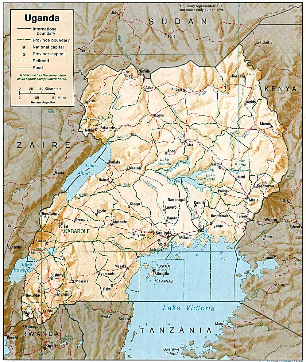
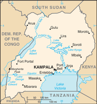
Moroto is a town in Moroto District in the Northern Region of Uganda. It is the location of the district headquarters. Location Moroto is approximately , by road, east of Gulu, the largest city in the Northern Region of Uganda. This is about , by road, northeast of Mbale, the largest city in the Eastern Region of Uganda. Moroto is located approximately , by road, northeast of Kampala, the capital and largest city of Uganda. The geographical coordinates of Moroto Town are 2°31'48.0"N, 34°40'12.0"E (Latitude:2.5300; Longitude:34.6700). Moroto sits at an average elevation of above mean sea level. Population The 2002 national census estimated the population of Moroto at 7,380. In 2010, the Uganda Bureau of Statistics (UBOS) estimated the population at 11,600. In 2011, UBOS estimated the mid-year population at 12,300. In 2014, the national population census put the population of Moroto at 14,196. In 2020, UBOS estimated the mid-year population of the town at 16,300 people. The ... [...More Info...] [...Related Items...] OR: [Wikipedia] [Google] [Baidu] |
Northern Region, Uganda
The Northern Region is one of four regions in the country of Uganda. As of Uganda's 2014 census, the region's population was . Districts As of 2010, the Northern Region had 30 districts A district is a type of administrative division that, in some countries, is managed by the local government. Across the world, areas known as "districts" vary greatly in size, spanning regions or counties, several municipalities, subdivisions o ...: References External links Google Map of the Northern Region of Uganda {{Districts of Uganda Regions of Uganda ... [...More Info...] [...Related Items...] OR: [Wikipedia] [Google] [Baidu] |
Uganda
}), is a landlocked country in East Africa East Africa, Eastern Africa, or East of Africa, is the eastern subregion of the African continent. In the United Nations Statistics Division scheme of geographic regions, 10-11-(16*) territories make up Eastern Africa: Due to the historical .... The country is bordered to the east by Kenya, to the north by South Sudan, to the west by the Democratic Republic of the Congo, to the south-west by Rwanda, and to the south by Tanzania. The southern part of the country includes a substantial portion of Lake Victoria, shared with Kenya and Tanzania. Uganda is in the African Great Lakes region. Uganda also lies within the Nile, Nile basin and has a varied but generally a modified equatorial climate. It has a population of around 49 million, of which 8.5 million live in the Capital city, capital and largest city of Kampala. Uganda is named after the Buganda kingdom, which encompasses a large portion of the south of the country, includi ... [...More Info...] [...Related Items...] OR: [Wikipedia] [Google] [Baidu] |
Civil Aviation Authority Of Uganda
The Uganda Civil Aviation Authority (UCAA) is the government agency responsible for licensing, monitoring, and regulating civil aviation matters. It is administered by the Uganda Ministry of Works and Transport. Location The authority's head offices are at Entebbe International Airport, approximately , by road, south of Kampala, the capital and largest city of Uganda. The coordinates of the CAA headquarters are 0°02'23.0"N, 32°26'53.0"E (Latitude:0.039722; Longitude:32.448056). Overview The agency was created by an Act of Parliament in 1994 as a state agency of the Ministry of Transport, Housing and Communication. As of October 2016, it was under the Ministry of Works and Transport. The mandate of the UCAA is to coordinate and oversee Uganda's aviation industry, including licensing, regulation, air search and rescue, air traffic control, ownership of airports and aerodromes, and Ugandan and international aviation law. It also represents Uganda in an international capacity w ... [...More Info...] [...Related Items...] OR: [Wikipedia] [Google] [Baidu] |
Transport In Uganda
Transport in Uganda refers to the transportation structure in Uganda. The country has an extensive network of paved and unpaved roads. Roadways As of 2017, according to the Uganda Ministry of Works and Transport, Uganda had about of roads, with approximately (4 percent) paved. Most paved roads radiate from Kampala, the country's capital and largest city. International highways The Lagos-Mombasa Highway, part of the Trans-Africa Highway and aiming to link East Africa and West Africa, passes through Uganda. This is complete only eastwards from the Uganda– DR Congo border to Mombasa, linking the African Great Lakes region to the sea. In East Africa, this roadway is part of the Northern Corridor. It cannot be used to reach West Africa because the route westwards across DR Congo to Bangui in the Central African Republic (CAR) is impassable after the Second Congo War and requires reconstruction. An alternative route (not part of the Trans-African network) to Bangui base ... [...More Info...] [...Related Items...] OR: [Wikipedia] [Google] [Baidu] |
List Of Airports In Uganda
This is a list of airports in Uganda, sorted by location. Uganda is a landlocked country in East Africa. It is bordered on the east by Kenya, on the north by South Sudan, on the west by the Democratic Republic of the Congo, on the southwest by Rwanda, and on the south by Tanzania. The southern part of the country includes a substantial portion of Lake Victoria, which is also bordered by Kenya and Tanzania. Uganda's capital and largest city is Kampala. __TOC__ Airports Names shown in bold indicate the airport has scheduled passenger service on commercial airlines. These include Entebbe International Airport, plus three domestic airports where Kampala-based Eagle Air (Uganda), Eagle Air provides service: Arua Airport, Gulu Airport, and Moyo Airport. See also * Transport in Uganda * List of airports by ICAO code: H#HU - Uganda * Wikipedia: WikiProject Aviation/Airline destination lists: Africa#Uganda References Great Circle Mapper: Airports in Uganda- IATA and ICAO cod ... [...More Info...] [...Related Items...] OR: [Wikipedia] [Google] [Baidu] |
Airports In Uganda
This is a list of airports in Uganda, sorted by location. Uganda is a landlocked country in East Africa. It is bordered on the east by Kenya, on the north by South Sudan, on the west by the Democratic Republic of the Congo, on the southwest by Rwanda, and on the south by Tanzania. The southern part of the country includes a substantial portion of Lake Victoria, which is also bordered by Kenya and Tanzania. Uganda's capital and largest city is Kampala. __TOC__ Airports Names shown in bold indicate the airport has scheduled passenger service on commercial airlines. These include Entebbe International Airport, plus three domestic airports where Kampala-based Eagle Air provides service: Arua Airport, Gulu Airport, and Moyo Airport. See also * Transport in Uganda * List of airports by ICAO code: H#HU - Uganda * Wikipedia: WikiProject Aviation/Airline destination lists: Africa#Uganda References Great Circle Mapper: Airports in Uganda- IATA and ICAO codes, coordinates, ... [...More Info...] [...Related Items...] OR: [Wikipedia] [Google] [Baidu] |


