|
Mongalkote
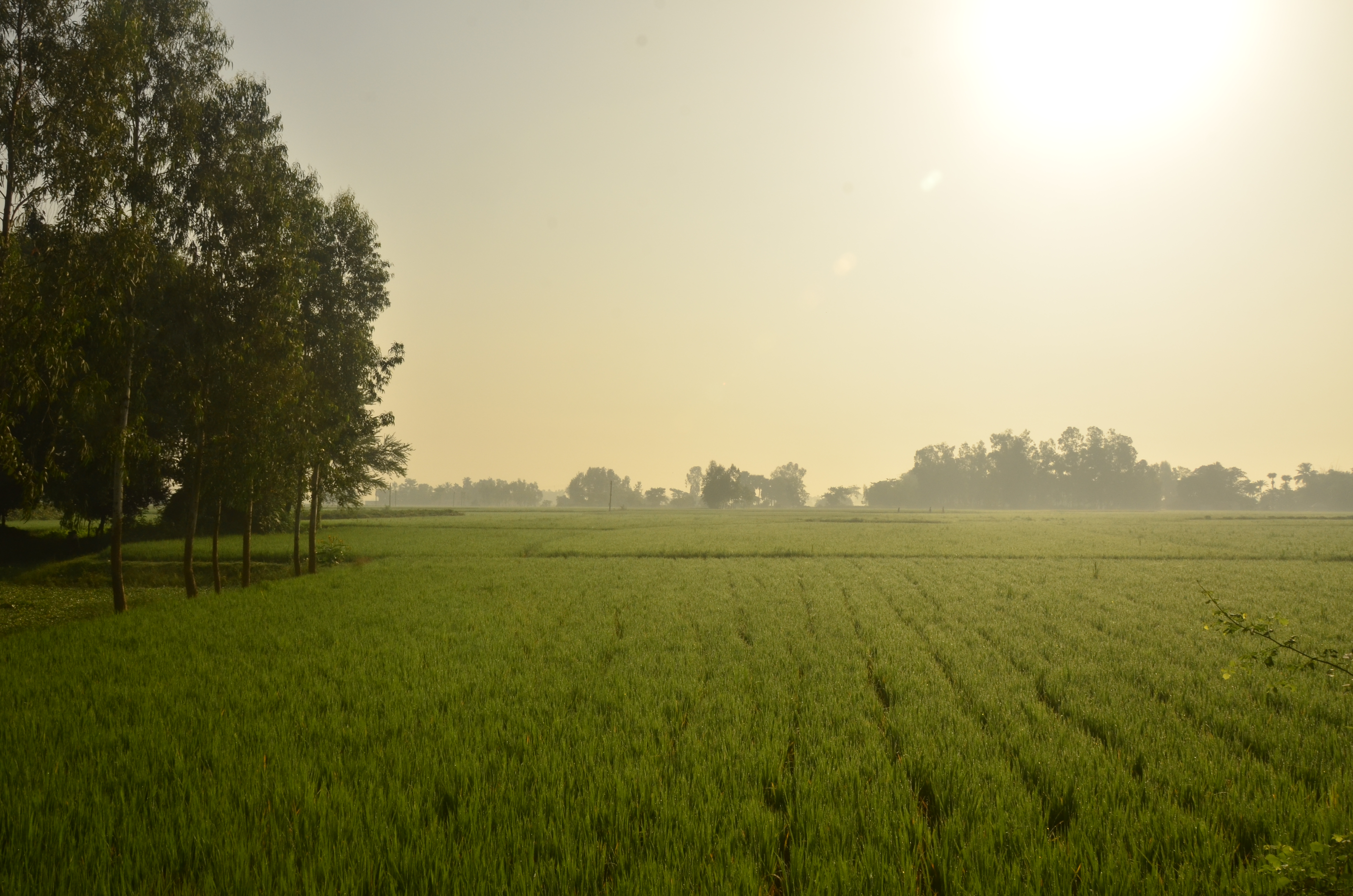
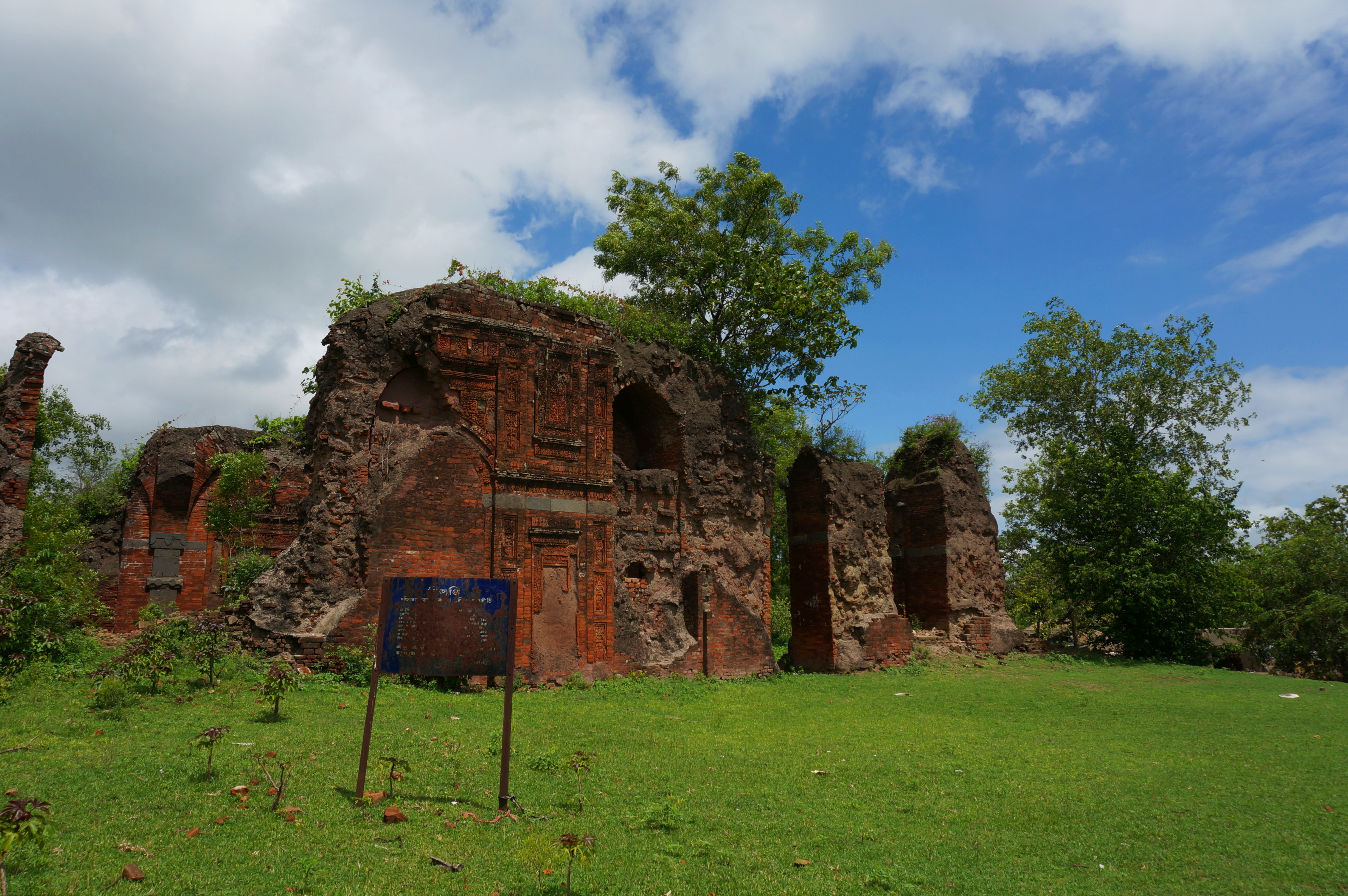
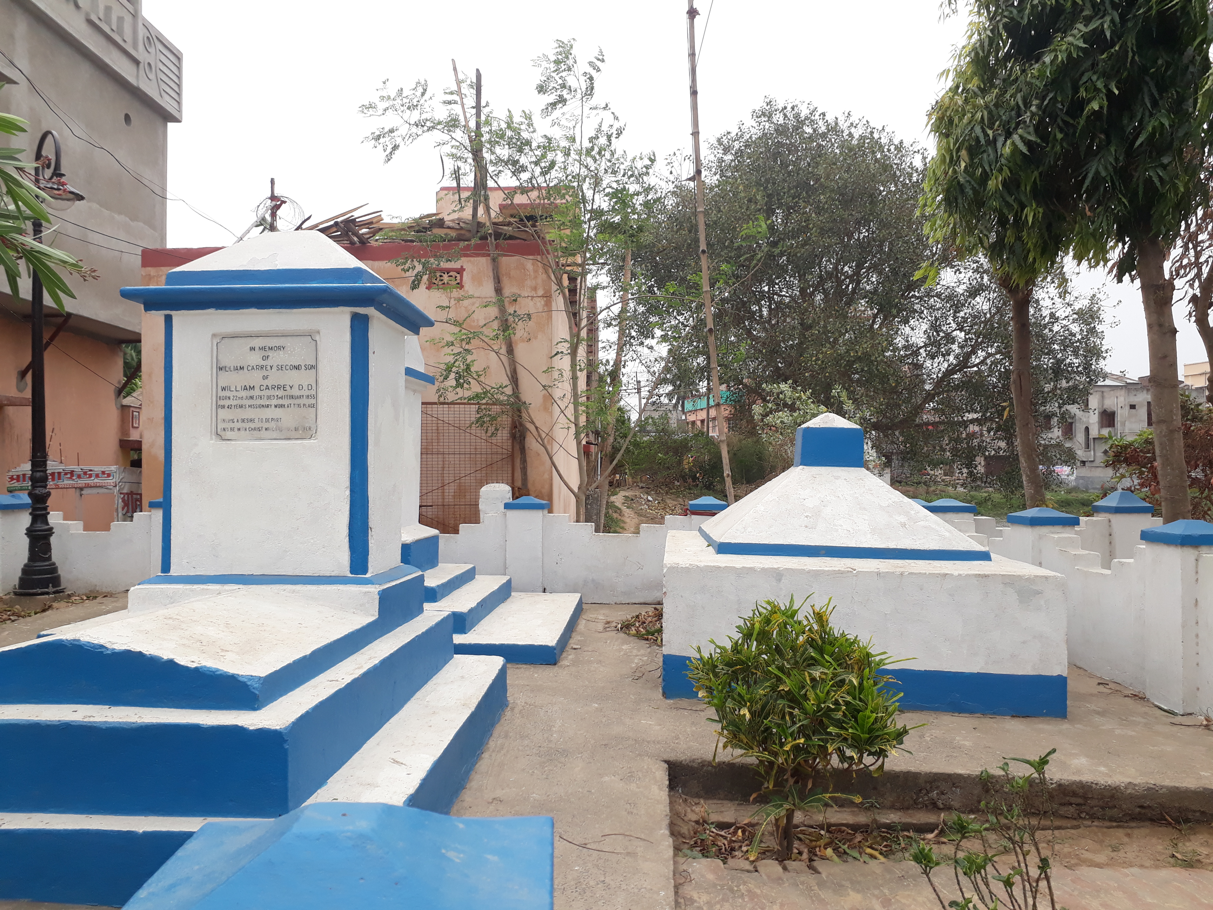
Mongalkote is a village in Mongalkote CD block in Katwa subdivision of Purba Bardhaman district in the state of West Bengal, India. History Mongalkote is an ancient place. In the Jataka tale (around 4th century BC) '' Vessantara'', the capital of Shivirattha kingdom was mentioned as a place called Jatuttara. In his publication ''Sibi Kings Vessantara, His Country and Cultural Heritage'', Aswini Kumar Choudhury has mentioned Jetuttara as being located at or near the present day Mangalkota, which was a flourishing place from the Gupta period to the Sena dynasty, but it rose to its greatest heights during Muslim rule. There are graves of five pirs, including Gholam Panjatan. Mosques were built by Danesh Mand and Hussain Shah. During the long Hindu and Buddhist periods, Mongalkote was obviously an important centre of activity. It is even thought that it had links with adjoining Gopbhum. However, not much is known about the period.Ghosh, Binoy, ''Paschim Banger Sanskriti'', , part ... [...More Info...] [...Related Items...] OR: [Wikipedia] [Google] [Baidu] |
Mongalkote (community Development Block)
Mongalkote (also spelled variously as Mangalkot, Mangolkot, Mongolkot etc.) is a community development block that forms an administrative division in Katwa subdivision of Purba Bardhaman district in the Indian state of West Bengal. History Damage to embankments of the Ajay and consequent flooding was a regular problem in the Ausgram and Mangalkot area. The devastating flood of 1943 caused immense suffering and led to a mass movement for restoration/ repair of the embankments. A massive meeting was organised at Guskara in 1944, with Uday Chand Mahtab, Maharaja of Bardhaman. However, the government did not take any action. Ultimately, the Communist Party, which had been at the forefront of agitations for some years, provided a huge work force for the purpose and completed the repair work. It laid the foundation for the party's popularity in the area. Geography Location Mongalkote is located at . Mangolkote CD Block is part of the Kanksa Ketugram plain, which lies along the Ajay. ... [...More Info...] [...Related Items...] OR: [Wikipedia] [Google] [Baidu] |
Katwa Subdivision
Katwa subdivision is an administrative subdivision of the Purba Bardhaman district in the state of West Bengal, India. Overview The Katwa subdivision extends from the Kanksa-Ketugram plain to the Bhagirathi basin. The Ajay River, Ajay flows through the subdivision and joins the Hooghly River, Bhagirathi. Subdivisions Purba Bardhaman district is divided into the following administrative subdivisions: Administrative units Katwa subdivision has 3 police stations, 5 community development blocks, 5 panchayat samitis, 46 gram panchayats, 388 mouzas, 373 inhabited villages, 2 municipalities and 1 census town. The municipalities are at Katwa and Dainhat. The census town is: Panuhat. The subdivision has its headquarters at Katwa. Demographics As per the 2011 Census of India data Katwa subdivision, after bifurcation of Bardhaman district in 2017, had a total population of 963,022. There were 494,584 (51%) males and 468,538 (49%) females. Population below 6 years was 109,884. As p ... [...More Info...] [...Related Items...] OR: [Wikipedia] [Google] [Baidu] |
Nutanhat
Nutanhat is a village in Mongalkote (community development block), Mongalkote Community development block in India, CD block in Katwa subdivision of Purba Bardhaman district in the state of West Bengal, India. Geography Physical features The Kunur River, Kunur, one of the main tributaries of the Ajay River, Ajay, joins the Ajay near Nutanhat. CD block HQ The headquarters of Mongalkote CD block are located at Nutanhat. Urbanisation 88.44% of the population of Katwa subdivision live in the rural areas. Only 11.56% of the population live in the urban areas. The map alongside presents some of the notable locations in the subdivision. All places marked in the map are linked in the larger full screen map. Demographics As per the 2011 Census of India Nutanhat had a total population of 5,349, of which 2,738 (51%) were males and 2,611 (49%) were females. Population below 6 years was 587. The total number of literates in Nutanhat was 3,328 (69.89% of the population over 6 years). Tran ... [...More Info...] [...Related Items...] OR: [Wikipedia] [Google] [Baidu] |
Kogram
Kogram is a village in Ketugram I CD block in Katwa subdivision of Purba Bardhaman district in West Bengal, India. History According to Binoy Ghosh, Kogram is located at the confluence of the Ajay and the Kunur. The Ajay has been eating up parts of Kogram and pushing it back. In olden days Ujani or Ujaninagar (not to be confused with Ujjaini) covered a much bigger area, covering present day Kogram, Mongalkote and surrounding areas. Kabikankan Mukundaram (16th century poet), in his Chandimangal, as well as other poets of the era, have spoken of the fortified Ujani, its king Vikramkesari and its merchants. Ujani was the home of Dhanapati Sadagar. It was also the paternal home of Behula of Manasamangal fame. In the olden days, many merchants lived in the riverine territory now a part of Purba Bardhaman and Hooghly districts, with easy access to the port-town of Saptagram. Around 700 merchants are said to have come to Ujani to attend the last rites Dhanapati Sadagar’s fathe ... [...More Info...] [...Related Items...] OR: [Wikipedia] [Google] [Baidu] |
Mangalkot (Vidhan Sabha Constituency)
Mangalkot Assembly constituency is an assembly constituency in Purba Bardhaman district in the Indian state of West Bengal. Overview As per orders of the Delimitation Commission, No. 272 Mangalkot assembly constituency covers Mongalkote community development block and Saragram, Gidhgram and Alampur gram panchayats of Katwa I CD Block. Mangalkot assembly constituency is part of No. 41 Bolpur (Lok Sabha constituency). The West Bengal political scenario has changed dramatically over the years. In the early years after independence it was a scene of fluctuating fortunes between the Congress and the Left wing parties, till the latter captured power in the late seventies. The United News of India in a candid analysis says, “The green surge swept Bengal to demolish the red bastion in 2011 Assembly elections… Moreover, as the Left still remained cornered in state politics, their neutralised voters are increasingly migrating to the BJP for a viable alternative.” Members of Legi ... [...More Info...] [...Related Items...] OR: [Wikipedia] [Google] [Baidu] |
Ketugram
Ketugram is a village in Ketugram II Community development block in India, CD block in Katwa subdivision of Purba Bardhaman district in the state of West Bengal, India. Etymology It is said that Ketugram was named after Chandraketu, son of king Bhopal. The earlier name of Ketugram was Bahula.Ghosh, Binoy, ''Paschim Banger Sanskriti'', , part I, 1976 edition, pages 188-189, Prakash Bhaban History According to Binoy Ghosh, it is claimed by some that Ketugram was the birthplace of 14th century lyric poet Chandidas of ''Vaishnava Padavali'' fame. It is said that the people of Ketugram were furious with Chandidas for marrying a low-caste widow. He went away to Nanoor in the adjoining district of Birbhum, along with the idol of Bisalakshi that he used to worship. Later, when hostilities subsided, Chandidas was even accepted back in Ketugram as the priest of Bahulakshi temple. The place in the northern part of Ketugram, which is believed to be the birth-place of Chandidas, is even toda ... [...More Info...] [...Related Items...] OR: [Wikipedia] [Google] [Baidu] |
Purba Bardhaman District
Purba Bardhaman district is in West Bengal. Its headquarters is in Bardhaman. It was formed on 7 April 2017 after the division of the previous Bardhaman district. Great revolutionary Rash Behari Bose was born in village Subaldaha in the district of Purba Bardhaman. Etymology Some historians link the name of the district to the 24th and last Jain ''tirthankara'', Mahavira Vardhamana, who came to preach in the area. Alternatively, ''Bardhamana'' means a prosperous and growing area. It was a forward frontier zone in the progress of Aryanisation by the people in the Upper Gangetic valley. ''Purba'' means east. History The district is recorded in the early 20th century British chronicles as ‘the richest tract in Bengal and the area of its oldest and most settled cultivation’. Archaeological excavations at Pandu Rajar Dhibi have indicated settlements in the Ajay valley in the Mesolithic age, around 5,000 BC. In early historical times Bardhamanbhukti, a part of the Rarh regio ... [...More Info...] [...Related Items...] OR: [Wikipedia] [Google] [Baidu] |
Panuhat
Panuhat is a census town in Katwa I CD Block of Katwa subdivision in Purba Bardhaman district in the Indian state of West Bengal. Geography Location Panuhat is located at . Urbanisation 88.44% of the population of Katwa subdivision live in the rural areas. Only 11.56% of the population live in the urban areas. The map alongside presents some of the notable locations in the subdivision. All places marked in the map are linked in the larger full screen map. Demographics As per the 2011 Census of India, Panuhat had a total population of 6,473 of which 3,354 (52%) were males and 3,119 (48%) were females. Population below 6 years was 650. The total number of literates in Panuhat was 4,817 (82.72% of the population over 6 years). India census A census is the procedure of systematically acquiring, recording and calculating information about the members of a given population. This term is used mostly in connection with national population and housing censuses; other common cens ... [...More Info...] [...Related Items...] OR: [Wikipedia] [Google] [Baidu] |
Dainhat
Dainhat is a town and a Municipality under Katwa police station of Katwa subdivision, in Purba Bardhaman district in the state of West Bengal, India. History A Maratha cavalry or Bargis under Bhaskar Pandit sent to Bengal by Raghoji I Bhonsle in the 18th century entered through Panchet and started looting the countryside. Bhaskar Pandit had decided to build Dainhat as his main camp to attack enemies. He had dug several trenches to protect his camp. A temple created by Bhaskar Pandit still exits near the place Swamaj Bati of Dainhat. Currently that temple is known as Kisore Kisori Mandir. Geography Location Dainhat is located at . CD block HQ The headquarters of Katwa II CD block are located at Dainhat. Urbanisation 88.44% of the population of Katwa subdivision live in the rural areas. Only 11.56% of the population live in the urban areas. The map alongside presents some of the notable locations in the subdivision. All places marked in the map are linked in the larger full s ... [...More Info...] [...Related Items...] OR: [Wikipedia] [Google] [Baidu] |
Katwa
Katwa is a sub-divisional town and railway junction in Purba Bardhaman district of the Indian state of West Bengal. It is the headquarters of the Katwa subdivision. The town was built at the confluence of Ganga and Ajay. Katwa is a border city of three districts; Purba Bardhaman District, Nadia District and Murshidabad District. Geography Location Katwa is located at . It has an average elevation of . It is situated between the Ajay River and the Hooghly River and so is bounded by water to the east, west, and north. Police station Katwa police station has jurisdiction over Katwa and Dainhat municipalities, and Katwa I and Katwa II CD Blocks. The area covered is 351.03 km2. Urbanisation 88.44% of the population of the Katwa subdivision live in rural areas. Only 11.56% of the population live in the urban areas. The map alongside presents some of the notable locations in the subdivision. All places marked on the map are linked in the larger full-screen map. History Ka ... [...More Info...] [...Related Items...] OR: [Wikipedia] [Google] [Baidu] |
Pir (Sufism)
Peer or Pir ( fa, پیر, lit=elder) is a title for a Sufi spiritual guide. They are also referred to as a ''Hazrat'' (from ar, حضرة, Haḍra) and ''Sheikh (Sufism), Sheikh'' or Shaykh, which is literally the Arabic equivalent. The title is often translated into English as "saint." In Sufism a Pir's role is to guide and instruct his disciples on the Sufi path. This is often done by general lessons (called ''Suhbas'') and individual guidance. Other words that refer to a Pir include ''Murshid'' ( ar, مرشد, lit=guide, mentor) and ''Sarkar'' ( fa, سرکار, lit=master, lord). The title ''Peer Baba'' (from fa, بابا, lit=father) is common in the Indian subcontinent used as a salutation to Sufi masters or similarly honored persons. After their death, people visit their tombs or mausolea, referred to as dargah or maqbara. The path of Sufism starts when a student takes an oath of allegiance with a teacher called ''Bai'at'' or ''Bay'ah'' (Arabic word meaning "transactio ... [...More Info...] [...Related Items...] OR: [Wikipedia] [Google] [Baidu] |
Ghazi (warrior)
A ''ghazi'' ( ar, غازي, , plural ''ġuzāt'') is an individual who participated in ''ghazw'' (, ''wikt:ghazwa, ''), meaning military expeditions or raiding. The latter term was applied in early Islamic literature to expeditions led by the Islamic prophet Muhammad, and later taken up by Turkic military leaders to describe their wars of conquest. In the context of the wars between Russia and the Muslim peoples of the Caucasus, starting as early as the late 18th century's Sheikh Mansur's resistance to Russian expansion, the word usually appears in the form ''gazavat'' (). In English-language literature, the ''ghazw'' often appears as ''Razzia (military), razzia'', a borrowing through French from Maghrebi Arabic. In modern Turkish language, Turkish, ''gazi'' is used to refer to Veteran, veterans, and also as a title for Turkic Muslim champions such as Ertuğrul and Osman I. Ghazw as raid—razzia In pre-Islamic Bedouin culture, ghazw[a] was a form of limited warfare verging ... [...More Info...] [...Related Items...] OR: [Wikipedia] [Google] [Baidu] |


.jpg)


