|
Mississippi Highway 309
Mississippi Highway 309 (MS 309) is a two-lane, north–south state highway in Marshall County, Mississippi. It runs from the Tennessee state line south through western Marshall County to its southern terminus at MS 4, just east of the community of Chulahoma. Route description MS 309 begins at the western edge of the community of Chulahoma at an intersection with MS 4. It winds its way northwest through a mix of farmland and wooded areas for several miles, where it makes both a sharp left, and a sharp right, as it passes through the community of Watson. The highway now enters the town of Byhalia at an interchange with Interstate 22 (I-22)/U.S. Route 78 (US 78) at their exit 14, and it travels through some neighborhoods before passing directly through downtown, where it has an intersection with MS 178. MS 309 leaves downtown as it crosses a railroad track, traveling north through more neighborhoods before leaving Byhalia at an interchange with I-269/ MS 304 (exit ... [...More Info...] [...Related Items...] OR: [Wikipedia] [Google] [Baidu] |
Mississippi Department Of Transportation
The Mississippi Department of Transportation (MDOT) is the organization in charge of developing and maintaining all state and federal roadways in the U.S. state of Mississippi. In addition to highways, the department also has a limited role in supporting Mississippi's public transportation system, ports and waterways system, aeronautics and railroads. MDOT is headquartered in downtown Jackson. Role and Responsibility MDOT is responsible for providing a safe intermodal transportation network that is planned, designed, constructed and maintained in an effective, cost-efficient and environmentally sensitive manner. MDOT's objective is to maximize taxpayers' dollars by providing a safe, efficient multimodal network that enhances economic stability and growth. History In 1916, the Mississippi State Highway Commission was formed by the Mississippi Legislature with three elected commissioners to act in a supervisory capacity in the administration of federal funds allotted to the stat ... [...More Info...] [...Related Items...] OR: [Wikipedia] [Google] [Baidu] |
Interstate 269
Interstate 269 (I-269) is a beltway around the city of Memphis, Tennessee, and its adjacent suburban areas in southwestern Tennessee and northern Mississippi, completed in October 2018. I-269 was planned and built to serve as an outer bypass for the Memphis metropolitan area, funneling through traffic around the metro area while also functioning as a bypass of future I-69, which will run directly through the center of the metro area. I-269 currently connects to its parent route, I-69, at an interchange in Hernando, Mississippi, and will do so again in Millington, Tennessee, in the future. Route description I-269 begins at an interchange with I-69 near Hernando, Mississippi. The highway travels eastward across rural areas to the town of Byhalia, Mississippi, where it has an interchange with I-22/ U.S. Route 78 (US 78). Here, the highway continues northeastward, slowly veering north towards the Tennessee state line. Entering Tennessee, I-269 has an interchange wi ... [...More Info...] [...Related Items...] OR: [Wikipedia] [Google] [Baidu] |
Memphis, Tennessee
Memphis is a city in the U.S. state of Tennessee. It is the seat of Shelby County in the southwest part of the state; it is situated along the Mississippi River. With a population of 633,104 at the 2020 U.S. census, Memphis is the second-most populous city in Tennessee, after Nashville. Memphis is the fifth-most populous city in the Southeast, the nation's 28th-largest overall, as well as the largest city bordering the Mississippi River. The Memphis metropolitan area includes West Tennessee and the greater Mid-South region, which includes portions of neighboring Arkansas, Mississippi and the Missouri Bootheel. One of the more historic and culturally significant cities of the Southern United States, Memphis has a wide variety of landscapes and distinct neighborhoods. The first European explorer to visit the area of present-day Memphis was Spanish conquistador Hernando de Soto in 1541. The high Chickasaw Bluffs protecting the location from the waters of the Mississipp ... [...More Info...] [...Related Items...] OR: [Wikipedia] [Google] [Baidu] |
Collierville, Tennessee
Collierville is a town in Shelby County, Tennessee, United States, and a suburb located in the Memphis metropolitan area. With a population of 51,324 in the 2020 census, Collierville is the third largest municipality in the county after Memphis and Bartlett. It is home to the Carriage Crossing shopping mall and is served by Collierville Schools. Founded by entrepreneur Jesse R. Collier in 1836, Collierville was the site of the First and Second Battles of Collierville during the American Civil War, during which the town suffered severe damage. After a period of regrowth, Collierville saw substantial economic expansion in the twentieth and twenty-first centuries and now boasts a high quality of life. Collierville's downtown area is listed on the National Register of Historic Places, and in 2014 Collierville's historic town square was ranked by ''Parade'' as the "Best Main Street" in America. History Collierville is the second oldest town in Shelby County. The original town of Co ... [...More Info...] [...Related Items...] OR: [Wikipedia] [Google] [Baidu] |
Mississippi Highway 302
Mississippi Highway 302 (MS 302), also known as Goodman Road, is the main east-west highway in DeSoto County, Mississippi, extending into Marshall County to the east. It runs approximately south of the Mississippi/Tennessee state line, from a western terminus at Mississippi Highway 161 (old U.S. Route 61 or US 61) in Walls to US 72 just west of Mount Pleasant. Route description MS 302, along with Goodman Road, begins at the northern edge of the Mississippi Delta region in DeSoto County in the town of Walls at an intersection with MS 161. It heads due east as a four-lane divided highway to have an interchange with US 61 before leaving Walls, climbing out of the Delta, and narrowing to an undivided four-lane as it passes through the neighboring community of Lynchburg, where it has an intersection with MS 301. The highway now enters the city of Horn Lake and travels through suburban areas, as well as the city's main business district, before having an interchange with In ... [...More Info...] [...Related Items...] OR: [Wikipedia] [Google] [Baidu] |
Barton, Mississippi
Barton is an unincorporated community in western Marshall County, Mississippi, United States. It is located at the intersection of State Highway 302 (Goodman Road) and State Highway 309 (Byhalia Road). Notable person Aviator Bennett Griffin Bennett Hill Griffin (September 22, 1895 – April 26, 1978) was an American aviator. Griffin was born in Mississippi in 1895, but was raised in Oklahoma arriving around 1900. In 1932, Griffin along with Jimmie Mattern attempted to break ..., who once held a record time for crossing the Atlantic, was born in Barton. References Unincorporated communities in Marshall County, Mississippi Unincorporated communities in Mississippi Memphis metropolitan area {{MarshallCountyMS-geo-stub ... [...More Info...] [...Related Items...] OR: [Wikipedia] [Google] [Baidu] |
Coldwater River (Mississippi)
The Coldwater River is a river which flows for through northwestern Mississippi in the United States. It is a tributary of the Tallahatchie River, and part of the watershed of the Mississippi River, via the Yazoo River. In the past, the Coldwater River has been referred to as the Okalopasaw, Copasaw, or Cold Water River. The one-word name "Coldwater" was officially settled upon in 1891. Course The Coldwater River rises in Marshall County, Mississippi, along Mississippi Highway 4 near the Benton County line. The river then flows northwest through a corner of Benton County and then the breadth of Marshall county to a point just south of the unincorporated community of Barton, where it turns southwest as it enters DeSoto County. Along the Desoto County- Tate County line, the river is impounded by a U.S. Army Corps of Engineers dam to form Arkabutla Lake. From Arkabutla Lake the Coldwater River takes a mostly southerly course, flowing roughly parallel to the nearby Mississip ... [...More Info...] [...Related Items...] OR: [Wikipedia] [Google] [Baidu] |
Mississippi Highway 304
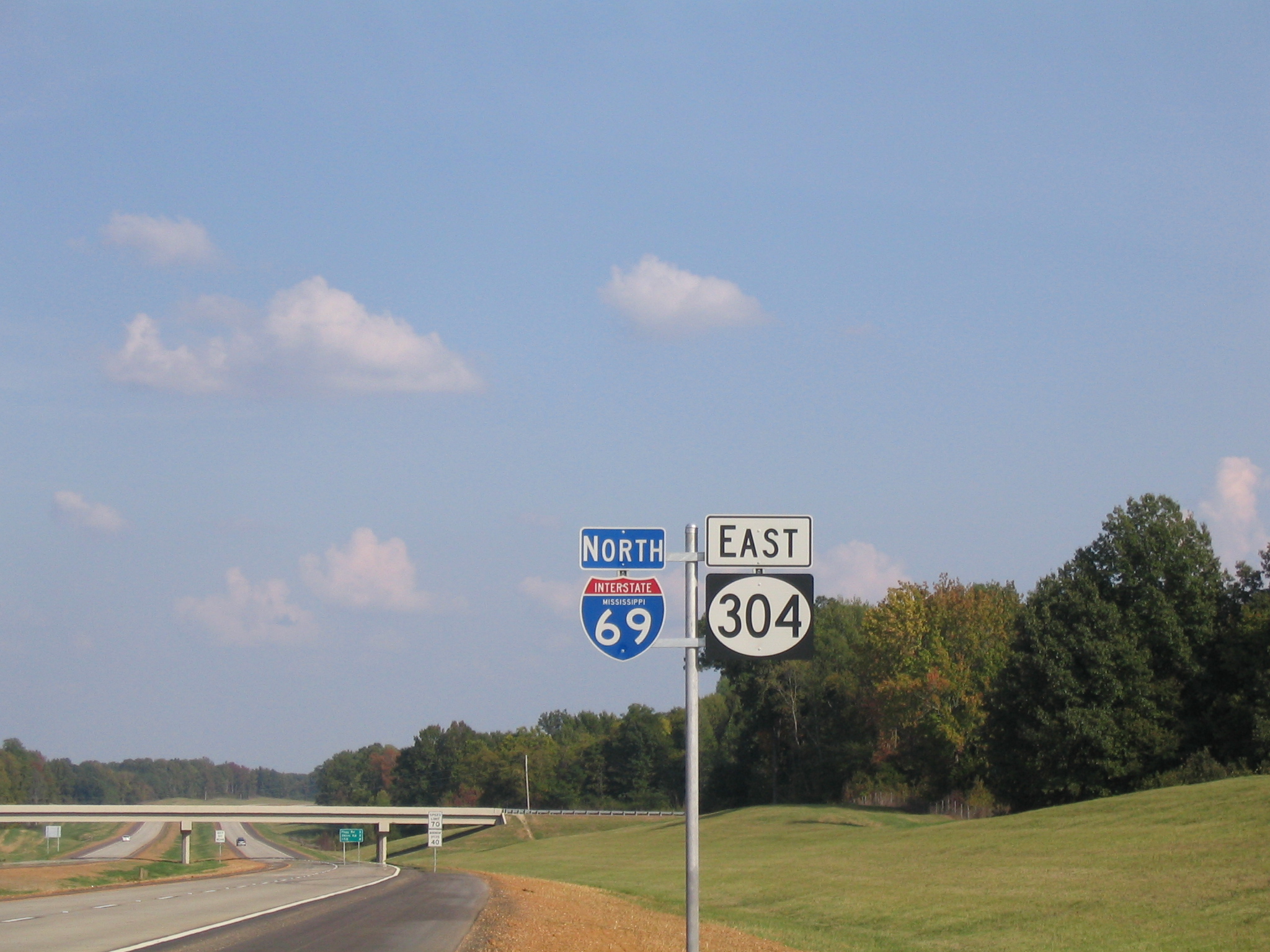
Mississippi Highway 304 (MS 304) is east-west State highway (US), state highway in the northwestern part of the U.S. state of Mississippi, running for as a four-lane freeway from U.S. Route 61 in Mississippi, U.S. Route 61 (US 61) in Tunica Resorts, Mississippi, Tunica Resorts to the Tennessee state line near Collierville, Tennessee, Collierville. It is mostly Concurrency (road), concurrent with Interstate 69 in Mississippi, Interstate 69 (I-69) and Interstate 269 (I-269). Route description MS 304 begins at a trumpet interchange with U.S. Route 61 in Mississippi, US 61 east of Tunica Resorts, Mississippi, Tunica Resorts in the northern reaches of the Mississippi Delta region. The four-lane freeway has a half-diamond interchange with Mississippi Highway 3, MS 3 that allows access to and from the east. MS 304 crosses over a rail line and has a partial interchange with a stub of Interstate 69 in Mississippi, I-69 that leads to Mississippi Highway ... [...More Info...] [...Related Items...] OR: [Wikipedia] [Google] [Baidu] |
Mississippi Highway 178
Mississippi Highway 178 (MS 178), or simply "Old 78", is a east-west state highway across the northern portion of the state of Mississippi. It is the former alignment of U.S. Route 78 (US 78), used from the 1940s until the 1990s. With the exception of a break at the Tennessee-Tombigbee Waterway in Fulton, MS 178 is a complete route from Memphis, Tennessee, to the Alabama state line. Route description MS 178 begins at the Tennessee state line in DeSoto County, with the road continuing northwest into the city of Memphis as Old Highway 78. It heads southeast as a two-lane highway to pass through the community of Mineral Wells before entering the city of Olive Branch and passing under the interchange between MS 302 and MS 305, with it connecting to both via side roads. The highway passes directly through downtown before passing through suburban areas and then leaving the city shortly thereafter. MS 178 crosses a bridge over the Coldwater River as it passes throug ... [...More Info...] [...Related Items...] OR: [Wikipedia] [Google] [Baidu] |
Chulahoma, Mississippi
Chulahoma is an unincorporated community in Marshall County, Mississippi, United States. It is located in the hill country of northern Mississippi. ''Chulahoma'' is a name derived from the Chickasaw language meaning "red fox". Culture *Blues singer and guitarist Junior Kimbrough (1930-1998) operated a juke joint Juke joint (also jukejoint, jook house, jook, or juke) is the vernacular term for an informal establishment featuring music, dancing, gambling, and drinking, primarily operated by African Americans in the southeastern United States. A juke joint ... in Chulahoma from c. 1992; following his death, Kimbrough's sons, musicians Kinney and David Malone Kimbrough, kept it open until it burned to the ground on April 6, 2000. References Unincorporated communities in Marshall County, Mississippi Memphis metropolitan area Unincorporated communities in Mississippi {{MarshallCountyMS-geo-stub ... [...More Info...] [...Related Items...] OR: [Wikipedia] [Google] [Baidu] |
Interstate 22 In Mississippi
Interstate 22 (I-22) is a Interstate Highway in the US states of Mississippi and Alabama, connecting I-269 near Byhalia, Mississippi, to I-65 near Birmingham, Alabama. I-22 is also Corridor X of the Appalachian Development Highway System. Designated in 2012, I-22 follows the route of the older U.S. Route 78 (US 78). The freeway mainly spans rural areas and passes numerous small towns along its route, including Fulton, Tupelo, New Albany, and Holly Springs in Mississippi; and Jasper, Winfield, and Hamilton in Alabama. I-22 was upgraded to Interstate Highway standards to close a gap in the Interstate Highway System, allowing for more direct connections between cities in the southeast with cities in the central part of the country. I-22 indirectly connects I-240, I-40, I-55, and I-69 in the Memphis metropolitan area via US 78 and I-269 with I-65, I-459, I-20, and I-59 in the Birmingham metro area. Route description I-22 serves as a connection between Bi ... [...More Info...] [...Related Items...] OR: [Wikipedia] [Google] [Baidu] |


.jpg)
.jpg)