|
Minnesota State Highway 39
Minnesota State Highway 39 (MN 39) is a short highway in northeast Minnesota, which runs from its intersection with State Highway 23 (Commonwealth Avenue) in Duluth and continues east to its eastern terminus at the Wisconsin state line (at the Oliver Bridge), where it becomes Wisconsin Highway 105 upon entering the village of Oliver, Wisconsin. The east end of Highway 39 crosses the Saint Louis River to Wisconsin, over the double-deck Oliver Bridge with a railroad track on the upper deck. Highway 39 is also known as ''McCuen Street'' in the Gary–New Duluth neighborhood of Duluth. Route description State Highway 39 serves as a short route between Duluth and the village of Oliver, Wisconsin. Highway 39, together with Wisconsin Highway 105, are part of a east–west connector between the city of Superior, WI, Oliver, and the Gary–New Duluth neighborhood of Duluth. The route is legally defined as Legislative Route 213 in the Minnesota Statutes. It is not marked wi ... [...More Info...] [...Related Items...] OR: [Wikipedia] [Google] [Baidu] |
Duluth, Minnesota
, settlement_type = City , nicknames = Twin Ports (with Superior), Zenith City , motto = , image_skyline = , image_caption = Clockwise from top: urban Duluth skyline; Minnesota Point beach; Duluth Ship Canal and Aerial Lift Bridge with Canal Park in background; and North Pier Lighthouse with freighter arriving , image_flag = Flag_of_Duluth,_Minnesota.svg , flag_alt = Flag of Duluth (gold star on a light blue banner with white, green, and dark blue waves below) , image_map = St. Louis County Minnesota Incorporated and Unincorporated areas Duluth Highlighted.svg , mapsize = 250x200px , map_caption = Location of the city of Duluthwithin St. Louis County, Minnesota , image_map1 = , mapsize1 = , map_caption1 = , pushpin_map = Minnesota#USA , pushpin_label = Duluth , pushp ... [...More Info...] [...Related Items...] OR: [Wikipedia] [Google] [Baidu] |
Gary - New Duluth
Gary may refer to: *Gary (given name), a common masculine given name, including a list of people and fictional characters with the name *Gary, Indiana, the largest city named Gary Places ;Iran *Gary, Iran, Sistan and Baluchestan Province ;United States *Gary (Tampa), Florida * Gary, Maryland *Gary, Minnesota *Gary, South Dakota *Gary, West Virginia *Gary – New Duluth, a neighborhood in Duluth, Minnesota *Gary Air Force Base, San Marcos, Texas *Gary City, Texas Ships * USS ''Gary'' (DE-61), a destroyer escort launched in 1943 * USS ''Gary'' (CL-147), scheduled to be a light cruiser, but canceled prior to construction in 1945 * USS ''Gary'' (FFG-51), a frigate, commissioned in 1984 * USS ''Thomas J. Gary'' (DE-326), a destroyer escort commissioned in 1943 People and fictional characters *Gary (surname), including a list of people with the name *Gary (rapper), South Korean rapper and entertainer *Gary (Argentine singer), Argentine singer of cuarteto songs Other uses *'' Gary: ... [...More Info...] [...Related Items...] OR: [Wikipedia] [Google] [Baidu] |
Duluth, Missabe And Iron Range Railway
The Duluth, Missabe and Iron Range Railway (DM&IR) , informally known as the Missabe Road, was a railroad operating in northern Minnesota and Wisconsin that used to haul iron ore and later taconite to the Great Lakes ports of Duluth and Two Harbors, Minnesota. Control of the railway was acquired on May 10, 2004, by the Canadian National Railway (CN) when it purchased the assets of Great Lakes Transportation. History The DM&IR was formed by the merger in 1937 of the Duluth, Missabe and Northern Railway (DM&N) and the Spirit Lake Transfer Railway. The following year, the Duluth and Iron Range Rail Road (D&IR) and Interstate Transfer Railway were added. All of these had been leased by the DM&N since 1930. The D&IR was formed in 1874 by Charlemagne Tower to haul iron ore from the Minnesota Iron Co. in Tower, Minnesota, to the new Lake Superior port of Two Harbors, Minnesota. On July 31, 1884, the D&IR carried its first ore shipment from the Soudan Mine. In 1887, the D&IR was ... [...More Info...] [...Related Items...] OR: [Wikipedia] [Google] [Baidu] |
Minnesota Department Of Transportation
The Minnesota Department of Transportation (MnDOT, ) oversees transportation by all modes including land, water, air, rail, walking and bicycling in the U.S. state of Minnesota. The cabinet-level agency is responsible for maintaining the state's trunk highway system (including state highways, U.S. Highways, and Interstate Highways), funding municipal airports and maintaining radio navigation aids, and other activities. History The agency's history can be traced to the state's Railroad and Warehouse Commission which emerged slowly from 1871 to 1905, and the State Highway Commission created in 1905. The Highway Commission was abolished in 1917 and replaced by a Department of Highways. The Minnesota Highway Department has been credited with numerous works listed on the U.S. National Register of Historic Places. For air transport, the Minnesota Aeronautics Commission was created in 1933. Much of the railroad oversight was transferred to the Minnesota Department of Public Service ... [...More Info...] [...Related Items...] OR: [Wikipedia] [Google] [Baidu] |
Wisconsin Department Of Transportation
The Wisconsin Department of Transportation (WisDOT) is a governmental agency of the U.S. state of Wisconsin responsible for planning, building and maintaining the state's highways. It is also responsible for planning transportation in the state relating to rail, including passenger rail, public transit, freight water transport and air transport, including partial funding of the Milwaukee-to-Chicago Hiawatha Service provided by Amtrak. The Wisconsin DOT is made up of three executive offices and five divisions organized according to transportation function. WisDOT's main office is located at Hill Farms State Transportation Building in Madison, and it maintains regional offices throughout the state. History In 1905 the state legislature introduced an amendment to the state constitution that would allow the state to fund construction and improvement of roads. It was approved by voters in 1908. On June 14, 1911 governor Francis McGovern signed legislation that created the State Hig ... [...More Info...] [...Related Items...] OR: [Wikipedia] [Google] [Baidu] |
Carlton, Minnesota
Carlton is a city in Carlton County, Minnesota, United States. The population was 948 at the 2020 census. It is the county seat of Carlton County. The town sits on the northwestern edge of Jay Cooke State Park. Minnesota State Highways 45 and 210 and County Roads 1 and 3 are four of Carlton's main routes. It is five miles south of Cloquet and 21 miles southwest of Duluth. History In 1870, the Northern Pacific Railroad finished a stretch of track that linked Duluth to St. Paul. Temporary shacks were erected for the workmen at the place that was soon known as "Northern Pacific Junction". In 1881, this settlement was incorporated as Carlton. It takes its name from former State Senator Reuben B. Carlton. Thomson merged with Carlton in 2015. Geography According to the United States Census Bureau, the city has an area of , of which is land and is water. The Saint Louis River is nearby. Carlton is the home of Black Bear Casino Resort. Thomson Dam, Thomson Reservoir, and Jay C ... [...More Info...] [...Related Items...] OR: [Wikipedia] [Google] [Baidu] |
Minnesota State Highway 45
Minnesota State Highway 45 (MN 45) is a short highway in northeast Minnesota, which runs from its intersection with State Highway 210 (Chestnut Avenue) and Carlton County Road 1 in the city of Carlton and continues north to its northern terminus at its interchange with Interstate 35 and Carlton County Highway 45 in the city of Scanlon. The route passes through the city of Carlton. Route description State Highway 45 serves as a short connector route between Carlton, Scanlon, and Interstate 35 in northeast Minnesota. It maintains Minnesota Constitutional Route 1 through the city of Carlton, following the historic route of former U.S. Highway 61. Highway 45 parallels the Saint Louis River. Jay Cooke State Park is located 3 miles east of the junction of Highways 45 and 210 at Carlton. The park entrance is located on Highway 210 adjacent to Thomson. Highway 45 is also known as ''Third Street N'' in the city of Carlton. The route has a junction with ''Carlton County Ro ... [...More Info...] [...Related Items...] OR: [Wikipedia] [Google] [Baidu] |
Jay Cooke State Park
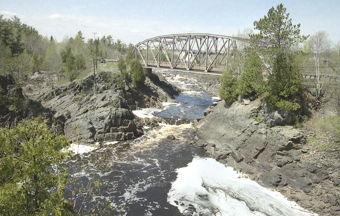
Jay Cooke State Park is a state park of Minnesota, United States, protecting the lower reaches of the Saint Louis River. The park is located about southwest of Duluth and is one of the ten most visited state parks in Minnesota. The western half of the park contains part of a rocky, gorge. This was a major barrier to Native Americans and early Europeans traveling by canoe, which they bypassed with the challenging Grand Portage of the St. Louis River. The river was a vital link connecting the Mississippi waterways to the west with the Great Lakes to the east. Today Minnesota State Highway 210 runs through Jay Cooke State Park. The of the route between Carlton and Highway 23—which include the park—are designated the Rushing Rapids Parkway, a state scenic byway. The park is named for Pennsylvania financier Jay Cooke, who had developed a nearby power plant, which is still in use. The Grand Portage trail and three districts of 1930s park structures are listed on the ... [...More Info...] [...Related Items...] OR: [Wikipedia] [Google] [Baidu] |
Minnesota State Highway 210
Minnesota State Highway 210 (MN 210) is a state highway in west-central, central, and northeast Minnesota, which runs from North Dakota Highway 210 (ND 210) at the North Dakota state line (at Breckenridge), and continues east to its eastern terminus at its intersection with MN 23 in Duluth near the Saint Louis River. The route runs across Minnesota from west-central to northeast; connecting Fergus Falls, Brainerd, and Duluth. At the western terminus of MN 210, upon crossing the Red River, the roadway becomes ND 210 and feeds into ND 13. MN 210 is in length. Route description MN 210 serves as an east–west route in west-central, central, and northeast Minnesota between Breckenridge, Fergus Falls, Staples, Baxter, Brainerd, Carlton, and Duluth. For part of its route (), MN 210 is concurrent with US Highway 10 (US 10) between Motley and Staples in central Minnesota. The highway crosses the Washington Street ... [...More Info...] [...Related Items...] OR: [Wikipedia] [Google] [Baidu] |
Superior, Wisconsin
, native_name_lang = oj , nickname = , total_type = , motto = , image_skyline = Tower Avenue.jpg , imagesize = , image_caption = Downtown Superior , image_flag = , flag_size = , image_seal = , seal_size = , image_shield = , shield_size = , image_blank_emblem = , blank_emblem_type = , blank_emblem_size = , pushpin_map = Wisconsin , pushpin_label_position = , pushpin_map_caption = Location of the city of Superiorin Douglas County, Wisconsin , pushpin_mapsize = , subdivision_type = Country , subdivision_name = United States , subdivision_type1 = U.S. state, State , subdivision_name1 = Wisconsin , subdivision_type2 = List of counties in Wisconsin, County , subdivision_name2 = Douglas County, Wisconsin, Douglas , seat_ty ... [...More Info...] [...Related Items...] OR: [Wikipedia] [Google] [Baidu] |
Saint Louis River (Lake Superior Tributary)
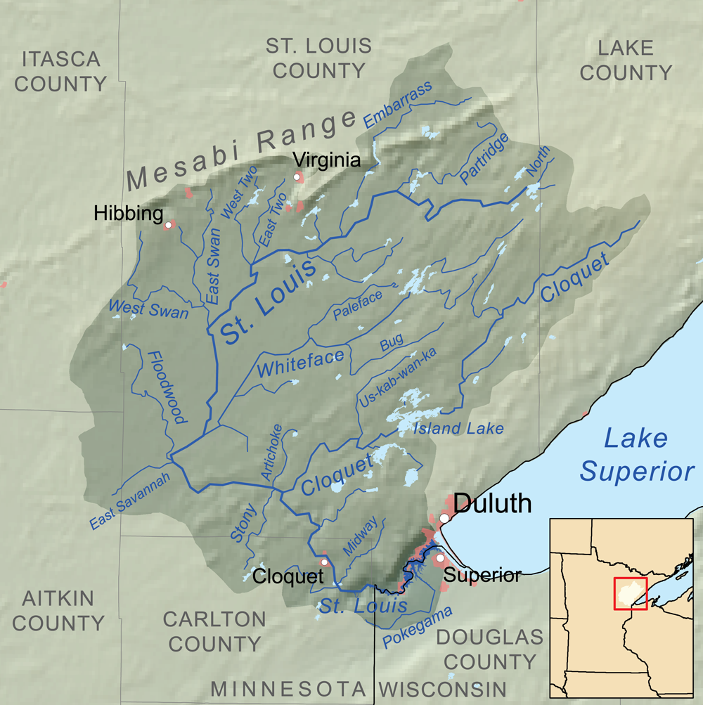
The Saint Louis River (abbreviated St. Louis River) is a river in the U.S. states of Minnesota and Wisconsin that flows into Lake Superior. The largest U.S. river to flow into the lake, it is in lengthU.S. Geological Survey. National Hydrography Dataset high-resolution flowline dataThe National Map accessed May 1, 2012 and starts east of Hoyt Lakes, Minnesota. The river's watershed covers . Near the Twin Ports of Duluth, Minnesota and Superior, Wisconsin, the river becomes a freshwater estuary. History According to Warren Upham, the Ojibwe name of the river is ''Gichigami-ziibi'' (Great-lake River). He notes: "The river was probably so named by Pierre Gaultier de Varennes, sieur de La Vérendrye (1685–1749), who was a very active explorer, in the years 1731 and onward. Shortly before his death the king of France in 1749 conferred on him the cross of Saint Louis as a recognition of the importance of his discoveries, and thence the name of the Saint Louis River appears to ... [...More Info...] [...Related Items...] OR: [Wikipedia] [Google] [Baidu] |
Oliver Bridge
The Oliver Bridge is a bridge across the Saint Louis River. It was constructed in 1910 as a railway bridge by the Interstate Transfer Railway Company, a Wisconsin corporation, under special federal authorization from the 60th United States Congress. A lower deck carrying road traffic was constructed in 1917 It connects the Gary – New Duluth neighborhood in Duluth, Minnesota with the village of Oliver, Wisconsin. The bridge is long and is principally of steel truss construction. The upper deck carries a single track rail line and a lower deck carries the road connecting Wisconsin Highway 105 to Minnesota State Highway 39. The upper deck was built to allow a streetcar line to be constructed from Gary–New Duluth to south Superior connecting the Duluth and Superior streetcar systems. The line was never built and the systems were connected across the Twin Ports Harbor. On the Oliver side, a section of the bridge was built to swing, allowing passage of large vessels despite ... [...More Info...] [...Related Items...] OR: [Wikipedia] [Google] [Baidu] |


