|
Minami Osaka Line
is a railway line operated by Kintetsu Railway connecting in Osaka and in Kashihara, Nara Prefecture via Osaka's southern suburb cities of Matsubara, Fujiidera and Habikino in Osaka Prefecture, and Katsuragi and Yamato-Takada in Nara Prefecture. The line is the major access from Osaka to southern part of Nara Basin, and together with the Yoshino Line is the main access to the Yoshino refuge of Emperor Godaigo, a popular tourism destination, especially during spring. The network formed by this line and some branch lines use a track gauge of , making them the only lines of the Kintetsu network at this gauge, other lines of Kintetsu are 1435mm gauge and 762mm gauge. History The first section of the line opened in 1898 in a part between Kashiwara Station and Furuichi Station by . The next year took over the line, then the company renamed itself . The railway constructed its own access line to Osaka center, completed in 1923 and electrified at 1,500 V DC, then the highest vol ... [...More Info...] [...Related Items...] OR: [Wikipedia] [Google] [Baidu] |
Osaka Prefecture
is a Prefectures of Japan, prefecture of Japan located in the Kansai region of Honshu. Osaka Prefecture has a population of 8,778,035 () and has a geographic area of . Osaka Prefecture borders Hyōgo Prefecture to the northwest, Kyoto Prefecture to the north, Nara Prefecture to the southeast, and Wakayama Prefecture to the south. Osaka is the capital and largest city of Osaka Prefecture, and the List of cities in Japan, third-largest city in Japan, with other major cities including Sakai, Higashiōsaka, and Hirakata. Osaka Prefecture is the third-most-populous prefecture, but by geographic area the second-smallest; at it is the second-most densely populated, below only Tokyo. Osaka Prefecture is one of Japan's two "Fu (country subdivision), urban prefectures" using the designation ''fu'' (府) rather than the standard ''Prefectures of Japan#Types of prefecture, ken'' for prefectures, along with Kyoto Prefecture. Osaka Prefecture forms the center of the Keihanshin metropolitan ar ... [...More Info...] [...Related Items...] OR: [Wikipedia] [Google] [Baidu] |
Kashihara Line
The is a north-south bound railway line in Nara Prefecture, Japan, owned and operated by the Kintetsu Railway, a private railway operator. It connects Yamato-Saidaiji Station and Kashiharajingu-mae Station. Service outline Most Express and Limited Express trains operate to and from the Kyoto Line (Kintetsu), Kyoto Line, and some Express services operate between Kyoto and Tenri via the line between Saidaiji and Hirahata stations. Stations *Local trains stop at every station. History The first section of the line, from Saidaiji Station (present-day ) to Kōriyama Station (present-day ), opened on 1 April 1921. The line was extended to on 1 April 1922, and the section from Hirahata to opened on 21 March 1923. See also * List of railway lines in Japan References {{Kintetsu Lines Lines of Kintetsu Railway, Kashihara Line Rail transport in Nara Prefecture Standard gauge railways in Japan Railway lines opened in 1921 1921 establishments in Japan ... [...More Info...] [...Related Items...] OR: [Wikipedia] [Google] [Baidu] |
Ōsaka Abenobashi Station
is a railway station on Kintetsu Minami Osaka Line in Abeno-ku, Osaka, Japan. The station is also called "Abenobashi Station" (あべの橋駅). According to the research on November 13, 2012, 159,075 passengers got on and off trains at Ōsaka Abenobashi Station. It was the largest number of passengers getting on and off trains at stations on the Kintetsu Lines. The west ticket gates of the station were shifted 35 m to the east on March 20, 2009, so that station facilities are entirely within the Kintetsu Abeno department store's "new" (east) building. The "old" (western) portion was demolished to make way for a new high-rise building. Connecting lines * Tennoji Station **West Japan Railway Company (JR West) *:*Osaka Loop Line *:*Hanwa Line *:*Yamatoji Line **Osaka Metro *:* Midosuji Line (M23) *:*Tanimachi Line (T27) * Tennoji-eki-mae Station **Hankai Tramway Uemachi Line Layout The station has six bay platforms serving five tracks on the first floor. ;Minami-Osaka Li ... [...More Info...] [...Related Items...] OR: [Wikipedia] [Google] [Baidu] |
Osaka Line
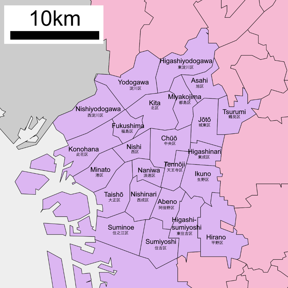
is a designated city in the Kansai region of Honshu in Japan. It is the capital of and most populous city in Osaka Prefecture, and the third most populous city in Japan, following Special wards of Tokyo and Yokohama. With a population of 2.7 million in the 2020 census, it is also the largest component of the Keihanshin Metropolitan Area, which is the second-largest metropolitan area in Japan and the 10th largest urban area in the world with more than 19 million inhabitants. Osaka was traditionally considered Japan's economic hub. By the Kofun period (300–538) it had developed into an important regional port, and in the 7th and 8th centuries, it served briefly as the imperial capital. Osaka continued to flourish during the Edo period (1603–1867) and became known as a center of Japanese culture. Following the Meiji Restoration, Osaka greatly expanded in size and underwent rapid industrialization. In 1889, Osaka was officially established as a municipality. The constructi ... [...More Info...] [...Related Items...] OR: [Wikipedia] [Google] [Baidu] |
Emperor Godaigo
Emperor Go-Daigo (後醍醐天皇 ''Go-Daigo-tennō'') (26 November 1288 – 19 September 1339) was the 96th emperor of Japan,Imperial Household Agency (''Kunaichō'')後醍醐天皇 (96) retrieved 2013-8-28. according to the traditional order of succession. He successfully overthrew the Kamakura shogunate in 1333 and established the short lived Kenmu Restoration to bring the Imperial House back into power. This was to be the last time the emperor had real power until the Meiji Restoration in 1868.Sansom 1977: 22–42. The Kenmu restoration was in turn overthrown by Ashikaga Takauji in 1336, ushering in the Ashikaga shogunate, and split the imperial family into two opposing factions between the Ashikaga backed Northern Court situated in Kyoto and the Southern Court based in Yoshino led by Go-Daigo and his later successors. This 14th-century sovereign personally chose his posthumous name after the 9th-century Emperor Daigo and ''go-'' (後), translates as "later", and he is thus ... [...More Info...] [...Related Items...] OR: [Wikipedia] [Google] [Baidu] |
Yamatotakada, Nara
is a city located in Nara Prefecture, Japan. As of April 1, 2017, the city had an estimated population of 66,400 and 29,713 households. The population density is 4,000 persons per km², and the total area is 16.48 km². The city continues to develop as a local business and government center in the center of Nara Prefecture. History Inhabited since the Paleolithic age, the city area nurtured paddy field agriculture in the fertile Nara Basin since ancient times. Large keyhole type burial mounds (''kofun'') were constructed in the northwestern part of the city around the 5th century. A local samurai family ruled the area in the medieval age, but the lord of Takada perished in 1580 at the hand of a local vassal of the powerful Oda Nobunaga. In the early modern age, the city area developed as a local market town with a big Buddhist temple at its core. With the introduction of Western Civilization into Japan, a modern spinning factory was set up here at the end of the ninet ... [...More Info...] [...Related Items...] OR: [Wikipedia] [Google] [Baidu] |
Katsuragi, Nara
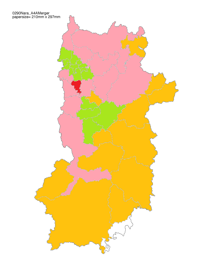
is a city located in Nara Prefecture, Japan. As of August 1, 2019, the city has an estimated population of 37,352, and 14,775 households. The population density is 1,107 persons per km2, and the total area is 33.73 km2. The modern city of Katsuragi was established on October 1, 2004, from the merger of the towns of Shinjō and Taima (both from Kitakatsuragi District). Katsuragi has a deep history being located in the ancient capital of Japan, Nara. Katsuragi has many temples, shrines and tombs, many which contain important national treasures and important cultural properties. Katsuragi has a rich natural environment. To the west lies the Kongo ranges which includes the mountains of Mt. Nijo, Mt. Iwahashi and Mt. Katsuragi. The east side of Katsuragi City includes the commercial and residential areas with National Route 24, railway stations and the Katsuragi River. The climate is generally mild and is classified as an inland climate. The temperature change during ... [...More Info...] [...Related Items...] OR: [Wikipedia] [Google] [Baidu] |
Habikino, Osaka
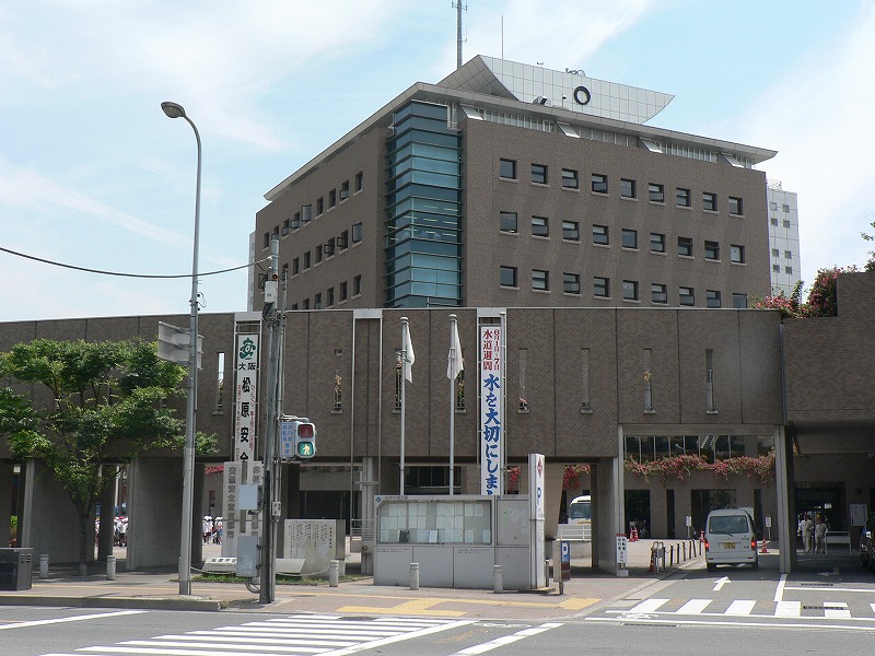
270px, Habikino city office is a city located in Osaka Prefecture, Japan. , the city had an estimated population of 109,479 in 50918 households and a population density of 4100 persons per km². The total area of the city is . The city is known for its grapes, and also for its large number of ancient '' kofun'' burial mounds. The city is also sometimes referred to by its former name . Geography Habikino is located in the southeastern part of Osaka Prefecture, in the Kawachi Plain surrounded by Ikoma, Kongō, and Katsuragi Mountains and Mount Nijō. It is within about 20 kilometers from the center of Osaka metropolis. Neighboring municipalities Osaka Prefecture *Sakai * Matsubara *Fujiidera *Kashiwara *Tondabayashi * Taishi Nara Prefecture * Kashiba Climate Habikino has a Humid subtropical climate (Köppen ''Cfa'') characterized by warm summers and cool winters with light to no snowfall. The average annual temperature in Habikino is 14.2 °C. The average annual rainfal ... [...More Info...] [...Related Items...] OR: [Wikipedia] [Google] [Baidu] |
Fujiidera, Osaka
270px, The temple of Fujii-dera, after which the city is named is a city located in Osaka Prefecture, Japan. , the city had an estimated population of 63,446 in 29501 households and a population density of 7100 persons per km². The total area of the city is . Geography Fujiidera is located in the southeastern part of the Osaka Plain, at the confluence of the Yamato and the Ishikawa rivers. The city area is almost flat and the rivers are bounded by high levees that protect low-lying areas from flooding. Sections of both river banks are maintained for recreation. Neighboring municipalities Osaka Prefecture * Yao * Kashiwara * Habikino * Matsubara Climate Fujiidera has a Humid subtropical climate (Köppen ''Cfa'') characterized by warm summers and cool winters with light to no snowfall. The average annual temperature in Fujiidera is 14.9 °C. The average annual rainfall is 1475 mm with September as the wettest month. The temperatures are highest on average in Augus ... [...More Info...] [...Related Items...] OR: [Wikipedia] [Google] [Baidu] |
Matsubara, Osaka
is a city located in Osaka Prefecture, Japan. , the city had an estimated population of 117,811 in 57351 households and a population density of 7100 persons per km². The total area of the city is . Geography Matsubara is located in the center of Osaka Prefecture. The city measures approximately 5.8 kilometers east-west by 5.1 kilometers north-south, and is mostly flatland. Neighboring municipalities Osaka Prefecture *Osaka ( Sumiyoshi-ku, Higashi Sumiyoshi-ku, Hirano-ku) *Sakai ( Kita-ku, Mihara-ku) * Yao *Fujiidera *Habikino Climate Matsubara has a Humid subtropical climate (Köppen ''Cfa'') characterized by warm summers and cool winters with light to no snowfall. The average annual temperature in Matsubara is 14.9 °C. The average annual rainfall is 1475 mm with September as the wettest month. The temperatures are highest on average in August, at around 27.0 °C, and lowest in January, at around 3.5 °C. Demographics Per Japanese census data, the p ... [...More Info...] [...Related Items...] OR: [Wikipedia] [Google] [Baidu] |
Kashihara, Nara
is a city located in Nara Prefecture, Japan. , the city has an estimated population of 124,829, with 52,034 households. Population density is around 3,176.79 persons per km2, and the total area is 39.52 km2. The city was founded on February 11, 1956. The former mayor was Yutaka Asoda, who was elected to his third term of office in 2003. The present mayor is Yutaka Morishita, who was elected in 2007. The exact spot of Emperor Jimmu's accession to the imperial throne (i.e. the foundation of Japan) was debated for centuries until in 1863 scholars of national studies claimed to have identified an area within Kashihara as the exact location. The city was the location of the Imperial capital Fujiwara-kyō, from 694 to 710. In the late 16th century it was said to be one of the two richest autonomous cities of Japan, as in ''Umi no Sakai, Riku no Imai'' (tr. "by the sea, Sakai – inland, Imai" - Imai or :ja:今井町 is now a part of Kashihara). On 8 July 2022, after former ... [...More Info...] [...Related Items...] OR: [Wikipedia] [Google] [Baidu] |
Osaka
is a designated city in the Kansai region of Honshu in Japan. It is the capital of and most populous city in Osaka Prefecture, and the third most populous city in Japan, following Special wards of Tokyo and Yokohama. With a population of 2.7 million in the 2020 census, it is also the largest component of the Keihanshin Metropolitan Area, which is the second-largest metropolitan area in Japan and the 10th largest urban area in the world with more than 19 million inhabitants. Osaka was traditionally considered Japan's economic hub. By the Kofun period (300–538) it had developed into an important regional port, and in the 7th and 8th centuries, it served briefly as the imperial capital. Osaka continued to flourish during the Edo period (1603–1867) and became known as a center of Japanese culture. Following the Meiji Restoration, Osaka greatly expanded in size and underwent rapid industrialization. In 1889, Osaka was officially established as a municipality. The construc ... [...More Info...] [...Related Items...] OR: [Wikipedia] [Google] [Baidu] |


