|
Millhouses
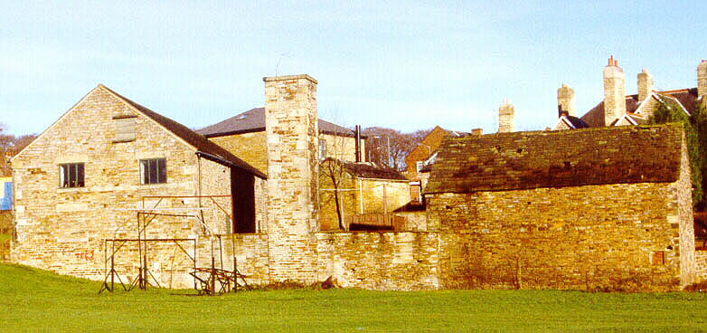
Millhouses is a neighbourhood in the City of Sheffield, England. It is located in Ecclesall ward; in the south-western portion of the city on the northwest bank of the River Sheaf. Its origins lie in a small hamlet that grew around the Ecclesall Corn Mill. It has a population (2006 estimate) of 4,424. The agriculture and industries of this area are now largely gone, leaving Millhouses as a mostly residential area. Local amenities include three schools, a park, three pubs, three supermarkets, three churches and numerous small shops. Geography Millhouses is set in of the part of the Sheaf valley known as Abbeydale.Harvey, ''Abbeydale and Millhouses'', pp. 7–8 It is bordered to the southeast by the River Sheaf and Hutcliffe Wood, to the west by Ecclesall Woods, Millhouses Lane and Button Hill, and to the north by Carter Knowle Road and Bannerdale Road. Running directly alongside the River Sheaf is the long and thin Millhouses Park. The main road through the area is the ... [...More Info...] [...Related Items...] OR: [Wikipedia] [Google] [Baidu] |
Millhouses Railway Station
Millhouses and Ecclesall railway station was a railway station in the Millhouses district of Sheffield, South Yorkshire, England. History It was built by the Midland Railway and was designed by the company architect John Holloway Sanders and opened in 1870 called Ecclesall. This was changed, first to Ecclesall & Millhouses and later Mill Houses & Ecclesall before becoming Millhouses and Ecclesall in 1932. It was situated on the Midland Main Line between Heeley railway station and Beauchief station, and was accessed from the Archer Road overbridge, near the junction of Abbeydale Road and Millhouses Lane. The station was opened at the same time as the main line from Chesterfield with just 2 flanking platforms. Between 1901 and 1903 the line was widened and two lines added. The station now consisted of 4 platforms with two flanking platforms and an island platform in the centre. The station buildings were situated at road level with access by steps to the island platform. The ... [...More Info...] [...Related Items...] OR: [Wikipedia] [Google] [Baidu] |
Ecclesall
Ecclesall Ward—which includes the neighbourhoods of Banner Cross, Bents Green, Carterknowle, Ecclesall, Greystones, Millhouses, and Ringinglow—is one of the 28 electoral wards in City of Sheffield, England. It is located in the southwestern part of the city and covers an area of . The population of this ward in 2007 was 19,211 people in 7,626 households, reducing to 6,657 at the 2011 Census. Ecclesall ward is one of the four wards that make up the South West Community Assembly and one of five wards that make up the Sheffield Hallam Parliamentary constituency. The Member of Parliament is Olivia Blake, a Labour MP. Ecclesall is one of the least socially deprived wards in the entire country, with a 2002 deprivation score of 4.7—making it the 8,105th most deprived (hence 309th least deprived) ward out of 8,414 wards in the country. The demographic consists largely of white, middle-class families. History Evidence of early occupation of the area can be found in Ecclesall Wo ... [...More Info...] [...Related Items...] OR: [Wikipedia] [Google] [Baidu] |
Midland Main Line
The Midland Main Line is a major railway line in England from London to Nottingham and Sheffield in the Midlands. It comprises the lines from London's St Pancras station via Leicester, Derby/Nottingham and Chesterfield in the East Midlands. Express passenger services on the line are operated by East Midlands Railway. The line is electrified between St Pancras and Corby and the section south of Bedford forms the northern half of the Thameslink network, with a semi-fast service to Brighton and other suburban services. A northern part of the route, between Derby and Chesterfield, also forms part of the Cross Country Route operated by CrossCountry. Tracks from Nottingham to Leeds via Barnsley and Sheffield are shared with Northern. East Midlands Railway also operates regional and local services using parts of the line. The Midland Main Line is to receive a major upgrade of new digital signalling and full line electrification from London to Sheffield. HS2 is to branch onto th ... [...More Info...] [...Related Items...] OR: [Wikipedia] [Google] [Baidu] |
River Sheaf
The River Sheaf in Sheffield, South Yorkshire, England, flows northwards, past Dore, through Abbeydale and north of Heeley. It then passes into a culvert, through which it flows under the centre of Sheffield before joining the River Don. This lower section of the River Sheaf, together with the River Don between the Blonk Street and Lady's Bridges, formed two sides of the boundary of Sheffield Castle. The main tributaries of the Sheaf are the Porter Brook, which joins it beneath Sheffield Midland station, and the Meers Brook. The river has been polluted upstream through centuries of industrial activity, including iron and steel working, and is only slowly recovering. The river used to provide the power for metal works such as the Grade I-listed Abbeydale Industrial Hamlet. A River Sheaf Walk has been developed which follows the river from Granville Square out to Millhouses Park and beyond to the Peak District. Name Until the 17th century the name ''Sheaf'' was written as ... [...More Info...] [...Related Items...] OR: [Wikipedia] [Google] [Baidu] |
Abbeydale, South Yorkshire
Abbeydale Cinema Abbeydale is an area in the City of Sheffield, England that follows the valley of the River Sheaf. It covers many districts of Sheffield in the south-west of the city running roughly from Heeley Bridge in the district of Heeley to Dore Road between Beauchief and Totley. It is named for the Abbey that existed at Beauchief from the 12th century to 1537. Although not the official name of any district, many businesses and institutions in the valley use ''Abbeydale'' in their name. These include: *The A621 Abbeydale Road, the main road along the valley. *The Abbeydale Brewery. *Abbeydale Picture House, a Grade II listed former cinema in Nether Edge. *Abbeydale Grange School, in Millhouses. *Abbeydale Industrial Hamlet, a former scythe works, now a museum and scheduled monument. *Beauchief railway station, which was originally called ''Beauchief and Abbey Dale railway station'' *Churches Together in Abbeydale. *Abbeydale Park Abbeydale Park is a sports venue in ... [...More Info...] [...Related Items...] OR: [Wikipedia] [Google] [Baidu] |
Hutcliffe Wood
Hutcliffe Wood and Marriott Wood are two areas of ancient woodland in Sheffield, South Yorkshire, England. They occupy the steep southeastern side of the Abbeydale valley between Archer Road and Abbey Lane, separated by the River Sheaf and the railway line from Millhouses Park. Hutcliffe Wood Road divides the two areas of woodland, Hutcliffe Wood to the west and Marriott Wood to the east. In the past, the woods have been managed with the coppice-with-standards technique for the production of charcoal, and ganister is also believed to have been mined in this area. Both of these products were used by local industry. The woods are currently made up of mature deciduous trees, and are currently managed by Sheffield City Council Sheffield City Council is the city council for the metropolitan borough of Sheffield in South Yorkshire, England. It consists of 84 councillors, elected to represent 28 wards, each with three councillors. It is currently under No Overall Contr ... for t ... [...More Info...] [...Related Items...] OR: [Wikipedia] [Google] [Baidu] |
Kingdom Of Northumbria
la, Regnum Northanhymbrorum , conventional_long_name = Kingdom of Northumbria , common_name = Northumbria , status = State , status_text = Unified Anglian kingdom (before 876)North: Anglian kingdom (after 876)South: Danish kingdom (876–914)South: Norwegian kingdom (after 914) , life_span = 654–954 , flag_type = Oswald's Stripes, the provincial flag of Northumbria and red was previously purple , image_coat = , image_map = Map_of_the_Kingdom_of_Northumbria_around_700_AD.svg , image_map_size = 250 , image_map_caption = Northumbria around 700 AD , image_map2 = , image_map2_size = , image_map2_caption = , government_type = Monarchy , year_start = 653 , year_end = 954 , event_end = South is annexed by Kingdom of England , event1 = South is annexed by the Danelaw , date_even ... [...More Info...] [...Related Items...] OR: [Wikipedia] [Google] [Baidu] |
Egbert Of Wessex
Ecgberht (770/775 – 839), also spelled Egbert, Ecgbert, Ecgbriht, Ecgbeorht, and Ecbert, was King of Wessex from 802 until his death in 839. His father was King Ealhmund of Kent. In the 780s, Ecgberht was forced into exile to Charlemagne's court in the Frankish Empire by the kings Offa of Mercia and Beorhtric of Wessex, but on Beorhtric's death in 802, Ecgberht returned and took the throne. Little is known of the first 20 years of Ecgberht's reign, but it is thought that he was able to maintain the independence of Wessex against the kingdom of Mercia, which at that time dominated the other southern English kingdoms. In 825, Ecgberht defeated Beornwulf of Mercia, ended Mercian Supremacy, Mercia's supremacy at the Battle of Ellandun, and proceeded to take control of the Mercian dependencies in southeastern England. In 829, he defeated Wiglaf of Mercia and drove him out of his kingdom, temporarily ruling Mercia directly. Later that year Ecgberht received the submission of ... [...More Info...] [...Related Items...] OR: [Wikipedia] [Google] [Baidu] |
Dore, South Yorkshire
Dore is a large village in South Yorkshire, England. The village lies on a hill above the River Sheaf which gave Sheffield its name and, until 1934, was part of Derbyshire but it is now a suburb of the city. Dore and Totley was the only ward of the city which regularly elected a Conservative councillor; however, as of May 2016, all three councillors were Liberal Democrats. The Member of Parliament for the Sheffield Hallam constituency, of which Dore is part, is Olivia Blake (Labour) who was elected in 2019. History The name ''Dore'' is most likely to derive from one of two possible origins. It could be the same Old English root as ''door'', signifying a 'gateway' or pass between two kingdoms. Alternatively, it could be associated with the Cymric (Welsh) 'dwr' (dur) for water, as is also found in Dour in Fife, Aberdeen and Kent, Dorchester in Dorset, Durra in Cornwall, and Doro in Ireland. This Welsh derivation would refer to the streams that meet at Dore. The Limb Brook, Rive ... [...More Info...] [...Related Items...] OR: [Wikipedia] [Google] [Baidu] |
Beauchief Abbey
Beauchief Abbey is a medieval monastic house now serving as a parish church in the southern suburbs of Sheffield, England. History The abbey was founded by Robert FitzRanulph de Alfreton. Thomas Tanner, writing in 1695, stated that it was founded in 1183. However, Samuel Pegge in his ''History of Beauchief Abbey'' noted that Albinas, the abbot of Derby, who was one of the witnesses to the charter of foundation, died in 1176, placing foundation before that date. The abbey was dedicated to Saint Mary and Saint Thomas Becket, who had been canonised in 1173. Tanner stated that Robert FitzRanulf was one of the murderers of Thomas Becket and founded the abbey to expiate his guilt. Pegge also disputed this fact, showing that Robert FitzRanulf had no connection with the murder. The abbey once contained an alabaster altar-piece, which depicted the death of Thomas Becket. In the 1879 the alter-piece was known to be in the possession of a Mr. Foljambe, of Osberton, near Worksop. ... [...More Info...] [...Related Items...] OR: [Wikipedia] [Google] [Baidu] |
Hallamshire
Hallamshire (or Hallam) is the historical name for an area of South Yorkshire, England, approximating to the current City of Sheffield local government area. The origin of the name is uncertain. The English Place-Name Society describe "Hallam" originating from a formation meaning "on the rocks". Alternative theories are that it is derived from ''halgh'' meaning an area of land at a border,David Hey, ''Historic Hallamshire'' Old Norse ''hallr'' meaning a slope or hill, or Old English ''heall'' meaning a hall or mansion. The exact boundaries of this historic district are unknown, but it is thought to have covered the parishes of Sheffield, Ecclesfield, and Bradfield—an area roughly equivalent to those parts of the present-day borough of the City of Sheffield that lie to the west of the rivers Don and Sheaf that are within the boundaries of the ancient county of Yorkshire (later descriptions also include Brightside and the parish of Handsworth).See chapter I of Hunter ... [...More Info...] [...Related Items...] OR: [Wikipedia] [Google] [Baidu] |
Mercia
la, Merciorum regnum , conventional_long_name=Kingdom of Mercia , common_name=Mercia , status=Kingdom , status_text=Independent kingdom (527–879)Client state of Wessex () , life_span=527–918 , era=Heptarchy , event_start= , date_start= , year_start=527 , event_end= , date_end= , year_end=918 , event1= , date_event1= , event2= , date_event2= , event3= , date_event3= , event4= , date_event4= , p1=Sub-Roman Britain , flag_p1=Vexilloid of the Roman Empire.svg , border_p1=no , p2=Hwicce , flag_p2= , p3=Kingdom of Lindsey , flag_p3= , p4=Kingdom of Northumbria , flag_p4= , s1=Kingdom of England , flag_s1=Flag of Wessex.svg , border_s1=no , s2= , flag_s2= , image_flag= , image_map=Mercian Supremacy x 4 alt.png , image_map_caption=The Kingdom of Mercia (thick line) and the kingdom's extent during the Mercian Supremacy (green shading) , national_motto= , national_anthem= , common_languages=Old English *Mercian dialect British Latin , currency=Sceat Penny , religion=PaganismChristia ... [...More Info...] [...Related Items...] OR: [Wikipedia] [Google] [Baidu] |


