|
Micalvi Cove
Micalvi Cove is a 1.9 km wide cove indenting for 1.35 km the southwest coast of Robert Island in the South Shetland Islands, Antarctica next northwest of Kermen Peninsula, and entered between Edwards Point and Zahari Point. Avren Rocks are situated in the interior of the cove. The area was visited by early 19th century sealers. The feature is named after the cutter ''Micalvi'' which took part in one of the Chilean Antarctic expeditions. Location The cove's midpoint is located at (British mapping in 1968, Chilean in 1971, Argentine in 1980, and Bulgarian in 2005 and 2009). See also * Robert Island * South Shetland Islands The South Shetland Islands are a group of Antarctic islands with a total area of . They lie about north of the Antarctic Peninsula, and between southwest of the nearest point of the South Orkney Islands. By the Antarctic Treaty of 195 ... Maps * L.L. Ivanov et al. Antarctica: Livingston Island and Greenwich Island, South Shetland ... [...More Info...] [...Related Items...] OR: [Wikipedia] [Google] [Baidu] |
Robert Island (South Shetland Islands)
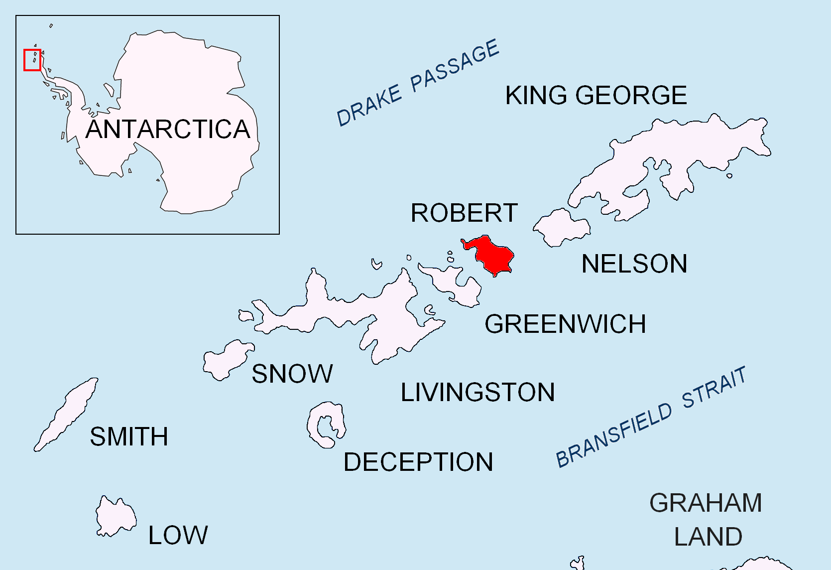
Robert Island or Mitchells Island or Polotsk Island or Roberts Island is an island long and wide, situated between Nelson Island and Greenwich Island in the South Shetland Islands, Antarctica. Robert Island is located at . Surface area . The name "Robert Island" dates back to around 1821 and is now established in international usage. Much of the Coppermine Peninsula in the west of the island is made up by a perched strandflat surface that was in past at sea level. Captain Richard Fildes may have named Robert Island for his brig . Fildes was sealing in the South Shetlands in 1821–1822 until ice destroyed his vessel in March 1822. Fildes Strait is named for him. See also * List of lighthouses in Antarctica * Clothier Harbor * Composite Antarctic Gazetteer * List of Antarctic and sub-Antarctic islands * List of Antarctic islands south of 60° S * SCAR * Territorial claims in Antarctica Seven sovereign states – Argentina, Australia, Chile, France, New Zealand, N ... [...More Info...] [...Related Items...] OR: [Wikipedia] [Google] [Baidu] |
South Shetland Islands
The South Shetland Islands are a group of Antarctic islands with a total area of . They lie about north of the Antarctic Peninsula, and between southwest of the nearest point of the South Orkney Islands. By the Antarctic Treaty of 1959, the islands' sovereignty is neither recognized nor disputed by the signatories and they are free for use by any signatory for non-military purposes. The islands have been claimed by the United Kingdom since 1908 and as part of the British Antarctic Territory since 1962. They are also claimed by the governments of Chile (since 1940, as part of the Antártica Chilena province) and Argentina (since 1943, as part of Argentine Antarctica, Tierra del Fuego Province). Several countries maintain research stations on the islands. Most of them are situated on King George Island, benefitting from the airfield of the Chilean base Eduardo Frei. There are sixteen research stations in different parts of the islands, with Chilean stations being ... [...More Info...] [...Related Items...] OR: [Wikipedia] [Google] [Baidu] |
Antarctica
Antarctica () is Earth's southernmost and least-populated continent. Situated almost entirely south of the Antarctic Circle and surrounded by the Southern Ocean, it contains the geographic South Pole. Antarctica is the fifth-largest continent, being about 40% larger than Europe, and has an area of . Most of Antarctica is covered by the Antarctic ice sheet, with an average thickness of . Antarctica is, on average, the coldest, driest, and windiest of the continents, and it has the highest average elevation. It is mainly a polar desert, with annual precipitation of over along the coast and far less inland. About 70% of the world's freshwater reserves are frozen in Antarctica, which, if melted, would raise global sea levels by almost . Antarctica holds the record for the lowest measured temperature on Earth, . The coastal regions can reach temperatures over in summer. Native species of animals include mites, nematodes, penguins, seals and tardigrades. Where vegetation o ... [...More Info...] [...Related Items...] OR: [Wikipedia] [Google] [Baidu] |
Kermen Peninsula
Kermen Peninsula ( bg, полуостров Кермен, poluostrov Kermen, ) is a 1.5-km long peninsula forming the south extremity of Robert Island, Antarctica. Bounded by Micalvi Cove to the northwest, and Bransfield Strait to the southeast. Its extremity Edwards Point is forming the east side of the south entrance to English Strait and the southwest side of the entrance to Devesil Bight. The southwest half — ca. L.L. Ivanov. Antarctica: Livingston Island and Greenwich, Robert, Snow and Smith Islands. Scale 1:120000 topographic map. Troyan: Manfred Wörner Foundation, 2010. (First edition 2009. ) — is snow-free in summer. British mapping in 1968, and Bulgarian in 2005 and 2009. Named after the town of Kermen in southeastern Bulgaria Bulgaria (; bg, България, Bǎlgariya), officially the Republic of Bulgaria,, ) is a country in Southeast Europe. It is situated on the eastern flank of the Balkans, and is bordered by Romania to the north, Serbia ... [...More Info...] [...Related Items...] OR: [Wikipedia] [Google] [Baidu] |
Edwards Point
Edwards Point is a rocky point in the south extremity of Kermen Peninsula and Robert Island in the South Shetland Islands, Antarctica. The point is a southeast entrance point of English Strait and forms the west side of the entrance to Devesil Bight and the southeast side of the entrance to Micalvi Cove. The area was visited by early 19th century sealers. The feature is named after Victor Edwards, a draughtsman in the British Admiralty Hydrographic Office during the 1930s. Location The point is located at which is 5.04 km northeast of Santa Cruz Point, Greenwich Island, 4.57 km southeast of Beron Point, and 6.14 km west-southwest of Robert Point (British mapping in 1935 and 1968, and Bulgarian in 2005 and 2009). See also * Robert Island * South Shetland Islands The South Shetland Islands are a group of Antarctic islands with a total area of . They lie about north of the Antarctic Peninsula, and between southwest of the nearest point of the Sou ... [...More Info...] [...Related Items...] OR: [Wikipedia] [Google] [Baidu] |
Zahari Point
Zahari Point (Nos Zahari \'nos za-'ha-ri\) is an ice-free point on the southwest coast of Robert Island in the South Shetland Islands, Antarctica forming the northwest side of the entrance to Micalvi Cove. Ice-free surface area .L.L. IvanovAntarctica: Livingston Island and Greenwich, Robert, Snow and Smith Islands.Scale 1:120000 topographic map. Troyan: Manfred Wörner Foundation, 2009. The feature is named after the Bulgarian writer and historiographer Zahari Stoyanov (1850–1889). Location The point is located at , which is 6.8 km southeast of Negra Point, 1.8 km east-southeast of Beron Point, and 2 km northwest of Edwards Point ( British mapping in 1968, and Bulgarian in 2005 and 2009). Map * L.L. Ivanov et al. Antarctica: Livingston Island and Greenwich Island, South Shetland Islands. Scale 1:100000 topographic map. Sofia: Antarctic Place-names Commission of Bulgaria, 2005. Notes References Zahari Point.SCAR Composite Gazetteer of Antarctica Bulga ... [...More Info...] [...Related Items...] OR: [Wikipedia] [Google] [Baidu] |
Avren Rocks
''Avren Rocks'' ( bg, Скали Аврен, Skali Avren ska-'li a-'vren) are three adjacent rocks situated in the interior of Micalvi Cove in the south extremity of Robert Island, South Shetland Islands. The group extends in north–south direction and is wide. The rocks were first mapped in 2008 by a Bulgarian team. They are named after two settlements in Varna and Kardzhali provinces situated in northeastern and southeastern Bulgaria respectively. See also * Composite Antarctic Gazetteer * List of Antarctic islands south of 60° S * SCAR * Territorial claims in Antarctica Maps * L.L. Ivanov et al., Antarctica: Livingston Island and Greenwich Island, South Shetland Islands (from English Strait to Morton Strait, with illustrations and ice-cover distribution), Scale 1: 100000 map, Antarctic Place-names Commission of Bulgaria, Ministry of Foreign Affairs, Sofia, 2005 * L.L. IvanovAntarctica: Livingston Island and Greenwich, Robert, Snow and Smith Islands.Scale 1:120000 topo ... [...More Info...] [...Related Items...] OR: [Wikipedia] [Google] [Baidu] |
Seal Hunting
Seal hunting, or sealing, is the personal or commercial hunting of seals. Seal hunting is currently practiced in ten countries: United States (above the Arctic Circle in Alaska), Canada, Namibia, Denmark (in self-governing Greenland only), Iceland, Norway, Russia, Finland and Sweden. Most of the world's seal hunting takes place in Canada and Greenland. The Canadian Department of Fisheries and Oceans (DFO) regulates the seal hunt in Canada. It sets quotas (total allowable catch – TAC), monitors the hunt, studies the seal population, works with the Canadian Sealers' Association to train sealers on new regulations, and promotes sealing through its website and spokespeople. The DFO set harvest quotas of over 90,000 seals in 2007; 275,000 in 2008; 280,000 in 2009; and 330,000 in 2010. The actual kills in recent years have been less than the quotas: 82,800 in 2007; 217,800 in 2008; 72,400 in 2009; and 67,000 in 2010. In 2007, Norway claimed that 29,000 harp seals were killed, Russ ... [...More Info...] [...Related Items...] OR: [Wikipedia] [Google] [Baidu] |
Cutter (boat)
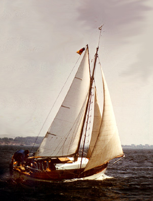
A cutter is a type of watercraft. The term has several meanings. It can apply to the rig (or sailplan) of a sailing vessel (but with regional differences in definition), to a governmental enforcement agency vessel (such as a coast guard or border force cutter), to a type of ship's boat which can be used under sail or oars, or, historically, to a type of fast-sailing vessel introduced in the 18th century, some of which were used as small warships. As a sailing rig, a cutter is a single-masted boat, with two or more headsails. On the eastern side of the Atlantic, the two headsails on a single mast is the fullest extent of the modern definition. In U.S. waters, a greater level of complexity applies, with the placement of the mast and the rigging details of the bowsprit taken into account so a boat with two headsails may be classed as a sloop. Government agencies use the term "cutter" for vessels employed in patrolling their territorial waters and other enforcement activities. Th ... [...More Info...] [...Related Items...] OR: [Wikipedia] [Google] [Baidu] |
Chilean Ship Micalvi (1925)
The ''Micalvi'' was an auxiliary vessel of the Chilean Navy. Career Built by Ostseewerft in Frauendorf, now Golęcino, as the ''Bragi'' in 1925. She was used as a merchant vessel on the Baltic Sea. In 1926 she was sold to O.A. Müller, Hamburg, and renamed ''Bostonlines''. In 1928 she was sold to the Chilean Navy and sailed from Europe with a cargo of ammunition for the battleship ''Almirante Latorre'', after arrival she was due to be broken up, but, like the ''Majestic'', she was refitted as a supply vessel for the Punta Arenas region, where she gave service to the colonists in sparsely inhabited areas, especial Tortel and Navarino Island. Chilean naval mutiny of 1931 During the Chilean naval mutiny of 1931 she was anchored in Talcahuano under the command of Lt Cdr. Pedro Espina Ritchie but the crew joined the mutiny and brought the ship into the hands of the insurrection. She was ordered to weigh anchor and sail to Lota in order to bring miners to support the rebellion ... [...More Info...] [...Related Items...] OR: [Wikipedia] [Google] [Baidu] |


