|
Mescalero Point
Mescalero Point is a -cliff-elevation point located in the central, (to beginning western), Grand Canyon, Coconino County of northern Arizona, United States. Mescalero Point is 3.6 miles from its closest highest scenic viewpoint, Yuma Point (6,654 ft), located east at Eremita Mesa, at the northeast, overlooking Central Hermit Canyon. (Hermit Canyon, with the Hermit Trail is located at the west terminus of West Rim Drive.) Mescalero Point is in a region of points, at the headwaters of canyons, and landforms below the South Rim. Jicarilla Point lies ~1.0 mile west-northwest, and Mimbreno Point lies ~0.7 miles southeast. Mescalero Point is distinctive because it has separated from the water divide between two canyons, by flat and forested, Diana Temple, which is narrow and linear, about a mile long. A saddle, about 0.1 mi long separates Mescalero Point from Diana Temple. Mescalero Point is at the headwaters of Slate Canyon, northwest, and Topaz Canyon, so ... [...More Info...] [...Related Items...] OR: [Wikipedia] [Google] [Baidu] |
Diana Temple (Grand Canyon)
Diana Temple is a summit located in the Grand Canyon, in Coconino County, Arizona, Coconino County of northern Arizona, Southwestern United States, US. It is situated nine miles northwest of Grand Canyon Village Historic District, Grand Canyon Village, and immediately northeast of Mescalero Point. Pollux Temple is one mile northwest, Marsh Butte one mile east-northeast, and Vesta Temple is one mile south. Topographic relief is significant as Diana Temple rises nearly above the Colorado River in less than two miles. Diana Temple is named for Diana (mythology), Diana, the goddess of the hunt and the moon according to Roman mythology. Clarence Dutton began the practice of naming geographical features in the Grand Canyon after mythological deities. The U.S. Geological Survey applied the name, and this geographical feature's name was officially adopted in 1908 by the U.S. Board on Geographic Names. In the early 1900s this mesa was sometimes called "No Mans Land". According to the Köp ... [...More Info...] [...Related Items...] OR: [Wikipedia] [Google] [Baidu] |
Supai Group
The Supai Group is a slope-forming section of red bed deposits found in the Colorado Plateau. The group was laid down during the Pennsylvanian to Lower Permian. Cliff-forming interbeds of sandstone are noticeable throughout the group. The Supai Group is especially exposed throughout the Grand Canyon in northwest Arizona, as well as local regions of southwest Utah, such as the Virgin River valley region. It occurs in Arizona at Chino Point, Sycamore Canyon, and famously at Sedona as parts of Oak Creek Canyon. In the Sedona region, it is overlain by the Hermit Formation, and the colorful Schnebly Hill Formation. The Supai Group is coeval with the Hermosa Group of east and south Utah; the Hermosa Group extended southeastwards from Utah to Durango, extreme southwest Colorado, and adjacent to the Hermosa type section. The Supai Group was originally designated as the Supai Formation by N.H. Darton in 1910 for exposures at Supai, Arizona. It was first raised to group stratigrap ... [...More Info...] [...Related Items...] OR: [Wikipedia] [Google] [Baidu] |
Geology Of The Grand Canyon Area
The geology of the Grand Canyon area includes one of the most complete and studied sequences of rock (geology), rock on Earth. The nearly 40 major sedimentary rock layers exposed in the Grand Canyon and in the Grand Canyon National Park area range in age from about 200 million to nearly 2 billion years old. Most were deposited in warm, shallow seas and near ancient, long-gone sea shores in western North America. Both marine and terrestrial sediments are represented, including lithified sand dunes from an extinct desert. There are at least 14 known Unconformity, unconformities in the geologic record found in the Grand Canyon. Uplift of the region started about 75 million years ago during the Laramide orogeny; a mountain-building event that is largely responsible for creating the Rocky Mountains to the east. In total, the Colorado Plateau was uplifted an estimated . The adjacent Basin and Range Province to the west started to form about 18 million years ago as th ... [...More Info...] [...Related Items...] OR: [Wikipedia] [Google] [Baidu] |
Slope-former
A slope-former is a unit of bedrock which is less resistant to erosion than overlying or underlying units and consequently results in outcrops with low relative slope angles. It may be contrasted with cliff-former. Typical slope forming lithologies include shales, and limestone Limestone ( calcium carbonate ) is a type of carbonate sedimentary rock which is the main source of the material lime. It is composed mostly of the minerals calcite and aragonite, which are different crystal forms of . Limestone forms whe ...s in humid environments. Geomorphology Erosion landforms {{geomorph-stub ... [...More Info...] [...Related Items...] OR: [Wikipedia] [Google] [Baidu] |
Cliff-former
A cliff-former is a geological unit of bedrock that is more resistant to erosion than overlying or underlying strata and consequently produces outcrops with high slope angles. It is more or less equivalent to ''ridge-former'', and may be contrasted with slope-former. In humid environments, sandstones are typically cliff-formers. In arid environments, limestones are often cliff-formers also. Recent lavas may be cliff-formers as well. In the Ridge-and-Valley Appalachians of the eastern United States the major ridge-formers are the Tuscarora Tuscarora may refer to the following: First nations and Native American people and culture * Tuscarora people **''Federal Power Commission v. Tuscarora Indian Nation'' (1960) * Tuscarora language, an Iroquoian language of the Tuscarora people * ..., Pocono, and Pottsville Formations. References {{geomorph-stub Erosion landforms Geomorphology ... [...More Info...] [...Related Items...] OR: [Wikipedia] [Google] [Baidu] |
131112-Z-WT236-003 (10855083144)
William Thomas Berry (born July 31, 1958) is an American musician who was the drummer for the alternative rock band R.E.M. Although best known for his economical drumming style, Berry also played other instruments, including guitar, bass guitar and piano, both for songwriting and on R.E.M. albums. In 1995, Berry suffered a cerebral aneurysm onstage and collapsed. After a successful recovery he left the music industry two years later to become a farmer, and has since maintained a low profile, making sporadic reunions with R.E.M. and appearing on other artists's recordings. His departure made him the only member of the band to not remain with them during their entire run. Berry eventually returned to the industry in 2022. Early years (1958–1980) William Thomas Berry was born on July 31, 1958, in Duluth, Minnesota, the fifth child of Don and Anna Berry. At the age of three, Berry moved with his family to Wauwatosa, Wisconsin, a suburb of Milwaukee, where they would remain fo ... [...More Info...] [...Related Items...] OR: [Wikipedia] [Google] [Baidu] |
Topaz Canyon
Topaz Canyon is a linear, narrow canyon in the western Grand Canyon, below the South Rim. It lies in a region of four canyons, and a fifth smaller canyon, all trending mostly northeasterly towards the west-flowing Colorado River, in western Grand Canyon National Park. The name of Topaz Canyon was named by the Board of Geographical Names for precious stones of the region. Topaz Canyon is the southeast border of the linear, and major, forested-landform, Diana Temple (Grand Canyon), Diana Temple; (Slate Canyon is Diana Temple’s northwest border).The northeast terminus of Topaz Canyon intersects with the outfall of Boucher Canyon and the tract of the Tonto Trail (west region). The Boucher Trail starting in Hermit Canyon, (just east of Eremita Mesa), ends at the termini of both Topaz and Boucher Canyons. The middle and lower regions of Topaz Canyon are in slopes and rocks of the Tonto Group. The major visible section of Topaz Canyon are the dull-greenish slope-former, slopes of the ... [...More Info...] [...Related Items...] OR: [Wikipedia] [Google] [Baidu] |
Saddle (landform)
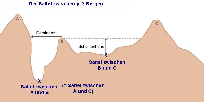
The saddle between two hills or mountains is the region surrounding the saddle point, the lowest point on the line tracing the drainage divide (the col) connecting the peaks. When, and if, the saddle is navigable, even if only on foot, the saddle of a (optimal) pass between the two massifs, is the area generally found around the lowest route on which one could pass between the two summits, which includes that point which is a mathematically when graphed a relative high along one axis, and a relative low in the perpendicular axis, simultaneously; that point being by definition the col of the saddle. Topography A saddle is the lowest area between two highlands (prominences or peaks) which has two wings which span the divide (the line between the two prominences) by crossing the divide at an angle, and, so is concurrently the local highpoint of the land surface which falls off in the lower direction. That is, the drainage divide is a ridge along the high point of the saddle, as ... [...More Info...] [...Related Items...] OR: [Wikipedia] [Google] [Baidu] |
Water Divide
A drainage divide, water divide, ridgeline, watershed, water parting or height of land is elevated terrain that separates neighboring drainage basins. On rugged land, the divide lies along topographical ridges, and may be in the form of a single range of hills or mountains, known as a dividing range. On flat terrain, especially where the ground is marshy, the divide may be difficult to discern. A triple divide is a point, often a summit, where three drainage basins meet. A ''valley floor divide'' is a low drainage divide that runs across a valley, sometimes created by deposition or stream capture. Major divides separating rivers that drain to different seas or oceans are continental divides. The term ''height of land'' is used in Canada and the United States to refer to a drainage divide. It is frequently used in border descriptions, which are set according to the "doctrine of natural boundaries". In glaciated areas it often refers to a low point on a divide where it is p ... [...More Info...] [...Related Items...] OR: [Wikipedia] [Google] [Baidu] |
Hermit Trail
The Hermit Trail is a hiking trail in Grand Canyon National Park, located in the U.S. state of Arizona. This trail provides access to a historic area of Grand Canyon and offers a more challenging route to the Colorado River for more experienced canyon hikers. Access and description The trailhead is located southwest of Hermit's Rest on the South Rim of the Grand Canyon. The trailhead is accessible by shuttle bus from Grand Canyon Village, Arizona on the Hermit Road. The road is closed to private vehicles between April and October annually but is open to all traffic other months. Two exceptions are for vehicles with government issued handicap placards and backpackers with valid permits for overnight camping in the Hermit use area. Those users can obtain the gate code by visiting the Backcountry Information Center in the park. Condition Grand Canyon National Park categorizes the Hermit Trail as a ''threshold trail'' and does not officially maintain it. The trail is rutted ... [...More Info...] [...Related Items...] OR: [Wikipedia] [Google] [Baidu] |
Scenic Viewpoint
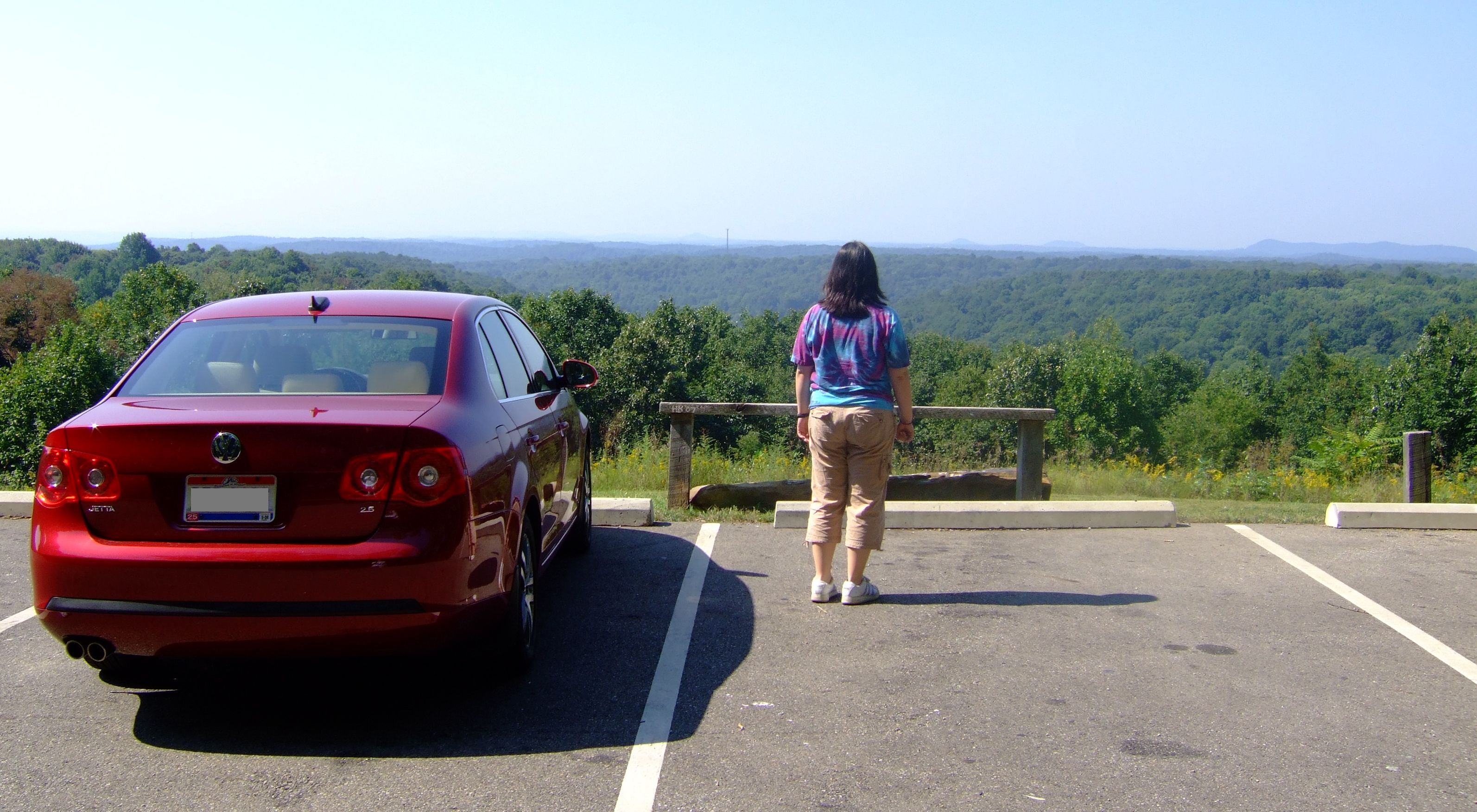
A scenic viewpoint – also called an observation point, viewpoint, viewing point, vista point, lookout, scenic overlook,These terms are more commonly used in North America. etc. – is an elevated location where people can view scenery (often with binoculars) and photograph it. Scenic viewpoints may be created alongside scenic routes or mountain roads, often as simple turnouts or lay-bys where motorists can pull over onto pavement, gravel, or grass on the right-of-way. Many viewpoints are larger, having parking areas, while some (typically on larger highways) are off the road completely. Viewing points may also be found on hill or mountain tops or on rocky spurs overlooking a valley and reached via a hiking trail. They may be protected by railings to protect the public or be enhanced by a viewing tower designed to elevate visitors above the surrounding terrain or trees in order to offer panoramic views. Overlooks are frequently found in national parks, and in the U.S. along n ... [...More Info...] [...Related Items...] OR: [Wikipedia] [Google] [Baidu] |


