|
Merzalbe
The Merzalbe, also called the Merzalb, is a stream, over long, in the Western Palatinate in the German state of Rhineland-Palatinate. It is an orographically right tributary of the Rodalb. In its upper reaches it is also called Mühlgraben. Course The Merzalbe rises in the middle of the Palatine Forest, west of the Palatine Watershed and between the two hills of the Weißenberg and the Eschkopf at a height of just under 500 metres. Its source is enclosed by the Christelbrunnen well. As it heads in a southwesterly direction the Merzalbe flows through the valley below the village of Leimen and then through Merzalben. After it empties from the right into the Rodalb near the Riegelbrunnerhof, a hamlet belonging to Münchweiler. Its waters then flow down the Schwarzbach, Blies, Saar and Moselle before finally reaching the Rhine. Name The name "Merzalbe" means "stream of the Mericho" (''Bach des Mericho'') and goes back to a Frankish settler who must have made his residen ... [...More Info...] [...Related Items...] OR: [Wikipedia] [Google] [Baidu] |
Merzalben
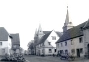
Merzalben is a municipality in Südwestpfalz district, in Rhineland-Palatinate, western Germany, deriving its name from the Merzalbe, also known as the Merzalb, that flows through the village. Along with 5 other '' Ortsgemeinden'' ("local municipalities") Merzalben belongs to the '' Verbandsgemeinde Rodalben'' ("collective municipality of Rodalben") in Südwestpfalz, wherein it is the largest in terms of physical area, but the smallest in terms of population. The municipality contains several distinct natural and cultural landmarks, with the earliest known records dating back to 1237. It was also considered a state-approved tourist resort (German: '' Fremdenverkehrsort'') before the title was dropped in Rhineland Palatinate in 2016 and all communities awarded the designation were barred from its use in 2020. Geography Location The town is located in the Palatinate Forest (German: ''Pfälzerwald''), primarily within its sub-area Gräfenstein Land, with only the northeast po ... [...More Info...] [...Related Items...] OR: [Wikipedia] [Google] [Baidu] |
Gräfenstein Castle
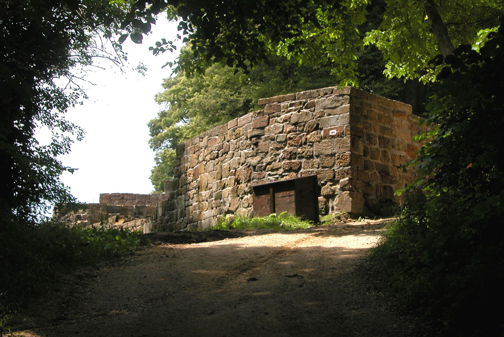
Gräfenstein Castle (german: Burg Gräfenstein) is a ruined rock castle about east of the village of Merzalben in the German state of Rhineland-Palatinate. It is in the county of Südwestpfalz within the Palatine Forest and is often called ''Merzalber Schloss'' ("Merzalben Castle"). It is built on a rock plateau high at an elevation of above sea level. History Gräfenstein Castle was built by the Saarbrücken counts, who had lost their fortress and were in need of a new one. Evidence for the exact date of the castle's building does not exist although the earliest record dates to a 1237 deed of partition by the counts of Leiningen. But from the castle's design and materials it can be deduced that it was built sometime between 1150 and 1200. Another clue is in the date of the restoration of the stone fortress, which took place in 1168, and coincides with first construction work on Gräfenstein Castle. The central element of the site, with its ''bergfried'' and ''palas'' proba ... [...More Info...] [...Related Items...] OR: [Wikipedia] [Google] [Baidu] |
Weißenberg (Frankenweide)
The Weißenberg in the Palatine Forest is a hill in the municipality of Merzalben (Südwestpfalz county, Rhineland-Pfalz). Its height is variously give as Landesamt für Vermessung und Geobasisinformation Rheinland-Pfalz, Koblenz, reference dated 19 September 2011, extract of discussion article or .Landesamt für Vermessung und Geobasisinformation Rheinland-Pfalz, Koblenz, enquiry dated 22 July 2010 The higher value has been officially recommended since 2011. That makes the Weißenberg the highest point in the west of the mountain range, ahead of the Eschkopf and Mosisberg (each ). As part of the Palatine Forest-North Vosges Biosphere Reserve it is protected by special conservation measures. Geography Location The Weißenberg lies in the central Palatine Forest in the Palatine Forest Nature Park. It rises about 6.5 kilometres east-northeast of Merzalben and eight kilometres north of Hauenstein (Palatinate), Hauenstein near the Wilgartswiesen hamlet of Hermersbergerhof. It ... [...More Info...] [...Related Items...] OR: [Wikipedia] [Google] [Baidu] |
Rodalb
The Rodalb, also called the Rodalbe, is a stream, just under long, in West Palatinate in the German state of Rhineland-Palatinate. It is an orographically left tributary of the Schwarzbach. Course The Rodalb rises in the southwestern Palatinate Forest, south of the town of Pirmasens near the hamlet of at a height of about 380 metres above sea level. To begin with it flows northeast, passing the villages of Lemberg and Ruppertsweiler. It then swings north, accompanies the B 10 federal highway, 2 kilometres away, and flows through Münchweiler. At Riegelbrunnerhof (a district of Münchweiler), it picks up the waters of the Merzalbe, its largest tributary, from the right and changes direction once again to head northwest, passing through the little town of Rodalben. Near the hamlet of it discharges into the Schwarzbach from the left. Sights * Lemberg Castle, built around 1200, in ruins since 1689 * Rodalben Rock Trail with a length - depending on the source – of 4 ... [...More Info...] [...Related Items...] OR: [Wikipedia] [Google] [Baidu] |
List Of Rivers Of Rhineland-Palatinate
A list of rivers of Rhineland-Palatinate, Germany: A * Aar * Adenauer Bach *Ahr * Alf * Alfbach *Appelbach *Asdorf * Aubach B * Birzenbach *Blattbach * Breitenbach * Brexbach * Brohlbach, tributary of the Moselle * Brohlbach, tributary of the Rhine D * Daade * Dernbach E * Eckbach * Eisbach, tributary of the Queich * Eisbach, tributary of the Rhine *Elbbach * Ellerbach, tributary of the Moselle * Ellerbach, tributary of the Nahe *Elzbach * Engelsbach *Enz * Erlenbach, tributary of the Lauter * Erlenbach, tributary of the Michelsbach * Erlenbach, tributary of the Speyerbach * Eußerbach F *Feller Bach * Floßbach * Fockenbach G * Glan * Gillenbach * Gosenbach * Großbach, tributary of the Nahe * Großbach, tributary of the Ruwer * Gutenbach H * Hainbach * Heimersheimer Bach * Heller * Helmbach * Hochspeyerbach * Holperbach *Holzbach *Horn I * Irserbach * Isenach K * Little Kyll * Klingbach * Kyll L *Lahn *Lambsbach * Langbach *Langendernbach *Lasterbach *Laubach *Lauter *L ... [...More Info...] [...Related Items...] OR: [Wikipedia] [Google] [Baidu] |
German Shoe Road
The German Shoe Road (german: Deutsche Schuhstraße) is one of several tourist-oriented, themed routes in southern Rheinhessen and in the West Palatinate in the German state of Rhineland-Palatinate. It is a circular route of more than 300 km largely running within the Palatine Forest-North Vosges Biosphere Reserve often on scenic secondary roads. Route The German Shoe Road includes the following way stations: Alzey, Wendelsheim, Nack, Bechenheim, Nieder-Wiesen, Kriegsfeld, Unterthierwasen, Bastenhaus-Dannenfels, Marienthal, Falkenstein, Enkenbach-Alsenborn, Hochspeyer, Johanniskreuz, Hauenstein, Dahn, Busenberg, Fischbach, Eppenbrunn, Trulben, Pirmasens, Walshausen, Rieschweiler-Mühlbach, Wallhalben, Mittelbrunn, Landstuhl, Miesenbach, Altenglan, Aschbach, Lauterecken, Meisenheim, Fürfeld, Wonsheim, Wendelsheim, Alzey Near Pirmasens the German Shoe Road divides into various branches that link e.g. Rodalben and Waldfischbach-Burgalben as well as Lemberg. Hi ... [...More Info...] [...Related Items...] OR: [Wikipedia] [Google] [Baidu] |
Ritterstein
A Ritterstein ("Ritter Stone") is the German name given to markers made of sandstone erected at sites of historic or natural interest in the Palatine Forest, a range of low mountains in the German state of Rhineland-Palatinate. In some cases, glacial erratics were used, in others, rocks or walls at the site were used on which to carve the information. The stones are typically inscribed with their name, a suitable symbol, the date they were erected, their height above sea level and the initials PWV for the ''Pfälzerwald-Verein'' or Palatine Forest Club, who set up and look after the stones. They are named after chief forester, Karl Albrecht von Ritter (died 1917), the founding chairman of the PWV, who initiated the system in the early 20th century. References Literature * * * External links * {{coord missing, Germany Palatinate Forest Monuments and memorials in Germany ... [...More Info...] [...Related Items...] OR: [Wikipedia] [Google] [Baidu] |
Rodalben
Rodalben () is a municipality in the Südwestpfalz district, in Rhineland-Palatinate, Germany. It is situated in the Palatinate forest, approx. 5 km northeast of Pirmasens. Rodalben is the seat of the ''Verbandsgemeinde'' ("collective municipality") Rodalben. Having a population above 7000 it is the largest local authority district. History Rodalben was founded by a Celtic tribe. In 1237 Rodalben was first mentioned as a "Meyerhof". Over the centuries mainly farmers lived there. The origin of the name isn't clarified. The suffix "alb (alben)" is a Celtic word for rivers or brooks. Modern era Before the Thirty Years' War 150 people lived in the ''Amt'' of Gräfenstein. by 1680, around 30 years after the war, the ''Amt'' had 30 families or inhabitants. Around 50 years later, in 1698, there were 50, of which 20 lived in Rodalben. The village grew steadily and was given greater importance by the transfer of the administration of the Gräfenstein ''Amt'' to Rodalben. Arou ... [...More Info...] [...Related Items...] OR: [Wikipedia] [Google] [Baidu] |
Thaleischweiler-Fröschen
Thaleischweiler-Fröschen is a municipality in the Südwestpfalz district, in Rhineland-Palatinate, Germany. It is situated on the western edge of the Palatinate forest, approximately north of Pirmasens. Thaleischweiler-Fröschen is the seat of the ''Verbandsgemeinde'' ("collective municipality") Thaleischweiler-Wallhalben Thaleischweiler-Wallhalben is a ''Verbandsgemeinde'' ("collective municipality") in the Südwestpfalz district, in Rhineland-Palatinate, Germany Germany,, officially the Federal Republic of Germany, is a country in Central Europe. It .... References Palatinate Forest Südwestpfalz {{Südwestpfalz-geo-stub ... [...More Info...] [...Related Items...] OR: [Wikipedia] [Google] [Baidu] |
Bergfried
''Bergfried'' (plural: ''bergfriede''; English: ''belfry''; French: ''tour-beffroi''; Spanish: ''torre del homenaje'') is a tall tower that is typically found in castles of the Middle Ages in German-speaking countries and in countries under German influence. Friar describes it as a "free-standing, fighting-tower".Friar (2003), p 36. Its defensive function is to some extent similar to that of a keep (also known as a ''donjon'') in English or French castles. However, the characteristic difference between a bergfried and a keep is that a bergfried was typically not designed for permanent habitation. Overview The living quarters of a castle with a bergfried are separate, often in a lower tower or an adjacent building called a ''palas'' (an English-style keep combines both functions of habitation and defence.) Consequently, a bergfried could be built as a tall slender tower with little internal room, few vaults and few if any windows. The bergfried served as a watchtower and as a ref ... [...More Info...] [...Related Items...] OR: [Wikipedia] [Google] [Baidu] |
Hohenstaufen
The Hohenstaufen dynasty (, , ), also known as the Staufer, was a noble family of unclear origin that rose to rule the Duchy of Swabia from 1079, and to royal rule in the Holy Roman Empire during the Middle Ages from 1138 until 1254. The dynasty's most prominent rulers – Frederick I (1155), Henry VI (1191) and Frederick II (1220) – ascended the imperial throne and also reigned over Italy and Burgundy. The non-contemporary name of 'Hohenstaufen' is derived from the family's Hohenstaufen Castle on the Hohenstaufen mountain at the northern fringes of the Swabian Jura, near the town of Göppingen. Under Hohenstaufen rule, the Holy Roman Empire reached its greatest territorial extent from 1155 to 1268. Name The name Hohenstaufen was first used in the 14th century to distinguish the 'high' (''hohen'') conical hill named Staufen in the Swabian Jura (in the district of Göppingen) from the village of the same name in the valley below. The new name was only applied to the hill ... [...More Info...] [...Related Items...] OR: [Wikipedia] [Google] [Baidu] |


