|
Melrose, Montana
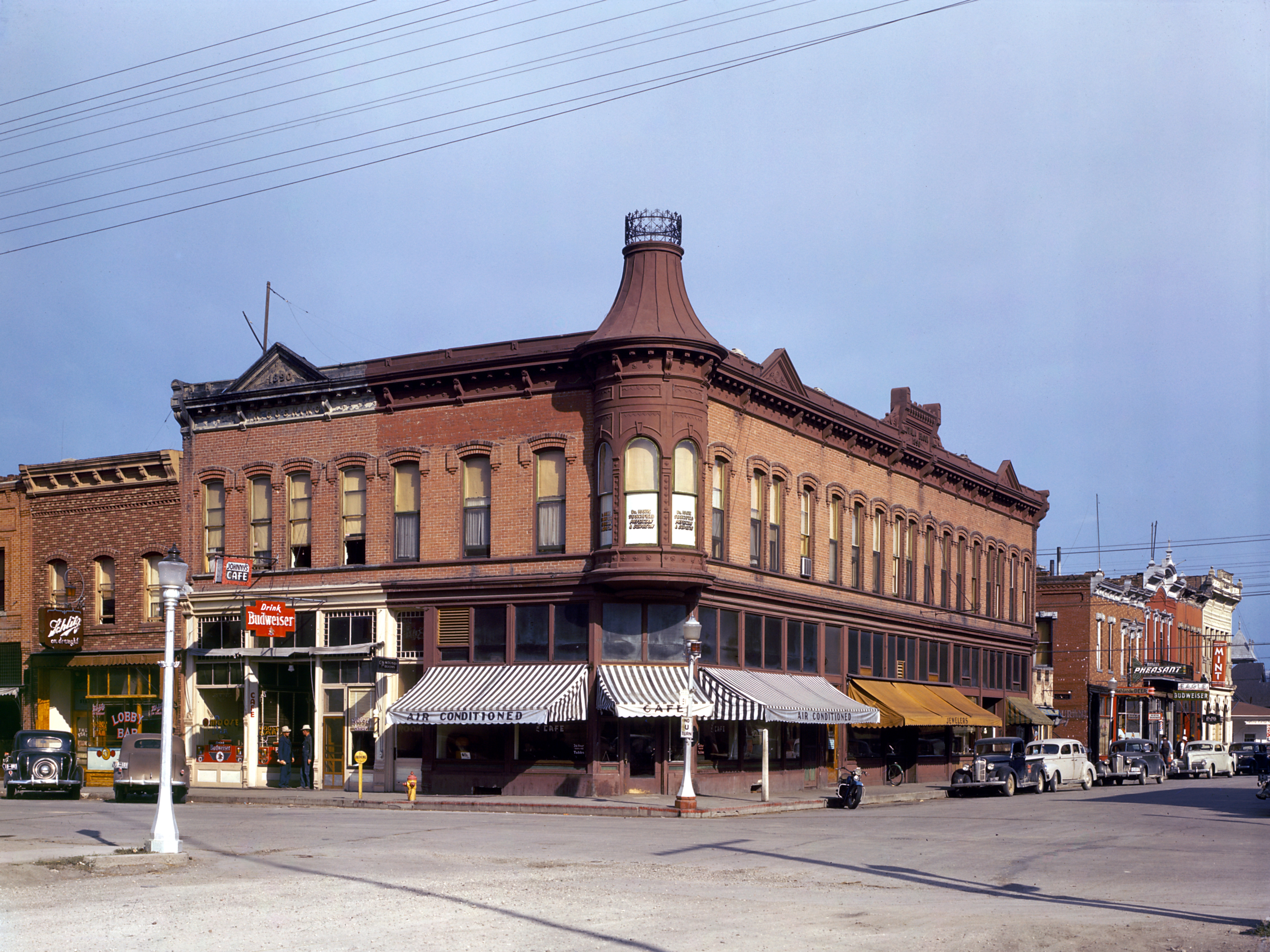
Melrose is a small community in Silver Bow County, Montana, United States. It is south of Butte, Montana, Butte and about north of Dillon, Montana, Dillon. The zip code is 59743. It was established in 1881 at the junction of the road from Corinne, Utah, and the smelter at Hecla, Montana, Glendale. Situated on a scenic stretch of the Big Hole River, Melrose today is famous for trout fishing. It is located in the Beaverhead–Deerlodge National Forest. Climate According to the Köppen Climate Classification system, Melrose has a semi-arid climate, abbreviated "BSk" on climate maps. References * https://web.archive.org/web/20110128195601/http://melrosemontana.com/ * {{authority control Populated places in Silver Bow County, Montana Neighborhoods in Montana Ghost towns in Montana ... [...More Info...] [...Related Items...] OR: [Wikipedia] [Google] [Baidu] |
Silver Bow County, Montana
Silver Bow County is a county in the U.S. state of Montana. As of the 2020 census, the population was 35,133. Its county seat is Butte. In 1977, the city and county governments consolidated to form the single entity of Butte-Silver Bow. Additionally, the town of Walkerville is a separate municipality from Butte and is within the county. Silver Bow County comprises the Butte-Silver Bow, MT Micropolitan Statistical Area. Geography According to the United States Census Bureau, the county has an area of , of which is land and (0.08%) is water. It is Montana's smallest county by area. Major highways * Interstate 15 * Interstate 90 * Interstate 115 * U.S. Highway 10 (Former) * U.S. Highway 91 (Former) * Montana Highway 2 * Montana Highway 41 * Montana Highway 43 * Montana Highway 55 Transit * Jefferson Lines * Salt Lake Express Adjacent counties * Deer Lodge County - northwest * Jefferson County - east * Madison County - south * Beaverhead County - so ... [...More Info...] [...Related Items...] OR: [Wikipedia] [Google] [Baidu] |
Butte, Montana
Butte ( ) is a consolidated city-county and the county seat of Silver Bow County, Montana, United States. In 1977, the city and county governments consolidated to form the sole entity of Butte-Silver Bow. The city covers , and, according to the 2020 United States Census, 2020 census, has a population of 34,494, making it Montana's List of municipalities in Montana, fifth-largest city. It is served by Bert Mooney Airport with airport code BTM. Established in 1864 as a mining camp in the northern Rocky Mountains on the Continental Divide of the Americas, Continental Divide, Butte experienced rapid development in the late 19th century, and was Montana's first major industrial city. In its heyday between the late 19th and early 20th centuries, it was one of the largest copper boomtown, boom towns in the American West. Employment opportunities in the mines attracted surges of Asian and European immigrants, particularly the Irish people, Irish; as of 2017, Butte has the largest populati ... [...More Info...] [...Related Items...] OR: [Wikipedia] [Google] [Baidu] |
Dillon, Montana
Dillon is a city in and the county seat of Beaverhead County, Montana, Beaverhead County, Montana, United States. The population was 3,880 at the 2020 United States census, 2020 census. The city was named for Sidney Dillon (1812–1892), president of Union Pacific Railroad. History Dillon was founded in the Beaverhead River, Beaverhead Valley as a railroad town in 1880. Originally named “Terminus” as it was temporarily the northernmost stop on the Utah and Northern Railway while it was under construction, in 1881, the community was renamed for Union Pacific Railroad President Sidney Dillon, who had directed the project of bringing the railroad through to Butte, Montana. The town's location was selected by the railroad in part because of its proximity to gold mining, gold mines in the area. The first ore discovered in the Dillon area was silver. Gold was first discovered at Grasshopper Creek in 1862, precipitating a flood of immigration to the area. The last real gold rush ... [...More Info...] [...Related Items...] OR: [Wikipedia] [Google] [Baidu] |
Corinne, Utah
} Corinne ( ) is a city in Box Elder County, Utah, United States. The population was 809 at the 2020 census, up from the 2010 figure of 685. History For almost ten years from its founding on 25 March 1869, the town of Corinne prospered as the unofficial " Gentile Capital of Utah". As the Union Pacific and Central Pacific railroads approached their historic meeting place at Promontory Summit early in 1869, a group of former Union Army officers and some determined non-Mormon merchants from Salt Lake City decided to locate a Gentile town on the Union Pacific line, believing that the town could compete economically and politically with the Saints of Utah. They chose a location about six miles west of Brigham City on the west bank of the Bear River where the railroad crossed that stream. Named by one of the founders ( General J. A. Williamson) for his fourteen-year-old daughter, Corinne was designed to be the freight-transfer point for the shipment of goods and supplies to t ... [...More Info...] [...Related Items...] OR: [Wikipedia] [Google] [Baidu] |
Hecla, Montana
Hecla was a town in Beaverhead County, Montana, United States. It has been designated as a ghost town A ghost town, deserted city, extinct town, or abandoned city is an abandoned settlement, usually one that contains substantial visible remaining buildings and infrastructure such as roads. A town often becomes a ghost town because the economi ..., with only a few ruined buildings remaining. It was notable at one time as the home of Blanche Lamont, who taught at Hecla's one-room schoolhouse. Lamont would become the first of two murder victims of Theodore Durrant. Margaret Brown also lived there for a time. The Hecla Mining District was "on the side of Lion Mountain, and was also referred to as the Glendale and/or Bryant Mining District, which was strung out along ten miles of gulches, the four towns included Trapper City, Lion City, Glendale, and Hecla." In 1881, the Hecla Company reorganized and came under the direction of Henry Knippenberg. Shortly after he assumed c ... [...More Info...] [...Related Items...] OR: [Wikipedia] [Google] [Baidu] |
Big Hole River
The Big Hole River is a tributary of the Jefferson River, approximately 153 miles (246 km) long, in Beaverhead County, Montana, Beaverhead County, in southwestern Montana, United States. It is the last habitat in the contiguous United States for native Fluvial processes, fluvial Arctic grayling and is a historically popular destination for fly fishing, especially for trout. History At the time the Lewis and Clark Expedition traveled through the Big Hole River watershed, it was a buffer zone between several rival Native American tribes including the Nez Perce, Nez Percé, Shoshone, Coast Salish, and Blackfoot Confederacy, Blackfeet. Lewis and Clark considered navigating up the Big Hole River, but chose the slower-flowing Beaverhead River instead. Trappers from both the Hudson's Bay Company, the North West Company and the American Fur Company exploited the region from about 1810 to the 1840s. Miners and homesteaders settled the area between 1864 and the early 190 ... [...More Info...] [...Related Items...] OR: [Wikipedia] [Google] [Baidu] |
Beaverhead–Deerlodge National Forest
The Beaverhead–Deerlodge National Forest is the largest of the National Forests in Montana, United States. Covering , the forest is broken into nine separate sections and stretches across eight counties in the southwestern area of the state. President Theodore Roosevelt named the two forests in 1908 and they were merged in 1996. Forest headquarters are located in Dillon, Montana. In Roosevelt's original legislation, the Deerlodge National Forest was called the Big Hole Forest Reserve. He created this reserve because the Anaconda Copper Mining Company, based in Butte, Montana, had begun to clearcut the upper Big Hole River watershed. The subsequent erosion, exacerbated by smoke pollution from the Anaconda smelter, was devastating the region. Ranchers and conservationists alike complained to Roosevelt, who made several trips to the area. (Munday 2001) The greatest part of the Anaconda-Pintler Wilderness is located in the larger Beaverhead National Forest portion of , which ... [...More Info...] [...Related Items...] OR: [Wikipedia] [Google] [Baidu] |
Köppen Climate Classification
The Köppen climate classification divides Earth climates into five main climate groups, with each group being divided based on patterns of seasonal precipitation and temperature. The five main groups are ''A'' (tropical), ''B'' (arid), ''C'' (temperate), ''D'' (continental), and ''E'' (polar). Each group and subgroup is represented by a letter. All climates are assigned a main group (the first letter). All climates except for those in the ''E'' group are assigned a seasonal precipitation subgroup (the second letter). For example, ''Af'' indicates a tropical rainforest climate. The system assigns a temperature subgroup for all groups other than those in the ''A'' group, indicated by the third letter for climates in ''B'', ''C'', ''D'', and the second letter for climates in ''E''. Other examples include: ''Cfb'' indicating an oceanic climate with warm summers as indicated by the ending ''b.'', while ''Dwb'' indicates a semi-Monsoon continental climate, monsoonal continental climate ... [...More Info...] [...Related Items...] OR: [Wikipedia] [Google] [Baidu] |
Semi-arid Climate
A semi-arid climate, semi-desert climate, or steppe climate is a dry climate sub-type. It is located on regions that receive precipitation below potential evapotranspiration, but not as low as a desert climate. There are different kinds of semi-arid climates, depending on variables such as temperature, and they give rise to different biomes. Defining attributes of semi-arid climates A more precise definition is given by the Köppen climate classification, which treats steppe climates (''BSh'' and ''BSk'') as intermediates between desert climates (BW) and humid climates (A, C, D) in ecological characteristics and agricultural potential. Semi-arid climates tend to support short, thorny or scrubby vegetation and are usually dominated by either grasses or shrubs as they usually cannot support forests. To determine if a location has a semi-arid climate, the precipitation threshold must first be determined. The method used to find the precipitation threshold (in millimeters): * ... [...More Info...] [...Related Items...] OR: [Wikipedia] [Google] [Baidu] |
Populated Places In Silver Bow County, Montana
Population is a set of humans or other organisms in a given region or area. Governments conduct a census to quantify the resident population size within a given jurisdiction. The term is also applied to non-human animals, microorganisms, and plants, and has specific uses within such fields as ecology and genetics. Etymology The word ''population'' is derived from the Late Latin ''populatio'' (a people, a multitude), which itself is derived from the Latin word ''populus'' (a people). Use of the term Social sciences In sociology and population geography, population refers to a group of human beings with some predefined feature in common, such as location, race, ethnicity, nationality, or religion. Ecology In ecology, a population is a group of organisms of the same species which inhabit the same geographical area and are capable of interbreeding. The area of a sexual population is the area where interbreeding is possible between any opposite-sex pair within the ... [...More Info...] [...Related Items...] OR: [Wikipedia] [Google] [Baidu] |
Neighborhoods In Montana
A neighbourhood (Commonwealth English) or neighborhood (American English) is a geographically localized community within a larger town, city, suburb or rural area, sometimes consisting of a single street and the buildings lining it. Neighbourhoods are often social communities with considerable face-to-face interaction among members. Researchers have not agreed on an exact definition, but the following may serve as a starting point: "Neighbourhood is generally defined spatially as a specific geographic area and functionally as a set of social networks. Neighbourhoods, then, are the spatial units in which face-to-face social interactions occur—the personal settings and situations where residents seek to realise common values, socialise youth, and maintain effective social control." Preindustrial cities In the words of the urban scholar Lewis Mumford, "Neighborhoods, in some annoying, inchoate fashion exist wherever human beings congregate, in permanent family dwellings; and ma ... [...More Info...] [...Related Items...] OR: [Wikipedia] [Google] [Baidu] |


