|
Mayor Buenaventura Vivas Airport
Mayor Buenaventura Vivas Airport , is an airport serving Santo Domingo in the Táchira state of Venezuela. The runway is just southwest of the town. The Santo Domingo VORTAC (Ident: STD) is located in the town. Airlines and destinations See also *Transport in Venezuela *List of airports in Venezuela Venezuela, officially known as the Bolivarian Republic of Venezuela ( es, República Bolivariana de Venezuela), is a country on the northern coast of South America. It is a continental mainland with numerous islands located off its coastline in th ... References External linksSkyVector - Santo Domingo [...More Info...] [...Related Items...] OR: [Wikipedia] [Google] [Baidu] |
Santo Domingo, Táchira
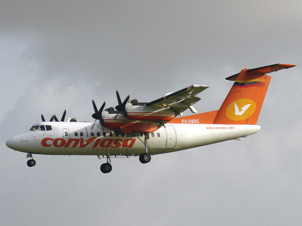
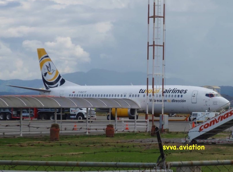
Santo Domingo, alternatively known as Santo Domingo del Táchira, is a city in Venezuela, located in Táchira. Climate Santo Domingo experiences a tropical rainforest climate (Köppen: ''Af''). The city's climate is characterized by consistently warm temperatures throughout the year and abundant precipitation, particularly during the wet season, which lasts from April to November. Transportation Santo Domingo is served by Mayor Buenaventura Vivas Airport, which is features limited domestic service on two airlines, Conviasa Línea Aérea Conviasa (legally ''Consorcio Venezolano de Industrias Aeronáuticas y Servicios Aéreos'') is a Venezuelan airline with its headquarters on the grounds of Simón Bolívar International Airport in Maiquetía, Venezuela, near Carac ... and Aerolineas Estelar. It is located 13.3km (22 minutes by car) away from the center of Santo Domingo. References {{Venezuela-stub, date=February 2017 Cities in Táchira ... [...More Info...] [...Related Items...] OR: [Wikipedia] [Google] [Baidu] |
Venezuela
Venezuela (; ), officially the Bolivarian Republic of Venezuela ( es, link=no, República Bolivariana de Venezuela), is a country on the northern coast of South America, consisting of a continental landmass and many islands and islets in the Caribbean Sea. It has a territorial extension of , and its population was estimated at 29 million in 2022. The capital and largest urban agglomeration is the city of Caracas. The continental territory is bordered on the north by the Caribbean Sea and the Atlantic Ocean, on the west by Colombia, Brazil on the south, Trinidad and Tobago to the north-east and on the east by Guyana. The Venezuelan government maintains a claim against Guyana to Guayana Esequiba. Venezuela is a federal presidential republic consisting of 23 states, the Capital District and federal dependencies covering Venezuela's offshore islands. Venezuela is among the most urbanized countries in Latin America; the vast majority of Venezuelans live in the cities of the n ... [...More Info...] [...Related Items...] OR: [Wikipedia] [Google] [Baidu] |
Táchira
Táchira State ( es, Estado Táchira, ) is one of the 24 states of Venezuela. The state capital is San Cristóbal. Táchira State covers a total surface area of and as of the 2011 census, had a population of 1,168,908. At the end of the 19th century, Táchira State was where oil was discovered in Venezuela. Currently, its main economic revenues come from the production of coffee and pineapple. The cattle and agricultural activities play an important role in Táchira's economy. There is also a strong industrial sector which focuses on the processing of potato, sugar, milk, and cheese and the production of textiles. Táchira State is one of the three Venezuelan Andean states (the other two are Mérida and Trujillo). This state borders Zulia State to the north, Barinas and Mérida States to the east, Apure and Barinas States to the south, and Colombia (Norte de Santander Department) to the west. Etymology Possible origins have been identified for the word Táchira, so one ... [...More Info...] [...Related Items...] OR: [Wikipedia] [Google] [Baidu] |
VORTAC
Very high frequency omnirange station (VOR) is a type of short-range radio navigation system for aircraft, enabling aircraft with a receiving unit to determine its position and stay on course by receiving radio signals transmitted by a network of fixed ground radio beacons. It uses frequencies in the very high frequency (VHF) band from 108.00 to 117.95 MHz. Developed in the United States beginning in 1937 and deployed by 1946, VOR became the standard air navigational system in the world,VOR VHF omnidirectional Range , Aviation Tutorial – Radio Navaids, kispo.net used by both commercial and general aviation, until supplanted by satellite navigation systems such as in th ... [...More Info...] [...Related Items...] OR: [Wikipedia] [Google] [Baidu] |
Simón Bolívar International Airport (Venezuela)
Maiquetía "Simón Bolívar" International Airport (, es, link=no, Aeropuerto Internacional de Maiquetía "Simón Bolívar") is an international airport located in Maiquetía, Vargas, Venezuela, about west of downtown Caracas, the capital of the country. Simply called by the local population, it is the main international air passenger gateway to Venezuela. It handles flights to destinations in the Americas, Europe and the Middle East. History The airport opened in 1945 as the . The site had been recommended as an appropriate location for an airport by Charles Lindbergh on behalf of Pan Am. The USA subsidised the construction of the airport as part of the Airport Development Program. Luis Malaussena was the architect who designed the original passenger terminal. It was regularly visited by the Anglo-French supersonic airliner Concorde until the 1980s. Commencing in the late 1970s, Air France operated weekly Concorde service between Caracas and Paris via a stop at Santa Ma ... [...More Info...] [...Related Items...] OR: [Wikipedia] [Google] [Baidu] |
Conviasa
Línea Aérea Conviasa (legally ''Consorcio Venezolano de Industrias Aeronáuticas y Servicios Aéreos'') is a Venezuelan airline with its headquarters on the grounds of Simón Bolívar International Airport in Maiquetía, Venezuela, near Caracas. It is the flag carrier and largest airline of Venezuela, operating services to domestic destinations and to destinations in the Caribbean and South America. History Early years In January 1997, Venezuela's former flag carrier, Viasa, ceased operations after 37 years of service due to prolonged financial problems. In May 2001, the idea to create a new flag carrier for Venezuela was proposed, but in December 2002, the project was put on hold until October 1, 2003. On March 31, 2004, then President of Venezuela, Hugo Chávez, signed a decree that formally established the airline. This decree was published in the nation's official gazette the next day. On November 28, 2004, Conviasa's inaugural flight was made with a De Havilland Canada ... [...More Info...] [...Related Items...] OR: [Wikipedia] [Google] [Baidu] |
Santiago Mariño Caribbean International Airport
Santiago Mariño Caribbean International Airport ( es, Aeropuerto Internacional del Caribe "Santiago Mariño", ) is an airport west-southwest of Porlamar, the largest city on Isla Margarita, an island in the state of Nueva Esparta in Venezuela. Facilities The airport has one terminal, which is divided into international and domestic sections. Airlines and destinations Passenger Past international service According to the Official Airline Guide (OAG), the airport had scheduled passenger airline service from Europe and the U.S. during the early 1990s including nonstop flights from Frankfurt, London, Miami, Milan and New York City operated by VIASA.Oct. 1, 1993 OAG Desktop Flight Guide, Worldwide Edition Additionally, several European and Canadian carriers, such as Condor, LTU (merged with Air Berlin in 2009), TUI Airways, TUI fly Netherlands, TUI fly Nordic, Martinair, Air Canada, and Air Transat, among others, had seasonal and charter services to Porlamar in the 1990s and 20 ... [...More Info...] [...Related Items...] OR: [Wikipedia] [Google] [Baidu] |
RUTACA Airlines
RUTACA Airlines (legally ''Rutas Aéreas C.A.'') is an airline headquartered in Ciudad Bolívar, Venezuela with its home base at Tomás de Heres Airport and a hub at Simón Bolívar International Airport in Caracas. History RUTACA Airlines was founded by Evard Mares Bianchi on February 6, 1974, and began operating non-scheduled cargo and passenger flights with small aircraft. It currently operates scheduled and charter services throughout the country. The airline's operations suffered gravely during the 2017 Venezuelan constitutional crisis, including suspending flights between key routes. Destinations , RUTACA Airlines serves the following destinations: Fleet Current fleet The RUTACA Airlines fleet includes the following aircraft (as of December 2022): Former fleet RUTACA Airlines formerly operated the following aircraft: *6 Antonov An-2TP *1 Beechcraft C-45 Expeditor *1 Britten-Norman BN-2 Islander *17 Cessna 206 *1 Cessna 207 *4 Cessna 208B Grand Caravan *1 Con ... [...More Info...] [...Related Items...] OR: [Wikipedia] [Google] [Baidu] |
Turpial Airlines
Turpial Airlines C.A. is a Venezuelan airline that has its hub at Arturo Michelena International Airport in Valencia, Venezuela. This airline has a fleet of 3 Boeing 737-400 authorized to operate regular and non-regular flights of passengers, cargo and mails within the nation, as well as internationally. History Turpial Airlines was founded on March 15, 2016, beginning its operations on April 7, 2017 with national routes that include Valencia, Maracaibo and Porlamar, additionally with Panama City Panama City ( es, Ciudad de Panamá, links=no; ), also known as Panama (or Panamá in Spanish), is the capital and largest city of Panama. It has an urban population of 880,691, with over 1.5 million in its metropolitan area. The city is locat ... being its first international destination. Destinations , Turpial operates services to the following destinations: Fleet Turpial Airlines includes the following aircraft as of January 2021: See also * List of airlines of Vene ... [...More Info...] [...Related Items...] OR: [Wikipedia] [Google] [Baidu] |
Arturo Michelena International Airport
Arturo Michelena International Airport is an airport serving the city of Valencia in Venezuela. The airport was named after artist Arturo Michelena, who was born in Valencia. It is a hub for Turpial Airlines and a secondary hub for Avior Airlines. Airlines and destinations See also *Transport in Venezuela *List of airports in Venezuela Venezuela, officially known as the Bolivarian Republic of Venezuela ( es, República Bolivariana de Venezuela), is a country on the northern coast of South America. It is a continental mainland with numerous islands located off its coastline in th ... References External links OurAirports - Valencia Airports in Venezuela [...More Info...] [...Related Items...] OR: [Wikipedia] [Google] [Baidu] |
Transport In Venezuela
Transport in Venezuela revolves around a system of highways and airports. Venezuela is connected to the world primarily via air ( Venezuela's airports include the Simón Bolívar International Airport near Caracas and La Chinita International Airport near Maracaibo) and sea (with major seaports at La Guaira, Maracaibo and Puerto Cabello). In the south and east the Amazon rainforest region has limited cross-border transport; in the west, there is a mountainous border of over shared with Colombia. The Orinoco River is navigable by oceangoing vessels up to 400 km inland, and connects the major industrial city of Ciudad Guayana to the Atlantic Ocean. Venezuela has a limited national railway system, which has no active rail connections to other countries. Several major cities have metro systems; the Caracas Metro has been operating since 1983. The Maracaibo Metro and Valencia Metro were opened more recently. Venezuela has a road network of around 100,000 km (placing it aro ... [...More Info...] [...Related Items...] OR: [Wikipedia] [Google] [Baidu] |


