|
Mayburgh Henge
Mayburgh Henge is a large prehistoric monument in the county of Cumbria in northern England. The henge is in the care of English Heritage and is a Scheduled Ancient Monument. It is 400 metres from King Arthur's Round Table Henge. Location The Ordnance Survey grid reference for Mayburgh Henge is . The henge is situated on a knoll just outside the village of Eamont Bridge close to the confluence of the Rivers Eamont and Lowther around 1 mile south of Penrith, just a few hundred yards from the M6 motorway. The henge sites are "to be seen as components in a landscape dominated by steep sided valleys and fast flowing streams...focused on a spring which lay between Mayburgh and King Arthur's Round Table, and which connected them to the River Eamont...on the other side of the Eamont are two less well known burial mounds." (The presence of the spring was noted by William Stukeley). The main communication routes of the time – "from Shap, from the Upper Eden, and down the Pet ... [...More Info...] [...Related Items...] OR: [Wikipedia] [Google] [Baidu] |
Eamont Bridge
Eamont Bridge is a small village immediately to the south of Penrith, Cumbria, England. The village is named after the bridge over the River Eamont and straddles the boundary between the historic counties of Cumberland and Westmorland. One of the houses in the village is called the "Welcome Inn" and was at one time the "Welcome into Cumberland Inn". Features There are two ancient sites in the village, namely the earthwork known as King Arthur's Round Table and the much better preserved Mayburgh Henge which is situated between the rivers Lowther and Eamont. Mayburgh Henge was built using stones from one or both rivers. The location between the rivers was probably important when it was built 3000 or 4000 years ago, which protected it from invasion. Both sites are under the protection of Historic England. There was another henge close to King Arthur's Round Table, which is now obliterated. A cup was reputed to have been found at the centre of the King Arthur's Round Table Henge. ... [...More Info...] [...Related Items...] OR: [Wikipedia] [Google] [Baidu] |
Shap Stone Avenue
The Shap Stone Avenue (an unofficial name) is a megalithic complex near Shap in Cumbria, England, comprising stone circles, a two-mile avenue (actually two avenues) of stones, and burial mounds. Location Shap Stone Avenue is one of three major complexes of megalithic monuments to be found in east Cumbria. The stone circles, henges, cairns and other standing stones in the area are often grouped at nodes of communication routes - the monuments around Shap form an 'avenue' running to the east of the River Lowther along a main route to the north; the Long Meg complex runs alongside the River Eden; Mayburgh Henge and the other henges run alongside the River Eamont near its confluence with the River Lowther. The OS grid reference of the Shap Avenue site can be given as , but the actual boundaries of the complex remain in doubt. Some stones have been lost, some natural erratics may have been added to the monument in historical times, and the various early accounts of the setting by ... [...More Info...] [...Related Items...] OR: [Wikipedia] [Google] [Baidu] |
Thornborough Henges
The Thornborough Henges are an unusual ancient monument complex that includes the three aligned henges that give the site its name. The complex is located near the village of Thornborough, close to the town of Masham in North Yorkshire, England. The complex includes many large ancient structures including a cursus, henges, burial grounds and settlements. They are thought to have been part of a Neolithic and Bronze Age 'ritual landscape' comparable to Salisbury Plain and date from between 3500 and 2500 BC. This monument complex has been called 'The Stonehenge of the North'. Historic England considers its landscape comparable in ceremonial importance to better known sites such as Stonehenge, Avebury, and Orkney. In recent decades, there has been public concern about the impact on the ritual landscape of quarrying by Tarmac. Cursus The cursus is the oldest and largest ancient monument at Thornborough. It is almost a mile in extent and runs from Thornborough village, under th ... [...More Info...] [...Related Items...] OR: [Wikipedia] [Google] [Baidu] |
Stonehenge
Stonehenge is a prehistoric monument on Salisbury Plain in Wiltshire, England, west of Amesbury. It consists of an outer ring of vertical sarsen standing stones, each around high, wide, and weighing around 25 tons, topped by connecting horizontal lintel stones. Inside is a ring of smaller bluestones. Inside these are free-standing trilithons, two bulkier vertical sarsens joined by one lintel. The whole monument, now ruinous, is aligned towards the sunrise on the summer solstice. The stones are set within earthworks in the middle of the densest complex of Neolithic and Bronze Age monuments in England, including several hundred ''tumuli'' (burial mounds). Archaeologists believe that Stonehenge was constructed from around 3000 BC to 2000 BC. The surrounding circular earth bank and ditch, which constitute the earliest phase of the monument, have been dated to about 3100 BC. Radiocarbon dating suggests that the first bluestones were raised between 2400 and 2200 BC, althou ... [...More Info...] [...Related Items...] OR: [Wikipedia] [Google] [Baidu] |
Durrington Walls
Durrington Walls is the site of a large Neolithic settlement and later henge enclosure located in the Stonehenge World Heritage Site in England. It lies north-east of Stonehenge in the parish of Durrington, just north of Amesbury in Wiltshire. The henge is the second-largest Late Neolithic palisaded enclosure known in the United Kingdom, after Hindwell in Wales. Between 2004 and 2006, excavations on the site by a team led by the University of Sheffield revealed seven houses. It has been suggested that the settlement may have originally had up to 1,000 houses and perhaps 4,000 people, if the entire enclosed area was used. The site was settled for about 500 years, starting sometime between 2800 and 2100 BC. The site may have been the largest settlement in northern Europe for a brief period. From 2010 to 2014, a combination of new technology and excavations revealed a -diameter henge constructed largely of wooden posts. Evidence suggests that this complex was a complementary m ... [...More Info...] [...Related Items...] OR: [Wikipedia] [Google] [Baidu] |
Langdale
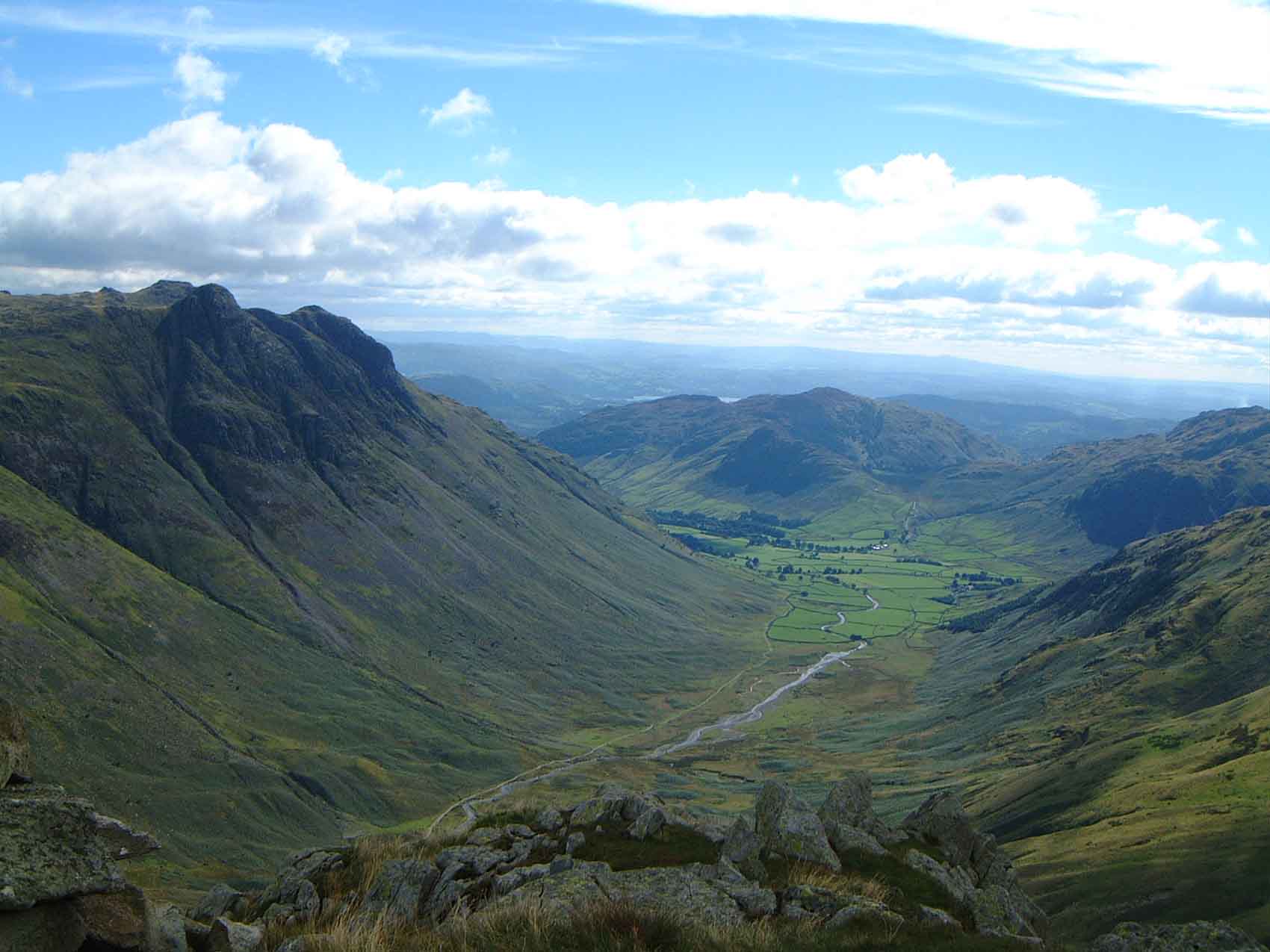
Great Langdale is a valley in the Lake District National Park in North West England, the epithet Great distinguishing it from the neighbouring valley of Little Langdale. Langdale is also the name of a valley in the Howgill Fells, elsewhere in Cumbria. It is a popular location for hikers, climbers, fell-runners, and other outdoor enthusiasts who are attracted by the many fells ringing the head of the valley. Among the best-known features of Great Langdale are the Langdale Pikes, a group of peaks on the northern side of the dale. England's highest mountain, Scafell Pike, can be climbed by a route from Langdale. Langdale has views of, in particular, Dungeon Ghyll Force waterfall, Harrison Stickle, and Pike of Stickle. Great Langdale was an important site during the Neolithic period for producing stone axes and was also one of the centres of the Lakeland slate industry. History Great Langdale is known to archaeologists as the source of a particular type of Neolithic polished s ... [...More Info...] [...Related Items...] OR: [Wikipedia] [Google] [Baidu] |
Central Standing Stone, Mayburgh Henge - Geograph
Central is an adjective usually referring to being in the center of some place or (mathematical) object. Central may also refer to: Directions and generalised locations * Central Africa, a region in the centre of Africa continent, also known as Middle Africa * Central America, a region in the centre of America continent * Central Asia, a region in the centre of Eurasian continent * Central Australia, a region of the Australian continent * Central Belt, an area in the centre of Scotland * Central Europe, a region of the European continent * Central London, the centre of London * Central Region (other) * Central United States, a region of the United States of America Specific locations Countries * Central African Republic, a country in Africa States and provinces * Blue Nile (state) or Central, a state in Sudan * Central Department, Paraguay * Central Province (Kenya) * Central Province (Papua New Guinea) * Central Province (Solomon Islands) * Central Province, Sri Lank ... [...More Info...] [...Related Items...] OR: [Wikipedia] [Google] [Baidu] |
Blencathra
Blencathra, also known as Saddleback, is one of the most northerly hills in the English Lake District. It has six separate fell tops, of which the highest is the Hallsfell Top at 2,848 feet (868 metres). Name For many years, Ordnance Survey listed Blencathra under the alternative name of Saddleback, which was coined in reference to the shape of the mountain when seen from the east. The guidebook author Alfred Wainwright popularised the use of the older Cumbric name, which is now used almost exclusively. Ordnance Survey currently marks the summit as ‘Saddleback or Blencathra’. It is likely that the name Blencathra is derived from the Cumbric elements *''blain'' ‘top, summit’ and ''cadeir'' ‘seat, chair’, meaning ‘the summit of the seat-like mountain’. Andrew Breeze has proposed an alternative interpretation of the second element of the name, arguing that it represents a Cumbric cognate of Middle Welsh ''carthwr'' ‘working horse’. Richard Coates has sug ... [...More Info...] [...Related Items...] OR: [Wikipedia] [Google] [Baidu] |
Castlerigg Stone Circle
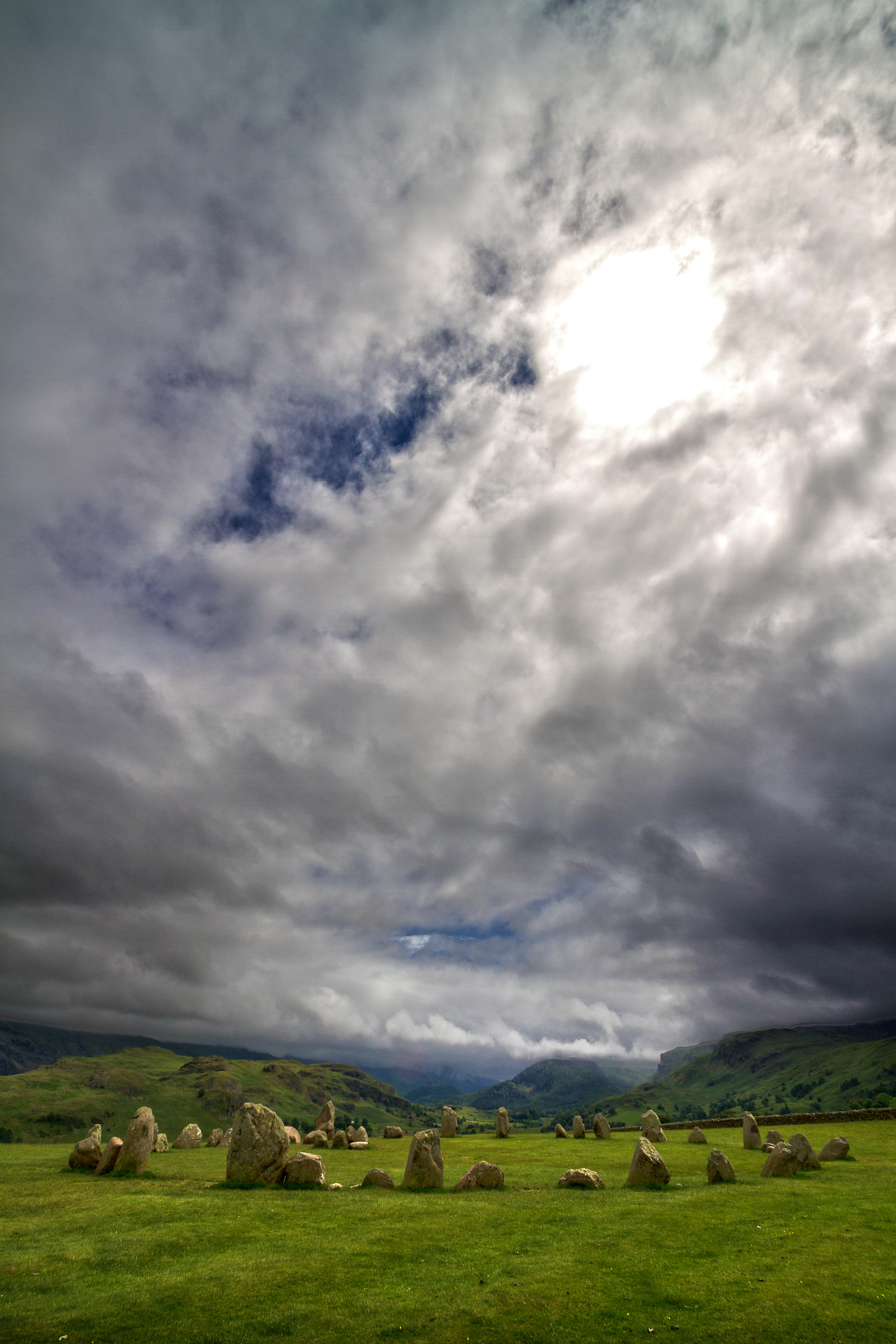
Castlerigg Stone Circle (alternatively Keswick Carles, or Carles) is situated on a prominent hill to the east of Keswick, in the Lake District National Park, North West England. It is one of around 1,300 stone circles in the British Isles and Brittany, constructed as a part of a megalithic tradition that lasted from approximately 3,200 BC to 2500 BC, during the Late Neolithic and Early Bronze Ages. Burl 2000. p. 13. Various archaeologists have commented positively on the beauty and romance of Castlerigg and its surrounding landscape. In his study of the stone circles of Cumbria, archaeologist John Waterhouse commented that the site was "one of the most visually impressive prehistoric monuments in Britain." Waterhouse 1985. p. 43. Every year, thousands of tourists travel to the site, making it the most visited stone circle in Cumbria. This plateau forms the raised centre of a natural amphitheatre created by the surrounding fells and from within the circle it is possible to see ... [...More Info...] [...Related Items...] OR: [Wikipedia] [Google] [Baidu] |
Thomas Pennant
Thomas Pennant (14 June Old Style, OS 172616 December 1798) was a Welsh natural history, naturalist, traveller, writer and antiquarian. He was born and lived his whole life at his family estate, Downing Hall near Whitford, Flintshire, in Wales. As a naturalist he had a great curiosity, observing the geography, geology, plants, animals, birds, reptiles, amphibians and fish around him and recording what he saw and heard about. He wrote acclaimed books including ''British Zoology'', the ''History of Quadrupeds'', ''Arctic Zoology'' and ''Indian Zoology'' although he never travelled further afield than continental Europe. He knew and maintained correspondence with many of the scientific figures of his day. His books influenced the writings of Samuel Johnson. As an antiquarian, he amassed a considerable collection of art and other works, largely selected for their scientific interest. Many of these works are now housed at the National Library of Wales. As a traveller he visited Sco ... [...More Info...] [...Related Items...] OR: [Wikipedia] [Google] [Baidu] |


