|
May 2014 San Diego County Wildfires
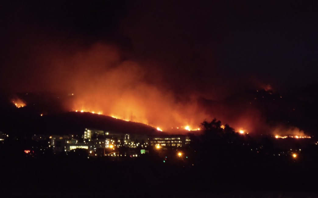
The May 2014 San Diego County wildfires were a swarm of 20 wildfires that erupted during May 2014, in San Diego County, California, during severe Santa Ana Wind conditions, historic drought conditions, and a heat wave. The main event during mid-May was preceded by a precursor fire that ignited on May 5. The Bernardo Fire has been declared accidental, and officials believe the Cocos Fire was intentionally set. The causes of the other fires are still under investigation by multiple agencies, and a joint task force was formed to coordinate the investigations and facilitate communications. Six injuries and one fire-related fatality were reported. At least eight major (named) fires were burning simultaneously at the height of the event, as well as several unnamed small brush fires. Smoke from the fires also prompted health advisories in parts of Orange and Los Angeles counties. On May 14, the County of San Diego declared a local emergency. Later that evening, Governor Jerry Brown de ... [...More Info...] [...Related Items...] OR: [Wikipedia] [Google] [Baidu] |
San Diego County, California
San Diego County (), officially the County of San Diego, is a county in the southwestern corner of the U.S. state of California. As of the 2020 census, the population was 3,298,634, making it California's second-most populous county and the fifth-most populous in the United States. Its county seat is San Diego, the second-most populous city in California and the eighth-most populous city in the United States. It is the southwesternmost county in the 48 contiguous United States, and is a border county. It is also home to 18 Native American tribal reservations, the most of any county in the United States. San Diego County comprises the San Diego-Chula Vista-Carlsbad, CA Metropolitan Statistical Area, which is the 17th most populous metropolitan statistical area and the 18th most populous primary statistical area of the United States as of July 1, 2012. San Diego County is also part of the San Diego–Tijuana transborder metropolitan area, the largest metropolitan area shar ... [...More Info...] [...Related Items...] OR: [Wikipedia] [Google] [Baidu] |
Red Flag Warning
A red flag warning is a forecast warning issued by the National Weather Service in the United States to inform the public, firefighters, and land management agencies that conditions are ideal for wildland fire combustion, and rapid spread. After drought conditions, when humidity is very low, and especially when there are high or erratic winds which may include lightning as a factor, the Red Flag Warning becomes a critical statement for firefighting agencies. These agencies often alter their staffing and equipment resources dramatically to accommodate the forecast risk. To the public, a Red Flag Warning means high fire danger with increased probability of a quickly spreading vegetation fire in the area within 24 hours. The weather criteria for fire weather watches and red flag warnings vary with each Weather Service office’s warning area based on the local vegetation type, topography, and distance from major water sources. They usually include the daily vegetation moisture cont ... [...More Info...] [...Related Items...] OR: [Wikipedia] [Google] [Baidu] |
Marine Corps Base Camp Pendleton
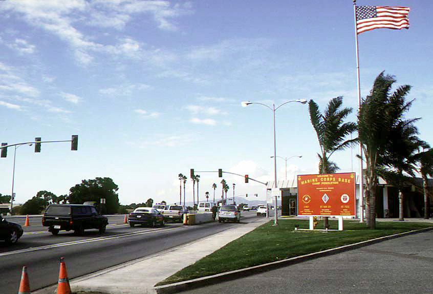
Marine Corps Base Camp Pendleton is the major West Coast base of the United States Marine Corps and is one of the largest Marine Corps bases in the United States. It is on the Southern California coast in San Diego County and is bordered by Oceanside to the south, San Clemente and Orange County to the north, Riverside County to the northeast, and Fallbrook to the east. The base was established in 1942 to train U.S. Marines for service in World War II. By October 1944, Camp Pendleton was declared a "permanent installation," and by 1946 it became the home of the 1st Marine Division. It was named after Major General Joseph Henry Pendleton (1860–1942), who had long advocated setting up a training base for the Marine Corps on the West Coast. Today it is home to myriad Fleet Marine Force, Operating Force units, including the I Marine Expeditionary Force and various training commands. History Prior to World War II In 1769, a Spanish expedition led by Captain Gaspar de Portolá ex ... [...More Info...] [...Related Items...] OR: [Wikipedia] [Google] [Baidu] |
Naval Weapons Station Seal Beach
Naval Weapons Station Seal Beach is a United States Navy weapons and munitions loading, storage and maintenance facility located in Seal Beach, California, with detachments in Fallbrook and Norco, both also in California. It also encloses the Seal Beach National Wildlife Refuge. Location and infrastructure NWS Seal Beach occupies 5,256 acres (8.2 square miles (21 km²)), has 230 buildings and 128 ammunition depots providing 589,299 feet² (54,747 m²) of ammunition storage space. Ammunition was moved from storage to the docks on 56 miles (90 km) of railroad line which closed in 2008 and the tracks were taken out in 2010, after which 80 miles (128 km) of road are used instead. The base owned 130 pieces of railroad rolling stock which were dismantled, their function being taken up by 230 trucks and trailers to move the ammunition, which is loaded onto ships using six mobile cranes that can lift up to 90 tons (81 tonnes). The ... [...More Info...] [...Related Items...] OR: [Wikipedia] [Google] [Baidu] |
Wildfire
A wildfire, forest fire, bushfire, wildland fire or rural fire is an unplanned, uncontrolled and unpredictable fire in an area of Combustibility and flammability, combustible vegetation. Depending on the type of vegetation present, a wildfire may be more specifically identified as a bushfire(bushfires in Australia, in Australia), desert fire, grass fire, hill fire, peat fire, prairie fire, vegetation fire, or veld fire. Fire ecology, Some natural forest ecosystems depend on wildfire. Wildfires are distinct from beneficial human usage of wildland fire, called controlled burn, controlled burning, although controlled burns can turn into wildfires. Fossil charcoal indicates that wildfires began soon after the appearance of terrestrial plants approximately 419 million years ago during the Silurian period. Earth's carbon-rich vegetation, seasonally dry climates, atmospheric oxygen, and widespread lightning and volcanic ignitions create favorable conditions for fires. The occurre ... [...More Info...] [...Related Items...] OR: [Wikipedia] [Google] [Baidu] |
Del Norte High School (San Diego, California)
Del Norte High School is a public high school located in and primarily serving the 4S Ranch and Del Sur communities of San Diego, California. It is part of the Poway Unified School District (PUSD). Established in 2009, the campus covers of land. History Del Norte opened on August 19, 2009, and was the last comprehensive high school to be opened in the Poway Unified School District. During its first year, Del Norte was expected to have approximately 700 students in order to create a personalized learning experience. Also notable was the absence of juniors and seniors, as the first year only contained freshmen and sophomores. The expected student population after the first few years was approximately 2,250 students. On May 13, 2014, the Bernardo Fire broke out near the school, leading to the evacuation of 21,000 nearby houses. On May 26, 2022, Del Norte High School and several nearby schools in Poway Unified School District were put into complete lockdown because of shooting th ... [...More Info...] [...Related Items...] OR: [Wikipedia] [Google] [Baidu] |
Rancho Bernardo, San Diego
Rancho Bernardo is a master-planned community in the northern hills of the city of San Diego, California. Geography The topography of Rancho Bernardo consists of canyons and rolling hills that have large bedrock outcroppings. The major floral biomes of Rancho Bernardo are chaparral, coastal sage scrub, Southern California grassland and freshwater marsh/riparian habitat. The community is a sprawling community with shopping centers, golf courses, and office parks typical of San Diego development located about north-northeast of downtown San Diego, immediately east of 4S Ranch, north of Carmel Mountain Ranch, northwest of the city of Poway, and south of the city of Escondido. Climate Rancho Bernardo has a Mediterranean climate (Köppen ''Csa''). Rancho Bernardo has warm, dry summers and mild winters. Rainfall is relatively sparse, and most rain falls between December and March. History Pre-Colonial The pre-colonial history of this area is divided into an early (prior to circa ... [...More Info...] [...Related Items...] OR: [Wikipedia] [Google] [Baidu] |
4S Ranch, California
4S Ranch is a locale of San Diego County, California. It is located about north of downtown San Diego and east of the Pacific Ocean in the North County Inland area of San Diego. To the east of 4S Ranch is the San Diego community of Rancho Bernardo. To the west is the Santa Fe Valley, which includes Rancho Santa Fe. Lake Hodges forms the northern border of the community while Black Mountain Ranch, which includes Del Sur and Santaluz, and Rancho Peñasquitos are both situated to the south. The ZIP Code is 92127, and the community is inside area code 858. History The origin of the name 4S Ranch is not specifically known. Some believe it’s a playful abbreviation of the word "forest"(4S). The first recorded owner of Rancho San Bernardo, as the area in which 4S Ranch is currently located and originally part of four separate sitios or square leagues, was acquired by an English sea captain named Joseph Snook "Captain Snook" (who later became a Mexican citizen and changed ... [...More Info...] [...Related Items...] OR: [Wikipedia] [Google] [Baidu] |
San Mateo Fire
The May 2014 San Diego County wildfires were a swarm of 20 wildfires that erupted during May 2014, in San Diego County, California, during severe Santa Ana Wind conditions, historic drought conditions, and a heat wave. The main event during mid-May was preceded by a precursor fire that ignited on May 5. The Bernardo Fire has been declared accidental, and officials believe the Cocos Fire was intentionally set. The causes of the other fires are still under investigation by multiple agencies, and a joint task force was formed to coordinate the investigations and facilitate communications. Six injuries and one fire-related fatality were reported. At least eight major (named) fires were burning simultaneously at the height of the event, as well as several unnamed small brush fires. Smoke from the fires also prompted health advisories in parts of Orange and Los Angeles counties. On May 14, the County of San Diego declared a local emergency. Later that evening, Governor Jerry Brown ... [...More Info...] [...Related Items...] OR: [Wikipedia] [Google] [Baidu] |
Poinsettia Fire
The Poinsettia Fire was the second most destructive of the May 2014 San Diego County wildfires. It caused property damage estimated at $22.5 million, as well as the only reported fatality in the San Diego County series of wildfires. As of July 10, 2014, the cause of the fire is listed as "undetermined", which allows for further investigation if more information comes to light. Fire The Poinsettia Fire started on May 14, around 10:40 AM PDT, in the city of Carlsbad. Burning in dry brush north of El Camino Real, it began near the intersection of Poinsettia Lane and Alicante. After the fire crossed El Camino Real, evacuation orders were issued to 11,600 homes and businesses in Carlsbad. Two elementary schools and a middle school were also evacuated. By the end of the day on May 14, the fire had destroyed eight homes, an 18-unit condominium complex, and two commercial buildings. The Carlsbad Unified School District closed all schools May 15 and 16. At 5 PM PDT on May 14, the fire c ... [...More Info...] [...Related Items...] OR: [Wikipedia] [Google] [Baidu] |
Tomahawk Fire
The Tomahawk Fire was the second-largest wildfire of the May 2014 San Diego County wildfires, behind the Pulgas Fire. The fire, which started on May 14 around 9:45 AM, on the Naval Weapons Station Seal Beach Detachment Fallbrook (also known as Fallbrook Naval Weapons Station), scorched . The Fallbrook Naval Weapons Station is on the eastern side of, and provides an entry point to, Marine Corps Base Camp Pendleton and is adjacent to the community of Fallbrook. Evacuation orders were issued for several schools and housing areas, as well as the Fallbrook Naval Weapons Station and the closed San Onofre Nuclear Generating Station. By 8 PM PDT on May 14, the Tomahawk Fire had reached a size of . On May 16, the fire had burned , and it was 23% contained. By May 17, it had burned and was 65% contained. During the evening of May 18, the fire was reported to be 100% contained. See also *October 2007 California wildfires *2014 California wildfires *December 2017 Southern California wildf ... [...More Info...] [...Related Items...] OR: [Wikipedia] [Google] [Baidu] |
Bernardo Fire
The May 2014 San Diego County wildfires were a swarm of 20 wildfires that erupted during May 2014, in San Diego County, California, during severe Santa Ana Wind conditions, historic drought conditions, and a heat wave. The main event during mid-May was preceded by a precursor fire that ignited on May 5. The Bernardo Fire has been declared accidental, and officials believe the Cocos Fire was intentionally set. The causes of the other fires are still under investigation by multiple agencies, and a joint task force was formed to coordinate the investigations and facilitate communications. Six injuries and one fire-related fatality were reported. At least eight major (named) fires were burning simultaneously at the height of the event, as well as several unnamed small brush fires. Smoke from the fires also prompted health advisories in parts of Orange and Los Angeles counties. On May 14, the County of San Diego declared a local emergency. Later that evening, Governor Jerry Brown d ... [...More Info...] [...Related Items...] OR: [Wikipedia] [Google] [Baidu] |


