|
Margraviate Of Upper Lusatia
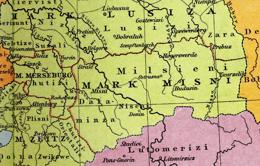
Upper Lusatia (german: Oberlausitz ; hsb, Hornja Łužica ; dsb, Górna Łužyca; szl, Gōrnŏ Łużyca; pl, Łużyce Górne or ''Milsko''; cz, Horní Lužice) is a historical region in Germany and Poland. Along with Lower Lusatia to the north, it makes up the region of Lusatia, named after the Slavic ''Lusici'' tribe. Both parts of Lusatia are home to the West Slavic minority group of the Sorbs. The major part of Upper Lusatia is part of the German federal state of Saxony, roughly comprising Bautzen district and Görlitz district. The northwestern extremity, around Ruhland and Tettau, is incorporated into the Oberspreewald-Lausitz district of the state of Brandenburg. The eastern part of Upper Lusatia is in Poland, east of the Neisse (''Nysa'') river, in Lower Silesian Voivodeship. A small strip of land in the north around Łęknica is incorporated into Lubusz Voivodeship, along with the Polish part of Lower Lusatia. The historic capital of Upper Lusatia is Bautzen ... [...More Info...] [...Related Items...] OR: [Wikipedia] [Google] [Baidu] |
Locator Upper Lusatia Within The Holy Roman Empire (1618)
Locator may refer to: * One who locates, or is entitled to locate, a land claim, land or mining claim * ''Lokator'' (in Latin ''locator''), a medieval servant in charge of organizing colonization and settlement * Locator map * Locator software, a type of e-commerce software * Maidenhead Locator System, a method used by amateur radio operators to define locations on the Earth * Record locators used by airlines and travel agencies * Uniform Resource Locator (URL) * A device used in acoustic location * ''The Locator'', a series of novels by Richard Greener which were adapted into the television series The Finder (U.S. TV series), ''The Finder'' *(Laboratory) A person in charge of knowing where all the staff of a laboratory are located, using signals from a badge that the staff wear. Aviation * Non-directional beacon, a radio navigation aid for use by pilots of aircraft * Locator outer marker, a radio navigation aid for use with an aircraft instrument landing system See also * ... [...More Info...] [...Related Items...] OR: [Wikipedia] [Google] [Baidu] |
Lusatian Neisse
The Lusatian Neisse (german: Lausitzer Neiße; pl, Nysa Łużycka; cs, Lužická Nisa; Upper Sorbian: ''Łužiska Nysa''; Lower Sorbian: ''Łužyska Nysa''), or Western Neisse, is a river in northern Central Europe.''Neisse River'' at www.britannica.com. Retrieved 4 Feb 2011. at http://eagri.cz/public. Retrieved 4 Feb 2011. It rises in the , near |
Man And The Biosphere Programme
Man and the Biosphere Programme (MAB) is an intergovernmental scientific program, launched in 1971 by UNESCO, that aims to establish a scientific basis for the improvement of relationships between people and their environments. MAB's work engages fully with the international development agenda—specially with the Sustainable Development Goals and the Post 2015 Development Agenda—and addresses challenges linked to scientific, environmental, societal and development issues in diverse ecosystems; from mountain regions to marine, coastal and island areas; from tropical forests to dry lands and urban areas. MAB combines the natural and social sciences, economics and education to improve human livelihoods and the equitable sharing of benefits, and to safeguard natural and managed ecosystems, thus promoting innovative approaches to economic development that are socially and culturally appropriate, and environmentally sustainable. The MAB program provides a unique platform for coop ... [...More Info...] [...Related Items...] OR: [Wikipedia] [Google] [Baidu] |
UNESCO
The United Nations Educational, Scientific and Cultural Organization is a specialized agency of the United Nations (UN) aimed at promoting world peace and security through international cooperation in education, arts, sciences and culture. It has 193 member states and 12 associate members, as well as partners in the non-governmental, intergovernmental and private sector. Headquartered at the World Heritage Centre in Paris, France, UNESCO has 53 regional field offices and 199 national commissions that facilitate its global mandate. UNESCO was founded in 1945 as the successor to the League of Nations's International Committee on Intellectual Cooperation.English summary). Its constitution establishes the agency's goals, governing structure, and operating framework. UNESCO's founding mission, which was shaped by the Second World War, is to advance peace, sustainable development and human rights by facilitating collaboration and dialogue among nations. It pursues this objective t ... [...More Info...] [...Related Items...] OR: [Wikipedia] [Google] [Baidu] |
Upper Lusatian Heath And Pond Landscape
The Upper Lusatian Heath and Pond Landscape (also ... District or ... Lake District, Vol. 73, Das Museum, 2001, p. 79. german: Oberlausitzer Heide- und Teichgebiet) is a natural region in Saxony. It runs from a line between and for roughly 60 kilo ... [...More Info...] [...Related Items...] OR: [Wikipedia] [Google] [Baidu] |
Geomorphology
Geomorphology (from Ancient Greek: , ', "earth"; , ', "form"; and , ', "study") is the scientific study of the origin and evolution of topographic and bathymetric features created by physical, chemical or biological processes operating at or near Earth's surface. Geomorphologists seek to understand why landscapes look the way they do, to understand landform and terrain history and dynamics and to predict changes through a combination of field observations, physical experiments and numerical modeling. Geomorphologists work within disciplines such as physical geography, geology, geodesy, engineering geology, archaeology, climatology, and geotechnical engineering. This broad base of interests contributes to many research styles and interests within the field. Overview Earth's surface is modified by a combination of surface processes that shape landscapes, and geologic processes that cause tectonic uplift and subsidence, and shape the coastal geography. Surface processes co ... [...More Info...] [...Related Items...] OR: [Wikipedia] [Google] [Baidu] |
Panorama Ringenhain
A panorama (formed from Greek πᾶν "all" + ὅραμα "view") is any wide-angle view or representation of a physical space, whether in painting, drawing, photography, film, seismic images, or 3D modeling. The word was originally coined in the 18th century by the English (Irish descent) painter Robert Barker to describe his panoramic paintings of Edinburgh and London. The motion-picture term ''panning'' is derived from ''panorama''. A panoramic view is also purposed for multimedia, cross-scale applications to an outline overview (from a distance) along and across repositories. This so-called "cognitive panorama" is a panoramic view over, and a combination of, cognitive spaces used to capture the larger scale. History The device of the panorama existed in painting, particularly in murals, as early as 20 A.D., in those found in Pompeii, as a means of generating an immersive "panoptic" experience of a vista. Cartographic experiments during the Enlightenment era prece ... [...More Info...] [...Related Items...] OR: [Wikipedia] [Google] [Baidu] |
Milceni
The Milceni or Milzeni ( cs, Milčané; german: Milzener; pl, Milczanie) were a West Slavic tribe, who settled in the present-day Upper Lusatia region. They were first mentioned in the middle of the 9th century AD by the Bavarian Geographer, who wrote of 30 ''civitates'' which possibly had fortifications. They were gradually conquered by Germans during the 10th century. Modern descendants of the Milceni are the Sorbs of the Free State of Saxony, Germany.Institut für Sorabistik.About Sorbian Language". Accessed November 8, 2006. History The Milceni travelled to Upper Lusatia in the 7th century during the Migration Period.''Bautzen.de''History. Accessed November 8, 2006. The exact borders of their settlement area are disputed. It is generally accepted that their fielded land had fruitful loess soil and had dimensions of approximately 50 km from east to west and 20 km from north to south. The northern border was in swampy and partially infertile terrain, while the south ... [...More Info...] [...Related Items...] OR: [Wikipedia] [Google] [Baidu] |
March Of Lusatia
The March or Margraviate of Lusatia (german: Mark(grafschaft) Lausitz) was as an eastern border march of the Holy Roman Empire in the lands settled by Polabian Slavs. It arose in 965 in the course of the partition of the vast ''Marca Geronis''. Ruled by several Saxon margravial dynasties, among them the House of Wettin, the lordship was contested by the Polish kings as well as by the Ascanian margraves of Brandenburg. The remaining territory was finally incorporated into the Lands of the Bohemian Crown in 1367. Geography The territory of the margraviate roughly corresponded with the present-day region of Lower Lusatia. It originally stretched from the border of the Saxon stem duchy along the Saale River in the west to the border with Poland on the Bober (Bóbr) River in the east. From about 1138, the adjacent territory beyond the river was part of the Duchy of Silesia (Lower Silesia). In the north, the March of Lusatia bordered on the Northern March, which was following the Grea ... [...More Info...] [...Related Items...] OR: [Wikipedia] [Google] [Baidu] |
Zgorzelec
Zgorzelec (, german: link=no, Görlitz, szl, Gorlice, Upper Lusatian German dialect: ''Gerlz'', ''Gerltz'', and ''Gerltsch'', hsb, Zhorjelc, dsb, Zgórjelc, cz, Zhořelec) is a town in southwestern Poland with 30,374 inhabitants (2019). It lies in Lower Silesian Voivodeship. It is the seat of Zgorzelec County and of Gmina Zgorzelec (although it is not part of the territory of the latter, as the town is an urban gmina in its own right). Zgorzelec is located on the Lusatian Neisse river, on the Polish-German border adjoining the German town of Görlitz, of which it constituted the eastern part up to 1945. History Up until 1945, the modern-day towns of Zgorzelec and Görlitz were a single entity; their history up to that point is shared. The date of the town's foundation is unknown. Middle Ages In the Early Middle Ages, the area was inhabited by the Bieżuńczanie tribe, one of the old Polish tribes, which together with the Sorbian Milceni tribe, with which it bordered in the ... [...More Info...] [...Related Items...] OR: [Wikipedia] [Google] [Baidu] |
Görlitz
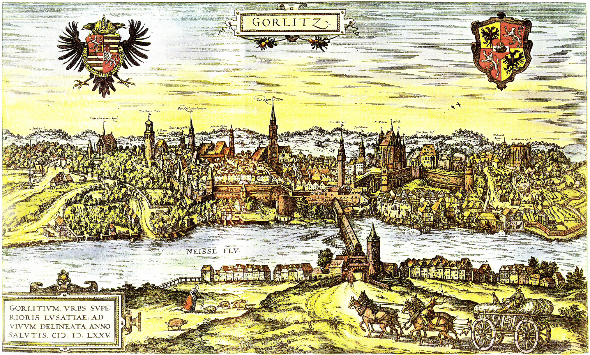
Görlitz (; pl, Zgorzelec, hsb, Zhorjelc, cz, Zhořelec, :de:Ostlausitzer Mundart, East Lusatian dialect: ''Gerlz'', ''Gerltz'', ''Gerltsch'') is a town in the Germany, German state of Saxony. It is located on the Lusatian Neisse River, and is the largest town in Upper Lusatia as well as the second-largest town in the region of Lusatia, after Cottbus. Görlitz is the easternmost town in Germany (easternmost village is Zentendorf, Zentendorf (Šćeńc)), and lies opposite the Poland, Polish town of Zgorzelec, which was the eastern part of Görlitz until 1945. The town has approximately 56,000 inhabitants, which make Görlitz the List of cities in Saxony by population, sixth-largest town in Saxony. It is the seat of the Görlitz (district), district of Görlitz. Together with Zgorzelec, it forms the Euro City of Görlitz/Zgorzelec, which has a combined population of around 86,000. While not Sorbian languages, Lusatiophone itself, the town is situated just east of the Sorbian la ... [...More Info...] [...Related Items...] OR: [Wikipedia] [Google] [Baidu] |
Bautzen
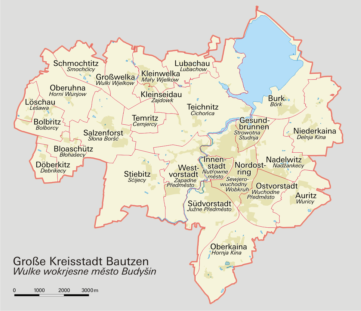
Bautzen () or Budyšin () is a hill-top town in eastern Saxony, Germany, and the administrative centre of the district of Bautzen. It is located on the Spree river. In 2018 the town's population was 39,087. Until 1868, its German name was ''Budissin''. In 1945 the Battle of Bautzen was Hitler’s last victory against the Soviet Union during the Battle of Berlin . Bautzen is often regarded as the unofficial, but historical capital of Upper Lusatia. The town is also the most important cultural centre of the Sorbian minority, which constitutes about 10 percent of Bautzen's population. Asteroid '' 11580 Bautzen'' is named in honour of the city. Names Like other cities and places in Lusatia, Bautzen has several different names across languages. Its German name was also officially changed in 1868. As well as ''Bautzen'' (German) and ''Budyšin'' (Upper Sorbian), the town has had the following names: * German: ''Budissin'' (variants used from c. 11th century onwards; Saxon governme ... [...More Info...] [...Related Items...] OR: [Wikipedia] [Google] [Baidu] |


