|
Mappleton
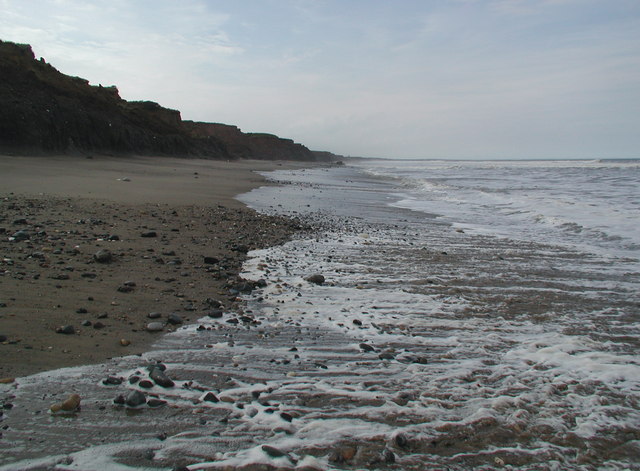
Mappleton is a village and civil parish in the East Riding of Yorkshire, England. It is situated on the North Sea coastline in an area known as Holderness, lying approximately south of the seaside resort of Hornsea. The civil parish is formed by the village of Mappleton and the hamlets of Cowden, Great Cowden and Rolston. According to the 2011 UK census, Mappleton parish had a population of 342, an increase on the 2001 UK census figure of 249. The parish church of All Saints is a Grade II* listed building. History In 1823 Mappleton was a civil parish in the Wapentake of Holderness and the Liberty of St Peter's. The ecclesiastical parish and church living was under the patronage of the Archdeacon of the East Riding. A public school was established in 1820 by subscription and run under the ideas of educationalist Andrew Bell. Population at the time was 187, including the hamlet of Rolston (then 'Rowlston'). Occupations included six farmers, a carpenter, a corn miller, and ... [...More Info...] [...Related Items...] OR: [Wikipedia] [Google] [Baidu] |
Cowden, East Riding Of Yorkshire
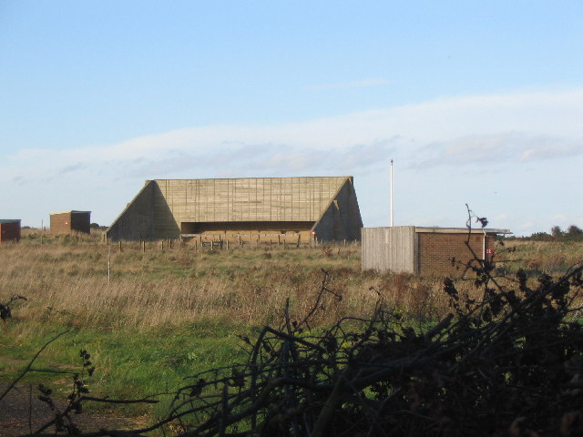
Cowden (or Little Cowden) is a hamlet in the East Riding of Yorkshire, England, in an area known as Holderness. It is situated approximately south of Hornsea and lies just east of the B1242 road towards the North Sea coast. Its name means a hill where charcoal was burnt. It forms part of the civil parish of Mappleton. Originally, Little Cowden was its own parish, however, the parish church was lost to coastal erosion, so it was moved into the parish of Mappleton. The Royal Air Force operated a bombing range on the beach at RAF Cowden between 1959 and 1998. The range was closed due to coastal erosion, which is quite common on the East Riding coast. The erosion regularly reveals buried ordnance which requires the MoD bomb disposal teams to attend and make them safe. The local HM Coastguard team at Hornsea frequently attend reports of ordnance in the first instance and send the details to the Humber Coastguard Operations Centre and EOD ops centre to decide on the appropriate m ... [...More Info...] [...Related Items...] OR: [Wikipedia] [Google] [Baidu] |
Hornsea
Hornsea is a seaside town and civil parish in the East Riding of Yorkshire, England. The settlement dates to at least the early medieval period. The town was expanded in the Victorian era with the coming of the Hull and Hornsea Railway in 1864. In the First World War the Mere was briefly the site of RNAS Hornsea Mere, a seaplane base. During the Second World War the town and beach was heavily fortified against invasion. The civil parish encompasses Hornsea town; the natural lake, Hornsea Mere; as well as the lost or deserted villages of ''Hornsea Beck'', ''Northorpe'' and ''Southorpe''. Structures of note in the parish include the medieval parish church of St Nicholas, Bettison's Folly, Hornsea Mere and the sea front promenade. The economy includes a mix of tourism and small manufacturing. Most notably, Hornsea Pottery was established in Hornsea in 1949 and closed in 2000. Modern Hornsea still functions as a coastal resort, and has large caravan sites to the north and sout ... [...More Info...] [...Related Items...] OR: [Wikipedia] [Google] [Baidu] |
Great Cowden
Great Cowden is a hamlet in the East Riding of Yorkshire, England, in an area known as Holderness. It is situated approximately south of Hornsea and lies just east of the B1242 road on the North Sea coast. Great Cowden forms part of the civil parish of Mappleton. In 1823 Cowden (as Great and Little Cowden) was also known as 'Coldon', and was in the parish of Mappleton. The parish incumbent's living was under the patronage of the King King is the title given to a male monarch in a variety of contexts. The female equivalent is queen, which title is also given to the consort of a king. *In the context of prehistory, antiquity and contemporary indigenous peoples, the tit ..., although at the time the parish church had been swallowed by the sea. Population was 146, with occupations including eleven farmers. Baines, Edward (1823): ''History, Directory and Gazetteer of the County of York'', p. 192 References * External links * * Villages in the East Rid ... [...More Info...] [...Related Items...] OR: [Wikipedia] [Google] [Baidu] |
Rolston
Rolston is a hamlet in the East Riding of Yorkshire, England, in an area known as Holderness. It is situated approximately south of Hornsea and lies just west of the B1242 road. It forms part of the civil parish of Mappleton Mappleton is a village and civil parish in the East Riding of Yorkshire, England. It is situated on the North Sea coastline in an area known as Holderness, lying approximately south of the seaside resort of Hornsea. The civil parish is formed .... References * External links * Villages in the East Riding of Yorkshire Holderness {{EastRiding-geo-stub ... [...More Info...] [...Related Items...] OR: [Wikipedia] [Google] [Baidu] |
United Kingdom Census 2011
A census of the population of the United Kingdom is taken every ten years. The 2011 census was held in all countries of the UK on 27 March 2011. It was the first UK census which could be completed online via the Internet. The Office for National Statistics (ONS) is responsible for the census in England and Wales, the General Register Office for Scotland (GROS) is responsible for the census in Scotland, and the Northern Ireland Statistics and Research Agency (NISRA) is responsible for the census in Northern Ireland. The Office for National Statistics is the executive office of the UK Statistics Authority, a non-ministerial department formed in 2008 and which reports directly to Parliament. ONS is the UK Government's single largest statistical producer of independent statistics on the UK's economy and society, used to assist the planning and allocation of resources, policy-making and decision-making. ONS designs, manages and runs the census in England and Wales. In its capacity a ... [...More Info...] [...Related Items...] OR: [Wikipedia] [Google] [Baidu] |
Archdeacon Of The East Riding
The Archdeacon of the East Riding is a senior ecclesiastical officer of an archdeaconry, or subdivision, of the Church of England Diocese of York in the Province of York. It is named for the East Riding of Yorkshire and consists of the eight rural deaneries of Beverley, Bridlington, Harthill, Howden, Hull, North Holderness, Scarborough and South Holderness. History Archdeacons occurred in the Diocese of York before 1093; before 1128, there were five serving simultaneously – probably each in their own area, but none occurs with a territorial title before 1133. The title Archdeacon of the East Riding is first recorded before 1133 with William FitzHerbert, Archdeacon of the East Riding (later Archbishop of York). Of the five archdeaconries, East Riding is one of three which has never split from York diocese. The archdeaconry is vacant since the resignation of David Butterfield; the acting archdeacon is retired archdeacon Peter Harrison; [...More Info...] [...Related Items...] OR: [Wikipedia] [Google] [Baidu] |
Andrew Bell (educationalist)
Andrew Bell (27 March 1753 – 27 January 1832) was a Scottish Episcopalian priest and educationalist who pioneered the Madras System of Education (also known as "mutual instruction" or the "monitorial system") in schools and was the founder of Madras College, a secondary school in St Andrews. Life and work Andrew Bell was born at St. Andrews, in Scotland on 27 March 1753 and attended St. Andrews University where he did well in mathematics and natural philosophy, graduating in 1774.Blackie 901 In 1774 he sailed to Virginia as a private tutor and remained there until 1781 when he left to avoid involvement in the war of independence. He returned to Scotland, surviving a shipwreck on the way, and officiated at the Episcopal Chapel in Leith. He was ordained Deacon in 1784 and Priest in the Church of England in 1785. In February 1787 he went out to India and went ashore at Madras, where he stayed for 10 years. He became chaplain to a number of British regiments and gave a co ... [...More Info...] [...Related Items...] OR: [Wikipedia] [Google] [Baidu] |
Kingston Upon Hull
Kingston upon Hull, usually abbreviated to Hull, is a port city and unitary authority in the East Riding of Yorkshire, England. It lies upon the River Hull at its confluence with the Humber Estuary, inland from the North Sea and south-east of York, the historic county town. With a population of (), it is the fourth-largest city in the Yorkshire and the Humber region after Leeds, Sheffield and Bradford. The town of Wyke on Hull was founded late in the 12th century by the monks of Meaux Abbey as a port from which to export their wool. Renamed ''Kings-town upon Hull'' in 1299, Hull had been a market town, military supply port, trading centre, fishing and whaling centre and industrial metropolis. Hull was an early theatre of battle in the English Civil Wars. Its 18th-century Member of Parliament, William Wilberforce, took a prominent part in the abolition of the slave trade in Britain. More than 95% of the city was damaged or destroyed in the blitz and suffere ... [...More Info...] [...Related Items...] OR: [Wikipedia] [Google] [Baidu] |
B1242 Road
B roads are numbered routes in Great Britain of lesser importance than A roads. See the article Great Britain road numbering scheme The Great Britain road numbering scheme is a numbering scheme used to classify and identify all roads in Great Britain. Each road is given a single letter (which represents the road's category) and a subsequent number (between 1 and 4 digits). ... for the rationale behind the numbers allocated. Zone 1 (3 digits) Zone 1 (4 digits) {{DEFAULTSORT:B Roads In Zone 1 Of The Great Britain Numbering Scheme 1 1 ... [...More Info...] [...Related Items...] OR: [Wikipedia] [Google] [Baidu] |
Erosion
Erosion is the action of surface processes (such as water flow or wind) that removes soil, rock, or dissolved material from one location on the Earth's crust, and then transports it to another location where it is deposited. Erosion is distinct from weathering which involves no movement. Removal of rock or soil as clastic sediment is referred to as ''physical'' or ''mechanical'' erosion; this contrasts with ''chemical'' erosion, where soil or rock material is removed from an area by dissolution. Eroded sediment or solutes may be transported just a few millimetres, or for thousands of kilometres. Agents of erosion include rainfall; bedrock wear in rivers; coastal erosion by the sea and waves; glacial plucking, abrasion, and scour; areal flooding; wind abrasion; groundwater processes; and mass movement processes in steep landscapes like landslides and debris flows. The rates at which such processes act control how fast a surface is eroded. Typically, physical ero ... [...More Info...] [...Related Items...] OR: [Wikipedia] [Google] [Baidu] |
Parish
A parish is a territorial entity in many Christian denominations, constituting a division within a diocese. A parish is under the pastoral care and clerical jurisdiction of a priest, often termed a parish priest, who might be assisted by one or more curates, and who operates from a parish church. Historically, a parish often covered the same geographical area as a manor. Its association with the parish church remains paramount. By extension the term ''parish'' refers not only to the territorial entity but to the people of its community or congregation as well as to church property within it. In England this church property was technically in ownership of the parish priest ''ex-officio'', vested in him on his institution to that parish. Etymology and use First attested in English in the late, 13th century, the word ''parish'' comes from the Old French ''paroisse'', in turn from la, paroecia, the latinisation of the grc, παροικία, paroikia, "sojourning in a fo ... [...More Info...] [...Related Items...] OR: [Wikipedia] [Google] [Baidu] |
Cliffs
In geography and geology, a cliff is an area of rock which has a general angle defined by the vertical, or nearly vertical. Cliffs are formed by the processes of weathering and erosion, with the effect of gravity. Cliffs are common on coasts, in mountainous areas, escarpments and along rivers. Cliffs are usually composed of rock that is resistant to weathering and erosion. The sedimentary rocks that are most likely to form cliffs include sandstone, limestone, chalk, and dolomite. Igneous rocks such as granite and basalt also often form cliffs. An escarpment (or scarp) is a type of cliff formed by the movement of a geologic fault, a landslide, or sometimes by rock slides or falling rocks which change the differential erosion of the rock layers. Most cliffs have some form of scree slope at their base. In arid areas or under high cliffs, they are generally exposed jumbles of fallen rock. In areas of higher moisture, a soil slope may obscure the talus. Many cliffs also featu ... [...More Info...] [...Related Items...] OR: [Wikipedia] [Google] [Baidu] |


