|
Manazuru
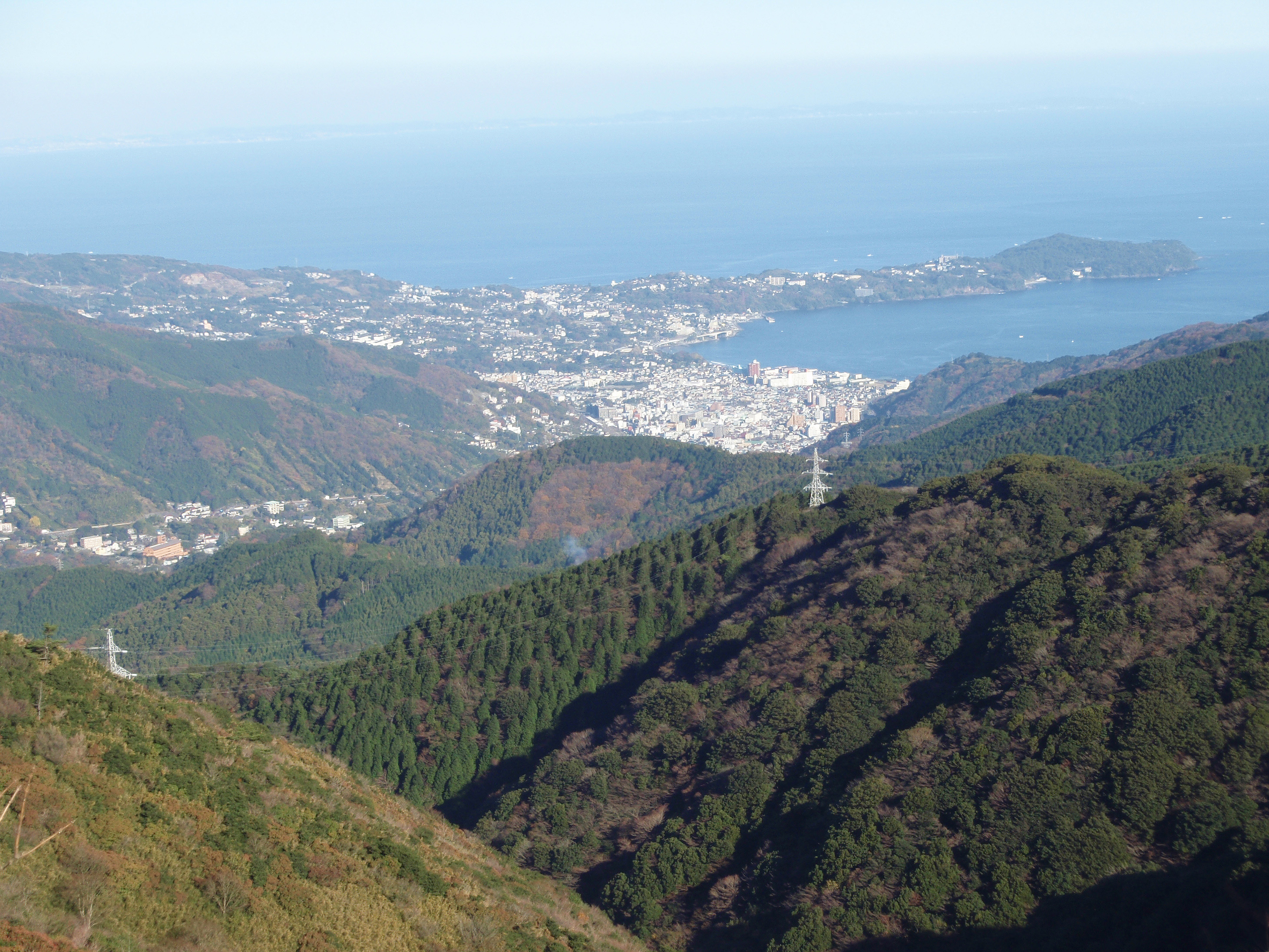
is a town located in Kanagawa Prefecture, Japan. , the town had an estimated population of 6,949 and a population density of 1000 persons per km². The total area of the town is . Geography Located in the southeast of Mount Hakone, the consists of the small Manazuru Peninsula, which extends into Sagami Bay from the southeast to the northwest, sandwiched between Odawara City in the north and Yugawara Town in the south. The Manazuru Peninsula is a lava plateau with a steep coast and The town area is generally rugged with few flat areas. The urban area is at the base of the peninsula, with Manazuru Station to the northwest, Iwa Fishing Port and Iwo Beach to the east, and Manazuru Port to the southeast. There are many quarries in the mountains north of the city. Mandarin oranges are cultivated in the hills along the northern coast. The northwestern part of the town is part of a mountainous area that extends to the outer ring of the Hakone volcano. The town is within the Manazuru H ... [...More Info...] [...Related Items...] OR: [Wikipedia] [Google] [Baidu] |
Ashigarashimo District, Kanagawa
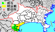
is a district of Japan located in western Kanagawa Prefecture, Japan. Most of the mountainous district is sparsely populated, and is part of the Fuji-Hakone-Izu National Park. The majority of the area of the city of Odawara was formerly part of Ashigarashimo District. As of 2009, the district had an estimated population of 48,713 and a density of 346 persons per km2. The total area was 140.73 km2. Towns and villages *Hakone *Yugawara *Manazuru History Ashigarashimo District was one of the ancient subdivisions of Sagami Province, per the Nara period Ritsuryō system, under the name as . The area was under control of the later Hōjō clan in the Sengoku period, and part of Odawara Domain during the Edo period. Following disasters caused by eruptions of nearby Mount Fuji, a portion also came to be held as ''tenryō'' territory administered by the Tokugawa shogunate. Timeline After the Meiji Restoration, it initially formed part of the short-lived Ashigara Prefecture, befo ... [...More Info...] [...Related Items...] OR: [Wikipedia] [Google] [Baidu] |
Manazuru Hantō Prefectural Natural Park
is a Prefectural Natural Park in Kanagawa Prefecture, Japan. Established in 1960, it derives its name from the . The park lies wholly within the municipality of Manazuru. See also * National Parks of Japan National may refer to: Common uses * Nation or country ** Nationality – a ''national'' is a person who is subject to a nation, regardless of whether the person has full rights as a citizen Places in the United States * National, Maryland, c ... References External links *Map of Manazuru Hantō Prefectural Natural Park Parks and gardens in Kanagawa Prefecture Protected areas established in 1960 1960 establishments in Japan Manazuru, Kanagawa {{Japan-protected-area-stub ... [...More Info...] [...Related Items...] OR: [Wikipedia] [Google] [Baidu] |
Kanagawa Prefecture
is a prefecture of Japan located in the Kantō region of Honshu. Kanagawa Prefecture is the second-most populous prefecture of Japan at 9,221,129 (1 April 2022) and third-densest at . Its geographic area of makes it fifth-smallest. Kanagawa Prefecture borders Tokyo to the north, Yamanashi Prefecture to the northwest and Shizuoka Prefecture to the west. Yokohama is the capital and largest city of Kanagawa Prefecture and the second-largest city in Japan, with other major cities including Kawasaki, Sagamihara, and Fujisawa. Kanagawa Prefecture is located on Japan's eastern Pacific coast on Tokyo Bay and Sagami Bay, separated by the Miura Peninsula, across from Chiba Prefecture on the Bōsō Peninsula. Kanagawa Prefecture is part of the Greater Tokyo Area, the most populous metropolitan area in the world, with Yokohama and many of its cities being major commercial hubs and southern suburbs of Tokyo. Kanagawa Prefecture was the political and economic center of Japan du ... [...More Info...] [...Related Items...] OR: [Wikipedia] [Google] [Baidu] |
Yugawara And Manazuru 20101204
is a town located in Ashigarashimo District, Kanagawa Prefecture, Japan. , the town had an estimated population of 23,267 and a population density of 570 persons per km2. The total area of the town is . Geography Yugawara is located in the far southwestern corner of the prefecture. The center of the town is located in the lowlands between the southern foot of Mount Hakone and the Sagami Bay. Much of the terrain formed by an eroded Quaternary volcano. In the northeast, bordering Manazuru Town, are gentle foothills where residential areas and mandarin orange fields coexist. In the south, hot spring resorts and residential areas are clustered along the north side of the Chitose River. The coastline has a sandy beach with a length of about 700 meters, which is crowded with swimmers in the summer. Surrounding municipalities Kanagawa Prefecture * Odawara * Manazuru * Hakone Shizuoka Prefecture * Atami * Kannami Climate Yugawara has a Humid subtropical climate (Köppen ''Cfa ... [...More Info...] [...Related Items...] OR: [Wikipedia] [Google] [Baidu] |
Yugawara, Kanagawa
is a town located in Ashigarashimo District, Kanagawa Prefecture, Japan. , the town had an estimated population of 23,267 and a population density of 570 persons per km2. The total area of the town is . Geography Yugawara is located in the far southwestern corner of the prefecture. The center of the town is located in the lowlands between the southern foot of Mount Hakone and the Sagami Bay. Much of the terrain formed by an eroded Quaternary volcano. In the northeast, bordering Manazuru Town, are gentle foothills where residential areas and mandarin orange fields coexist. In the south, hot spring resorts and residential areas are clustered along the north side of the Chitose River. The coastline has a sandy beach with a length of about 700 meters, which is crowded with swimmers in the summer. Surrounding municipalities Kanagawa Prefecture * Odawara * Manazuru * Hakone Shizuoka Prefecture * Atami * Kannami Climate Yugawara has a Humid subtropical climate (Köppen ''Cfa'') c ... [...More Info...] [...Related Items...] OR: [Wikipedia] [Google] [Baidu] |
Towns Of Japan
A town (町; ''chō'' or ''machi'') is a local administrative unit in Japan. It is a local public body along with prefecture (''ken'' or other equivalents), city (''shi''), and village (''mura''). Geographically, a town is contained within a district. Note that the same word (町; ''machi'' or ''chō'') is also used in names of smaller regions, usually a part of a ward in a city. This is a legacy of when smaller towns were formed on the outskirts of a city, only to eventually merge into it. Towns See also * Municipalities of Japan * Japanese addressing system The Japanese addressing system is used to identify a specific location in Japan. When written in Japanese characters, addresses start with the largest geographical entity and proceed to the most specific one. When written in Latin characters, ad ... References {{reflist External links "Large_City_System_of_Japan";_graphic_shows_towns_compared_with_other_Japanese_city_types_at_p._1_[PDF_7_of_40/nowiki>">DF_7_of_4 ... [...More Info...] [...Related Items...] OR: [Wikipedia] [Google] [Baidu] |
List Of Towns In Japan
A town (町; ''chō'' or ''machi'') is a local administrative unit in Japan. It is a local public body along with prefecture (''ken'' or other equivalents), city (''shi''), and village (''mura''). Geographically, a town is contained within a district. Note that the same word (町; ''machi'' or ''chō'') is also used in names of smaller regions, usually a part of a ward in a city. This is a legacy of when smaller towns were formed on the outskirts of a city, only to eventually merge into it. Towns See also * Municipalities of Japan * Japanese addressing system The Japanese addressing system is used to identify a specific location in Japan. When written in Japanese characters, addresses start with the largest geographical entity and proceed to the most specific one. When written in Latin characters, ad ... References {{reflist External links "Large_City_System_of_Japan";_graphic_shows_towns_compared_with_other_Japanese_city_types_at_p._1_[PDF_7_of_40/nowiki>">DF_7_of_4 ... [...More Info...] [...Related Items...] OR: [Wikipedia] [Google] [Baidu] |
Odawara, Kanagawa
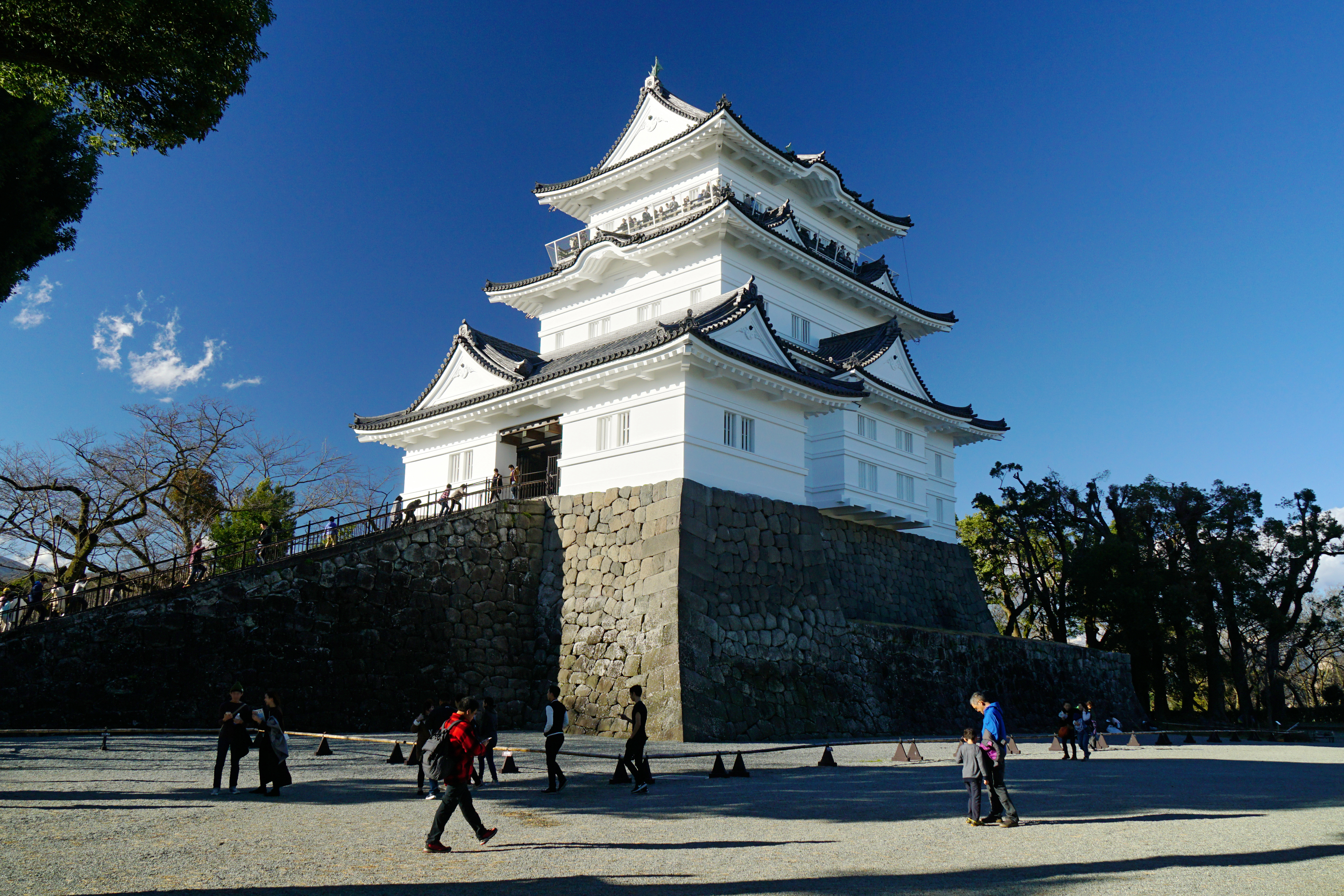
is a city in Kanagawa Prefecture, Japan. , the city had an estimated population of 188,482 and a population density of 1,700 persons per km2. The total area of the city is . Geography Odawara lies in the Ashigara Plains, in the far western portion of Kanagawa Prefecture at the southwestern tip of the Kantō region. It is bordered by the Hakone Mountains to the north and west, the Sakawa River to the east, and Sagami Bay of the Pacific Ocean to the south. Surrounding municipalities Kanagawa Prefecture * Minamiashigara * Ninomiya * Ōi, Kaisei, Nakai *Hakone, Hakone, Manazuru, Yugawara Climate Odawara has a humid subtropical climate (Köppen ''Cfa'') characterized by warm summers and cool winters with light to no snowfall. The average annual temperature in Odawara is 13.4 °C. The average annual rainfall is 2,144 mm with September as the wettest month. The temperatures are highest on average in August, at around 24.2 °C, and lowest in January, at around 2.9& ... [...More Info...] [...Related Items...] OR: [Wikipedia] [Google] [Baidu] |
Mount Hakone
, with its highest peak Mount Kami (1,438 meters), is a complex volcano in Kanagawa Prefecture, Japan that is truncated by two overlapping calderas, the largest of which is 10 × 11 km wide. The calderas were formed as a result of two major explosive eruptions about 180,000 and 49,000–60,000 years ago. Lake Ashi () lies between the southwestern caldera wall and a half dozen post-caldera lava domes that arose along a southwest–northeastern trend cutting through the center of the calderas. Dome growth occurred progressively to the south, and the largest and youngest of them, Mount Kami, forms the high point of Hakone. The calderas are breached to the east by the Haya River canyon. Mount Ashigara is a parasitic cone. The latest magmatic eruptive activity at Hakone occurred 2,900 years ago. It produced a pyroclastic flow and a lava dome in the explosion crater, although phreatic eruptions took place as recently as the 12–13th centuries AD. According to the nea ... [...More Info...] [...Related Items...] OR: [Wikipedia] [Google] [Baidu] |
Sagami Bay
lies south of Kanagawa Prefecture in Honshu, central Japan, contained within the scope of the Miura Peninsula, in Kanagawa, to the east, the Izu Peninsula, in Shizuoka Prefecture, to the west, and the Shōnan coastline to the north, while the island of Izu Ōshima marks the southern extent of the bay. It lies approximately southwest of the capital, Tokyo. Cities on the bay include Odawara, Chigasaki, Fujisawa, Hiratsuka, Itō, and Kamakura. History The center of the Great Kantō earthquake in 1923 was deep beneath Izu Ōshima Island in Sagami Bay. It devastated Tokyo, the port city of Yokohama, and the surrounding prefectures of Chiba, Kanagawa, and Shizuoka, and caused widespread damage throughout the Kantō region. The shallow nature of the seabed on the north of the bay, and the funnelling effect of tsunami and typhoon wave energy, contributed to certain parts of the Shonan coast having suffered considerable damage, including the destruction of the Kōtoku-in temple hou ... [...More Info...] [...Related Items...] OR: [Wikipedia] [Google] [Baidu] |
Humid Subtropical Climate
A humid subtropical climate is a zone of climate characterized by hot and humid summers, and cool to mild winters. These climates normally lie on the southeast side of all continents (except Antarctica), generally between latitudes 25° and 40° and are located poleward from adjacent tropical climates. It is also known as warm temperate climate in some climate classifications. Under the Köppen climate classification, ''Cfa'' and ''Cwa'' climates are either described as humid subtropical climates or warm temperate climates. This climate features mean temperature in the coldest month between (or ) and and mean temperature in the warmest month or higher. However, while some climatologists have opted to describe this climate type as a "humid subtropical climate", Köppen himself never used this term. The humid subtropical climate classification was officially created under the Trewartha climate classification. In this classification, climates are termed humid subtropical when the ... [...More Info...] [...Related Items...] OR: [Wikipedia] [Google] [Baidu] |
Later Hōjō Clan
The was one of the most powerful samurai families in Japan in the Sengoku period and held domains primarily in the Kantō region. Their last name was simply Hōjō (北条) but in order to differentiate between the earlier Hōjō clan with the same name and '' mon'' were called "Later Hōjō", although this was not the official family name. History The history of the family is written in the ''Hōjō Godaiki''. The clan is traditionally reckoned to be started by Ise Shinkurō, who came from a branch of the prestigious Ise clan, descendants of Taira no Toshitsugu, a family in the direct service of the Ashikaga shoguns, as close advisors and ''Shugo'' (Governor) of Yamashiro Province (Ise Sadamichi since 1493). During the Imagawa clan succession crisis in 1476, Shinkurō whose sister was married to Imagawa Yoshitada, Shugo (Governor) of Suruga Province, became associated with the Imagawa clan. At the death of Yoshitada in battle, Shinkurō went down to Suruga Province to suppo ... [...More Info...] [...Related Items...] OR: [Wikipedia] [Google] [Baidu] |


