|
Mamquam River
The Mamquam River is a c.35 km (c. 21 mi) tributary of the Squamish River. Course The Mamquam River originates at Mamquam Pass and starts off by flowing northwest for about 7.5 km. Shortly below its source, the river picks up the waters of the stream draining November Lake. The river, after about 7.5 km, turns north and continues in that direction for about 6.9 km to its confluence with its second named tributary, Martin Creek. At the mouth of Martin Creek, the river turns southwest for about 5.4 km to the mouth of Skookum Creek. At the mouth of Skookum Creek, the river turns west and flows that way for about 12 km all the way to its confluence with the Squamish River in Squamish, British Columbia, Squamish. Its other main tributaries, Ring and Mashiter Creeks, enter near the river's mouth. Tributaries The Mamquam River has three main tributaries. They are: 1. ''Skookum Creek'': Skookum Creek flows southwest from remote Mamquam Lake ... [...More Info...] [...Related Items...] OR: [Wikipedia] [Google] [Baidu] |
Canada
Canada is a country in North America. Its ten provinces and three territories extend from the Atlantic Ocean to the Pacific Ocean and northward into the Arctic Ocean, covering over , making it the world's second-largest country by total area. Its southern and western border with the United States, stretching , is the world's longest binational land border. Canada's capital is Ottawa, and its three largest metropolitan areas are Toronto, Montreal, and Vancouver. Indigenous peoples have continuously inhabited what is now Canada for thousands of years. Beginning in the 16th century, British and French expeditions explored and later settled along the Atlantic coast. As a consequence of various armed conflicts, France ceded nearly all of its colonies in North America in 1763. In 1867, with the union of three British North American colonies through Confederation, Canada was formed as a federal dominion of four provinces. This began an accretion of provinces an ... [...More Info...] [...Related Items...] OR: [Wikipedia] [Google] [Baidu] |
Garibaldi Provincial Park
Garibaldi Provincial Park, also called Garibaldi Park, is a wilderness park located on the coastal mainland of British Columbia, Canada, 70 kilometres (43.5 mi) north of Vancouver. It was established in 1920 and named a Class A Provincial Park of British Columbia in 1927. The park is a popular destination for outdoor recreation, with over 30,000 overnight campers and over 106,000 day users in the 2017/2018 season. Garibaldi Park spans an area of over 1,950 square kilometres (753 sq mi), encompassing a majority of the Garibaldi Range mountains. The western side of the park is highly trafficked by the public due to access provided by the nearby Sea to Sky Highway to destinations in the park such as Elfin Lakes, Garibaldi Lake, The Black Tusk, Cheakamus Lake, and Wedgemount Lake. The eastern wilderness of the park is harder to access and therefore more remote than its western counterpart. To the south, Garibaldi Park connects with Golden Ears Provincial Park and Pi ... [...More Info...] [...Related Items...] OR: [Wikipedia] [Google] [Baidu] |
Rivers Of The Pacific Ranges
A river is a natural flowing watercourse, usually freshwater, flowing towards an ocean, sea, lake or another river. In some cases, a river flows into the ground and becomes dry at the end of its course without reaching another body of water. Small rivers can be referred to using names such as creek, brook, rivulet, and rill. There are no official definitions for the generic term river as applied to geographic features, although in some countries or communities a stream is defined by its size. Many names for small rivers are specific to geographic location; examples are "run" in some parts of the United States, "burn" in Scotland and northeast England, and "beck" in northern England. Sometimes a river is defined as being larger than a creek, but not always: the language is vague. Rivers are part of the water cycle. Water generally collects in a river from precipitation through a drainage basin from surface runoff and other sources such as groundwater recharge, springs, a ... [...More Info...] [...Related Items...] OR: [Wikipedia] [Google] [Baidu] |
Mamquam Icefield
The Mamquam Icefield is an icefield in southwestern British Columbia, Canada, located at the headwaters of Skookum Creek. It lies at the southern end of Garibaldi Provincial Park and is one of the southernmost icefields in the Pacific Ranges of the Coast Mountains. The highest summit of the icefield is Mamquam Mountain, located at its southern end with an elevation of . See also *List of glaciers in Canada *Mamquam River The Mamquam River is a c.35 km (c. 21 mi) tributary of the Squamish River. Course The Mamquam River originates at Mamquam Pass and starts off by flowing northwest for about 7.5 km. Shortly below its source, the river picks up t ... References * Garibaldi Ranges Glaciers of the Pacific Ranges Ice fields of British Columbia {{canada-glacier-stub ... [...More Info...] [...Related Items...] OR: [Wikipedia] [Google] [Baidu] |
Mamquam Mountain
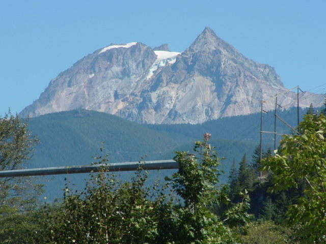
Mamquam Mountain is a mountain in the Pacific Ranges of the Coast Mountains in southwestern British Columbia, Canada, located southeast of Eanastick Meadows and east of Brackendale. It represents the highest summit of the Mamquam Icefield and lies at the southern end of Garibaldi Provincial Park. Mamquam Mountain was named on September 2, 1930 in association with the Mamquam River. Climate Based on the Köppen climate classification, Mamquam Mountain is located in the marine west coast climate zone of western North America. Most weather fronts originate in the Pacific Ocean, and travel east toward the Coast Mountains where they are forced upward by the range (Orographic lift), causing them to drop their moisture in the form of rain or snowfall. As a result, the Coast Mountains experience high precipitation, especially during the winter months in the form of snowfall. Temperatures can drop below −20 °C with wind chill factors below −30 °C. The months July ... [...More Info...] [...Related Items...] OR: [Wikipedia] [Google] [Baidu] |
List Of British Columbia Rivers
The following is a partial list of rivers of British Columbia, organized by watershed. Some large creeks are included either because of size or historical importance (See Alphabetical List of British Columbia rivers ). Also included are lakes that are "in-line" connecting upper tributaries of listed rivers, or at their heads. Arctic drainage Arctic Ocean via Mackenzie River drainage :''(NB Liard tributaries on Yukon side of border omitted)'' Liard River watershed * Liard River ** Petiewewtot River **Fort Nelson River *** Sahtaneh River ****Snake River ***Muskwa River ****Prophet River ***** Minaker River *****Besa River **** Tetsa River **** Chischa River ****Tuchodi River ***Sikanni Chief River ****Buckinghorse River ***Fontas River ** Dunedin River ** Beaver River **Toad River ***West Toad River *** Racing River *** Schipa River **Grayling River ** Trout River **Vents River ** Smith River ** Coal River ** Rabbit River *** Gundahoo River **Kechika River *** Red River ***Turnag ... [...More Info...] [...Related Items...] OR: [Wikipedia] [Google] [Baidu] |
Rapids
Rapids are sections of a river where the river bed has a relatively steep gradient, causing an increase in water velocity and turbulence. Rapids are hydrological features between a ''run'' (a smoothly flowing part of a stream) and a ''cascade''. Rapids are characterized by the river becoming shallower with some rocks exposed above the flow surface. As flowing water splashes over and around the rocks, air bubbles become mixed in with it and portions of the surface acquire a white color, forming what is called "whitewater". Rapids occur where the bed material is highly resistant to the erosive power of the stream in comparison with the bed downstream of the rapids. Very young streams flowing across solid rock may be rapids for much of their length. Rapids cause water aeration of the stream or river, resulting in better water quality. Rapids are categorized in classes, generally running from I to VI. A Class 5 rapid may be categorized as Class 5.1-5.9. While Class I rapids are eas ... [...More Info...] [...Related Items...] OR: [Wikipedia] [Google] [Baidu] |
Garibaldi Estates
Giuseppe Maria Garibaldi ( , ;In his native Ligurian language, he is known as ''Gioxeppe Gaibado''. In his particular Niçard dialect of Ligurian, he was known as ''Jousé'' or ''Josep''. 4 July 1807 – 2 June 1882) was an Italian general, patriot, revolutionary and republican. He contributed to Italian unification and the creation of the Kingdom of Italy. He is considered one of the greatest generals of modern times and one of Italy's " fathers of the fatherland", along with Camillo Benso, Count of Cavour, Victor Emmanuel II of Italy and Giuseppe Mazzini. Garibaldi is also known as the "''Hero of the Two Worlds''" because of his military enterprises in South America and Europe. Garibaldi was a follower of the Italian nationalist Mazzini and embraced the republican nationalism of the Young Italy movement. He became a supporter of Italian unification under a democratic republican government. However, breaking with Mazzini, he pragmatically allied himself with the monarchist C ... [...More Info...] [...Related Items...] OR: [Wikipedia] [Google] [Baidu] |
Columnar Peak
Mount Garibaldi (known as Nch'kaý to the indigenous Squamish people) is a dormant stratovolcano in the Garibaldi Ranges of the Pacific Ranges in southwestern British Columbia, Canada. It has a maximum elevation of and rises above the surrounding landscape on the east side of the Cheakamus River in New Westminster Land District. Mount Garibaldi contains three summits, two of which are individually named. Atwell Peak is a sharp, conical summit slightly higher than the more rounded summit of Dalton Dome. Both summits were volcanically active at different times throughout Mount Garibaldi's eruptive history. The northern and eastern flanks of Mount Garibaldi are obscured by the Garibaldi Névé, a large snowfield containing several radiating glaciers. Flowing from the steep western face of Mount Garibaldi is the Cheekye River, a tributary of the Cheakamus River. Opal Cone on the southeastern flank is a small volcanic cone from which a lengthy lava flow descends. The western face is a ... [...More Info...] [...Related Items...] OR: [Wikipedia] [Google] [Baidu] |
Diamond Glacier (British Columbia)
Diamond Glacier is a glacier in the Garibaldi Ranges of the Pacific Ranges in southwestern British Columbia, Canada. It lies on the Mount Garibaldi massif between Atwell Peak Atwell Peak is a dramatic pyramid shaped volcanic peak located at the southern edge of Mount Garibaldi, British Columbia, Canada. Atwell Peak was the source of many pyroclastic flows during Garibaldi's development. Frequent landslides on its wes ... and Diamond Head. References Glaciers of the Pacific Ranges Garibaldi Ranges {{BritishColumbiaCoast-geo-stub ... [...More Info...] [...Related Items...] OR: [Wikipedia] [Google] [Baidu] |
Waterfalls
A waterfall is a point in a river or stream where water flows over a vertical drop or a series of steep drops. Waterfalls also occur where meltwater drops over the edge of a tabular iceberg or ice shelf. Waterfalls can be formed in several ways, but the most common method of formation is that a river courses over a top layer of resistant bedrock before falling on to softer rock, which erodes faster, leading to an increasingly high fall. Waterfalls have been studied for their impact on species living in and around them. Humans have had a distinct relationship with waterfalls for years, travelling to see them, exploring and naming them. They can present formidable barriers to navigation along rivers. Waterfalls are religious sites in many cultures. Since the 18th century they have received increased attention as tourist destinations, sources of hydropower, andparticularly since the mid-20th centuryas subjects of research. Definition and terminology A waterfall is generally d ... [...More Info...] [...Related Items...] OR: [Wikipedia] [Google] [Baidu] |
.jpg)


