|
Malott, Washington
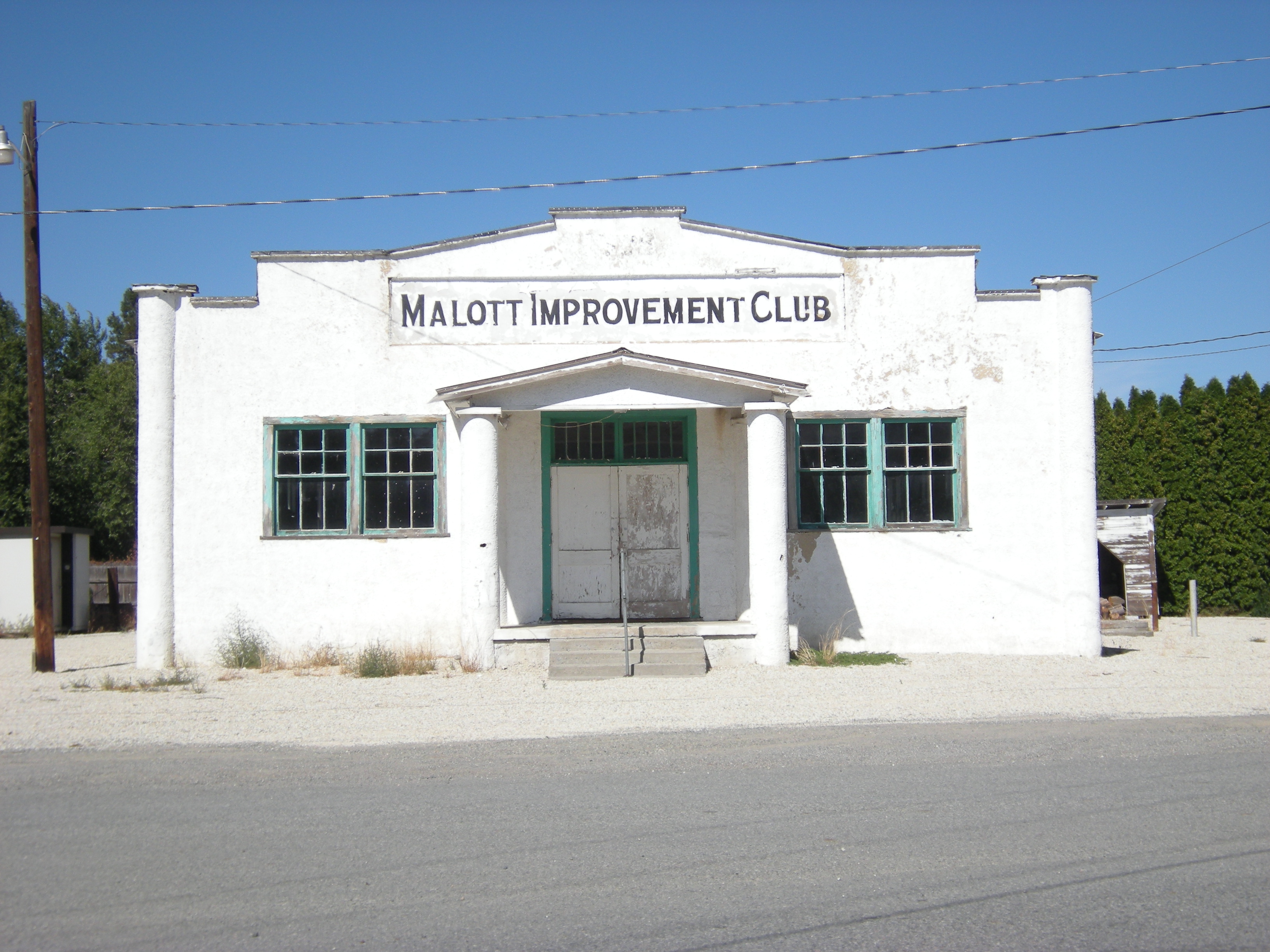
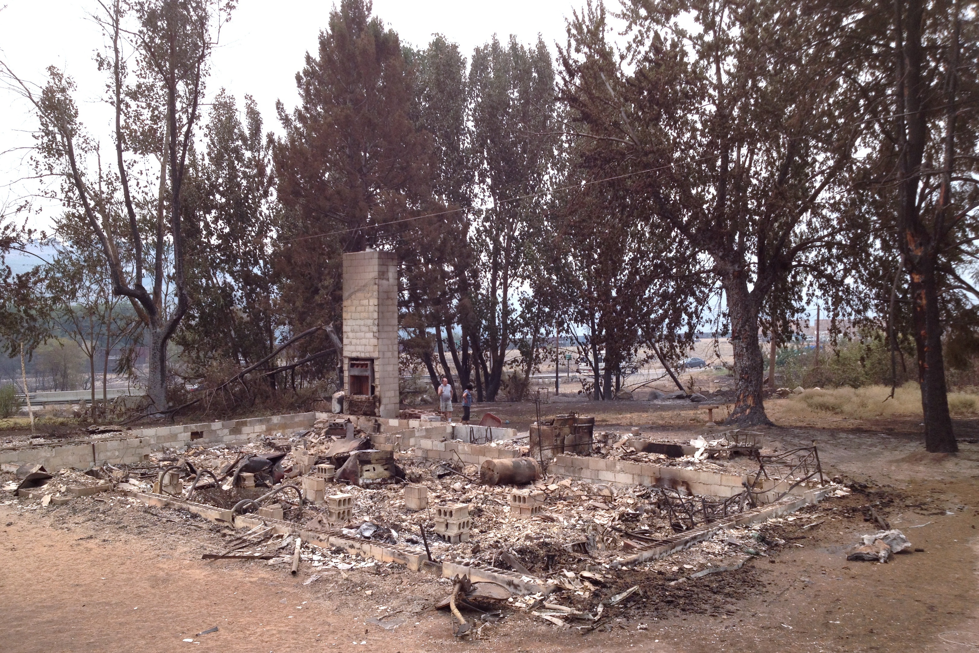
Malott is a census-designated place (CDP) in Okanogan County, Washington, United States, within the Greater Omak Area. The population was 487 at the 2010 census. Malott sits on the western bank of the Okanogan River and has bridge access to U.S. Route 97. It has a general store, bar and church. The community took its name from L.C. Malott, who first settled in the area in 1886. The town was established in 1890 and platted in 1909. Originally a stopover point with a hotel, most of the town was destroyed by flooding in 1938 after a dam burst on Loop Loop Creek. Malott was evacuated in July 2014 due to the approaching Carlton Complex wildfires. The city of Okanogan lies to the northeast. Climate This climatic region is typified by large seasonal temperature differences, with warm to hot (and often humid) summers and cold (sometimes severely cold) winters. According to the Köppen Climate Classification system, Malott has a humid continental climate A humid continental clima ... [...More Info...] [...Related Items...] OR: [Wikipedia] [Google] [Baidu] |
Okanogan, Washington
Okanogan ( ; derived from Syilx'tsn: "rendezvous" or "meeting place") is a city in Okanogan County, Washington, United States. The population was 2,552 at the 2010 census, within the Greater Omak Area. It is the seat of Okanogan County. It has a small commuter airfield, Okanogan Legion Airport – (S35) with one paved runway of in length. History Okanogan was officially incorporated on October 29, 1907. A pair of 115 year old long murals possibly by Western photographer Frank S. Matsura was discovered during renovation of a 1907 commercial building in January 2022. The building had been used as a theater several times and Matsura had played in the Okanogan County Band on stage there. The mural is painted on canvases split between the north and south walls, and a 1915 newspaper clipping found by the Okanogan County Historical Society provided coverage of plans for the murals. Then the Hub Theater, the building was planned to incorporate panoramic scenery murals in tan ... [...More Info...] [...Related Items...] OR: [Wikipedia] [Google] [Baidu] |
Washington (state) Populated Places On The Okanogan River
Washington commonly refers to: * Washington (state), United States * Washington, D.C., the capital of the United States ** A metonym for the federal government of the United States ** Washington metropolitan area, the metropolitan area centered on Washington, D.C. * George Washington (1732–1799), the first president of the United States Washington may also refer to: Places England * Washington, Tyne and Wear, a town in the City of Sunderland metropolitan borough ** Washington Old Hall, ancestral home of the family of George Washington * Washington, West Sussex, a village and civil parish Greenland * Cape Washington, Greenland * Washington Land Philippines *New Washington, Aklan, a municipality *Washington, a barangay in Catarman, Northern Samar *Washington, a barangay in Escalante, Negros Occidental *Washington, a barangay in San Jacinto, Masbate *Washington, a barangay in Surigao City United States * Washington, Wisconsin (other) * Fort Washington (disambiguation ... [...More Info...] [...Related Items...] OR: [Wikipedia] [Google] [Baidu] |
Census-designated Places In Washington (state) ...
The following is a complete list of the 345 populated places in the U.S. state of Washington delineated as census-designated places (CDPs) by the United States Census. These include unincorporated villages, groups of villages, commercial developments, and Air Force Bases. Population data are included in the list. See also * List of cities in Washington * List of towns in Washington * List of undesignated communities in Washington References {{DEFAULTSORT:List Of Census-Designated Places In Washington Washington Census A census is the procedure of systematically acquiring, recording and calculating information about the members of a given population. This term is used mostly in connection with national population and housing censuses; other common censuses incl ... [...More Info...] [...Related Items...] OR: [Wikipedia] [Google] [Baidu] |
Humid Continental Climate
A humid continental climate is a climatic region defined by Russo-German climatologist Wladimir Köppen in 1900, typified by four distinct seasons and large seasonal temperature differences, with warm to hot (and often humid) summers and freezing cold (sometimes severely cold in the northern areas) winters. Precipitation is usually distributed throughout the year but often do have dry seasons. The definition of this climate regarding temperature is as follows: the mean temperature of the coldest month must be below or depending on the isotherm, and there must be at least four months whose mean temperatures are at or above . In addition, the location in question must not be semi-arid or arid. The cooler ''Dfb'', ''Dwb'', and ''Dsb'' subtypes are also known as hemiboreal climates. Humid continental climates are generally found between latitudes 30° N and 60° N, within the central and northeastern portions of North America, Europe, and Asia. They are rare and isolat ... [...More Info...] [...Related Items...] OR: [Wikipedia] [Google] [Baidu] |
Köppen Climate Classification
The Köppen climate classification is one of the most widely used climate classification systems. It was first published by German-Russian climatologist Wladimir Köppen (1846–1940) in 1884, with several later modifications by Köppen, notably in 1918 and 1936. Later, the climatologist Rudolf Geiger (1894–1981) introduced some changes to the classification system, which is thus sometimes called the Köppen–Geiger climate classification system. The Köppen climate classification divides climates into five main climate groups, with each group being divided based on seasonal precipitation and temperature patterns. The five main groups are ''A'' (tropical), ''B'' (arid), ''C'' (temperate), ''D'' (continental), and ''E'' (polar). Each group and subgroup is represented by a letter. All climates are assigned a main group (the first letter). All climates except for those in the ''E'' group are assigned a seasonal precipitation subgroup (the second letter). For example, ''Af'' indi ... [...More Info...] [...Related Items...] OR: [Wikipedia] [Google] [Baidu] |
Climate
Climate is the long-term weather pattern in an area, typically averaged over 30 years. More rigorously, it is the mean and variability of meteorological variables over a time spanning from months to millions of years. Some of the meteorological variables that are commonly measured are temperature, humidity, atmospheric pressure, wind, and precipitation. In a broader sense, climate is the state of the components of the climate system, including the atmosphere, hydrosphere, cryosphere, lithosphere and biosphere and the interactions between them. The climate of a location is affected by its latitude/longitude, terrain, altitude, land use and nearby water bodies and their currents. Climates can be classified according to the average and typical variables, most commonly temperature and precipitation. The most widely used classification scheme was the Köppen climate classification. The Thornthwaite system, in use since 1948, incorporates evapotranspiration along with temperature ... [...More Info...] [...Related Items...] OR: [Wikipedia] [Google] [Baidu] |
Carlton Complex Fire
The Carlton Complex Fire was a massive wildfire in north central Washington which burned during the 2014 Washington wildfire season. It began on July 14, 2014 as four separate lightning-caused fires in the Methow Valley which merged into one by July 18. The complex destroyed 353 homes in and around the towns of Pateros and Brewster, as well as rural Okanogan County. The fire caused an estimated $98 million (2014 USD) in damages. The Carlton Complex remains the largest single wildfire in Washington state history, surpassing the 1902 Yacolt Burn. Events The Carlton Complex Fire began as four relatively small fires (the Stokes Fire, the Gold Hikes Fire, the French Creek Fire and the Cougar Flat Fire) which were ignited by lightning strikes in the Methow Valley on July 14. A low snowpack and lack of precipitation that spring, along with two weeks of high temperatures and low humidity had created an extreme fire risk in the region. Three of the fires burned near the town of Car ... [...More Info...] [...Related Items...] OR: [Wikipedia] [Google] [Baidu] |
Census-designated Place
A census-designated place (CDP) is a concentration of population defined by the United States Census Bureau for statistical purposes only. CDPs have been used in each decennial census since 1980 as the counterparts of incorporated places, such as self-governing cities, towns, and villages, for the purposes of gathering and correlating statistical data. CDPs are populated areas that generally include one officially designated but currently unincorporated community, for which the CDP is named, plus surrounding inhabited countryside of varying dimensions and, occasionally, other, smaller unincorporated communities as well. CDPs include small rural communities, edge cities, colonias located along the Mexico–United States border, and unincorporated resort and retirement communities and their environs. The boundaries of any CDP may change from decade to decade, and the Census Bureau may de-establish a CDP after a period of study, then re-establish it some decades later. Most unin ... [...More Info...] [...Related Items...] OR: [Wikipedia] [Google] [Baidu] |
Okanogan River
The Okanogan River (known as the Okanagan River in Canada) is a tributary of the Columbia River, approximately 115 mi (185 km) long, in southern British Columbia and north central Washington. It drains a scenic plateau region called the Okanagan Country east of the Cascade Range and north and west of the Columbia, and also the Okanagan region of British Columbia. The Canadian portion of the river has been channelized since the mid-1950s. Course The Okanagan River rises in southern British Columbia, issuing out of the southern end of Okanagan Lake, which is on the north side of the city of Penticton. It flows south past Penticton, through Skaha Lake, past Okanagan Falls, through Vaseux Lake, and past Oliver to Osoyoos and Osoyoos Lake, which spans the Canada–United States border and has its outlet into the Okanogan River at Oroville, on the southern shore of the lake, in Okanogan County. At the border the river's name (and the region and also the name of the Okanag ... [...More Info...] [...Related Items...] OR: [Wikipedia] [Google] [Baidu] |
2010 United States Census
The United States census of 2010 was the twenty-third United States national census. National Census Day, the reference day used for the census, was April 1, 2010. The census was taken via mail-in citizen self-reporting, with enumerators serving to spot-check randomly selected neighborhoods and communities. As part of a drive to increase the count's accuracy, 635,000 temporary enumerators were hired. The population of the United States was counted as 308,745,538, a 9.7% increase from the 2000 census. This was the first census in which all states recorded a population of over half a million people as well as the first in which all 100 largest cities recorded populations of over 200,000. Introduction As required by the United States Constitution, the U.S. census has been conducted every 10 years since 1790. The 2000 U.S. census was the previous census completed. Participation in the U.S. census is required by law of persons living in the United States in Title 13 of the United ... [...More Info...] [...Related Items...] OR: [Wikipedia] [Google] [Baidu] |


