|
Mallemort
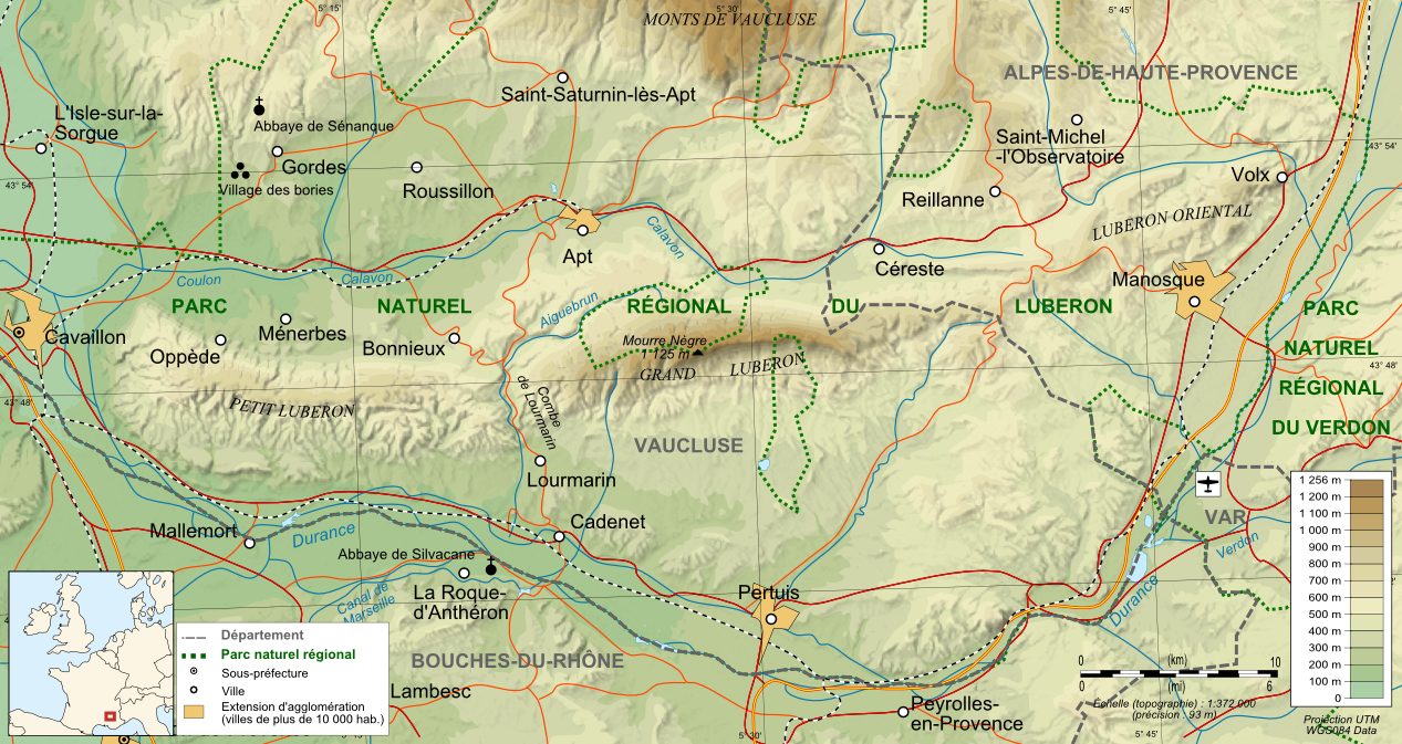
Mallemort (; oc, Malamòrt) is a commune in the Bouches-du-Rhône department in southern France. Mallemort is a quiet town located on the river Durance, south of the Luberon mountain range. The town itself is off the Autoroute du Soleil (the main motorway to the South and Marseille), within easy reach of Arles, Saint-Rémy, and Salon-de-Provence. Population See also * Communes of the Bouches-du-Rhône department The following is a list of the 119 communes of the Bouches-du-Rhône department of France. The communes cooperate in the following intercommunalities (as of 2020):Communes of Bouches-du-Rhône [...More Info...] [...Related Items...] OR: [Wikipedia] [Google] [Baidu] |
Durance
The Durance (; ''Durença'' in the Occitan classical norm or ''Durènço'' in the Mistralian norm) is a major river in Southeastern France. A left tributary of the Rhône, it is long. Its drainage basin is .Bassin versant : Durance (La) Observatoire Régional Eau et Milieux Aquatiques en PACA Its source is in the southwestern part of the , in the ski resort near ; it flows southwest through the following [...More Info...] [...Related Items...] OR: [Wikipedia] [Google] [Baidu] |
Aix-Marseille-Provence Metropolis
The Aix-Marseille-Provence Metropolis (french: métropole d'Aix-Marseille-Provence) is the ''métropole'', an intercommunal structure, centred on the cities of Marseille and Aix-en-Provence. It is located in the Bouches-du-Rhône, Var and Vaucluse departments, in the Provence-Alpes-Côte d'Azur region, southeastern France.Métropole d'Aix-Marseille-Provence (N° SIREN : 200054807) BANATIC. Accessed 4 April 2022. It was created in January 2016, replacing the previous '' [...More Info...] [...Related Items...] OR: [Wikipedia] [Google] [Baidu] |
Communes Of The Bouches-du-Rhône Department
The following is a list of the 119 communes of the Bouches-du-Rhône department of France. The communes cooperate in the following intercommunalities (as of 2020):BANATIC Périmètre des EPCI à fiscalité propre. Accessed 3 July 2020. * Métropole d'Aix-Marseille-Provence (partly) * * |
Communes Of France
The () is a level of administrative division in the French Republic. French are analogous to civil townships and incorporated municipalities in the United States and Canada, ' in Germany, ' in Italy, or ' in Spain. The United Kingdom's equivalent are civil parishes, although some areas, particularly urban areas, are unparished. are based on historical geographic communities or villages and are vested with significant powers to manage the populations and land of the geographic area covered. The are the fourth-level administrative divisions of France. vary widely in size and area, from large sprawling cities with millions of inhabitants like Paris, to small hamlets with only a handful of inhabitants. typically are based on pre-existing villages and facilitate local governance. All have names, but not all named geographic areas or groups of people residing together are ( or ), the difference residing in the lack of administrative powers. Except for the municipal arrondi ... [...More Info...] [...Related Items...] OR: [Wikipedia] [Google] [Baidu] |
Bouches-du-Rhône
Bouches-du-Rhône ( , , ; oc, Bocas de Ròse ; "Mouths of the Rhône") is a department in Southern France. It borders Vaucluse to the north, Gard to the west and Var to the east. The Mediterranean Sea lies to the south. Its prefecture and largest city is Marseille; other important cities include Aix-en-Provence, Arles, Martigues and Aubagne. Marseille, France's second-largest city, has one of the largest container ports in the country. It prizes itself as France's oldest city, founded by Greek settlers from Phocaea around 600 BC. Bouches-du-Rhône is the most populous department of the Provence-Alpes-Côte d'Azur region, with 2,043,110 inhabitants as of 2019.Populations légales 2019: 13 Bouches-du-Rhône INSEE It has an area of . Its [...More Info...] [...Related Items...] OR: [Wikipedia] [Google] [Baidu] |
Departments Of France
In the administrative divisions of France, the department (french: département, ) is one of the three levels of government under the national level ("territorial collectivities"), between the administrative regions and the communes. Ninety-six departments are in metropolitan France, and five are overseas departments, which are also classified as overseas regions. Departments are further subdivided into 332 arrondissements, and these are divided into cantons. The last two levels of government have no autonomy; they are the basis of local organisation of police, fire departments and, sometimes, administration of elections. Each department is administered by an elected body called a departmental council ( ing. lur.. From 1800 to April 2015, these were called general councils ( ing. lur.. Each council has a president. Their main areas of responsibility include the management of a number of social and welfare allowances, of junior high school () buildings and technical staff, ... [...More Info...] [...Related Items...] OR: [Wikipedia] [Google] [Baidu] |
France
France (), officially the French Republic ( ), is a country primarily located in Western Europe. It also comprises of Overseas France, overseas regions and territories in the Americas and the Atlantic Ocean, Atlantic, Pacific Ocean, Pacific and Indian Oceans. Its Metropolitan France, metropolitan area extends from the Rhine to the Atlantic Ocean and from the Mediterranean Sea to the English Channel and the North Sea; overseas territories include French Guiana in South America, Saint Pierre and Miquelon in the North Atlantic, the French West Indies, and many islands in Oceania and the Indian Ocean. Due to its several coastal territories, France has the largest exclusive economic zone in the world. France borders Belgium, Luxembourg, Germany, Switzerland, Monaco, Italy, Andorra, and Spain in continental Europe, as well as the Kingdom of the Netherlands, Netherlands, Suriname, and Brazil in the Americas via its overseas territories in French Guiana and Saint Martin (island), ... [...More Info...] [...Related Items...] OR: [Wikipedia] [Google] [Baidu] |
Luberon
The Luberon ( or ; Provençal: ''Leberon'' or ''Leberoun'' ) is a massif in central Provence in Southern France, part of the French Prealps. It has a maximum elevation of and an area of about . It is composed of three mountain ranges (from west to east): Lesser Luberon (''Petit Luberon''), Greater Luberon (''Grand Luberon'') and Eastern Luberon (''Luberon oriental''). The valleys north and south of them contain a number of towns and villages as well as agricultural land; the northern part is marked by the Calavon, while the southern part is characterised by the Durance. The Luberon is often advertised under the name Lubéron (with an acute accent on top of the "e"); some dictionaries justify that the two spellings are interchangeable. The total number of inhabitants varies greatly between winter and summer, due to a massive influx of tourists during the warm season. It is a favourite destination for French high society and British and American visitors because of the pleasant ... [...More Info...] [...Related Items...] OR: [Wikipedia] [Google] [Baidu] |
A7 Autoroute
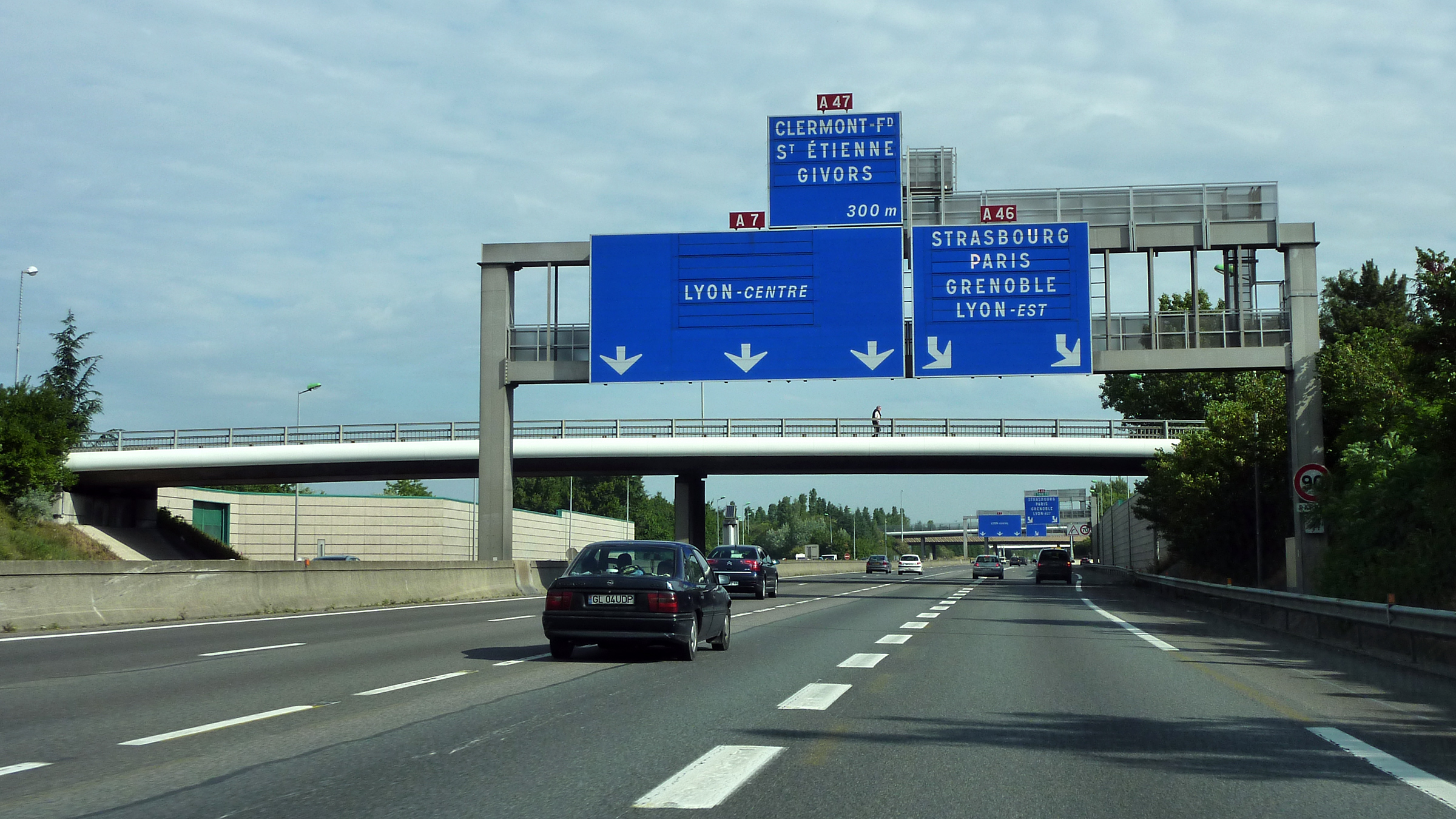
The A7 Autoroute, also known as l'autoroute du Soleil (English: the Motorway of the Sun) is a French motorway. It continues the A6 and links Lyon to Marseille. The autoroute du Soleil is long and forms part of European routes E15, E80, and E714. History The part of the road in Marseille was built by the Nazi invaders in 1941. Sorties (Exits) * A7- A6 Junction * 01 1.8 km: Lyon-''centre'' * 02 2.3 km: Lyon-''centre'' * 03 4 km: Oullins * 04 5.5 km: Pierre-Bénite * 05 5.5 km: St.-Fons (vers le Boulevard Périphérique, via le Boulevard Pierre-Sémard) * 06 9.1 km: Vénissieux * Aire de Solaize * 07 13.5 km: Solaize * 07a 14 km: Sérézin-du-Rhône * Aire de Sérézin-du-Rhône (southbound) * A7- A46- A47 Junction * 08 21.5 km: chasse-sur-Rhône (de Marseille) * 09 26 km: Vienne, Valence par N7, Grenoble par RN (de Lyon) * 10 32 km: Vienne, L'Isle d'Abeau (de Marseille) * Péage de Vienne * Aires d ... [...More Info...] [...Related Items...] OR: [Wikipedia] [Google] [Baidu] |
Arles
Arles (, , ; oc, label= Provençal, Arle ; Classical la, Arelate) is a coastal city and commune in the South of France, a subprefecture in the Bouches-du-Rhône department of the Provence-Alpes-Côte d'Azur region, in the former province of Provence. A large part of the Camargue, the largest wetlands in France, is located on the territory of the commune, making it the largest commune in Metropolitan France in terms of geographic territory. (Maripasoula, French Guiana, is much larger than Arles). The city has a long history, and was of considerable importance in the Roman province of Gallia Narbonensis. The Roman and Romanesque Monuments of Arles were listed as UNESCO World Heritage Sites in 1981 for their testimony to the history of the region. Many artists have lived and worked in this area because of the southern light, including Pablo Picasso, Paul Gauguin, Jacques Réattu, and Peter Brown. The Dutch post-Impressionist painter Vincent van Gogh lived in Arles from 1888 ... [...More Info...] [...Related Items...] OR: [Wikipedia] [Google] [Baidu] |
Saint-Rémy-de-Provence
Saint-Rémy-de-Provence (; Provençal Occitan: ''Sant Romieg de Provença'' in classical and ''Sant Roumié de Prouvènço'' in Mistralian norms) is a commune in the Bouches-du-Rhône department, Provence-Alpes-Côte d'Azur, Southern France. Located in the northern part of the Alpilles, of which it is the main town, it had a population of 9,893 in 2017. History The town, which has been inhabited since Prehistory, was named after Saint Remigius under the Latin name ''Villa Sancti Remigii''. From May 1889 to May 1890, Vincent van Gogh was a patient at the Saint-Paul Asylum in Saint-Rémy-de-Provence, and painted some of his most memorable works, including The Starry Night, which features the town. Geography Saint-Rémy-de-Provence is situated about south of Avignon, just north of the Alpilles mountain range. Transportation The Avignon-TGV high-speed train station is 20 km from the city. The closest airports are located in Avignon, Nîmes, and Marseille. Also, there ar ... [...More Info...] [...Related Items...] OR: [Wikipedia] [Google] [Baidu] |
Salon-de-Provence
Salon-de-Provence (, ; oc, label= Provençal Occitan, Selon de Provença/Seloun de Provènço, ), commonly known as Salon, is a commune located about northwest of Marseille in the Bouches-du-Rhône department, region of Provence-Alpes-Côte d'Azur, Southern France. It is the home of an important French Air and Space Force (''Armée de l'Air et de l'Espace'') air base. In 2017, it had a population of 45,528. History Salon was a Gallo-Roman oppidum well positioned on the salt trade routes between Adriatic, Atlantic and Mediterranean seas, hence its name. This region was under the Phocaean influence since the sixth century BC, and stretches of the Via Aurelia can still be recognized just outside the town, but the earliest mention of the place under its familiar name is of the ninth century, as ''Villa Salone''. The archbishops of Arles controlled the site. Its principal claim to fame today is as the place where Nostradamus spent his last years and is buried. His dwelling is main ... [...More Info...] [...Related Items...] OR: [Wikipedia] [Google] [Baidu] |


