|
Makiling, Calamba
Makiling is an upland barangay in Calamba in the province of Laguna, Philippines. It is named after its location on the foot of Mount Makiling, the highest mountain in Laguna province. School * Lyceum of the Philippines University-Laguna The lyceum is a category of educational institution defined within the education system of many countries, mainly in Europe. The definition varies among countries; usually it is a type of secondary school. Generally in that type of school the th ... Population *2020 - 12,508 *2015 - 10,760 *2010 - 7,510 *2007 - 7,100 *2000 - 5,130 *1995 - 4,326 *1990 - 3,382 *1980 - 2,000 References External linksOfficial Website of the Government of Laguna Barangays of Calamba, Laguna {{Calabarzon-geo-stub ... [...More Info...] [...Related Items...] OR: [Wikipedia] [Google] [Baidu] |
Barangay
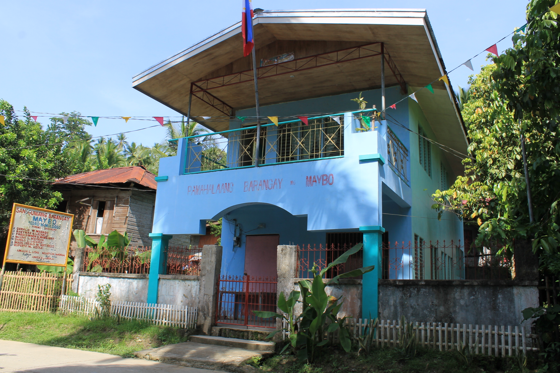
A barangay (; abbreviated as Brgy. or Bgy.), historically referred to as barrio (abbreviated as Bo.), is the smallest administrative division in the Philippines and is the native Filipino term for a village, district, or ward. In metropolitan areas, the term often refers to an inner city neighborhood, a suburb, or a suburban neighborhood or even a borough. The word ''barangay'' originated from '' balangay'', a type of boat used by a group of Austronesian peoples when they migrated to the Philippines. Municipalities and cities in the Philippines are politically subdivided into barangays, with the exception of the municipalities of Adams in Ilocos Norte and Kalayaan in Palawan, with each containing a single barangay. Barangays are sometimes informally subdivided into smaller areas called ''purok'' ( en, " zone"), or barangay zones consisting of a cluster of houses for organizational purposes, and '' sitios'', which are territorial enclaves—usually rural—far from th ... [...More Info...] [...Related Items...] OR: [Wikipedia] [Google] [Baidu] |
Purok
A ''purok'' ( en, district or zone) is a division within a barangay in the Philippines. While not officially considered a local government unit (LGU), a purok often serves as a unit for delivering services and administration within a barangay. A ''purok'' is typically composed of twenty to fifty or more households, depending on the particular geographical location and cluster of houses. The term purok is often applied to a neighborhood (zone) within an urbanized barangay, or a portion (district) of a less densely populated, but still relatively geographically compact, barangay. This contrasts with the '' sitio'', which is usually a cluster of households (hamlet) in a more dispersed, rural barangay. If created and given a mandate by an ordinance of the barangay, municipality, or city, a purok could perform government functions under the coordination and supervision of their local officials. Sometimes, a member of the Sangguniang Barangay (Barangay Council) may be recognized a ... [...More Info...] [...Related Items...] OR: [Wikipedia] [Google] [Baidu] |
Lyceum Of The Philippines University-Laguna
The lyceum is a category of educational institution defined within the education system of many countries, mainly in Europe. The definition varies among countries; usually it is a type of secondary school. Generally in that type of school the things that are taught are basic science and also in some part of that type of schools, some introduction to specific kind of jobs also may be done. History ''Lyceum'' is a Latin rendering of the Ancient Greek (), the name of a '' gymnasium'' in Classical Athens dedicated to Apollo Lyceus. This original lyceum is remembered as the location of the peripatetic school of Aristotle. Some countries derive the name for their modern schools from the Latin but use the Greek name for the ancient school: for example, Dutch has (ancient) and (modern), both rendered ''lyceum'' in English (note that in classical Latin the ''C'' in was always pronounced as a ''K'', not a soft ''C'', as in modern English). The name ''lycée'' was retrieved and utili ... [...More Info...] [...Related Items...] OR: [Wikipedia] [Google] [Baidu] |
Mount Makiling
Mount Makiling (also known as Mount Maquiling), is an inactive stratovolcano located in the provinces of Laguna and Batangas on the island of Luzon, Philippines. The mountain rises to an elevation of above mean sea level and is the highest feature of the Laguna Volcanic Field. The volcano has no recorded historic eruption but volcanism is still evident through geothermal features like mud spring and hot springs. South of the mountain is the Makiling-Banahaw Geothermal Plant. The Philippine Institute of Volcanology and Seismology (PHIVOLCS) classifies the volcano as " Inactive". Mount Makiling is a state-owned forest reserve administered by the University of the Philippines Los Baños. Prior to its transfer to the university, the mountain was the first national park of the Philippines. Mount Makiling National Park was established on February 23, 1933, by ''Proclamation No. 552''. However, it was decommissioned as a national park on June 20, 1963, by ''Republic Act no. 3523'' ... [...More Info...] [...Related Items...] OR: [Wikipedia] [Google] [Baidu] |
Laguna (province)
Laguna, officially the Province of Laguna ( fil, Lalawigan ng Laguna), is a Provinces of the Philippines, province in the Philippines located in the Calabarzon Regions of the Philippines, region in Luzon. Its capital is Santa Cruz, Laguna, Santa Cruz while its largest city is the Calamba, Laguna, City of Calamba and the province is situated southeast of Metro Manila, south of the province of Rizal, west of Quezon, north of Batangas and east of Cavite. Laguna hugs the southern shores of Laguna de Bay, the largest lake in the country. As of the 2020 census, the province's total population is 3,382,193. It is the seventh richest province in the country. Laguna is notable as the birthplace of José Rizal, the country's ''de facto'' national hero. It has numerous natural and cultural attractions such as Pagsanjan Falls, the University of the Philippines Los Baños and the University of the Philippines Open University in Los Baños, Laguna, Los Baños, the hot spring resorts of Calamb ... [...More Info...] [...Related Items...] OR: [Wikipedia] [Google] [Baidu] |
Calamba, Laguna
Calamba, officially the City of Calamba ( fil, Lungsod ng Calamba), is a 1st class component city in the province of Laguna, Philippines. According to the 2020 census, it has a population of 539,671 people. Calamba is the regional center of the Calabarzon region. It is situated south of Manila and west of Santa Cruz. The city is known as the "Spring Resort Capital of the Philippines" because of its numerous hot spring resorts, which are mostly located in Barangays Pansol, Bucal, Bagong Kalsada, and Lingga. According to the 2020 census, Calamba has a population of 539,671 people, making it the most populous local government unit in Laguna. It is the fifth-densest city in the province with more than 2,600 people per square kilometer after San Pedro, Biñan, Cabuyao, and Santa Rosa. Based on the overall rankings of the 2014 Cities and Municipalities Index, the city ranked 18th in the overall competitiveness (cities ranking) and first among cities in the Calabarzon regio ... [...More Info...] [...Related Items...] OR: [Wikipedia] [Google] [Baidu] |
Barangay
A barangay (; abbreviated as Brgy. or Bgy.), historically referred to as barrio (abbreviated as Bo.), is the smallest administrative division in the Philippines and is the native Filipino term for a village, district, or ward. In metropolitan areas, the term often refers to an inner city neighborhood, a suburb, or a suburban neighborhood or even a borough. The word ''barangay'' originated from '' balangay'', a type of boat used by a group of Austronesian peoples when they migrated to the Philippines. Municipalities and cities in the Philippines are politically subdivided into barangays, with the exception of the municipalities of Adams in Ilocos Norte and Kalayaan in Palawan, with each containing a single barangay. Barangays are sometimes informally subdivided into smaller areas called ''purok'' ( en, " zone"), or barangay zones consisting of a cluster of houses for organizational purposes, and '' sitios'', which are territorial enclaves—usually rural—far from th ... [...More Info...] [...Related Items...] OR: [Wikipedia] [Google] [Baidu] |
Calamba City
Calamba, officially the City of Calamba ( fil, Lungsod ng Calamba), is a 1st class component city in the province of Laguna, Philippines. According to the 2020 census, it has a population of 539,671 people. Calamba is the regional center of the Calabarzon region. It is situated south of Manila and west of Santa Cruz. The city is known as the "Spring Resort Capital of the Philippines" because of its numerous hot spring resorts, which are mostly located in Barangays Pansol, Bucal, Bagong Kalsada, and Lingga. According to the 2020 census, Calamba has a population of 539,671 people, making it the most populous local government unit in Laguna. It is the fifth-densest city in the province with more than 2,600 people per square kilometer after San Pedro, Biñan, Cabuyao, and Santa Rosa. Based on the overall rankings of the 2014 Cities and Municipalities Index, the city ranked 18th in the overall competitiveness (cities ranking) and first among cities in the Calabarzon regio ... [...More Info...] [...Related Items...] OR: [Wikipedia] [Google] [Baidu] |
Country
A country is a distinct part of the world, such as a state, nation, or other political entity. It may be a sovereign state or make up one part of a larger state. For example, the country of Japan is an independent, sovereign state, while the country of Wales is a component of a multi-part sovereign state, the United Kingdom. A country may be a historically sovereign area (such as Korea), a currently sovereign territory with a unified government (such as Senegal), or a non-sovereign geographic region associated with certain distinct political, ethnic, or cultural characteristics (such as the Basque Country). The definition and usage of the word "country" is flexible and has changed over time. '' The Economist'' wrote in 2010 that "any attempt to find a clear definition of a country soon runs into a thicket of exceptions and anomalies." Most sovereign states, but not all countries, are members of the United Nations. The largest country by area is Russia, while the ... [...More Info...] [...Related Items...] OR: [Wikipedia] [Google] [Baidu] |
Cities Of The Philippines
A city ( fil, lungsod/siyudad) is one of the units of local government in the Philippines. All Philippine cities are chartered cities ( fil, nakakartang lungsod), whose existence as corporate and administrative entities is governed by their own specific municipal charters in addition to the Local Government Code of 1991, which specifies their administrative structure and powers. As of December 17, 2022, there are 148 cities. A city is entitled to at least one representative in the House of Representatives if its population reaches 250,000. Cities are allowed to use a common seal. As corporate entities, cities have the power to take, purchase, receive, hold, lease, convey, and dispose of real and personal property for its general interests, condemn private property for public use ( eminent domain), contract and be contracted with, sue and exercise all the powers conferred to it by Congress. Only an Act of Congress can create or amend a city charter, and with this city charte ... [...More Info...] [...Related Items...] OR: [Wikipedia] [Google] [Baidu] |
Calabarzon
Calabarzon (), formally known as the Southern Tagalog Mainland, is an administrative region in the Philippines, designated as Region IV-A. The region comprises five provinces: Batangas, Cavite, Laguna, Quezon, and Rizal; and one highly urbanized city, Lucena. The region is the most populous region in the Philippines according to the Philippine Statistics Authority, having over 14.4 million inhabitants in 2020, and is also the country's second most densely populated after the National Capital Region. The region is situated southeast of Metro Manila, and is bordered by the Manila Bay to the west, Lamon Bay and the Bicol Region to the east, the Tayabas Bay and Sibuyan Sea to the south, and Central Luzon to the north. It is home to places like Mount Makiling near Los Baños, Laguna, and the Taal Volcano in Batangas. Prior to its creation as a region, Calabarzon, together with the Mimaropa region, the province of Aurora and several parts of Metro Manila, formed the histor ... [...More Info...] [...Related Items...] OR: [Wikipedia] [Google] [Baidu] |


